Stories
Freely written, typos and mistakes guaranteed!
Enjoy reading!
- North West India – Spiti, Zanskar & East Ladakh
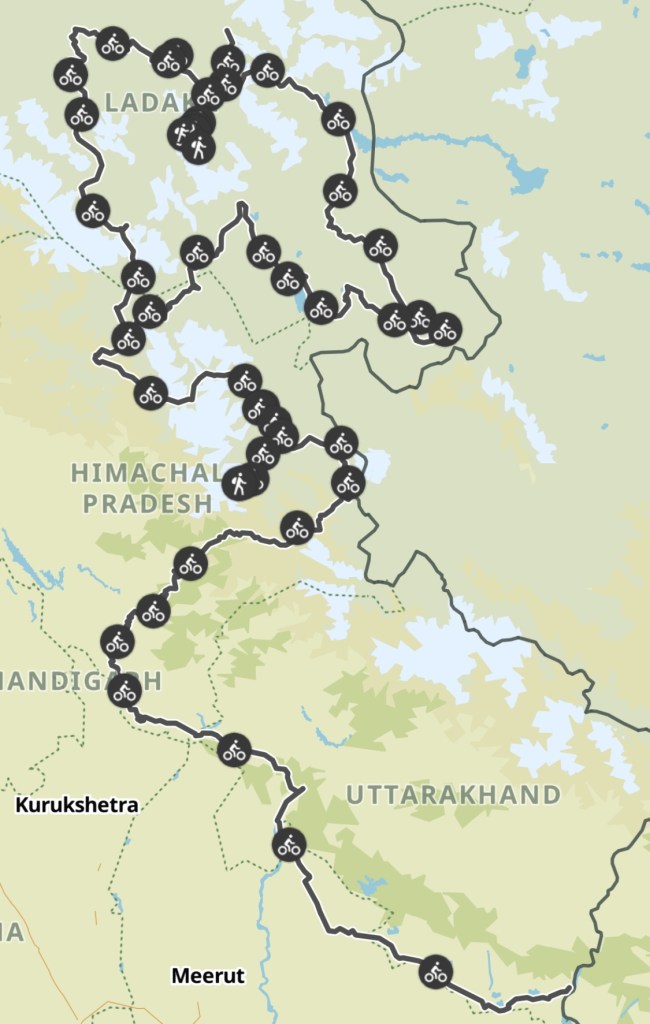
North West India – Spiti, Zanskar & East Ladakh
July 2025 – We are heading to the regions of Himachal Pradesh and Ladhak!
Traffic, Heat and other Obstacles
India greats us with amazing food on the rooftop of a hotel during a roaming thunderstorm, where the air is filled with the rich aromas of spices. As we savor each bite, the sky lightens up in a purple light every other minute, illuminating the clouds in a dramatic display.
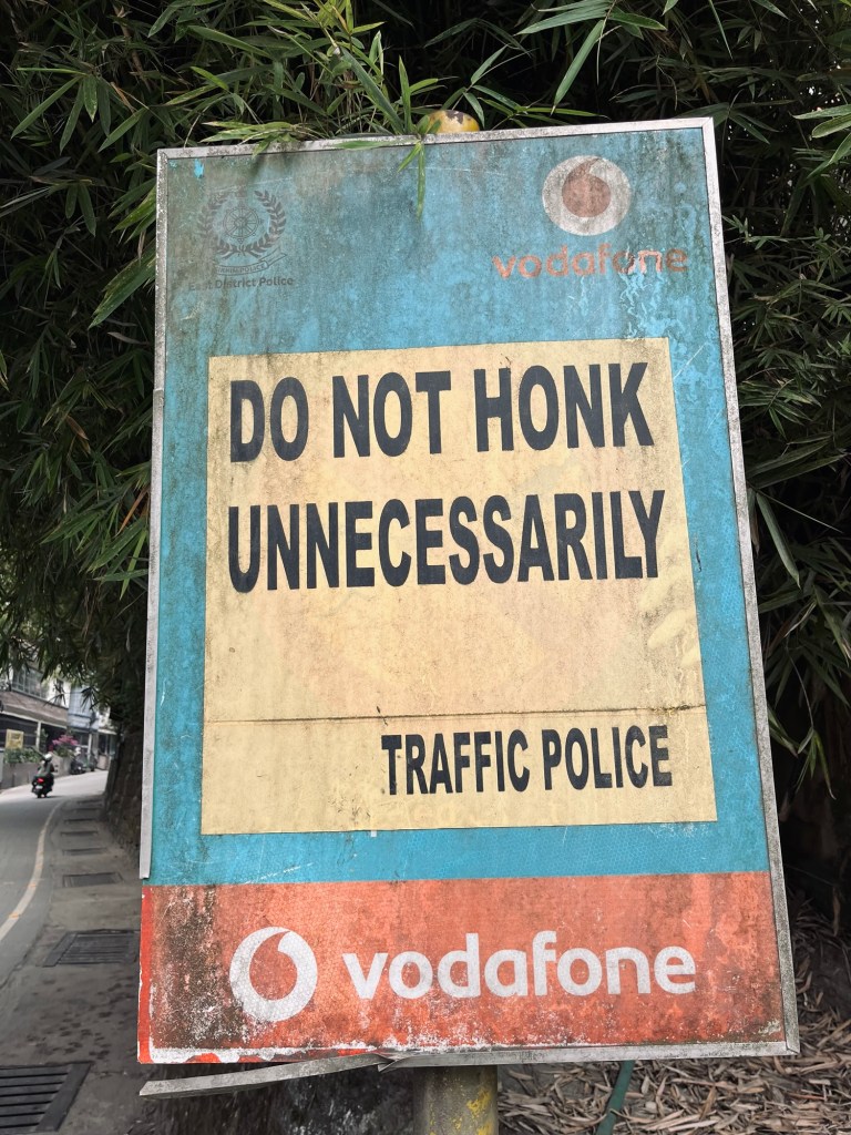
We know that the next few days will not be our style of cycling. A few hundred kilometers have to be covered on flat tarmac through populated areas in the heat in order to reach the mountains, where we hope to find respite from this relentless heat. We discuss if taking a bus is the better option, acknowledging the ease it would bring, but we didn’t have the nerves for yet another bus hassle, especially after the last experience was so chaotic. So sweat is dripping on the handlebar, a constant reminder of the rising temperatures and our exertion. Eardrums are about to burst from the honking, a cacophony of noise that saturates the air as cars weave dangerously close. Adrenaline is rushing as we try to avoid collisions with what seems to us suicidal driving on the crowded roads, each moment an exhilarating mix of anxiety. Fun times!!
Haridwar and Rishikesh
Haridwar is one of the holiest places for Hindus, nestled on the banks of the Ganges river at the foot of the majestic Himalayas, where spiritual energy seems to permeate the air. During this time of year, it is pilgrims’ season, and the streets are bustling with crowds, each person seeking solace, purification and divine blessings in the water of the Ganges. We decide to stay for a short while, soaking in the deeply spiritual atmosphere before we continue our journey to Rishikesh.
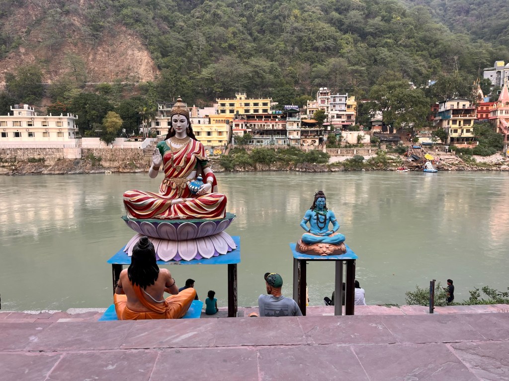
At the banks of Ganges Once there, I join a yoga class, while we both indulge in a variety of delicious vegan food. After savouring our meal, we take a short dip in the sacred waters of the Ganges. We set off once more, navigating through a few quiet forest roads that lead us gracefully to the enchanting hill station of Shimla, where a cool(er) breeze awaits us and David, an indian friend we met in Kyrgyzstan before, invites us to his lovely house.
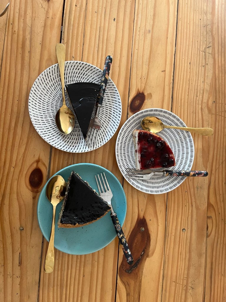
Cakes for two 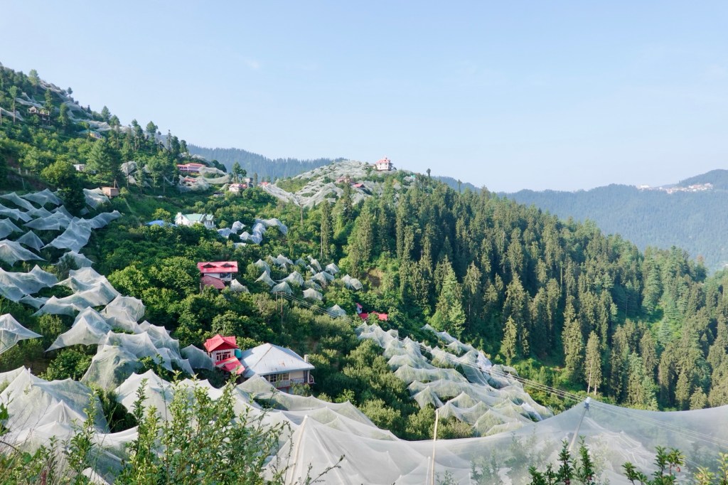
Shimla 
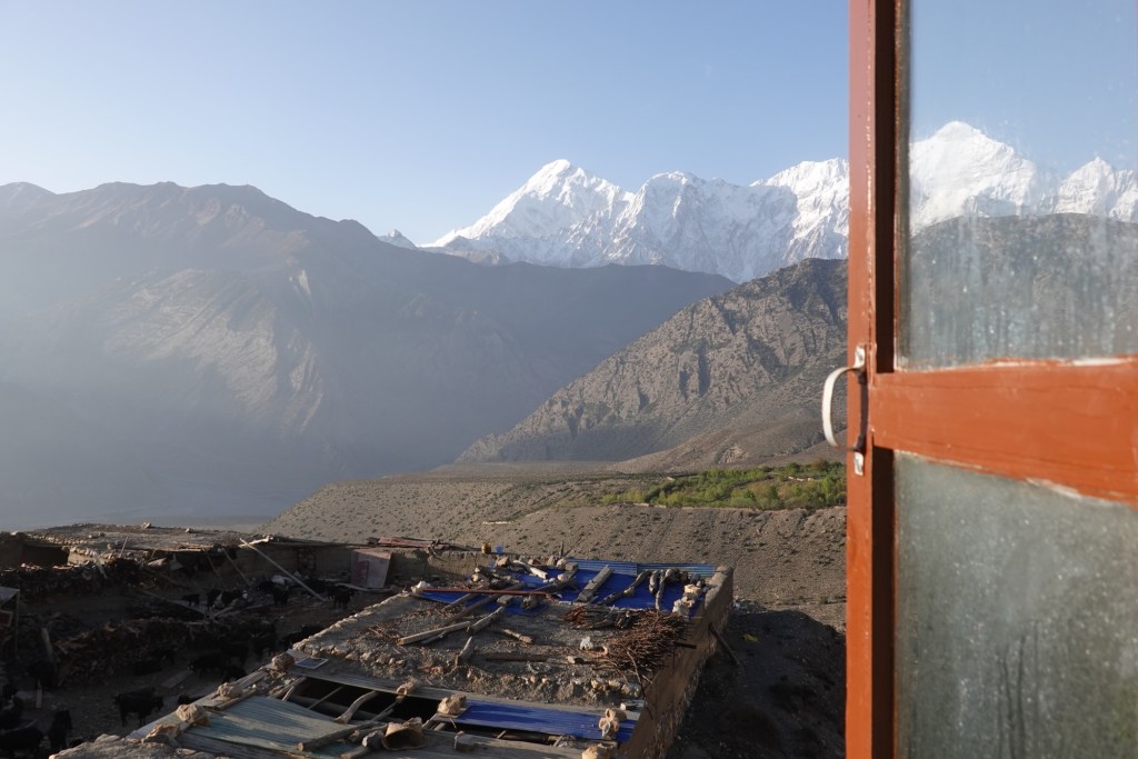
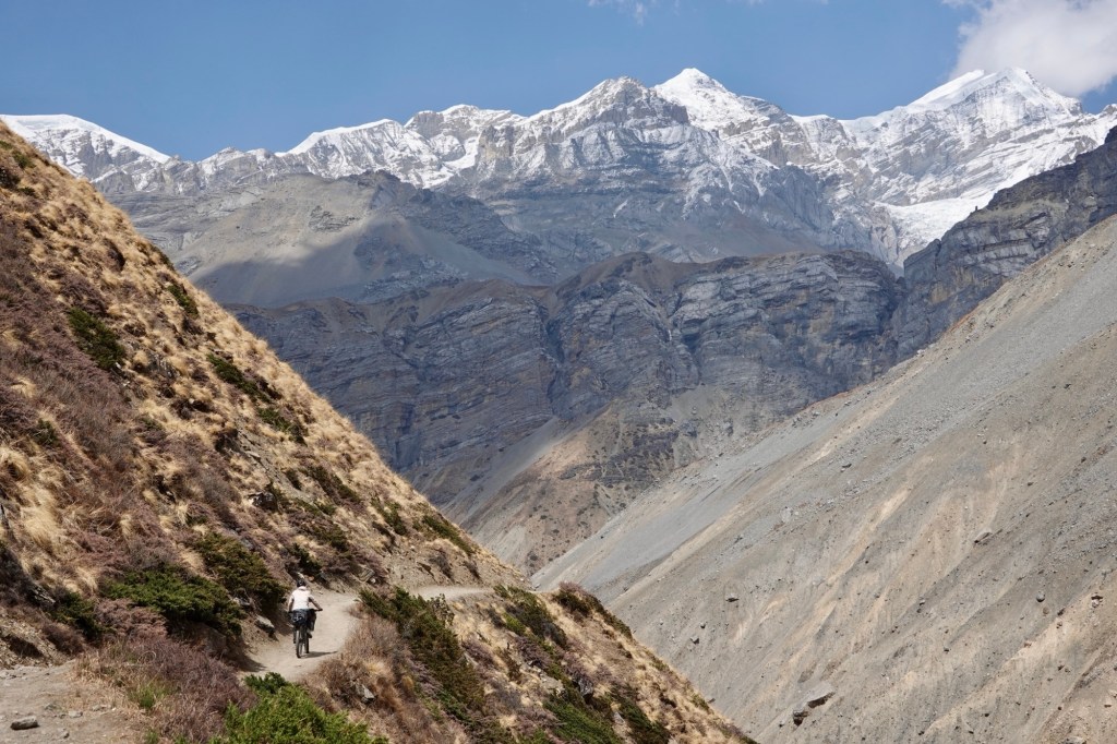
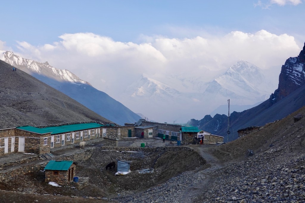
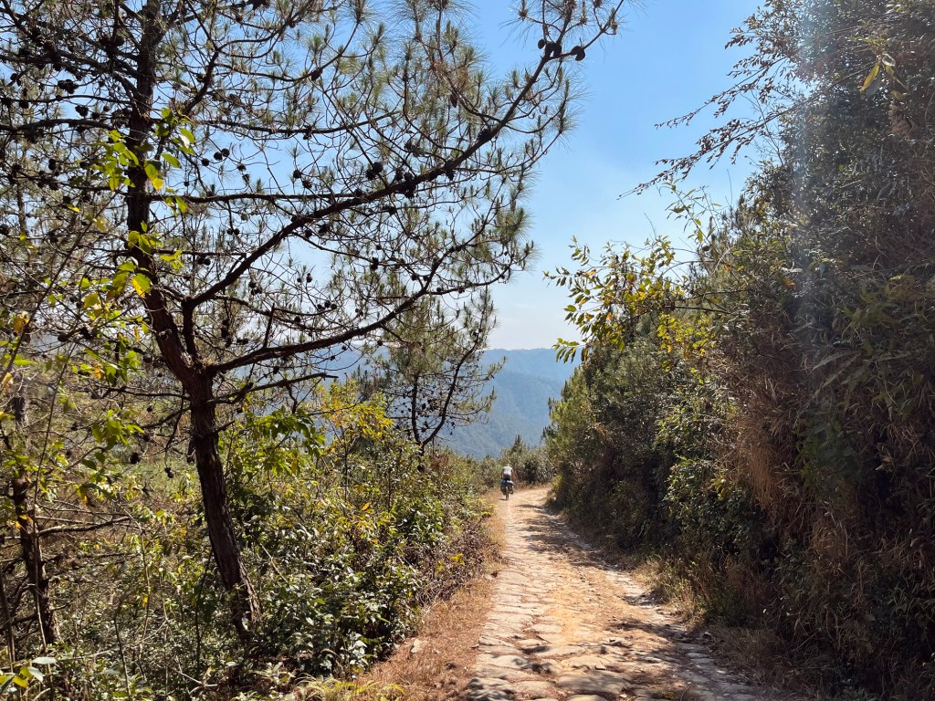
Fuel Spiti Valley – The middle land
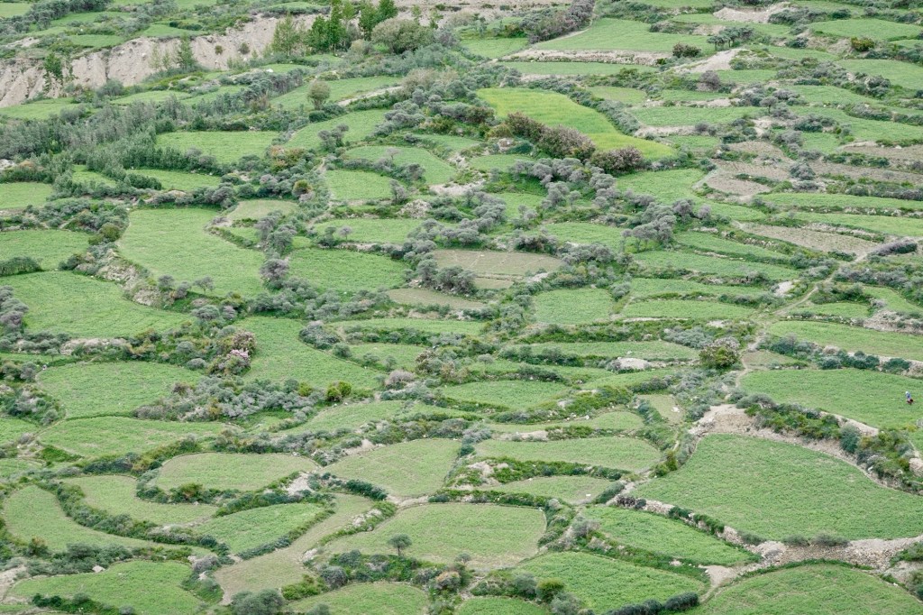
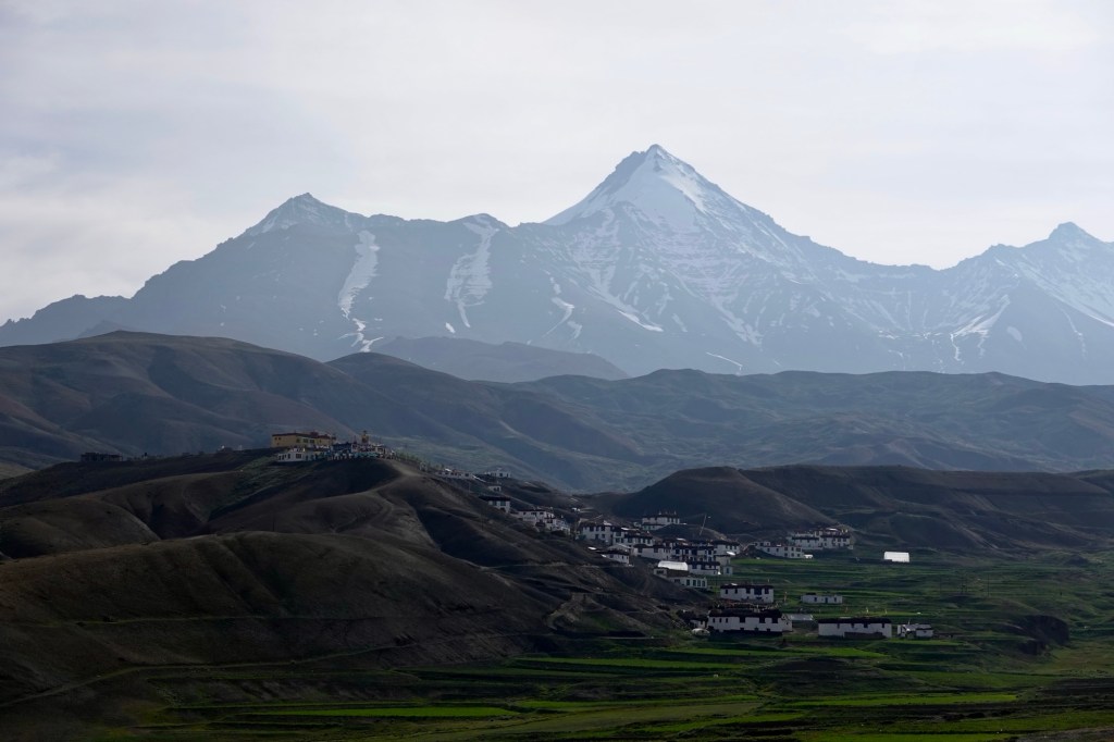
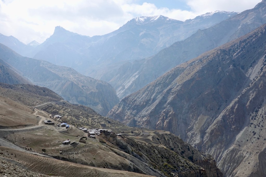
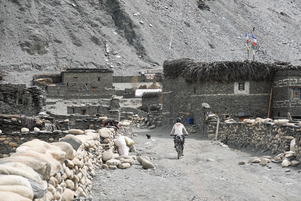
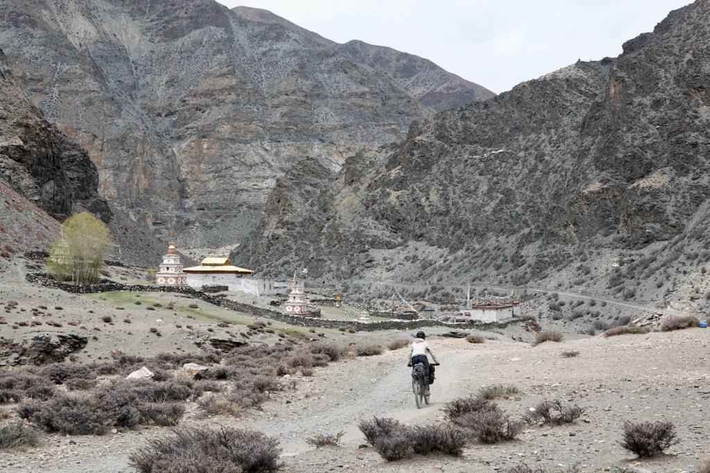
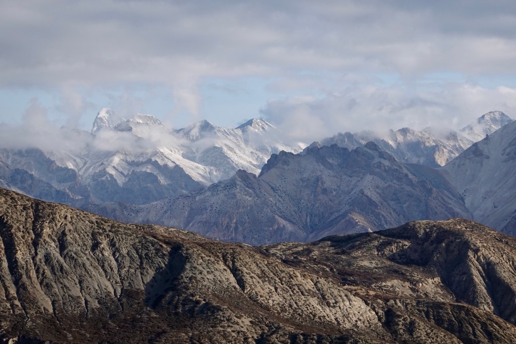
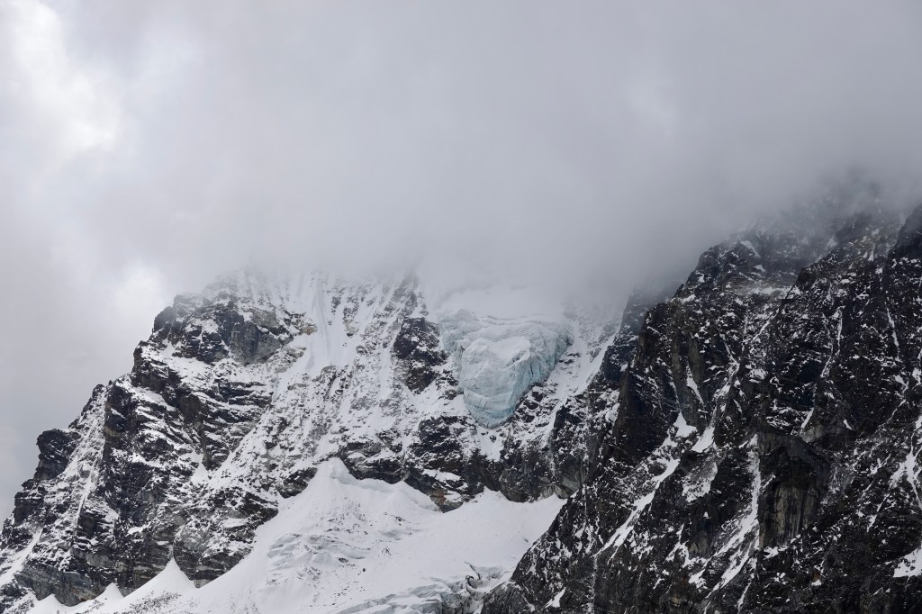
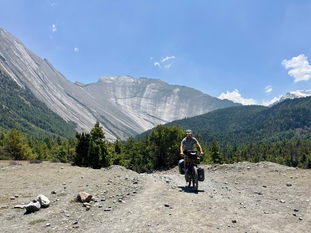
Once a hidden gem, Spiti valley borders with Tibet; and is also called the land in the middle. Now it is a very well-known place among indian motorcyclists who seek the thrill of the open road against such stunning backdrops. A few more hot kilometres until we finally reach a bearable temperature at about 3000 m, where the cool mountain air provides a refreshing contrast. The high altitude arid desert is characterized by its rugged terrain, striking rock formations, and stunning vistas that change with the shifting light of day. Here, ancient monasteries perch precariously on cliffs, adding a touch of spirituality to the beauty of the region.
Gompas 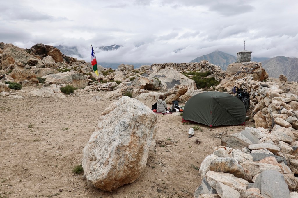
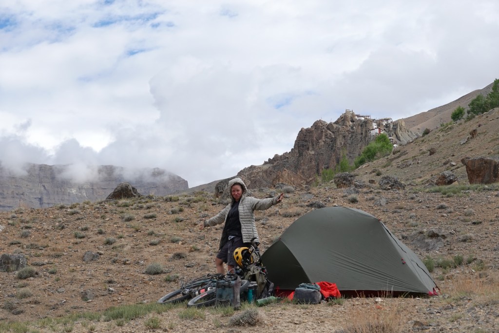
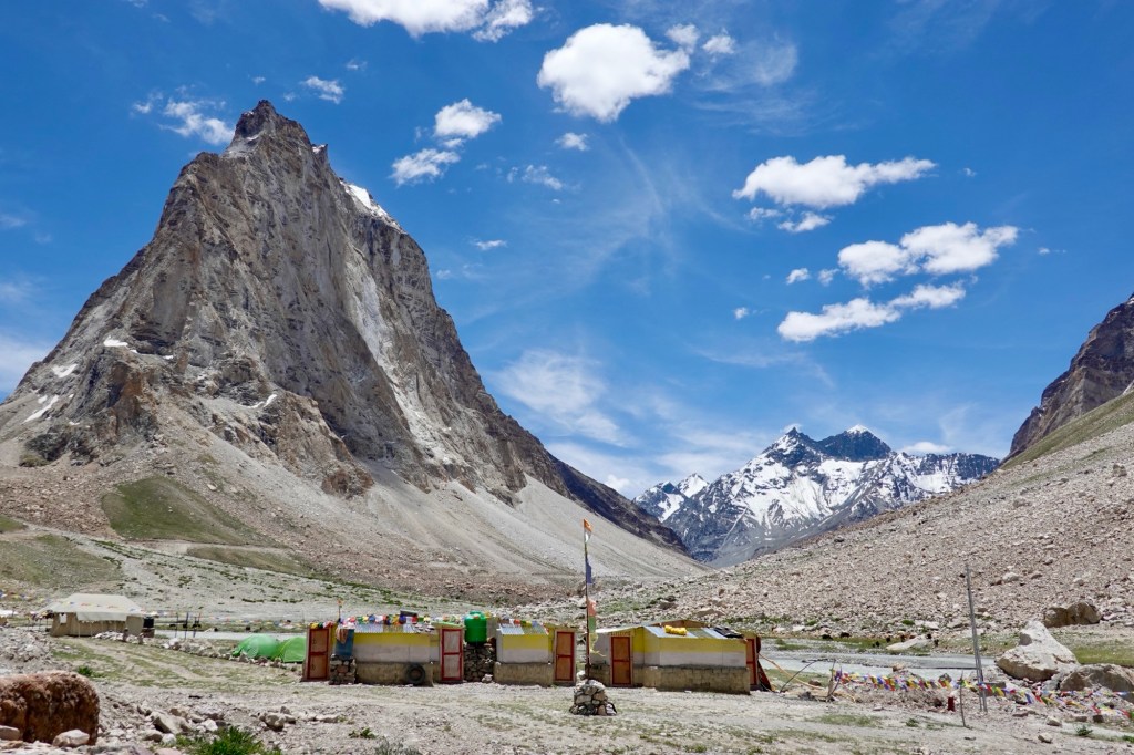
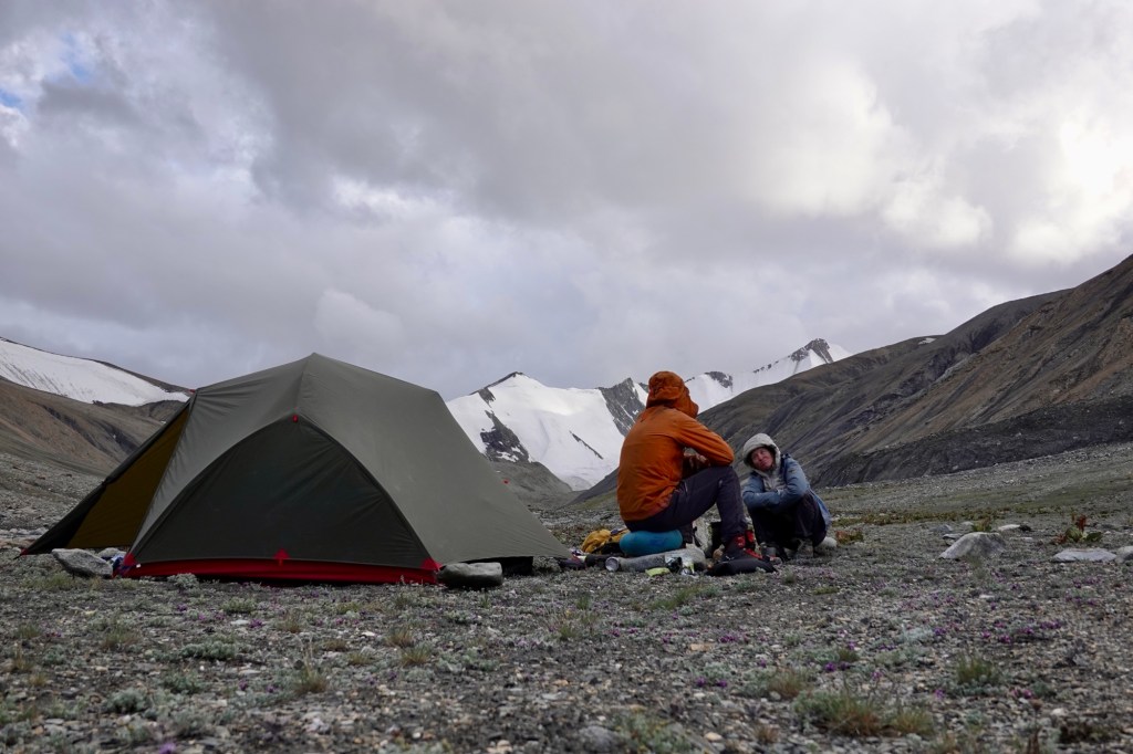
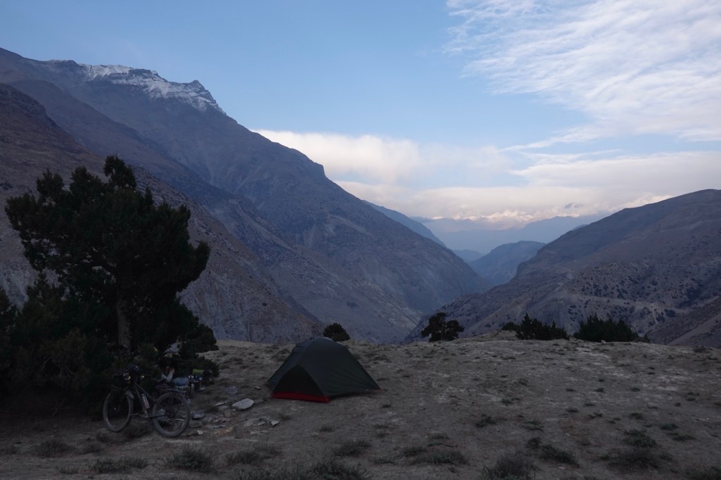
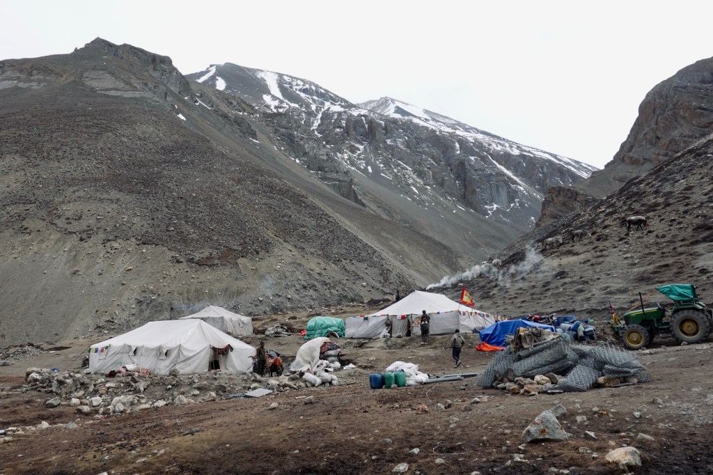
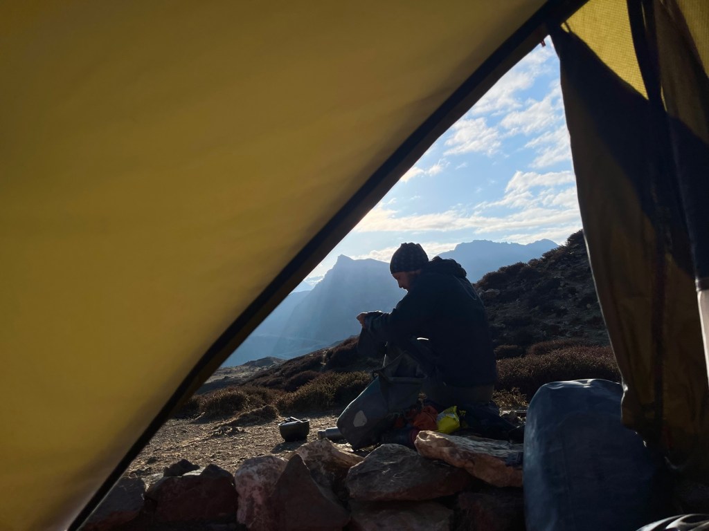
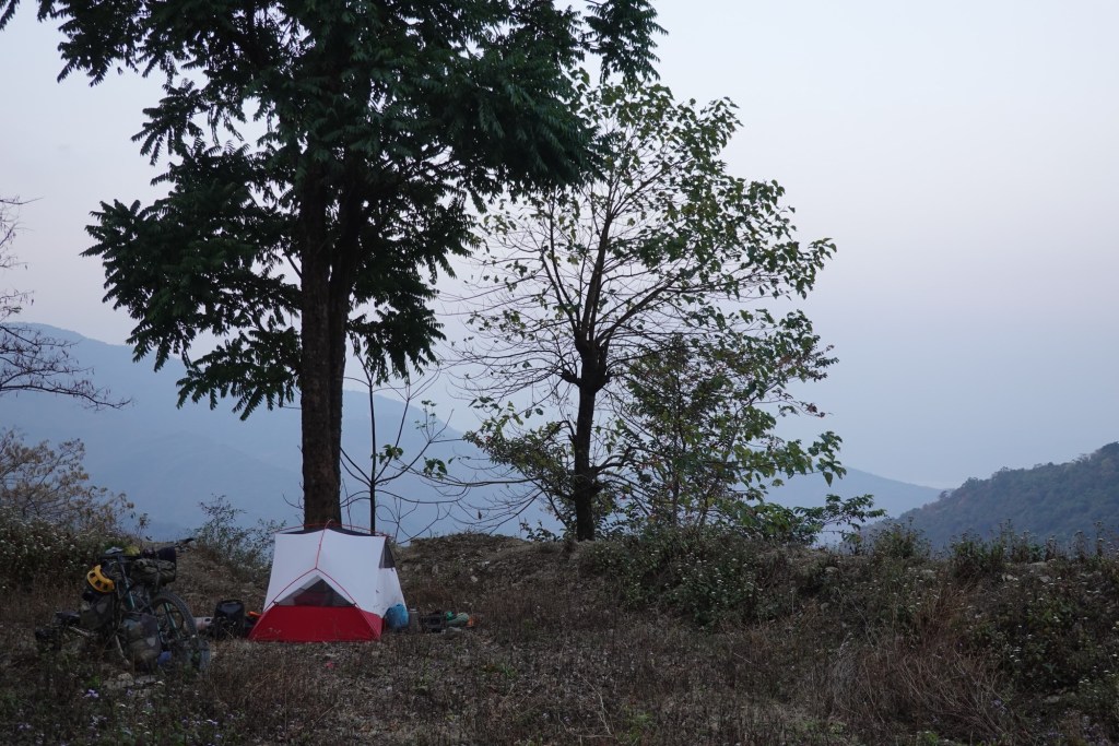
Camp 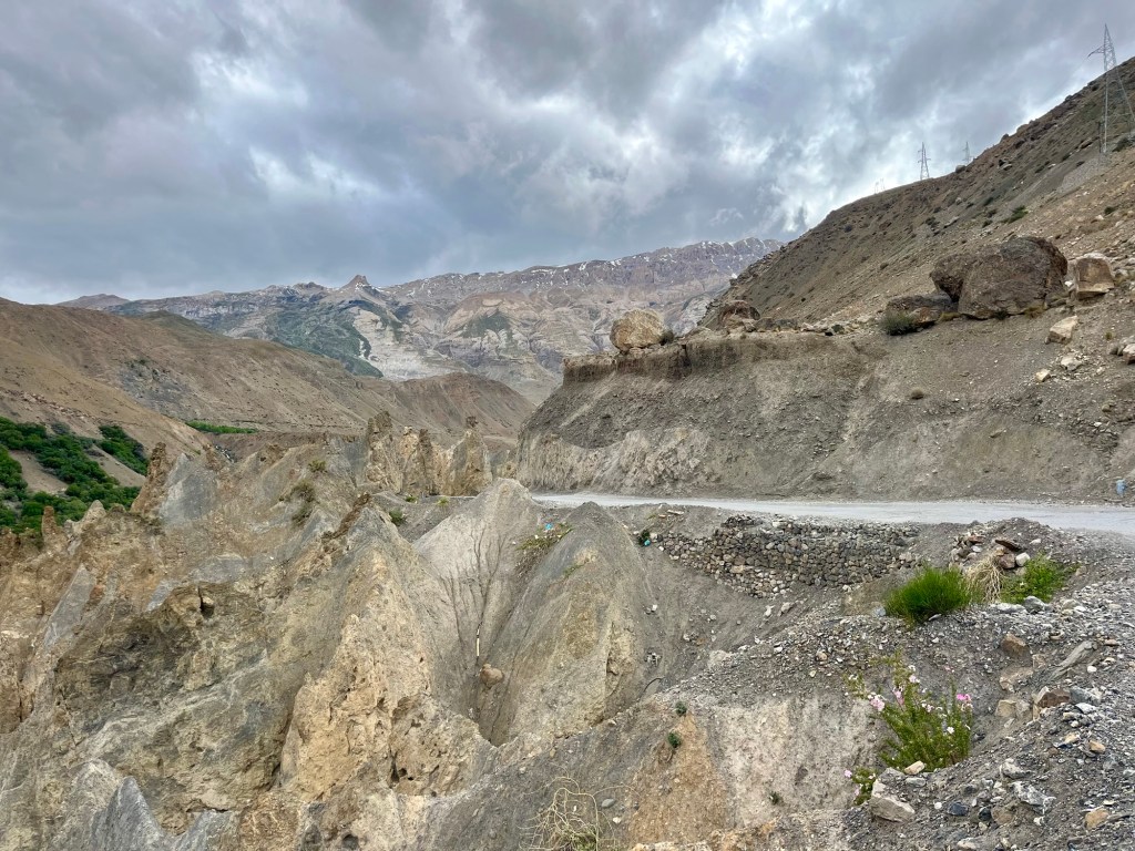
Views Tabo Monastery
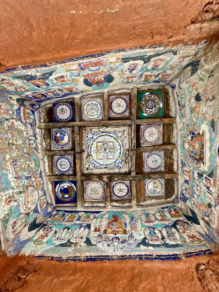
The Tabo monastery, built in the 10th century, is known for its ancient relicts and beautiful wall paintings, which depict various aspects of Buddhist teachings and history.
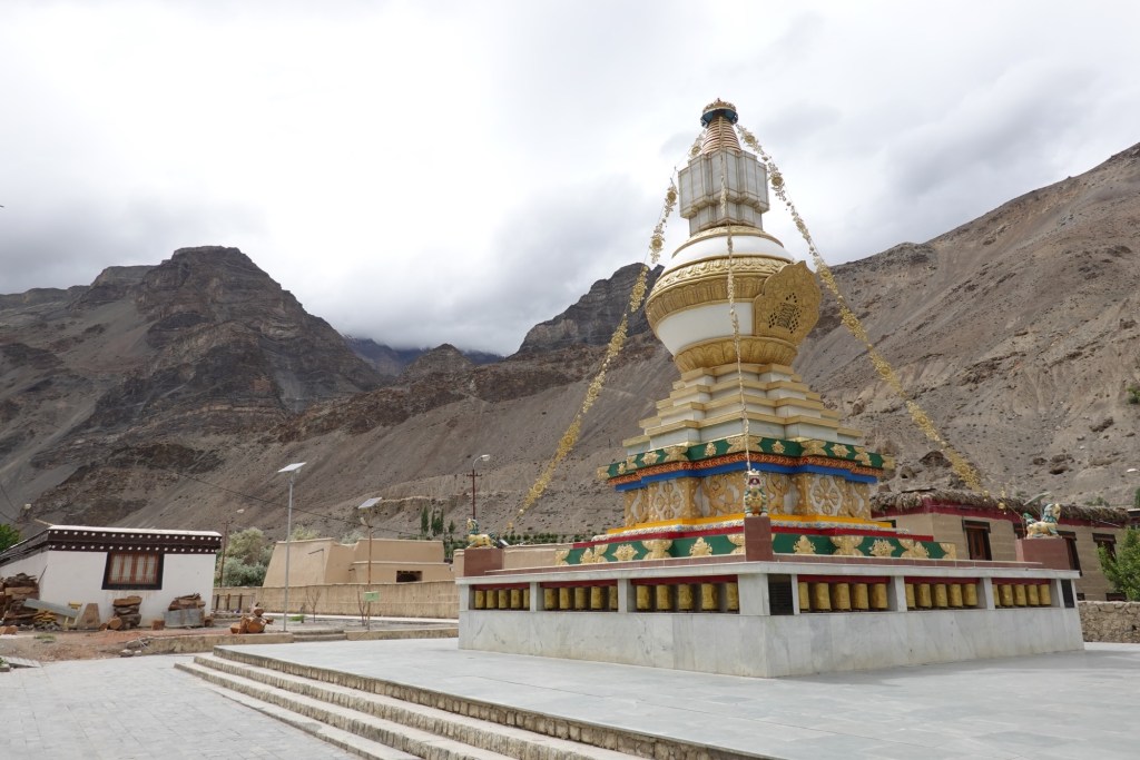
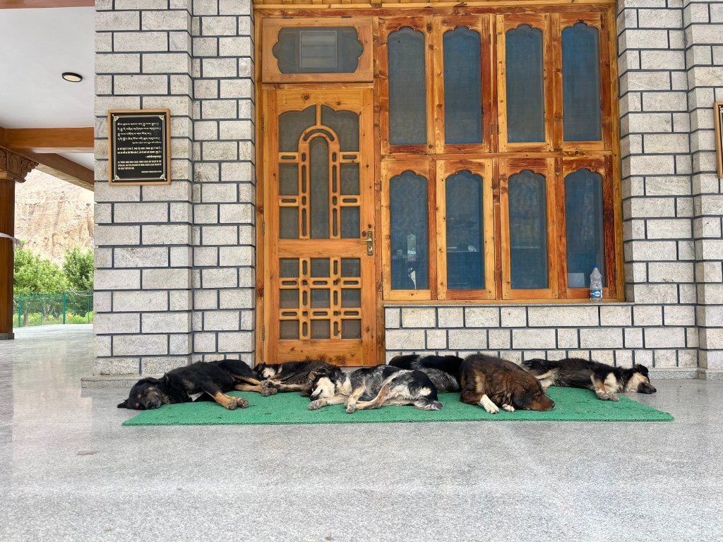
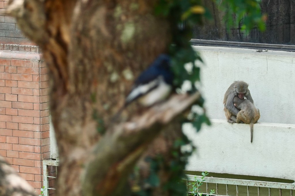
Dogs chilling at the monastery The monastery has withstood the test of time such as an earthquake, preserving its rich cultural heritage and spiritual essence, while the surrounding mountains add to its tranquil ambiance.
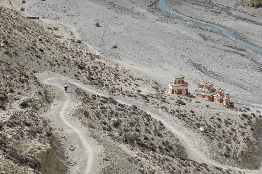
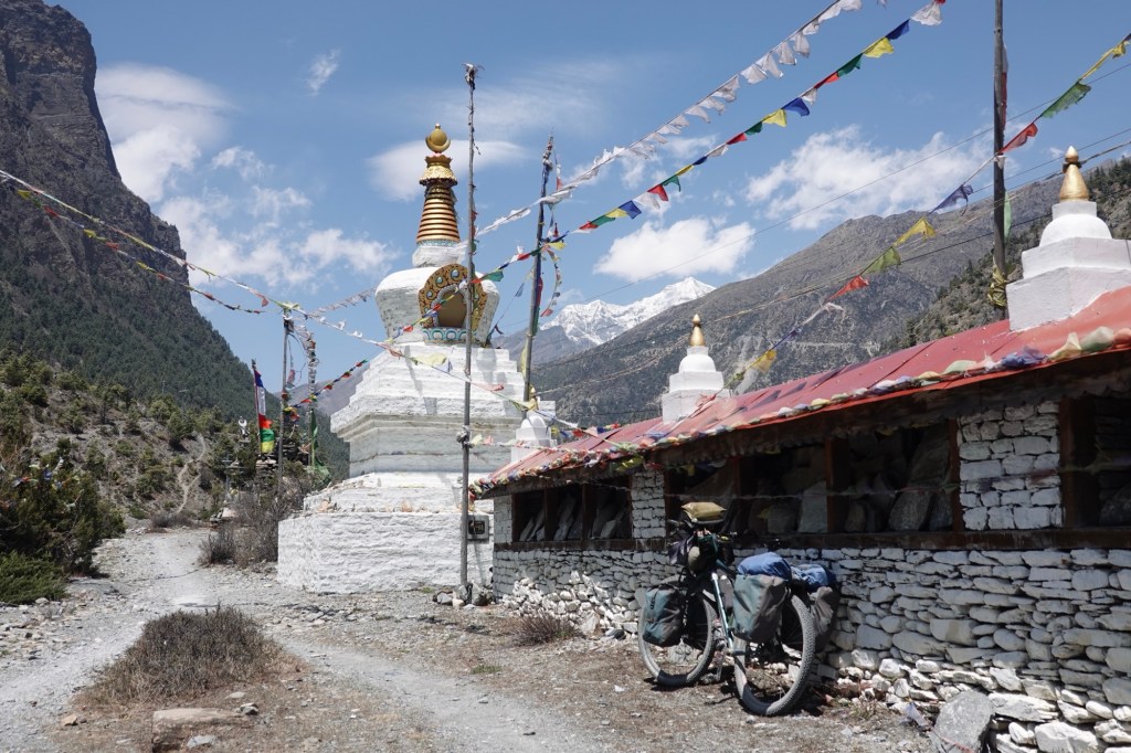
Plenty of camping options are on our way! We take a detour to Dhankar monastery, which was built in 12th century. The monastery lies on a cliff and is overlooking the confluence of Spiti and Pin River.
Dankhar 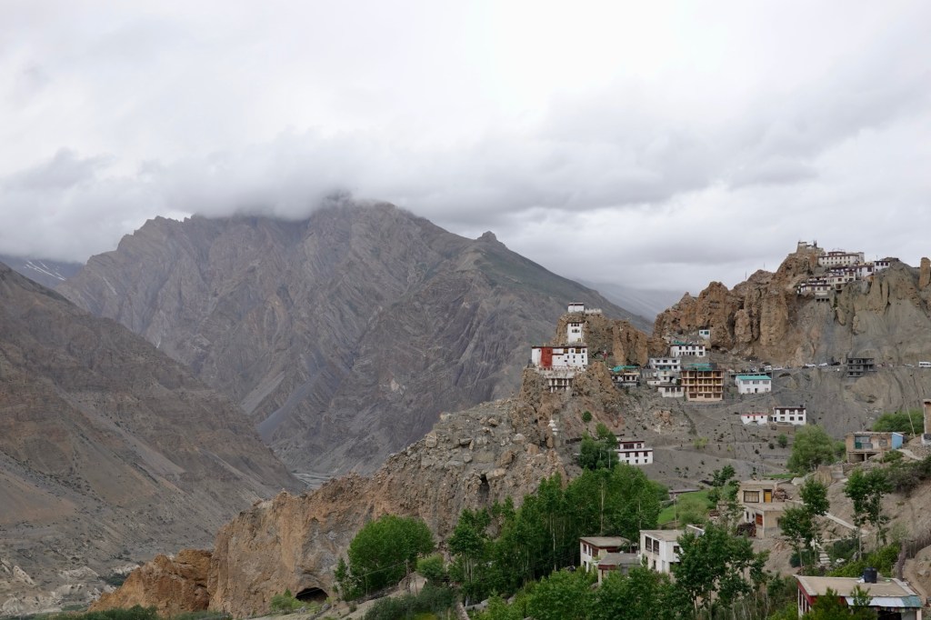
Dankhar Afterwards we head to Lhalung a quiet village away from the main road, framed with beautiful farm terraces.
Lhalung 
Lhalung 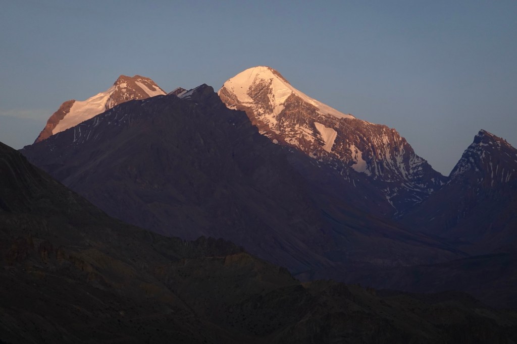
Valley view 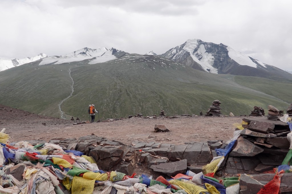
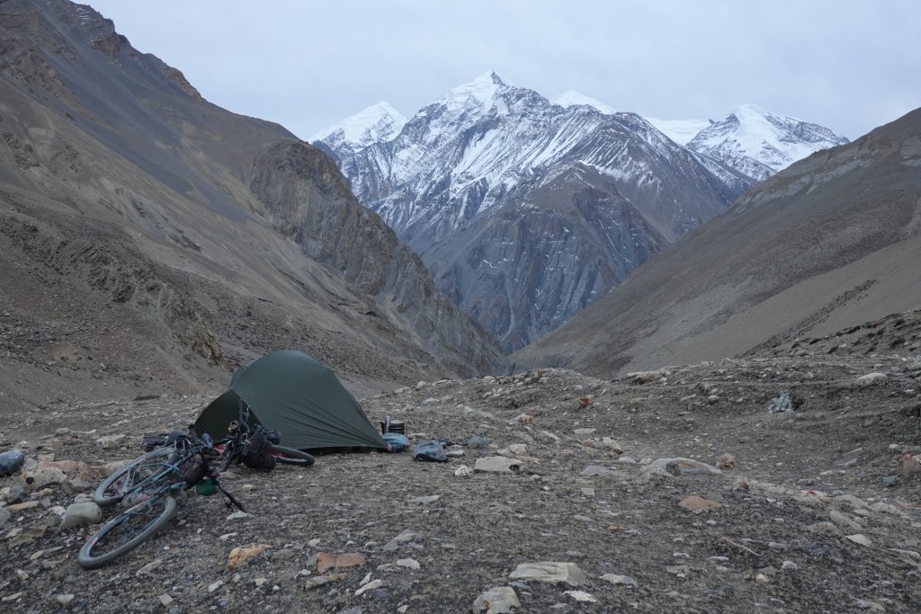
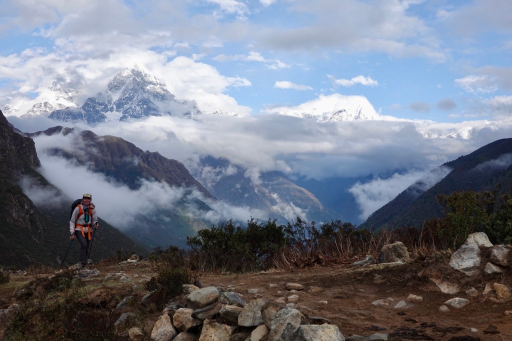
Kang Yatze I & II 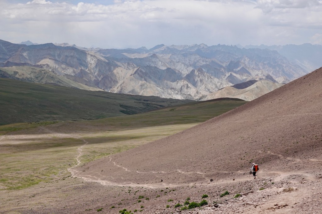
Way to the BC 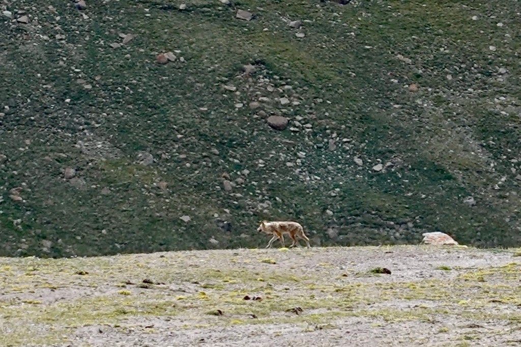
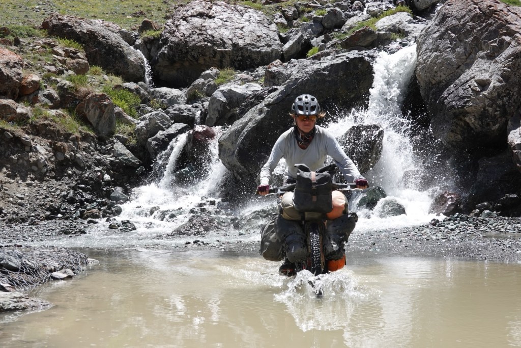
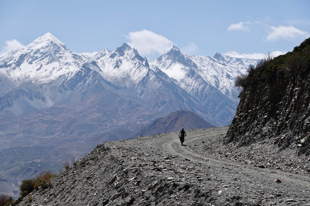
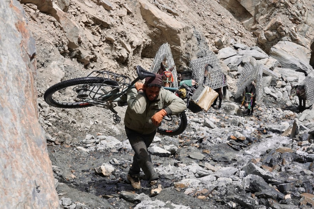
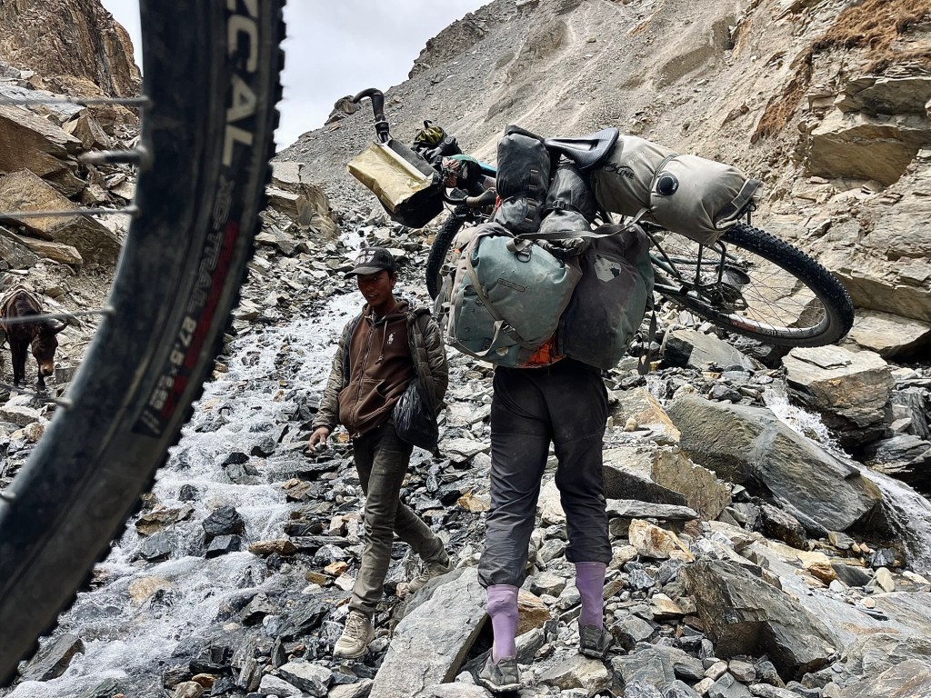
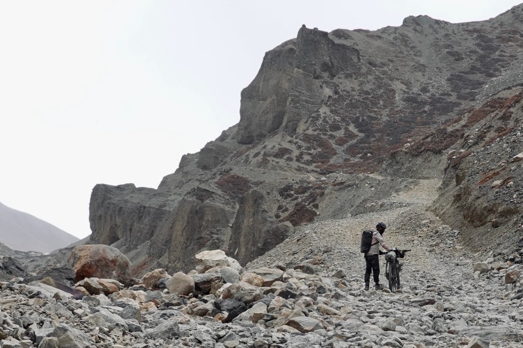
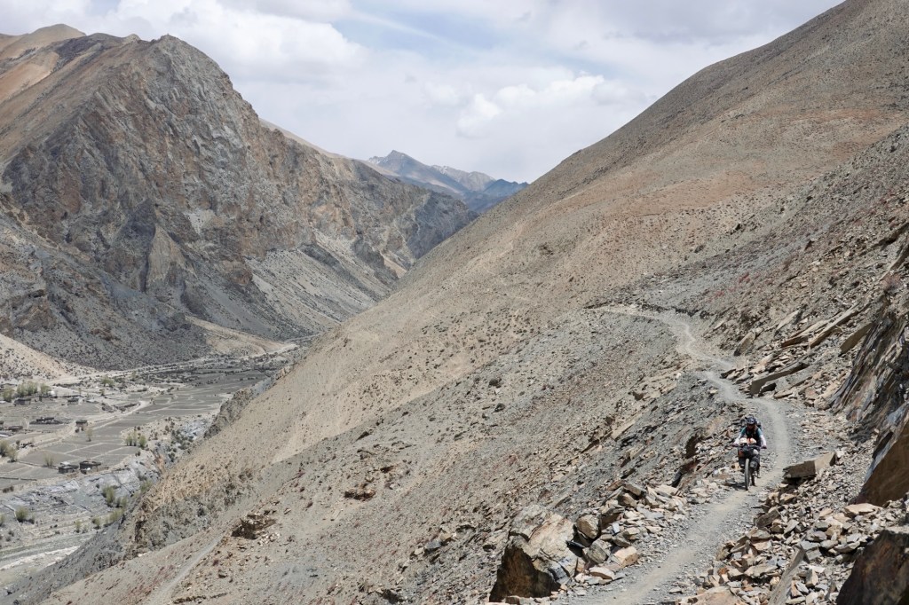
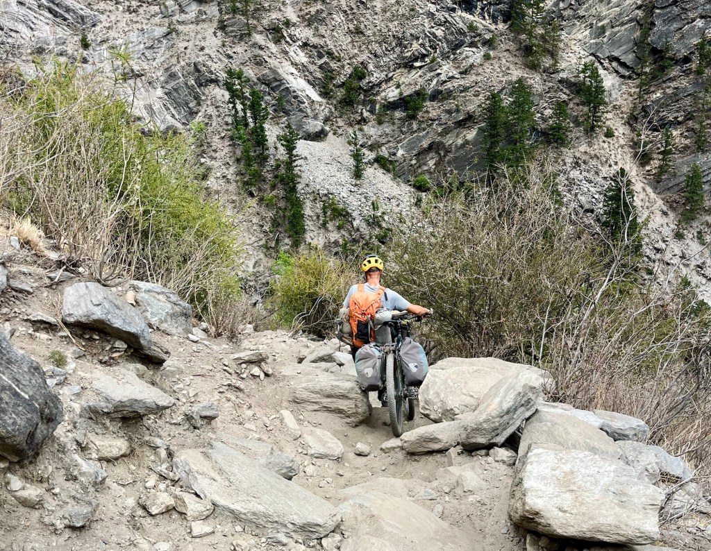
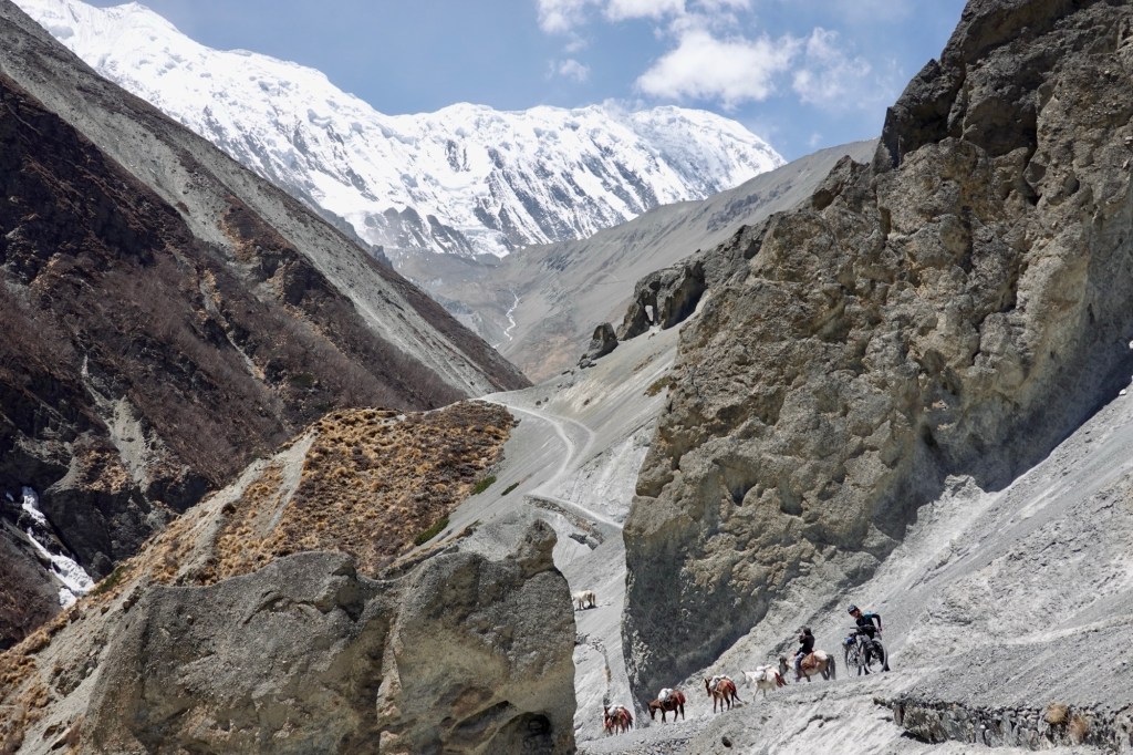
Wolf Afterwards we head into Pin Valley. As we embark on this journey, it’s a bit early in the season; rivers run high and fast, making the biking and hiking a refreshing undertaking. The scenery unfolds infront of us, with breathtaking views that change with each turn. New roads are everywhere in the making, linking high villages nestled in the mountains, extending to remote mountain passes, and connecting military bases.
Way to the valley 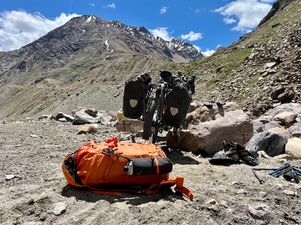
Hike a bike 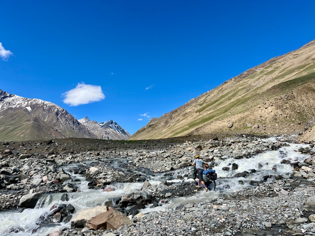
Rivers 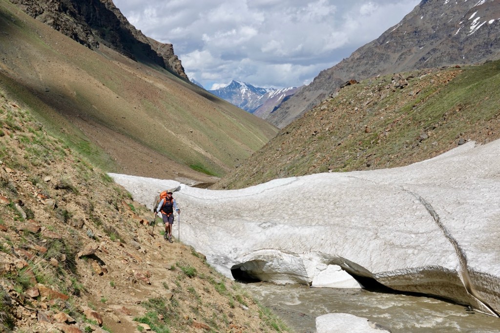
Only hiking 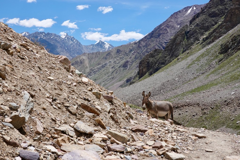
Donkeys 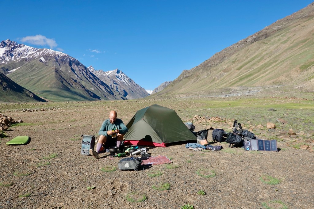
Camp 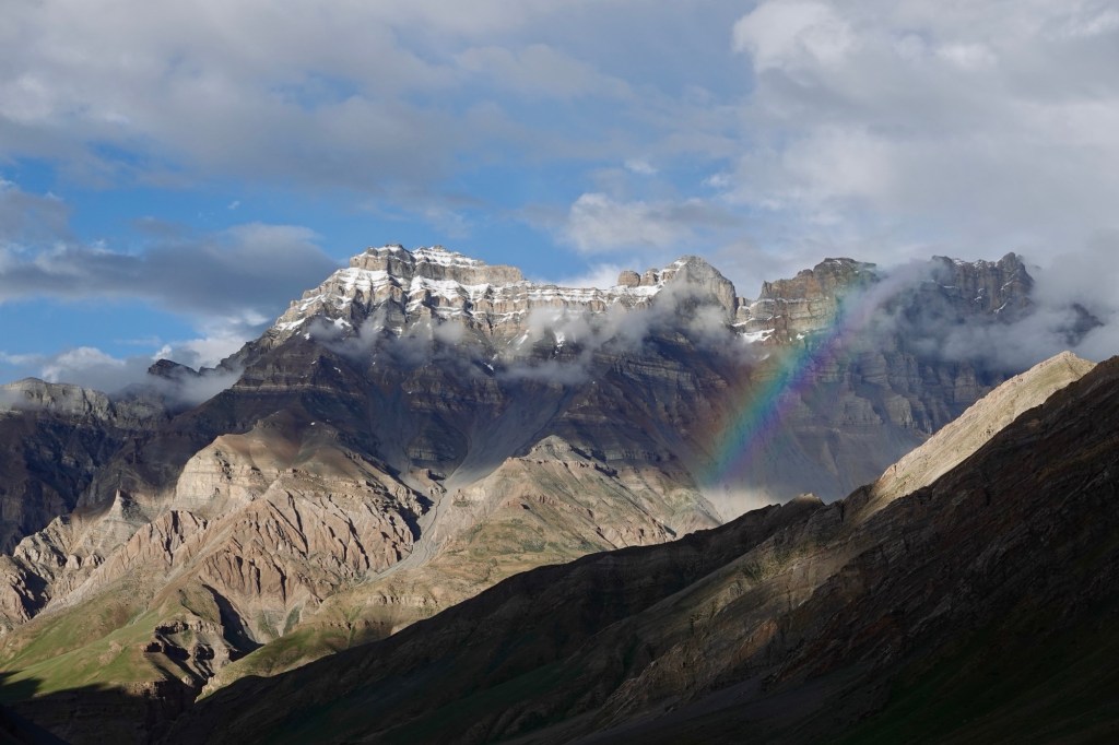
Rainbow 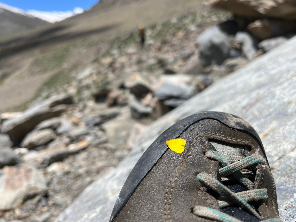
Hiking We choose another small detour over small villages that are located higher up in the valley.
Hikkim 
Tracks 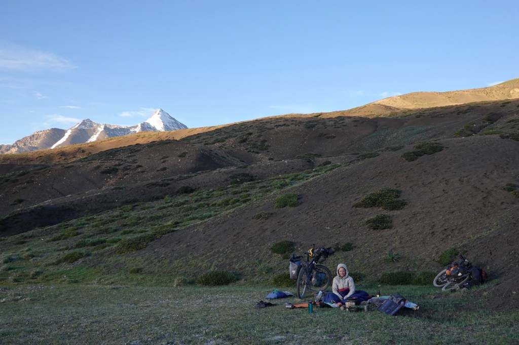
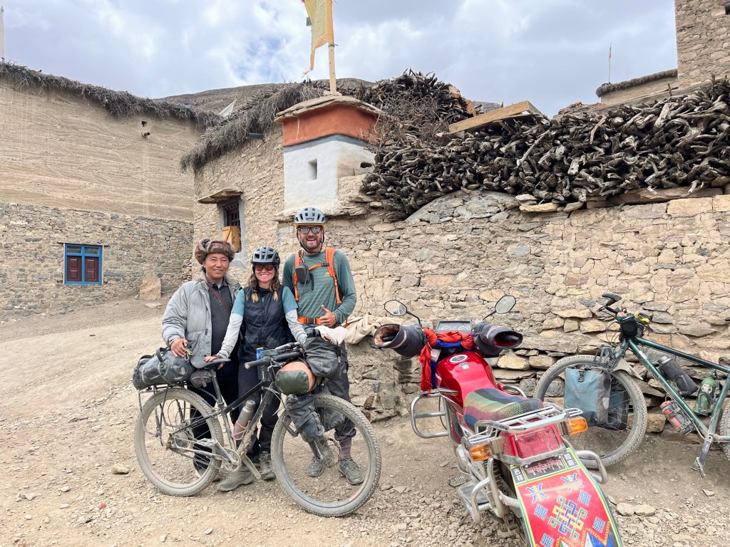
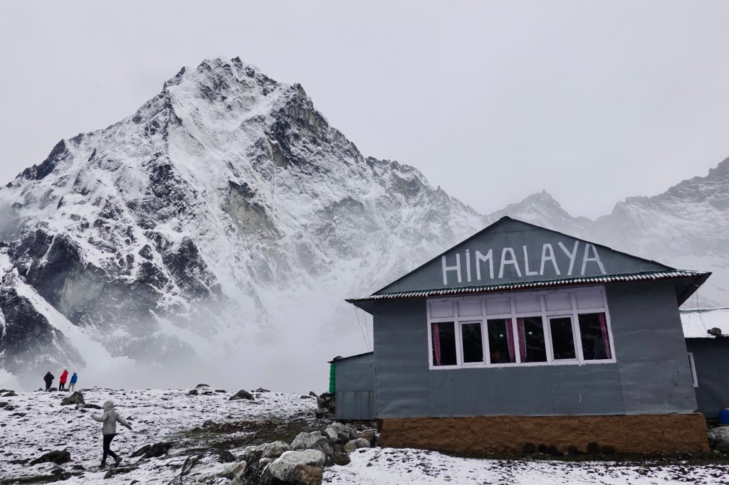
Midsummer a bivy In Kaza, we get to visit the hotel of a passionate cyclist who has explored many fascinating places, particularly in Africa. His spirit and experiences make it captivating to listen to his stories. While he operates one of the best-visited hotels in the region and boasts a well-run restaurant that serves delicious, locally-sourced cuisine, he still endeavors to keep the genuine spirit of slow traveling alive.
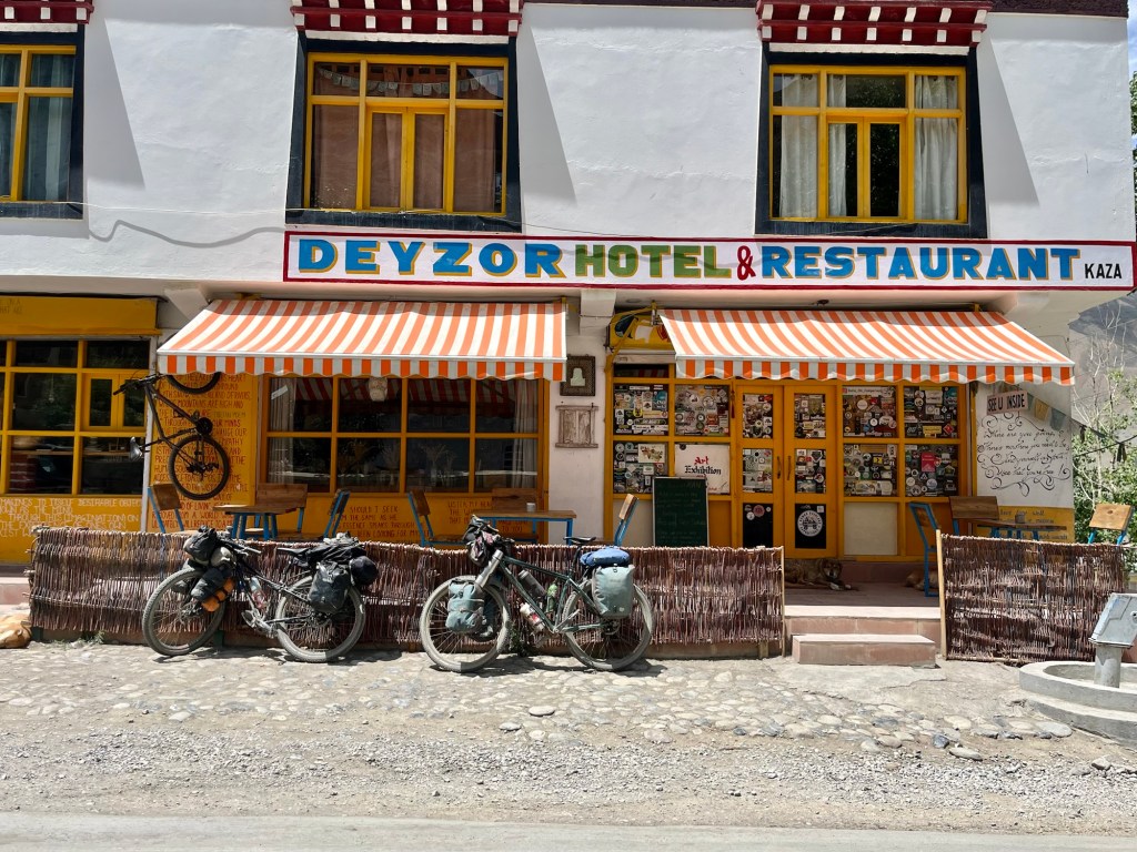
Deyzor – hotel In a village close by, we get to visit the fascinating project of his partner, a visionary who has dedicated her efforts to preserve sustainable architecture. A small group of dedicated individuals is working tirelessly to maintain the local, well thought-through natural architecture, which seamlessly blends with the surrounding environment. They engage in various activities, from using locally sourced materials to implementing traditional building techniques, ensuring that their work not only respects but also celebrates the natural landscape.
Some local tourists stop us, asking for directions, shops, and guesthouses. A few even ponder where this “Spiti Valley” is? Well, it was kind of hard to explain that we are currently in the middle of this Spiti Valley.
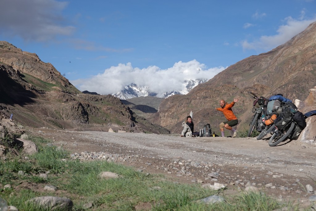
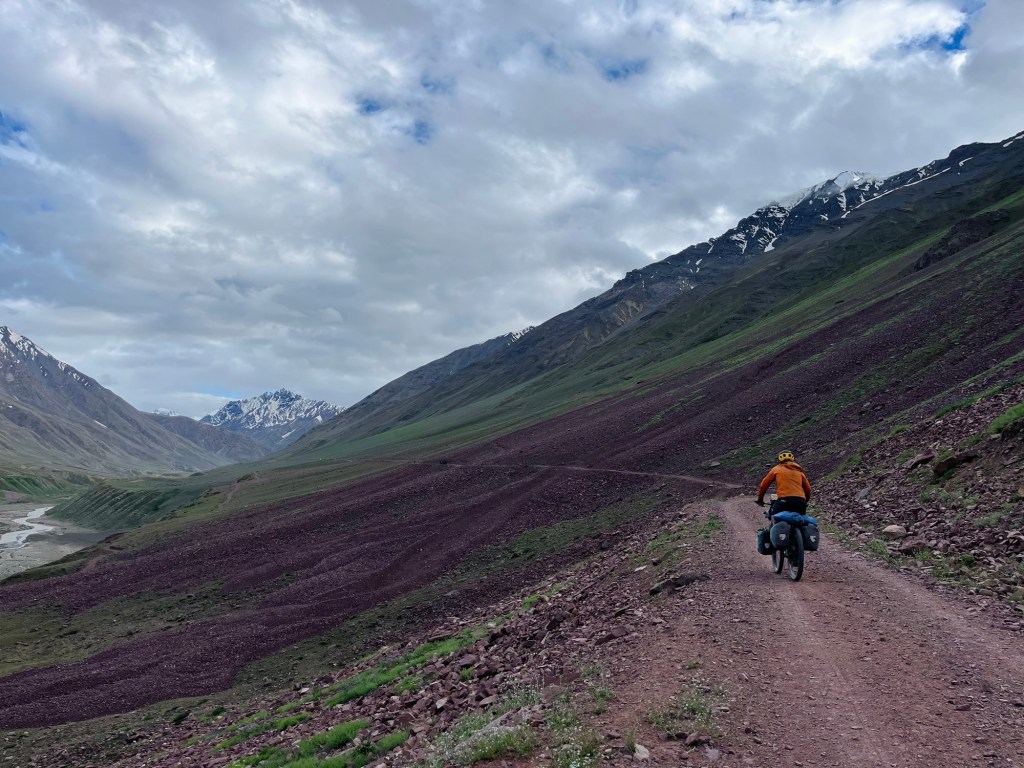
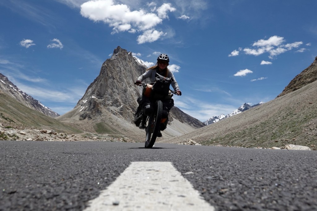
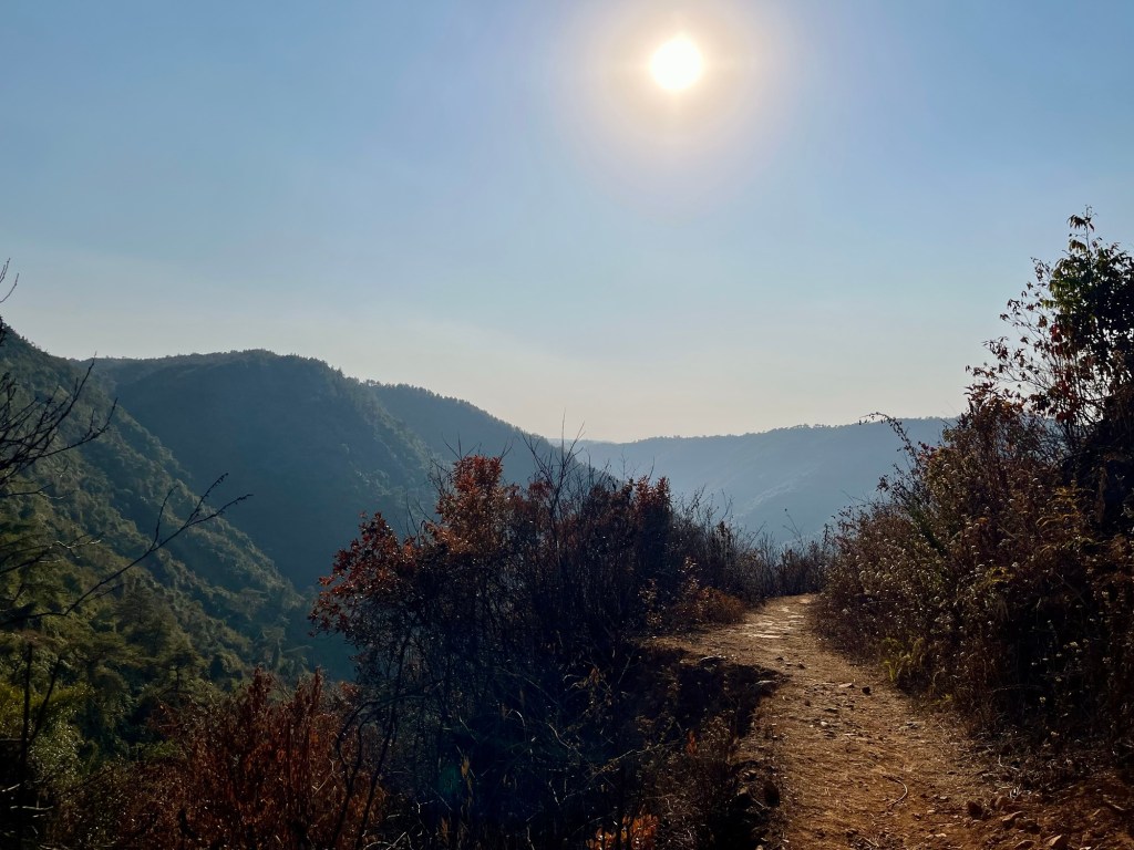
Road to the pass One minor food poising later, we head to the pass and are on our way to Zanskar via the lush and green Lahaul valley. As we traverse the winding roads, we are greeted by the majestic peaks of the Himalayas towering above us, their snow-capped summits glistening under the clear blue sky.
Lunch 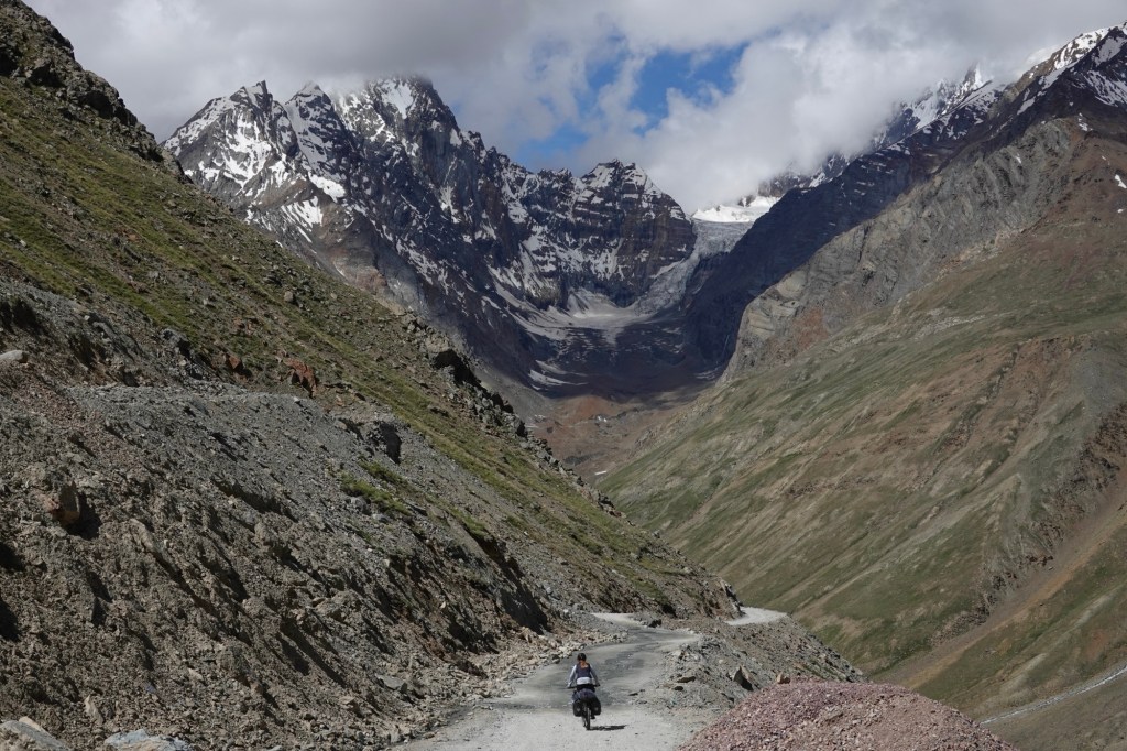
Downhill 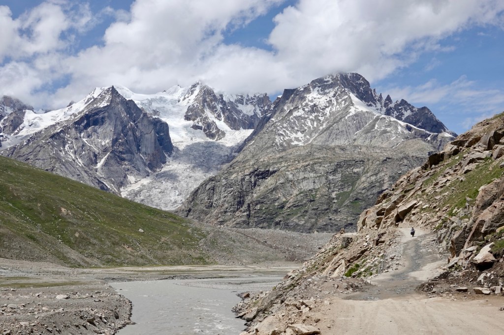
Downhill 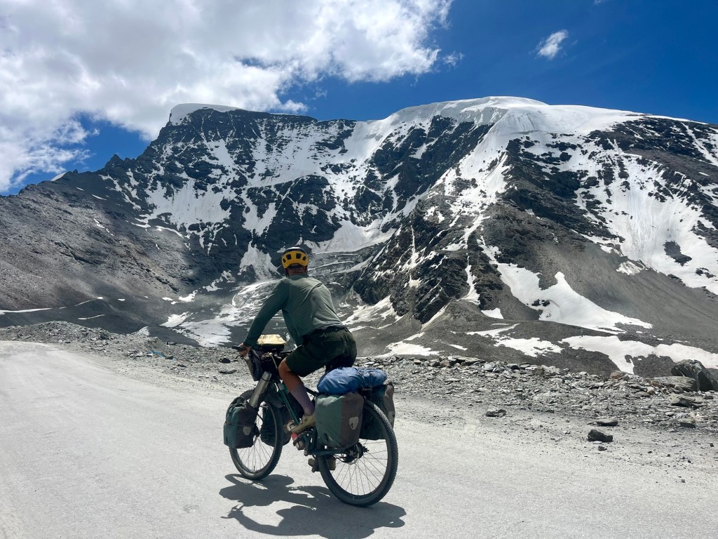
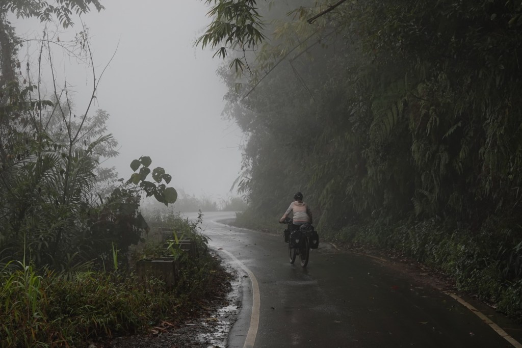
Downhill Entering Zanskar
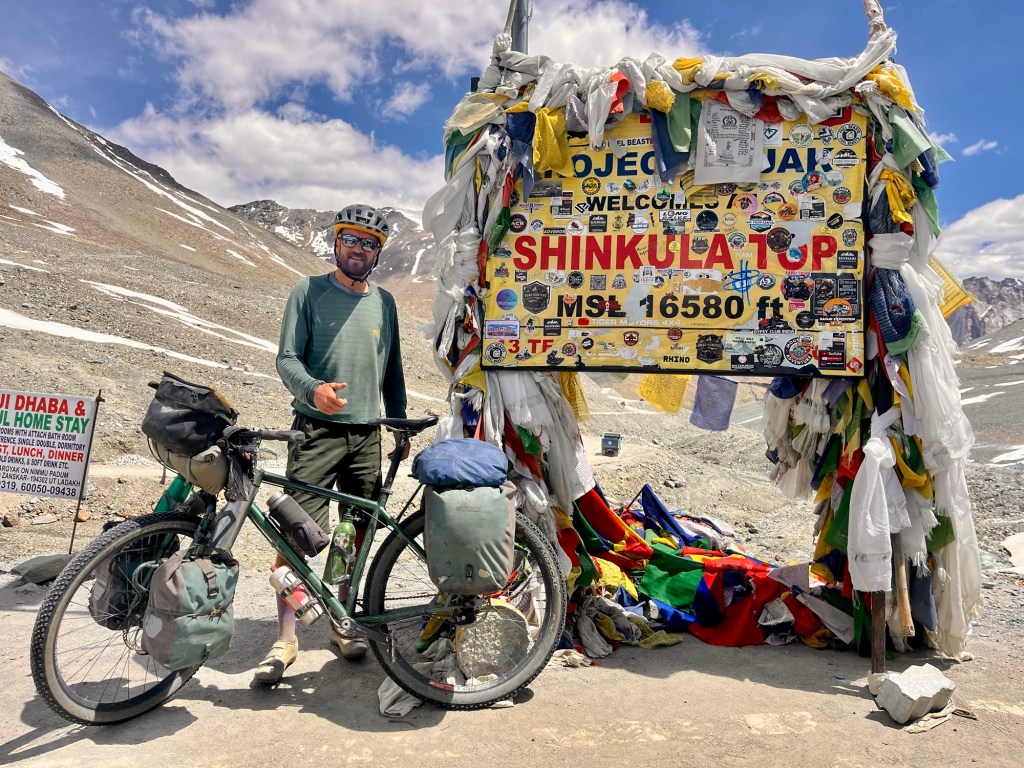
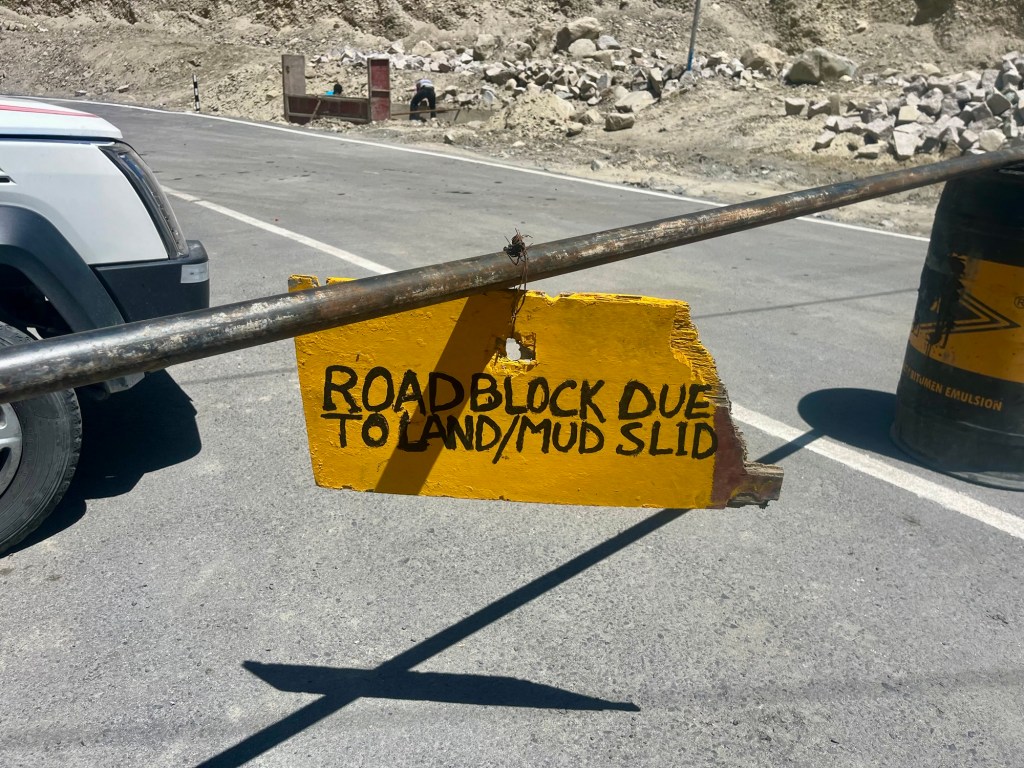
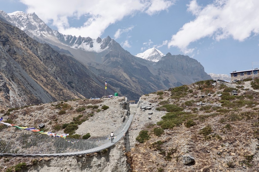
The mystery of Zanskar, with its frozen rivers and remote villages, crumbles with every stone that is blasted for the new roads being constructed to improve access to this untouched paradise. On the way to Shinku La, we find ourselves overtaken by many cars, and we join the throng of tourists whose eyes are glued to their cellphones eagerly capturing the moment as they pose next to the towering 5054 meter sign marking the pass. Oxygen bottles decorate the snowy slopes while on the other side road works are ongoing.
Shinku La 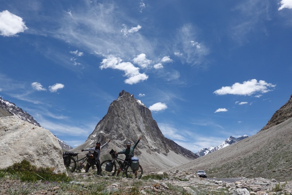
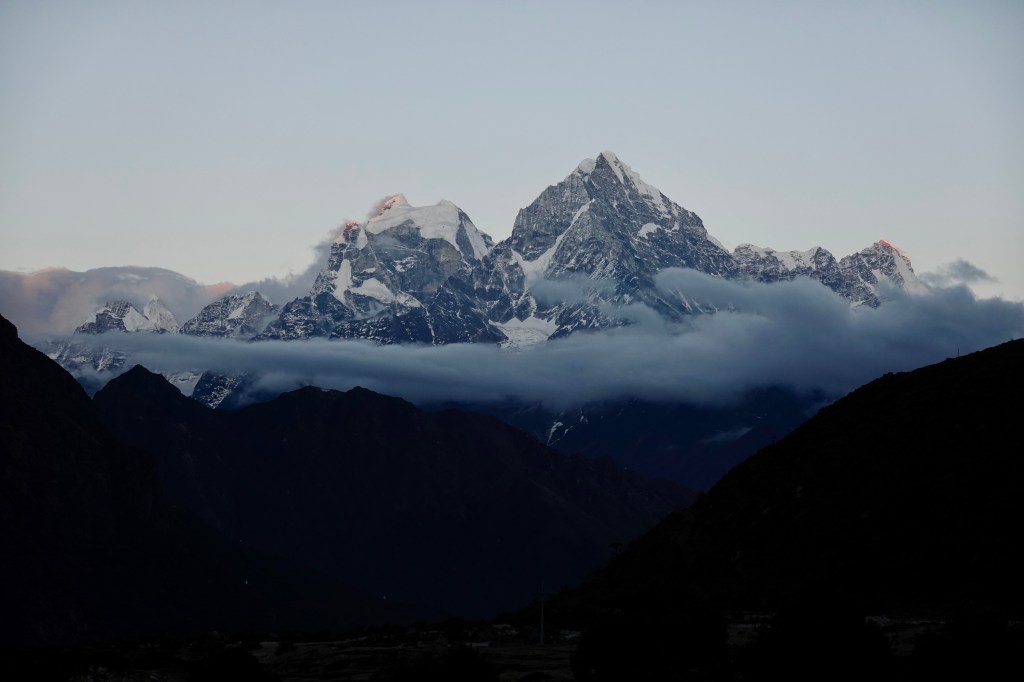
Gonbo Rangjon The excitement on the high pass is damped, yet on the way down, we become blissfully alone as we pass by the holy, very impressive Gonbo Rangjon mountain. The road here is fairly new and partially still under construction.
Cruising down the fresh tarmac with Gonbo Rangjon in the back Hiking guides who formerly led the multi-day excursion through Zanskar now own teahouses. As they reminisce about the adventure by foot they embarked only a few year ago. Now they take other opportunities with increasing tourist influx.
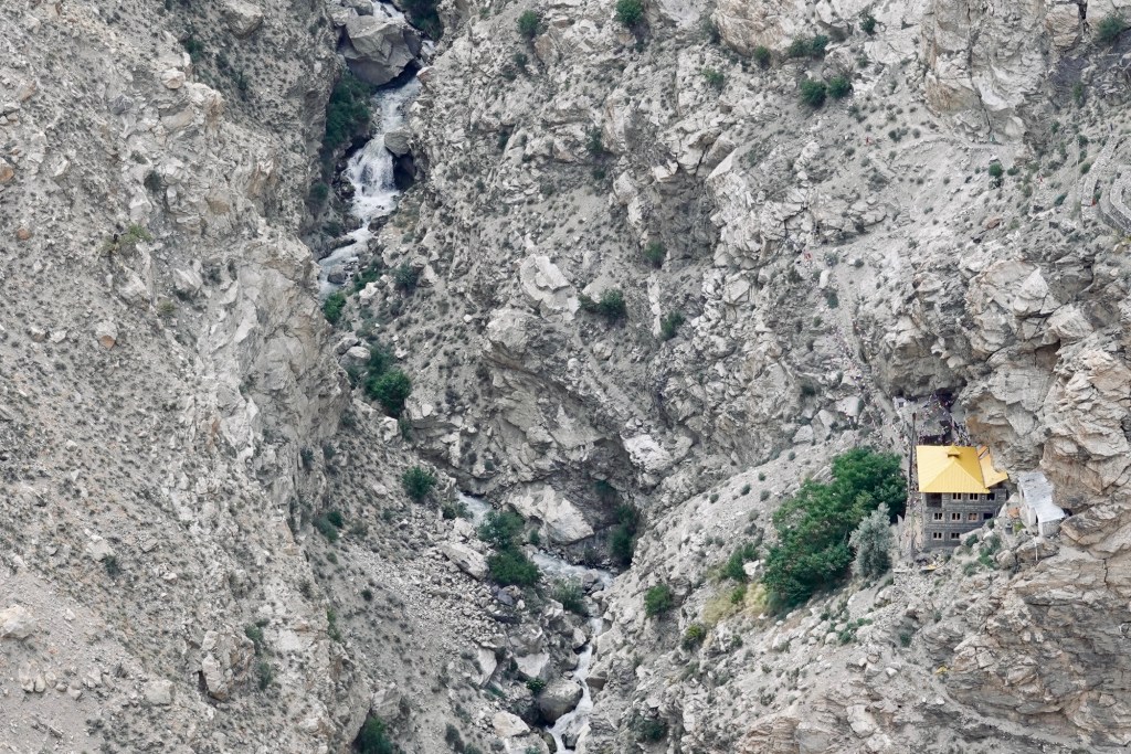
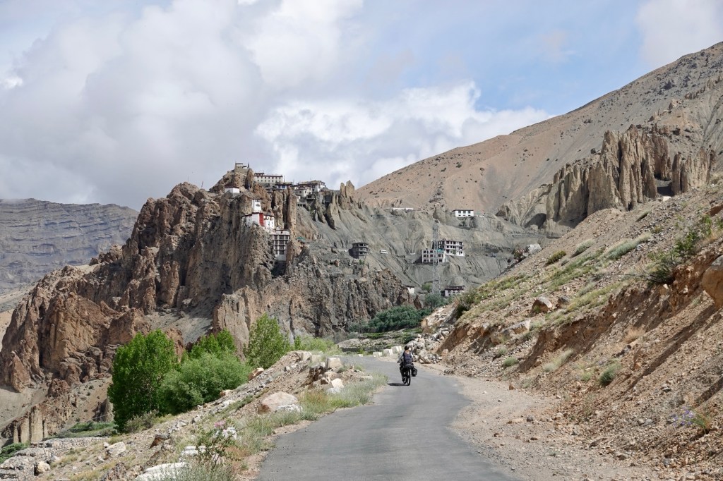
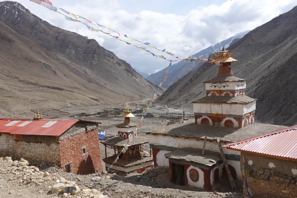
Gonbo Rangjon with tea houses In the evening, we visit the Phuktal monastery, built around an ancient meditation cave that has stood for centuries. It is believed that the cave was used 2,550 years ago as a mediation retreat. The gompa was set up in the 15th century and serves the Gelug school of Buddhism. Just few years ago it took several days of walking to get there, now we just pass by on the newly built road.
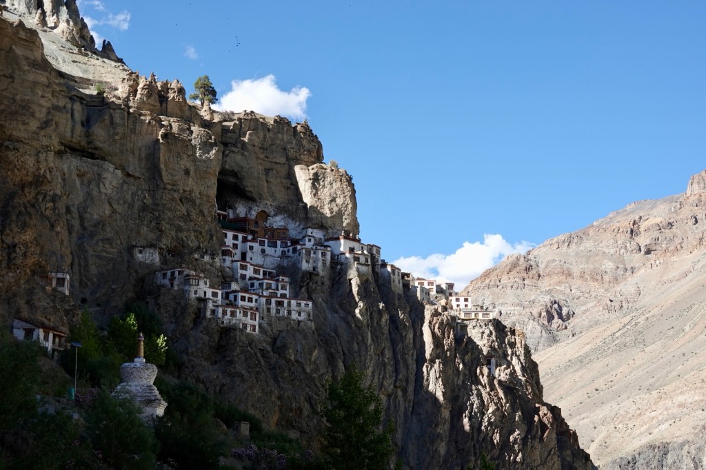
Phuktal 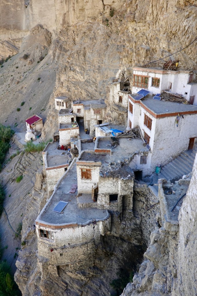
Phuktal 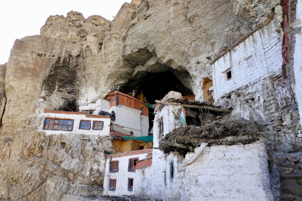
Phuktal 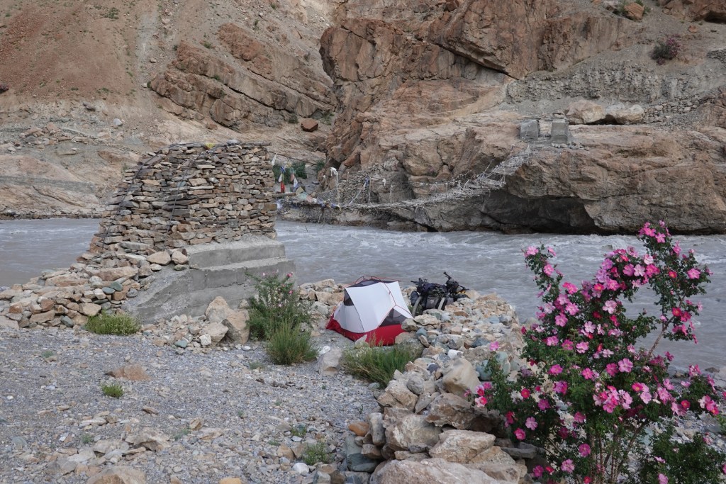
Camp Our journey takes us to Padum, a crucial junction where roads diverge towards the east and west, connecting to the regions of Kashmir and Jammu.
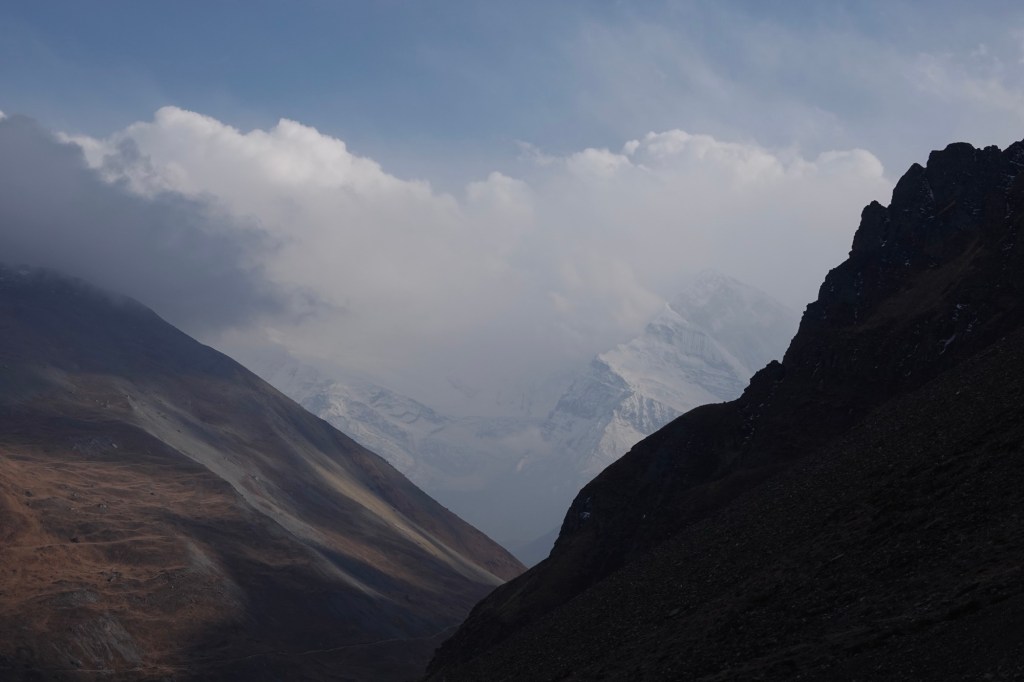
The view towards Padum is spectacular, with the mountains rising in the background like silent guardians, their snow-capped peaks glistening in the fading sunlight. From here, the road becomes more thrilling as it winds its way through newly constructed stretches, transforming from paved roads to gravel pathways alongside the rushing river. Massive amounts of rock are blasted to carve out this route. As we travel here, we can’t help but reflect on the past mysteries of traversing these mountains, a route once taken by explorers and traders who navigated the frozen rivers and high mountain passes.
Bath tub 
Passes 
Villages 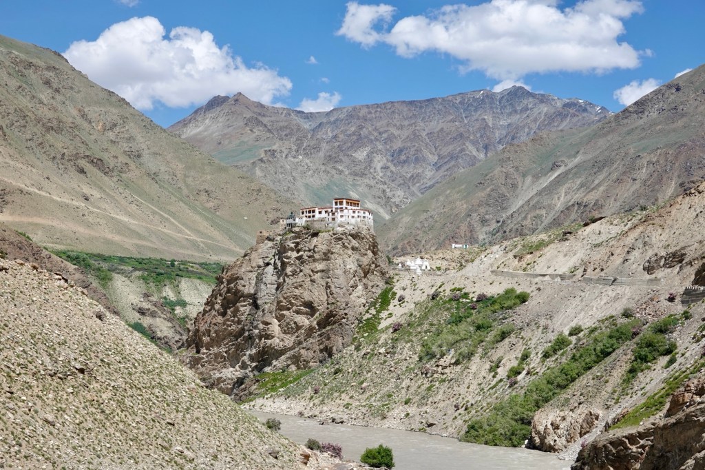
Monasteries 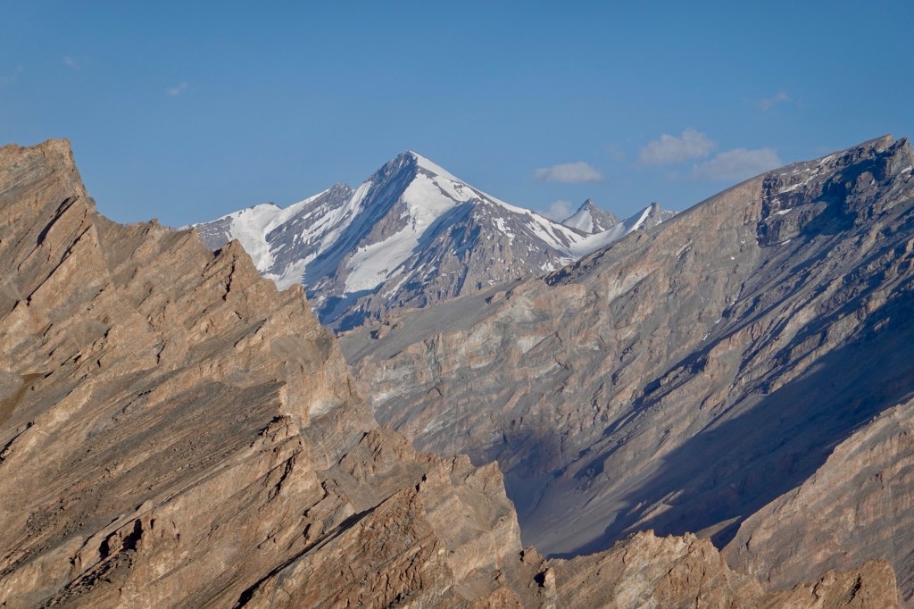
View A few 5000m passes later we are one a fun downhill towards the mighty Indus river, which we met in Pakistan last year alteady. On the way to Leh we stop at Alchi monastery, with impressive murals and wooden sculptures (no pictures allowed so you’ll have to believe us)!
River crossings 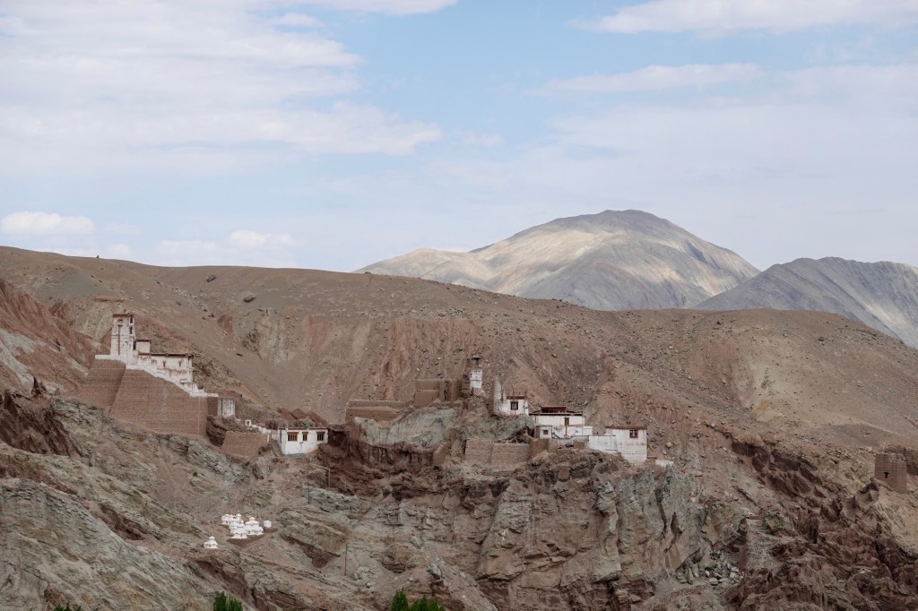
Villages 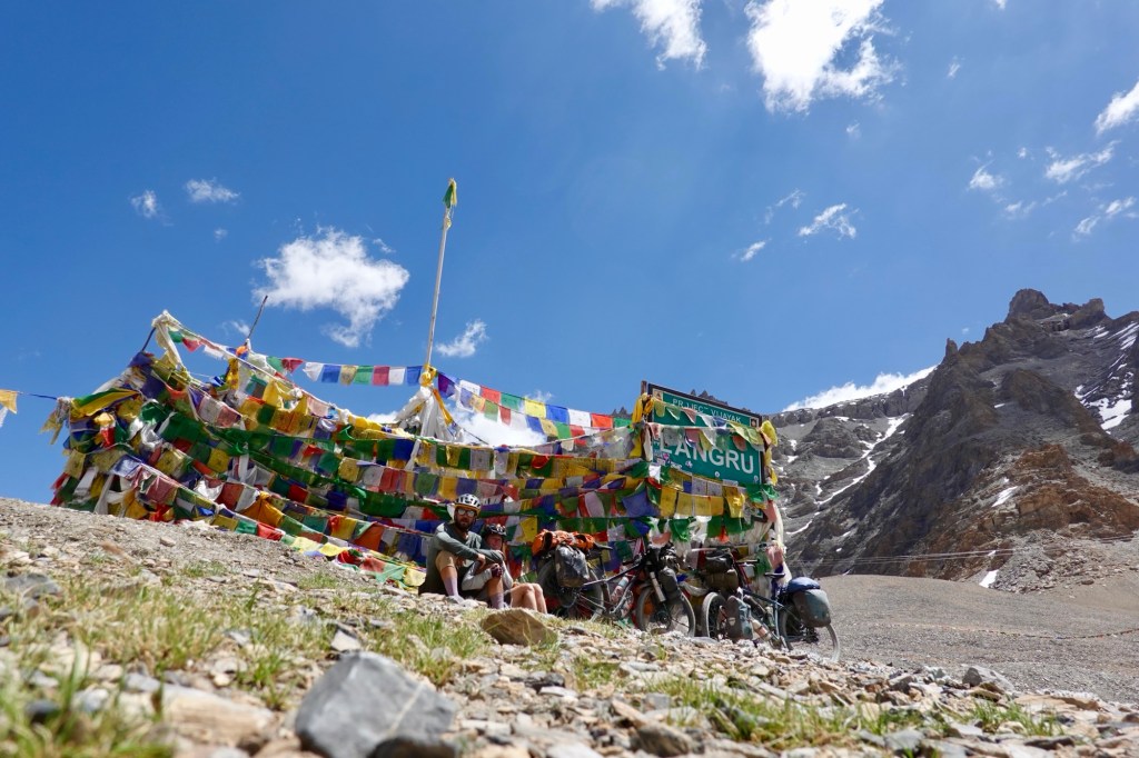
Pass 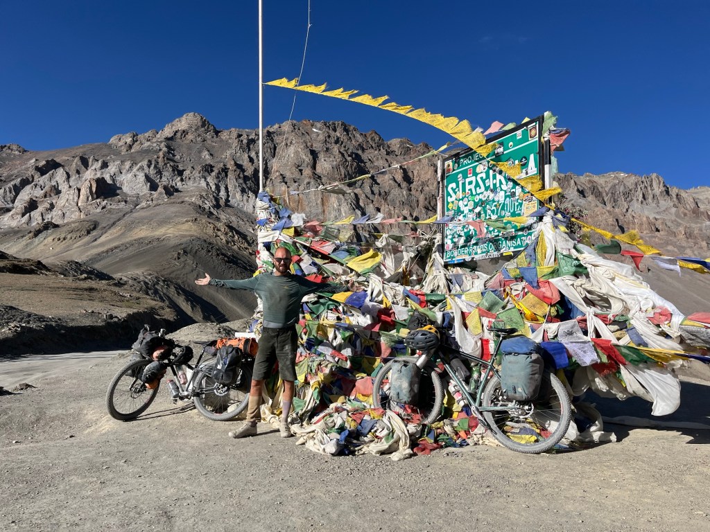
Pass Thereafter we finally reach Leh, the center of the region and capital of Ladakh, where breathtaking sceneries and vibrant touristic infrastructure await us.
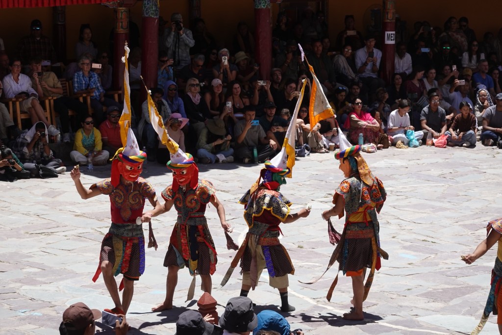
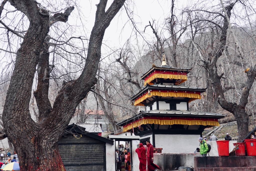
Hemis Festival
Equipped with our mountaineering gear, we are excitedly heading towards a little expedition – the cycles stay parked in Leh. Our first stop is the Hemis Monastery.
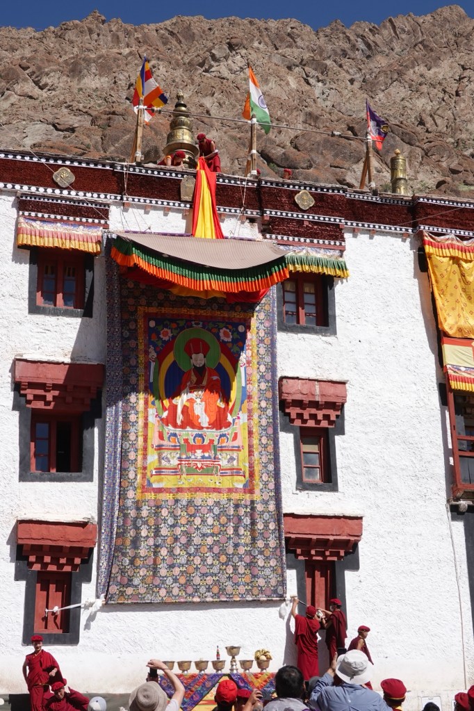
Thangka Here a traditional festival is currently taking place, attracting visitors from all around.
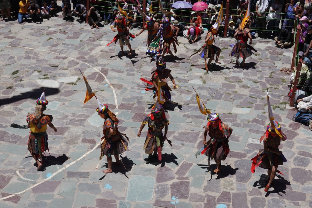
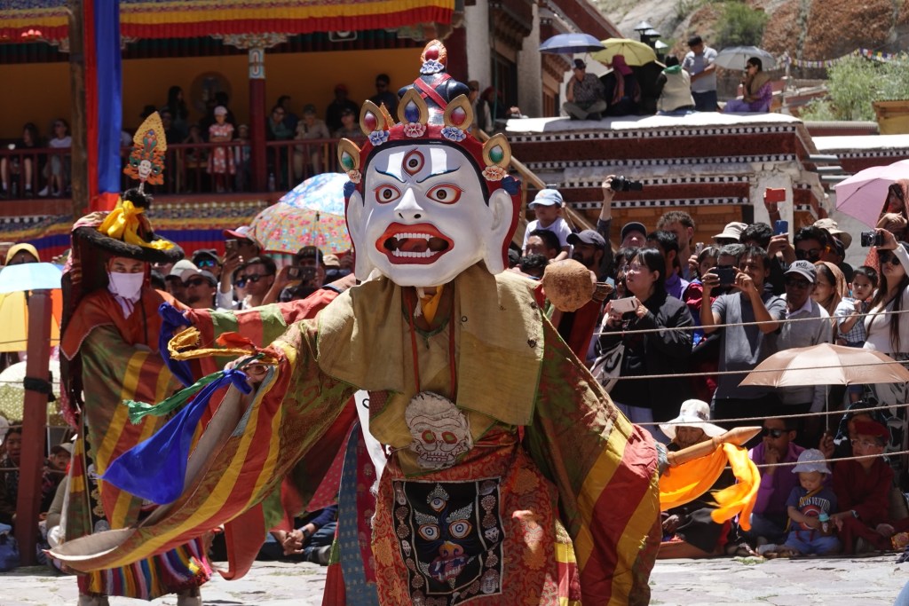
During this event, the traditional cham dance unfolds over the course of two days, beautifully depicting the deep-rooted history and captivating legends of the monastery.
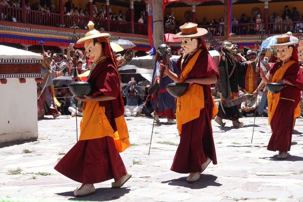
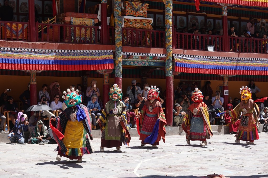
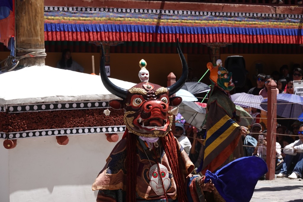
The colorful costumes, crafted masks and rhythmic music create an unqiue atmosphere under the burning Ladhaki sun.
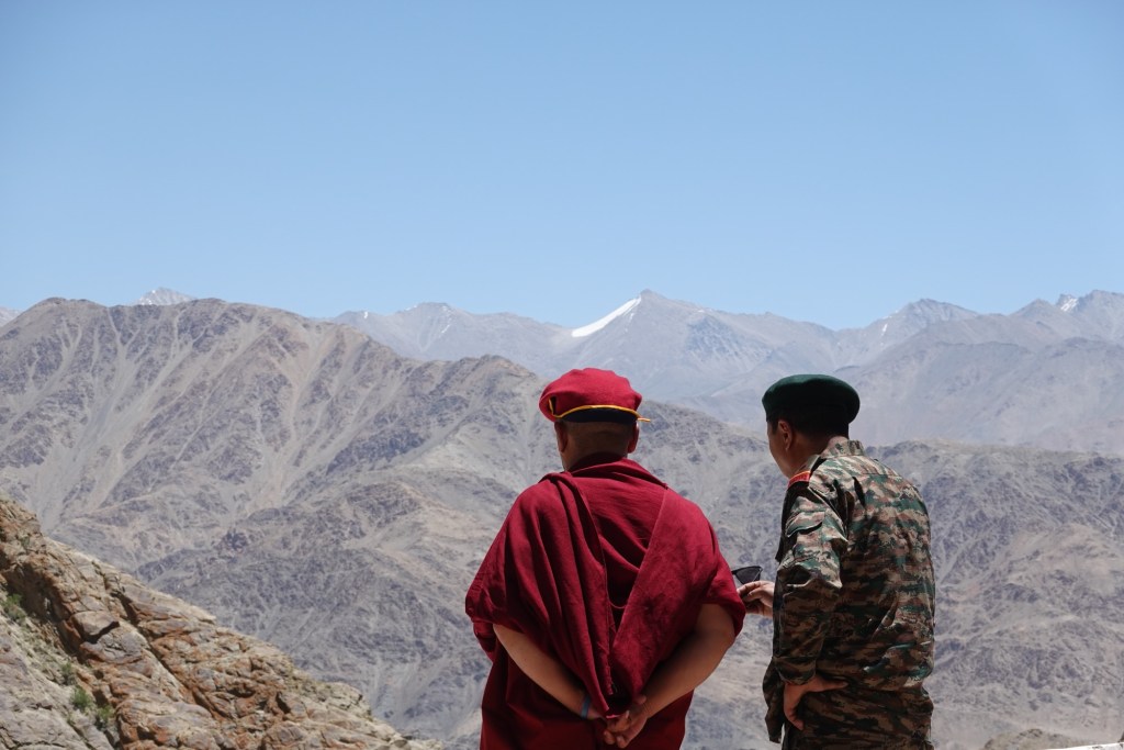
Military and monastery elders Kang Yatze II
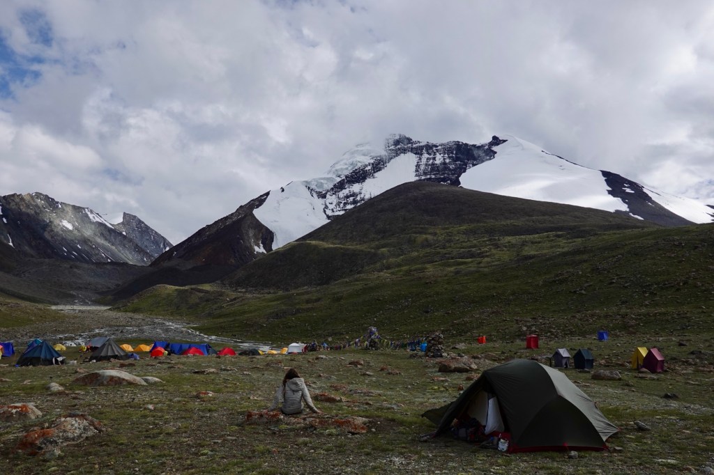
A little later, we are off to the base camp of Kang Yatze II, a well known and relatively accessible peak standing at 6200 meters. On the way we spot an animal hushing via the plains – way too big for a marmot and no deer. After zooming in with the camera it turns out we spotted a wolf on 5000 meters. Just before the basecamp! What a great moment.
We set our alarm for 3 AM the following morning; however, we soon realize that the relentless rain/ snow and ominous thunders and clouds are not the best conditions for this tour, forcing us to stay grounded.
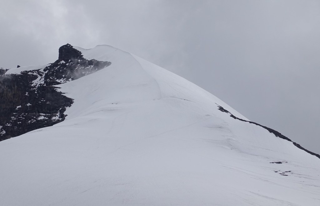
Kang Yatze II After a long day cooped up in our tent, we try our luck again the next day. After 500 altitude meters over jagged rocks, we finally reach the edge of the glacier. The route is straightforward – a steep ascent that seems to push us nearly vertical to the top. The air grows thinner as we ascend past 6000 meters, making every breath feel like a challenge. Shortly thereafter, we find ourselves at the peak.
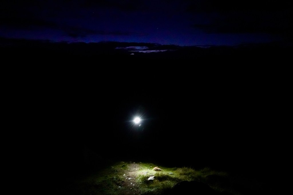
Early start 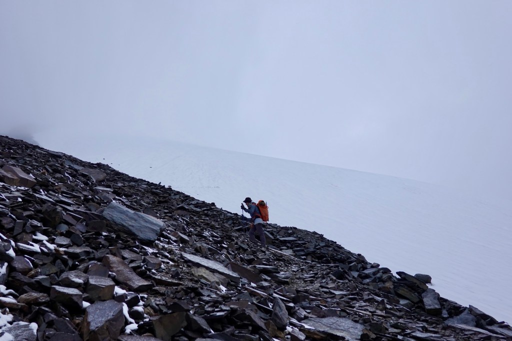
Hike 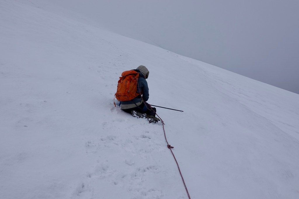
Glacier 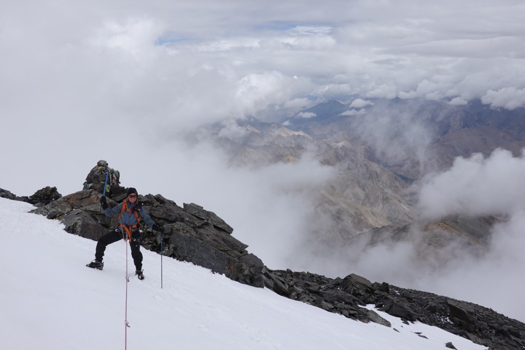
the only few that day 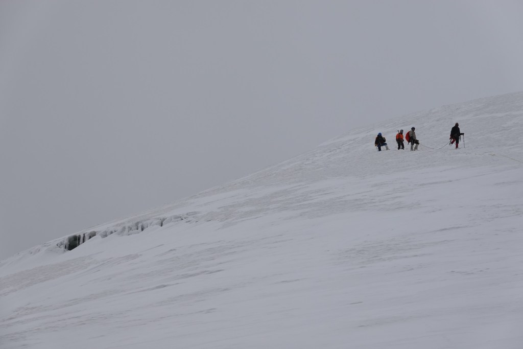
One more group 
Peak!! Although we are met with no breathtaking views, we are thrilled to reach the peak – second 6000m peak, this time around as a team of two. As we make our way back to camp, thunder rumbles ominously in the distance, and we fortunately return just in time, to enjoy one sip of celebration coffee before retreating back to the tent because of a hailstorm.
Later, we prepare to move on to the next base camp of Dzo Jongo, but the snow fall during the night dictates our decision to forget about the summit.
So we continue our trek via an alternative route that we have carefully chosen. Leading us through Pobe La, a little-known pass that cuts through a majestic valley filled with towering peaks over moonlike landscape before entering an alpine flower garden. The trails are not marked and vanish at some point, leaving us reliant on our GPS to navigate this unfamiliar terrain.
Cuddle 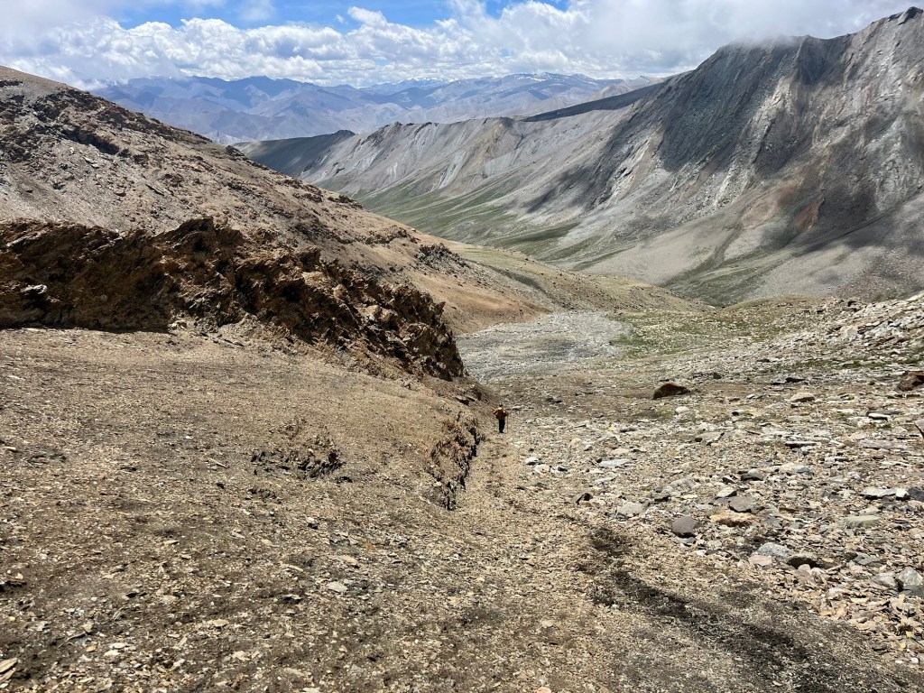
Tracks 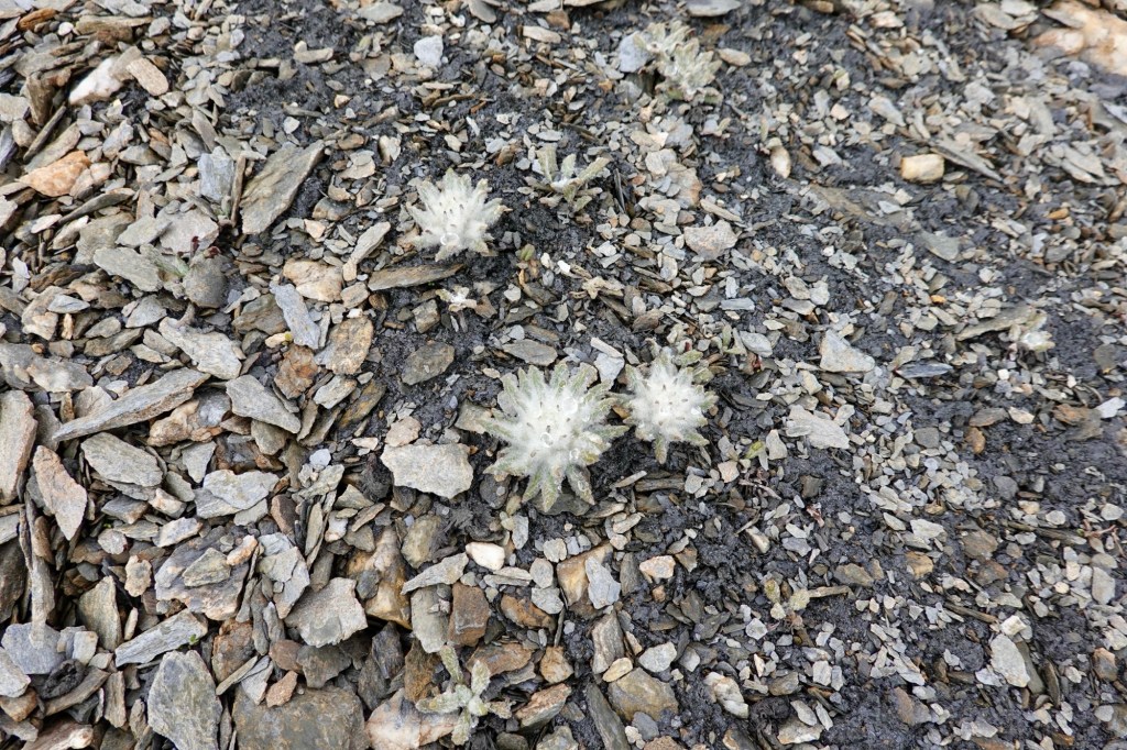
Edelweiss 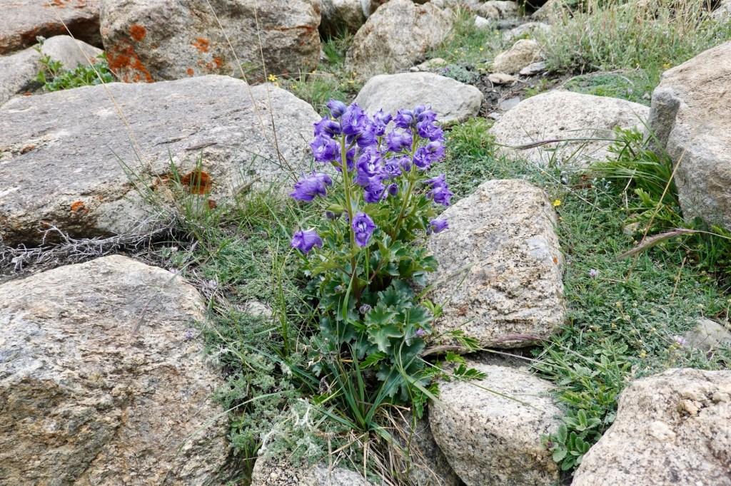
Bloom 
Bloom 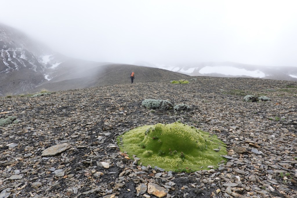
Moos plobs As we continue our trek to Lato village, which lies on the Manali Leh highway. From here we plan to hitch a ride back to Leh. Our stay in Leh ends up being longer than we initially intended; the food is simply too good to resist! Amidst our culinary delights, we discover that fellow cyclists, whose routes inspired a significant portion of our Mongolian adventure, are urgently seeking a specific Rohloff spare part – one that we have fortuitously been carrying for many kilometers.
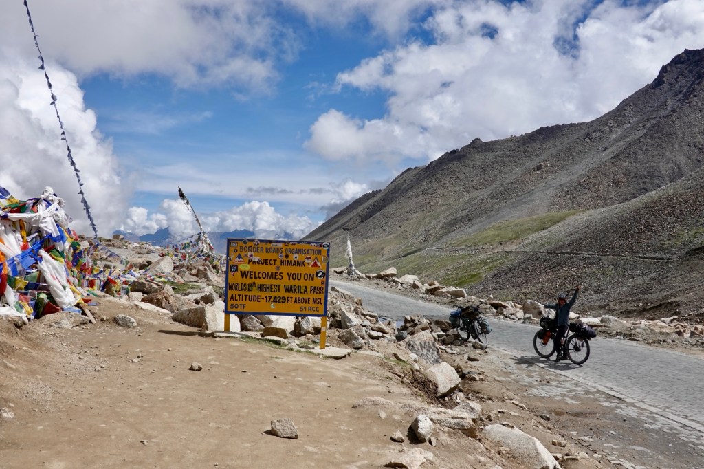
Boys and bikes We head to Wari La, from where we are rewarded with another spectacular view of Kang Yatze II.
Wari La After the downhill at Wari La we find ourselves at a roadblock due to a glacier eruption. So we hitch back up to take an alternative route and make our way to Chang La.
Well…. 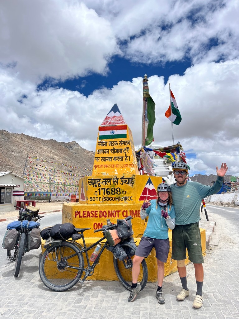
Chang La 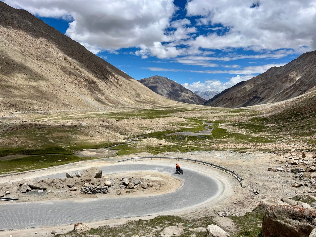
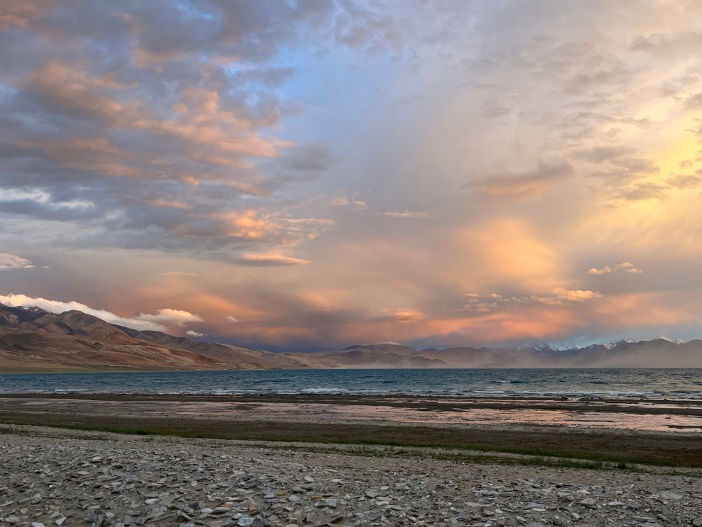
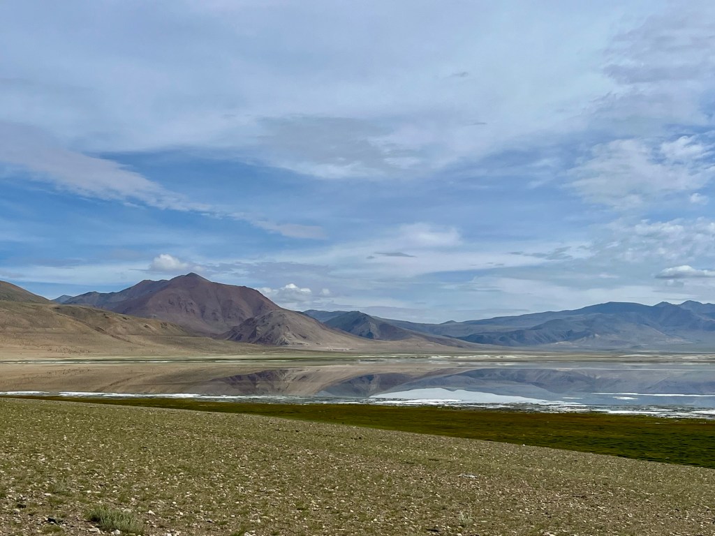
Downhill We traverse Chang La again soaring above 5000 meters. A brief stopover at carribean like Pangong Lake. China and India share the lake. Wild horses/ wild arse are roaming around its shore and a good amount of birds bath and feed in the lake.
Camp Lakeside 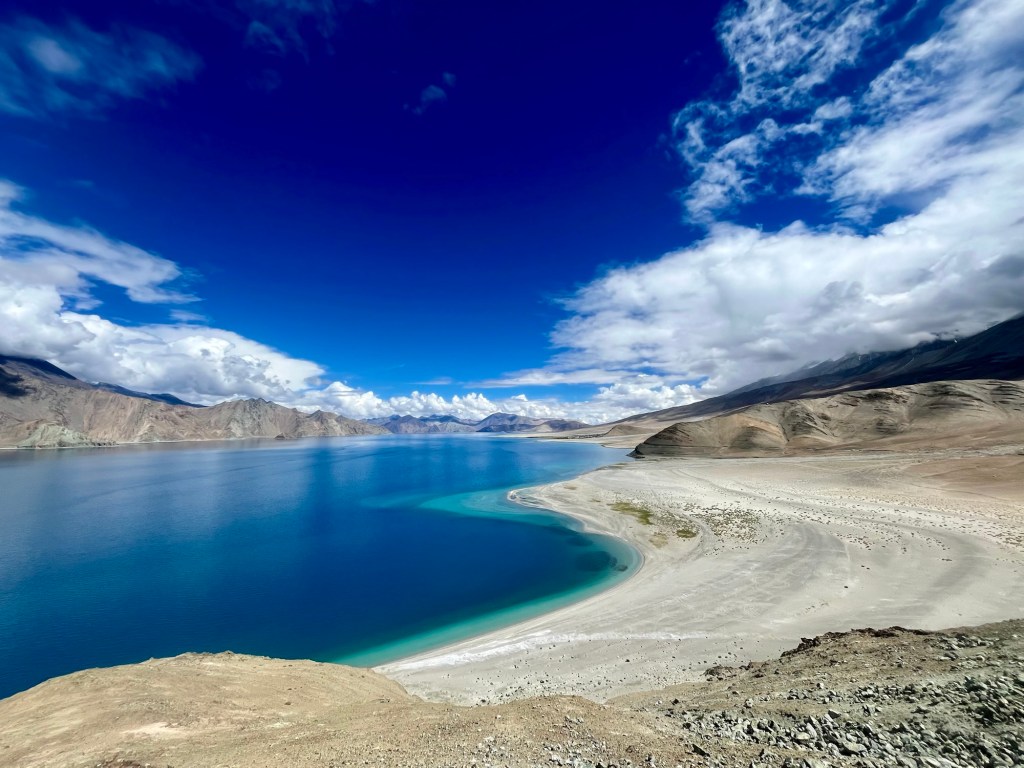
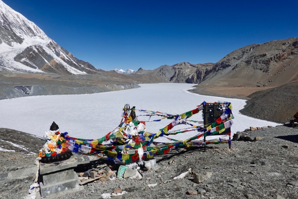
Pangong Lake Thenafter we head to Kaksang La, which until now was our favorite pass.

Kaksang La Before we continue on our adventure, we make a stop in the quaint village of Hanle. It is here that we meet David – he is guiding a Swiss cycling group, who are on their high-altitude training trip. Hopping seemingly effortlessly from one pass to another.
Umling La 5800 meters
Thereafter, we make our way to Umling La, which is currently recognized as the highest motorable pass in the world, reaching an astonishing altitude of 5800 meters. The climb, surprisingly, feels easy and once we reach the top, we take a moment to reflect on the other “major” achievements of our tour so far. While Umling La holds the title of the highest pass we’ve conquered on a bicycle, we can’t shake the feeling that other passes, located in more remote and untouched areas, resonate with us on a deeper level, leaving lasting impressions and sensations.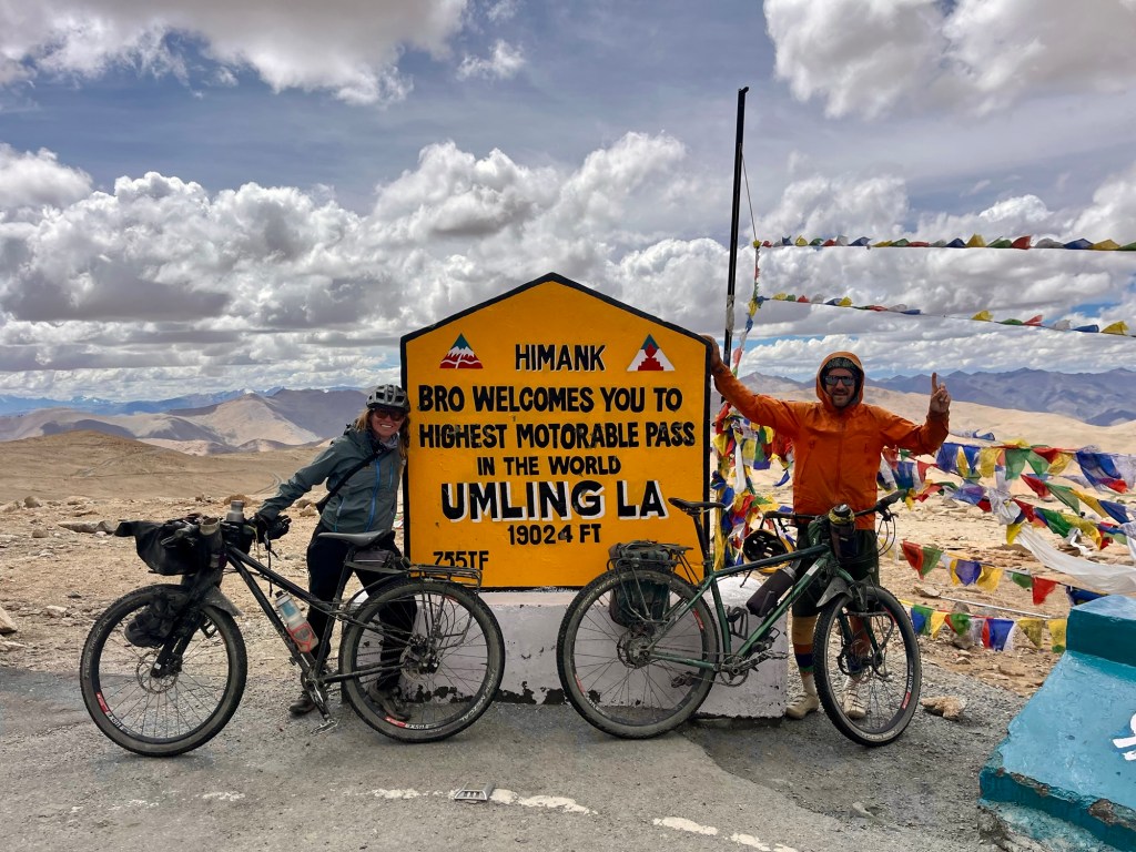
Pass 
Signs The next day, we head towards a bit of a quieter area, where I get to enjoy my birthday party at the beautiful Ryul Tso (lake).
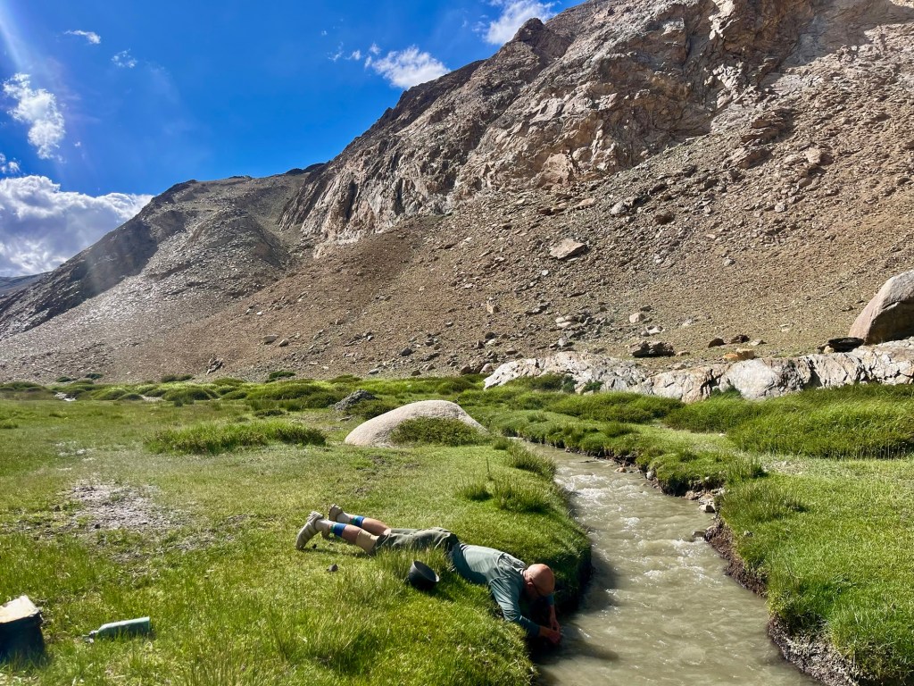
Water refill 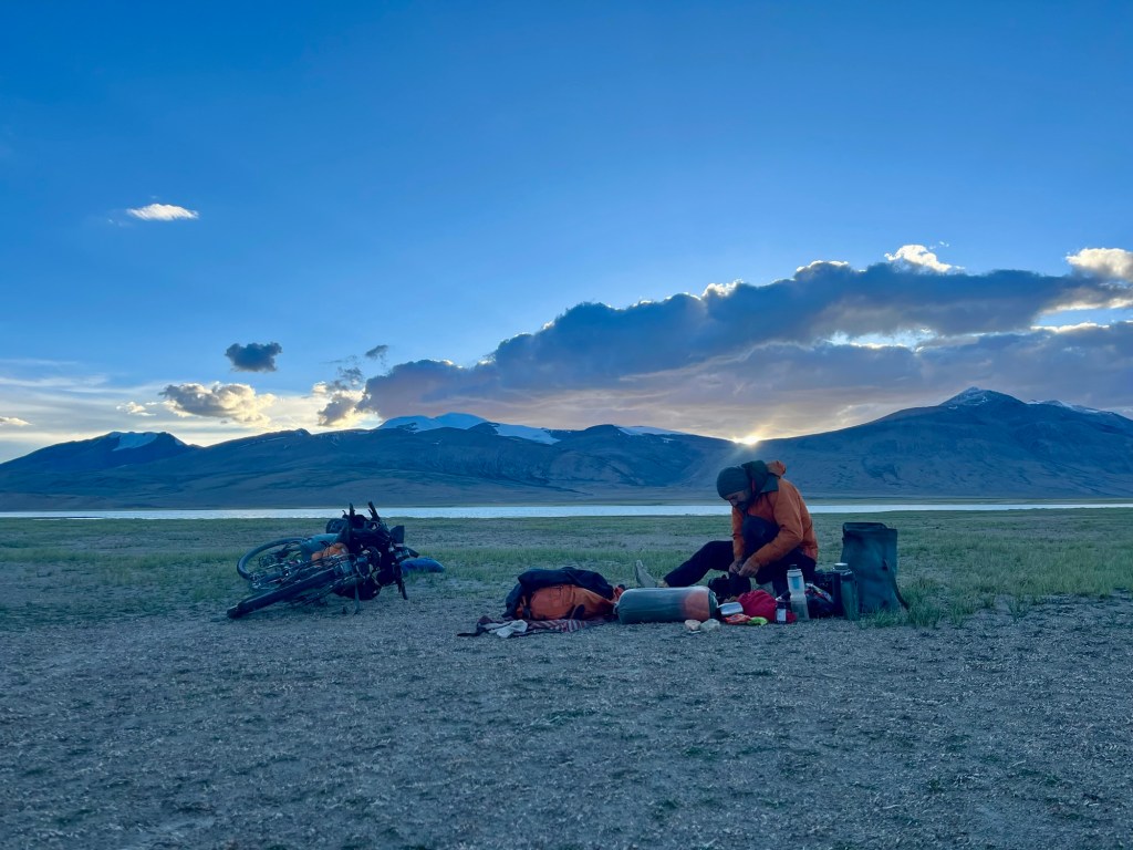
Lake serenity At Tso Moriri, we decide it is time once again for some long overdue hike a bike adventure, and we excitedly follow the winding hiking path towards Tso Kar lake.
Tso Moriri 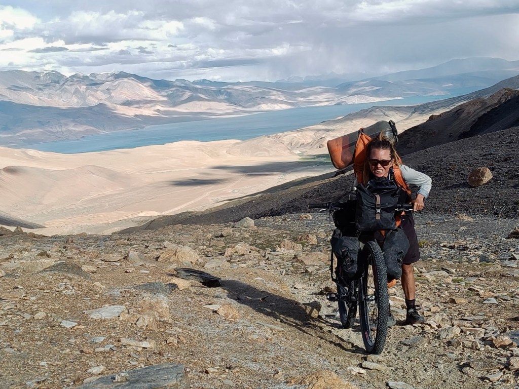
Pushing up to the pass with Tso Moriri in the back 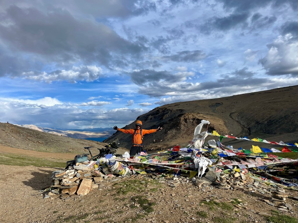
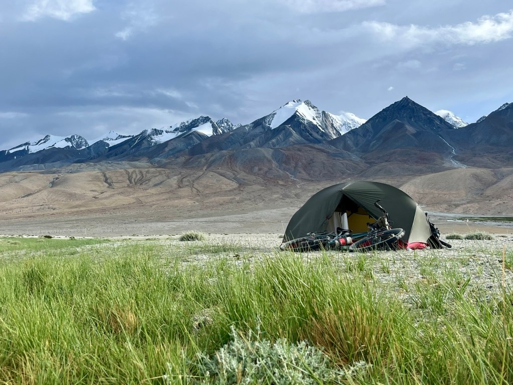
Pass We enjoy the highest camp of our tour at 5400 meter, some technical paths and pure nature. One shepherd comes our way aside from this the valley is absolutely quiet.
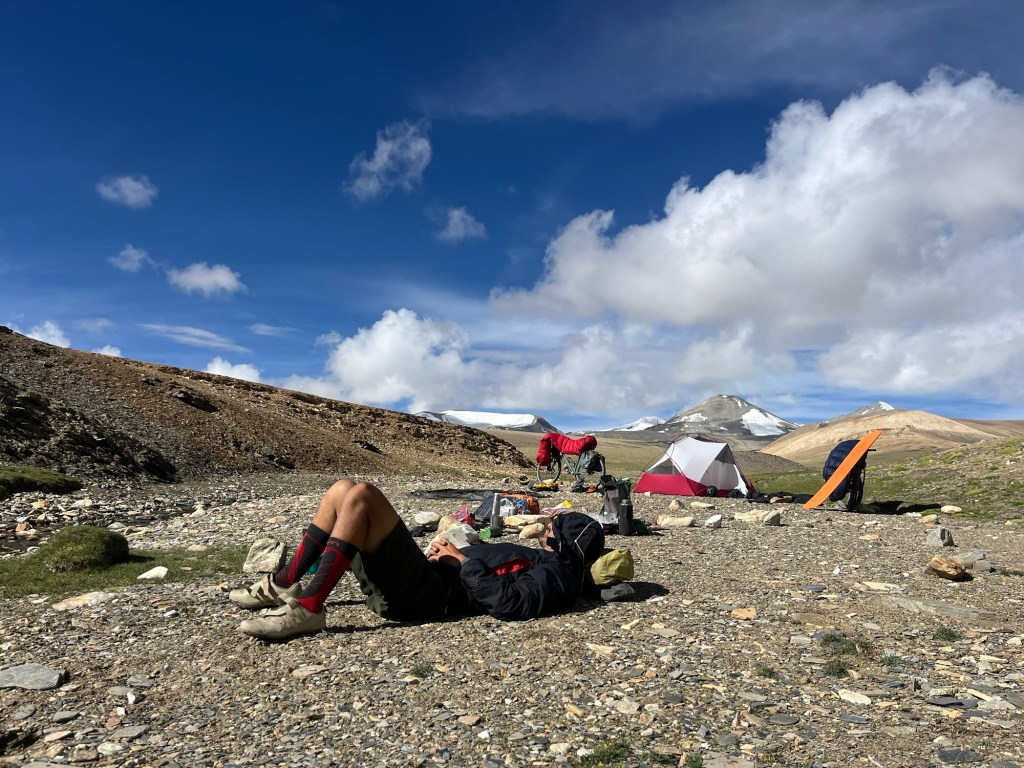
Camp chillout 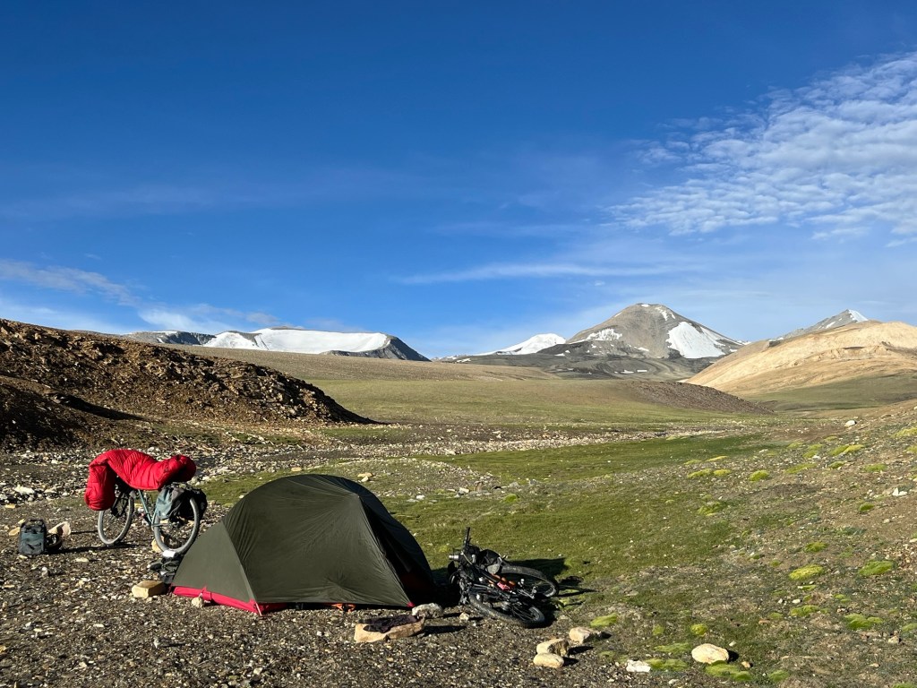
5400 meter The fun track offers crystal clear rivers around every bend, and it feels so much more adventurous as soon as we leave the tarmac behind.
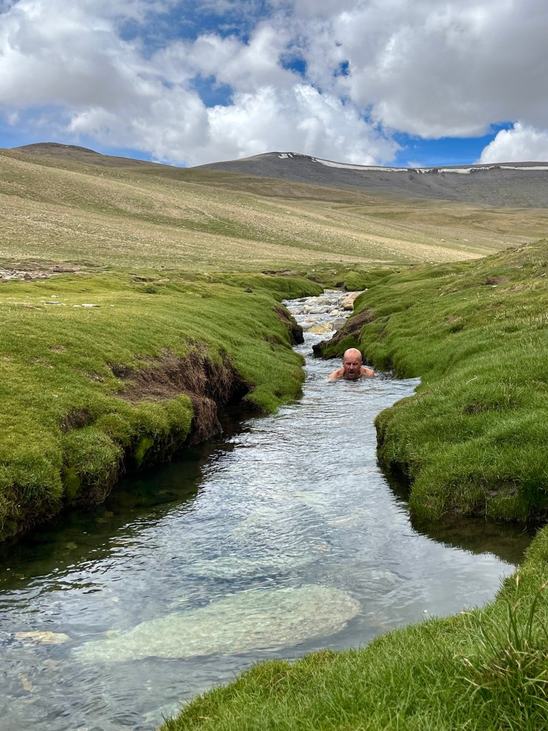
Bath 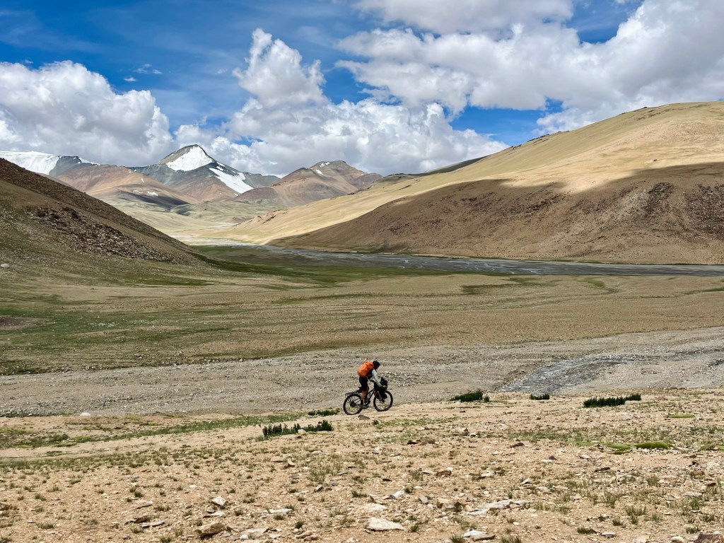
Tracks 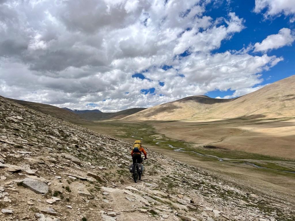
Tracks 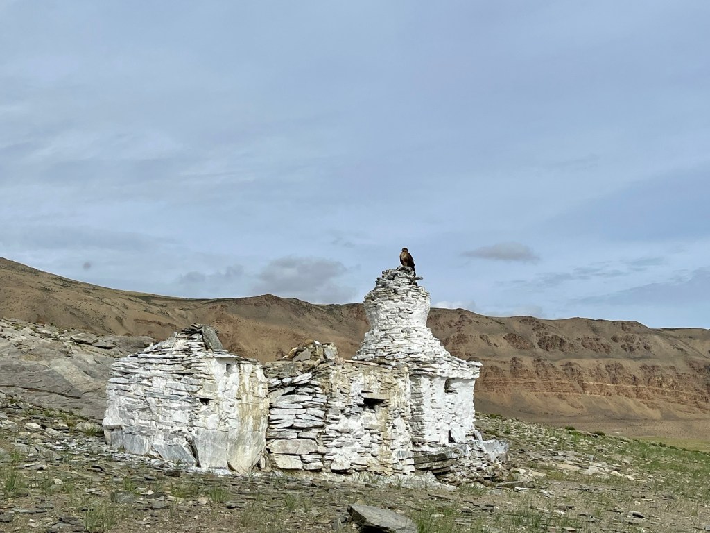
Birdlife We reach Tso Kar which lies like a mirror in the barren landscape.
Tso Kar Thereafter, we navigate along the iconic Manali Leh highway until Keylong, where we gather to celebrate Rolfi’s birthday in the cozy warmth of a sauna, providing a perfect antidote to the chill of the high-altitude surroundings. A bad weather period is incoming, and with it comes the challenge of blocked roads, which makes it increasingly difficult to move forward on our journey. So we decide to hitchhike, an experience that turns out to be quite difficult as we find ourselves waiting for a long time, exchanging hopeful glances with passing vehicles. The rain continues to pour down relentlessly, leading to roads becoming flooded and landslides blocking our way. The area we traverse is especially prone to flooding and landslides, a reality that causes numerous fatalities and significant damages each year. After a temporary halt in Manali, we finally attempt to make our way to Delhi; however, a journey that usually takes about 10 hours stretches to a daunting 72 hours due to the extensive road damages.
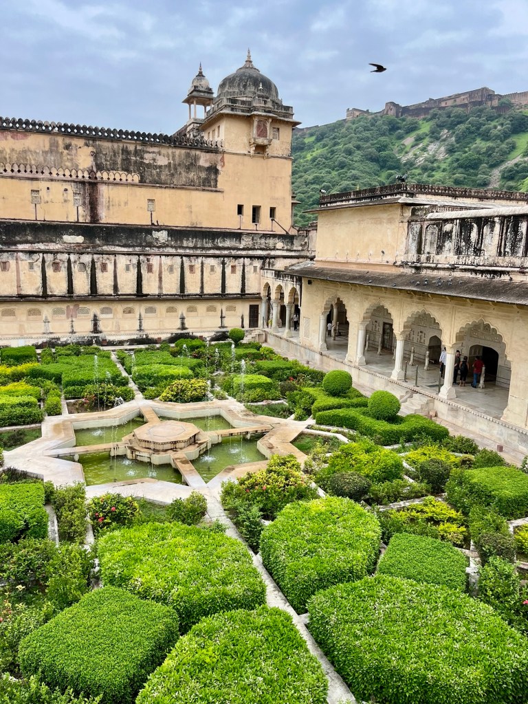
Once we reach Delhi, we get some sleep and start to organise one last sightseeing trip to the city of Jaipur.
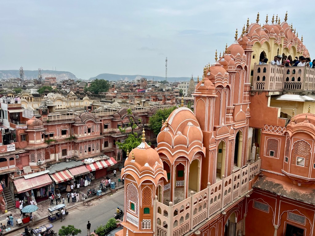
Hawa Mahal – Wind palace We wander through the historic forts, an ancient astronomy observatory and palaces. And we get to enjoy one of the best coffees of our trip with beans from the south of India.
Fort 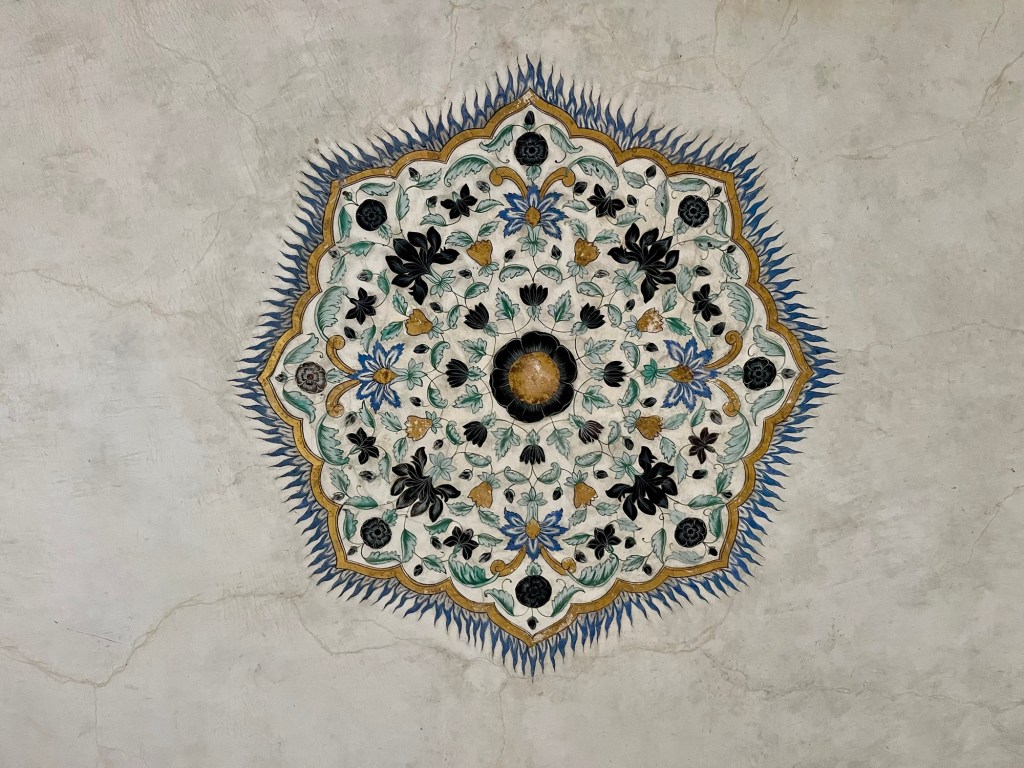
Details 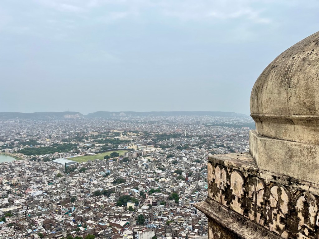
Jaipur 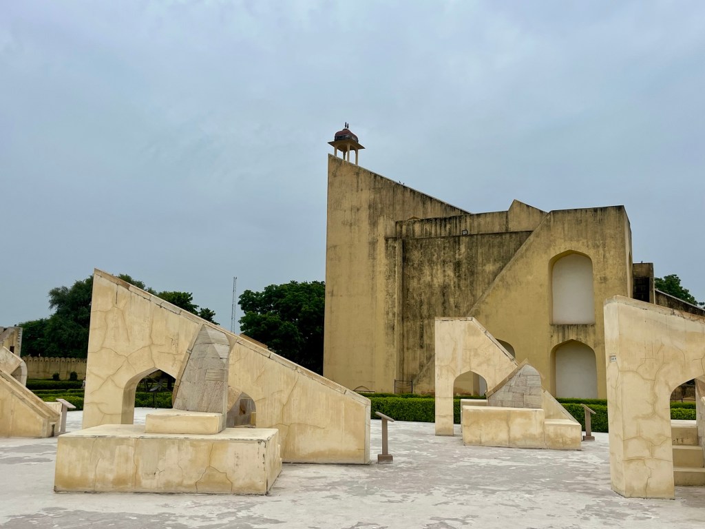
Observatory 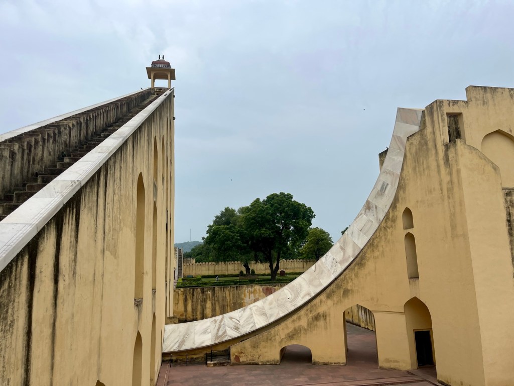
Observatory This part of our journey is the only one where Rolfi and I have differing perspectives. On the one hand, it was Rolf’s dream to return to this beautiful area after he has been here many years ago; making this trip particularly special for him. This was a route he had envisioned for a few years: with high altitude passes, stunning landscapes, superb camping options available and frequent resupply points throughout the journey, it is bikepacking paradise. However, we both found ourselves yearning for a dash of more adventure. Yet while I absolutely love the stunning landscape and the majestic mountains of the region, cycling wasn’t my favourite here. The hours spent on monotonous asphalt roads tested my patience. Despite this, my desire to explore the mountains surrounding us is unwavering; to discover the trails and peaks of this region.
We leave India a second time with awe, confusion and admiration. We had many wonderful encounters and had a good share of challenging ones as well. We experienced a different type of tourism in its extremes – where youtube channels are the new guidebooks and locations are selected by views and clicks. We got to learn a lot about local spirituality, the amazing food and got to visit many ancient places. The nature; which we are usually guided by; was absolutely breathtaking.
Now a long time off the bike starts as we head via bus and train to Nepal, Tibet and China. With the goal to cycle in again in Mongolia!
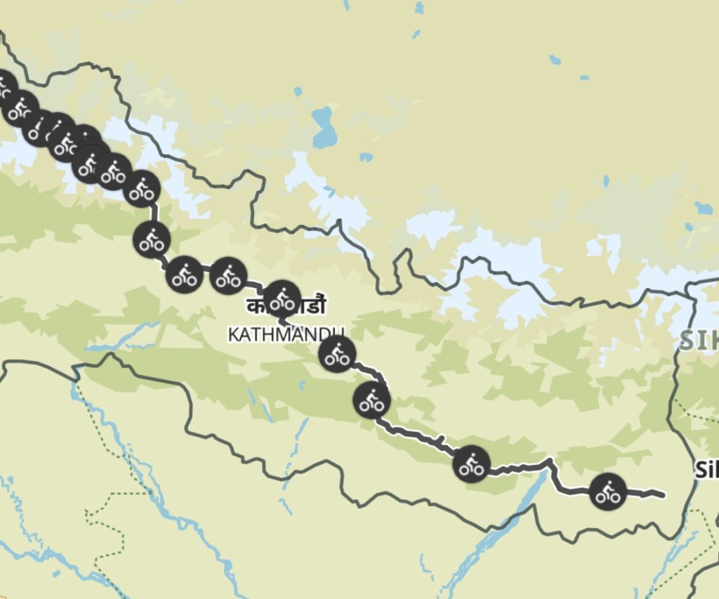
Our Path
India in total: 3200km | 48000 altitude meters
- Hidden valleys, Himalaya’s most famous and Tiger & Co. Safari – Nepal Part 2
Nepal Route Nepal Adventures continued
Better late than never – welcome to our tardy travel diary from May and June 2025, where we pedaled our way through a stunning region and potentially uncovered our most adventurous cycling routes so far. We also managed to do some trekking in the Khumbu Region and stumbled upon a decent amount of wildlife in southern Nepal!
Dolpo – The Hidden Land
Dolpo, a breathtaking area nestled between lush hills and the majestic Himalayan giants, sits on the edge of the Tibetan plateau. Known as the hidden land, it presents an exciting adventure, as reaching it, particularly its northern part, offers a challenge. How hard? We will uncover that soon enough!
Planning Game
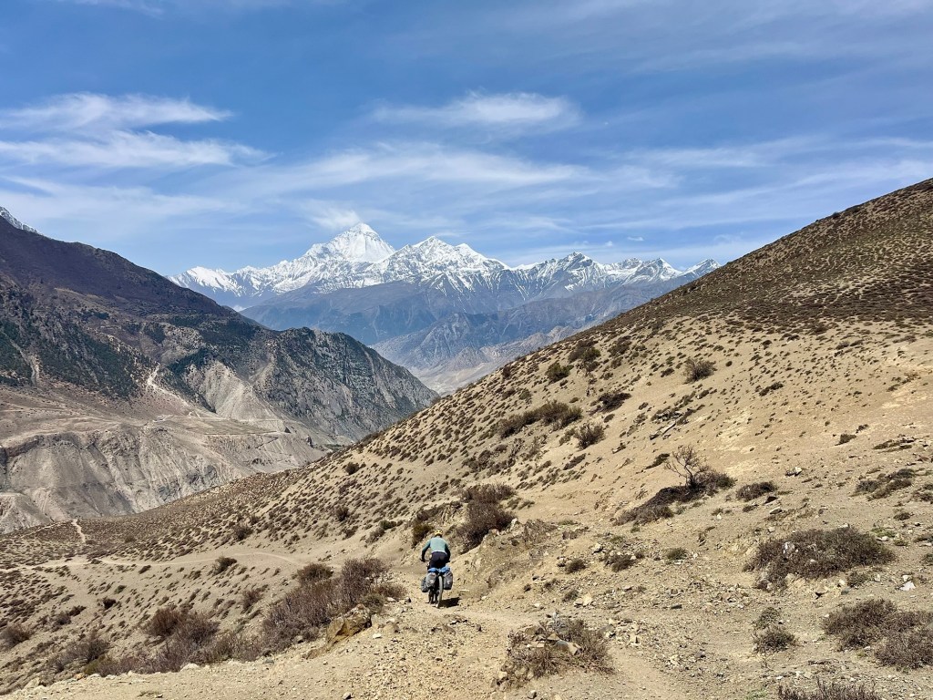
It all began a few weeks ago in Kathmandu, right in front of a map of Nepal. Where else would any adventure story commence? The hostel owner pointed at the map, revealing an exciting option to traverse the Himalayan range westwards towards the hidden valley of Dolpo. The challenge is that there’s no road marked on the map—only a network of trading trails that have become hiking paths for tourist. Some bigger, some smaller – from a distance it is impossible to say what is a challenging hiking trail and what is a gravel road, as all of the trails have the same category! This area was completely off-limits to tourism until the 1980s. Naturally, our curiosity was piqued. Now that we’ve reached Muktinath, there’s no way we’re going back down to the flatlands on fresh tarmac. We are surrounded by majestic peaks and on the brink of the Tibetan plateau, truly in biking paradise. While information about our plan is scarce, local bike shop owners have connected us with a MTB rider from Kathmandu who has triumphantly completed the Great Himalayan Trail on bicycle (what a champion!). Here you can check out his epic adventure! Thanks to them, we’re piecing together the missing links.
After countless hours of Google Satellite Images and grilling locals about those “new roads” and cycle friendly hiking paths we still find ourselves staring at a map full of black spots. Turning back isn’t just a possibility; it feels like it might happen to 50%! We’re mentally prepping for the prospect of being sent back due to restrictions or getting stuck in a terrain better suited for a goat than a human. And let’s not forget the joy of packing hamster food. After two days of planning we finally gear up and head out of Muktinah. Our excitement is bubbling, giving us that delightful flutter in the stomach, while a tiny little voice in our heads seems to be saying, “Are you sure this is a good idea?”
Magic Trail
The morning dawns as we prepare to leave enchanting Muktinah, embarking on what is revered as the magic trail which is leading us to Lupa. Awe-inspiring vistas of Daulagiri unfold before us, each turn is an adventure filled with exhilarating twists, while we embrace the challenges of washed-out paths that seem to vanish into the breathtaking landscape.
Trails with views 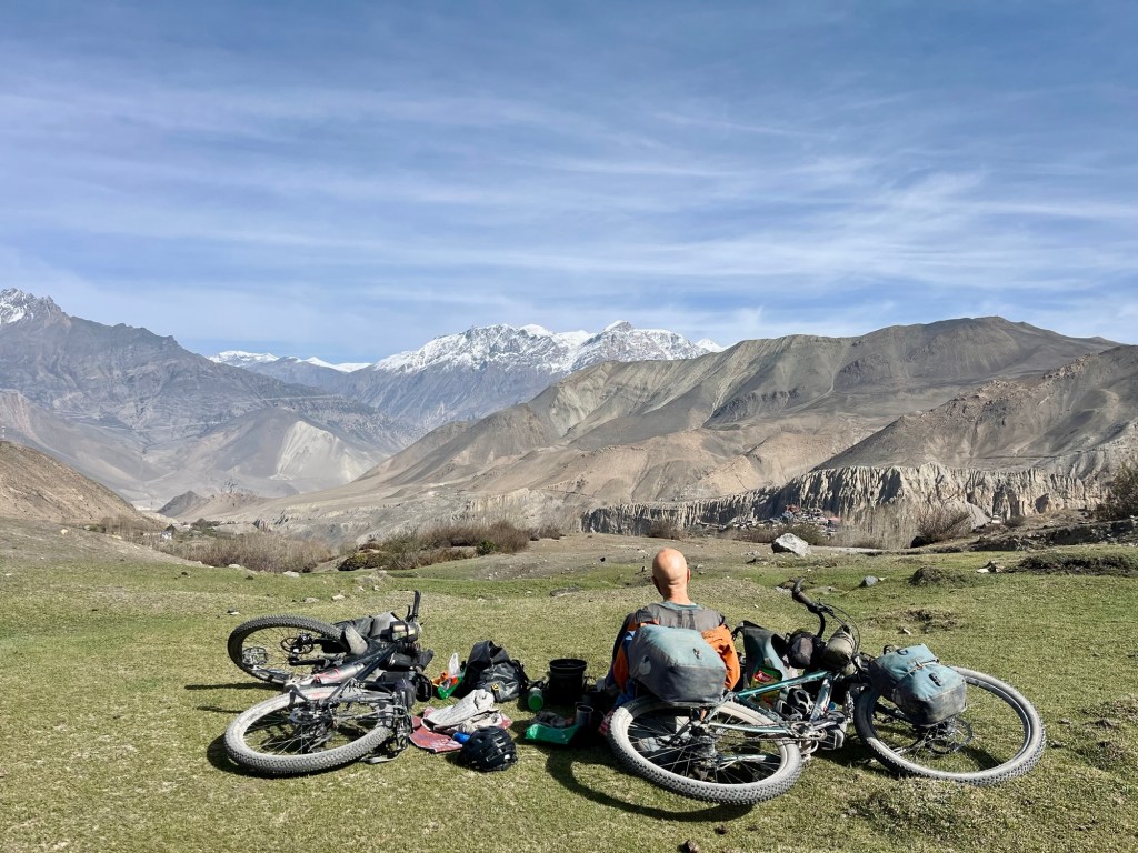
Breakfast with a view 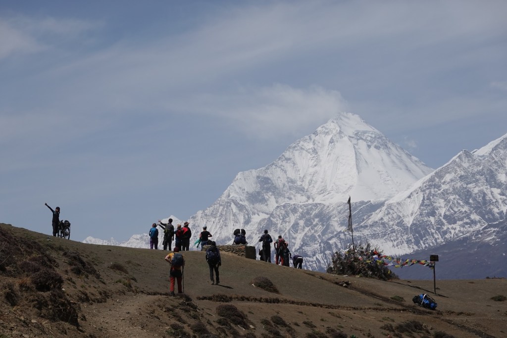
Viewpoint 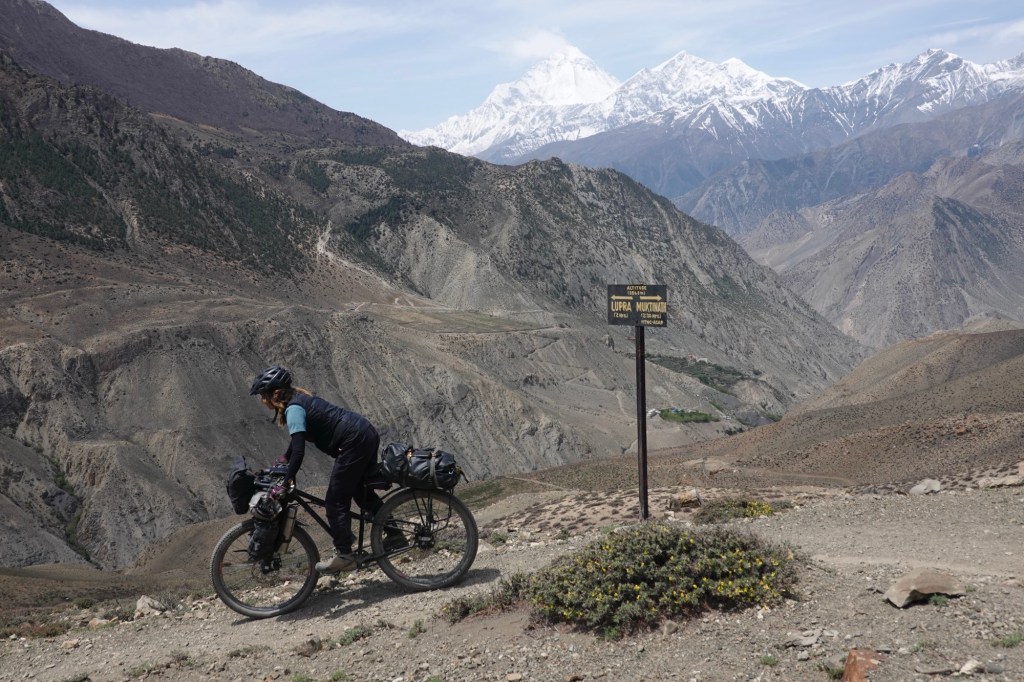
Lupra 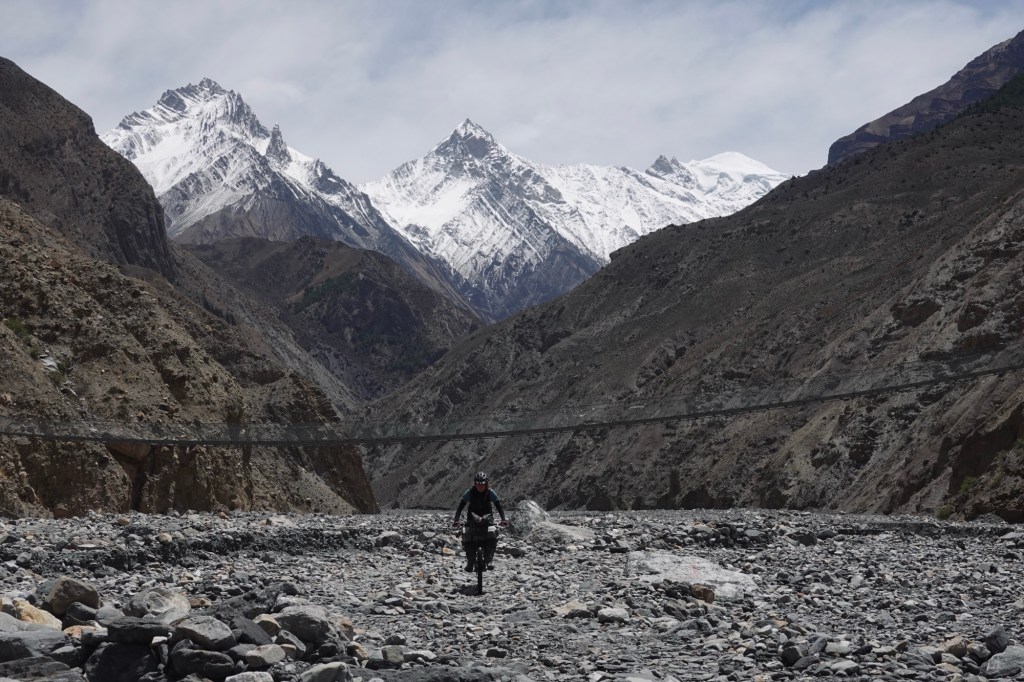
Valleys 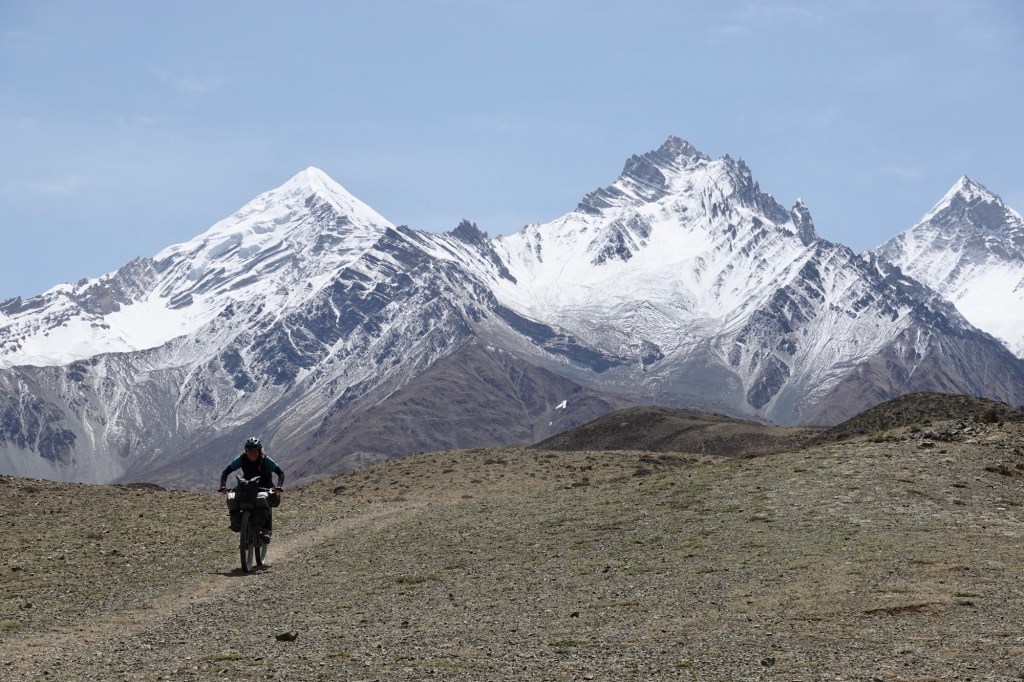
Views We pass through Lupa and briefly check out an ancient meditation cave.
In Kagbeni we indulge in a much-needed food and supply stop. The menu gleams with excitement: cabbage rolls—what a delightful surprise! After one final shopping session, we pack away food for five days with meticulous care, readying ourselves for the thrilling unknown ahead—tracing the tracks to the west. However, our eagerness is met with a challenge as the first day is abruptly cut short; the heavy winds roar, making riding nearly impossible, and we find solace in the cozy guesthouse in Phalyak village.
View 
Alarm Clock As we progress the next day we get wonderful views over the mountain range. Tracks are empty only a few tractors pass our path.
Views 
Bikes We pass by sleepy Sangda and follow the newly constructed dirt roads which are not yet marked in our maps.
Sangda 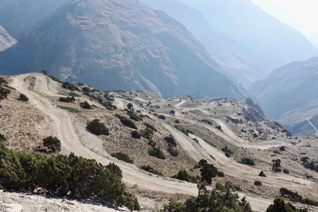
New roads Camping options are plentiful. We find a beautiful spot overlooking the valley!
Valley view 
Tree, flat, view – what else would we need? 
Happy camper 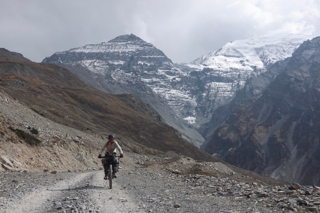
Gravel foads Entering the “hidden land” – where the road ends and the fun starts
The next morning kicks off with a bit of drama! One brake pad apparently decided it was time to retire early and went on strike, blocking the disc. We both reminisce about that debate in the hostel in Kathmandu while tinkering with our bikes: “Should we bring brake pads or not?” “But we just replaced them!” “Yes, no, maybe, okay, YES!” (I do not know why we even had this discussion – it is a must have in a repair kit) And where the heck are they anyway? Maybe the cheeky Kathmandu monkey gang nabbed them while we weren’t looking!
Searching for our breakpads? Determined not to let brake pads ruin our adventure, we get creative and declare that “1.5 brakes” on my lighter bike should do the trick, as long as I treat the brake like a fragile piece of art. And just like that, the drama comes to a close—lesson learned! Now, who’s ready for some coffee?
Morning drama 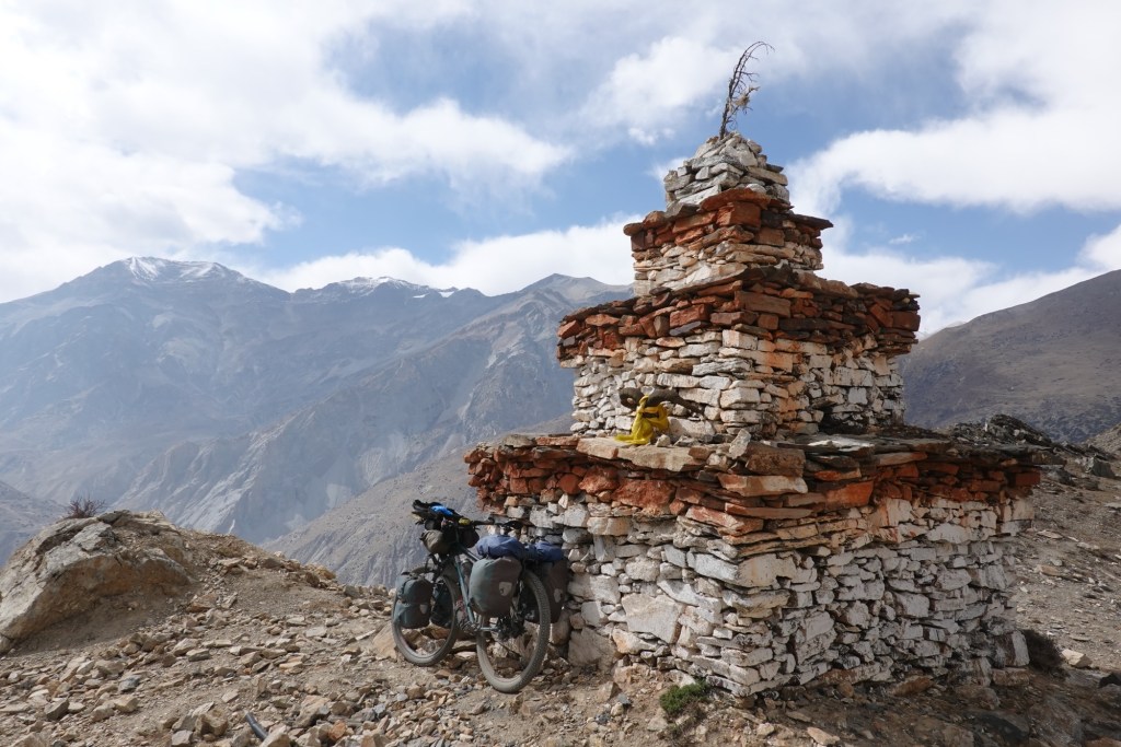
Coffee spot 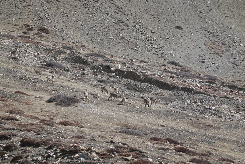
Wild goats The tracks leads over a beautiful plateau towards a canyon. It is way smoother than we expected, hard packed gravel. Wild goats graze on the dry slopes. A gentle breeze follows us, the sun stings on our skin.
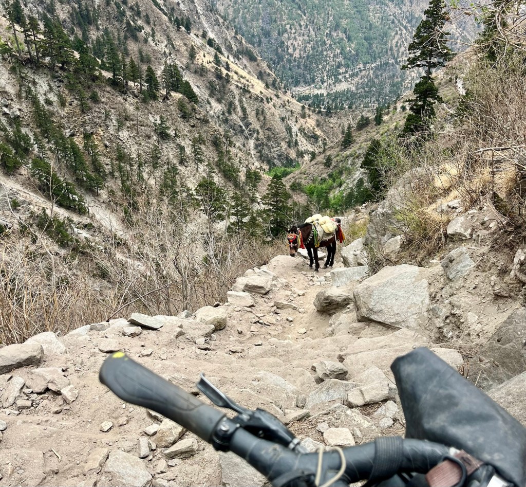
Passing the donkeys – I am keeping my distance. They look cute and we never had any troubles when passing them. But if they are fully loaded you need to be careful, the underestimate their “size” and it might just happen that they push you against rock (or down the river). Never on purpose though! A few kilometres later, we encounter the tractors from yesterday once more. We have arrived at the end of the dirt road, a bittersweet moment that stirs the spirit with adventure.
How many people can you fit on a tractor? 
Dead end coming This is the gateway to the area we are so eager to explore. Only to be reached by foot or hooves.
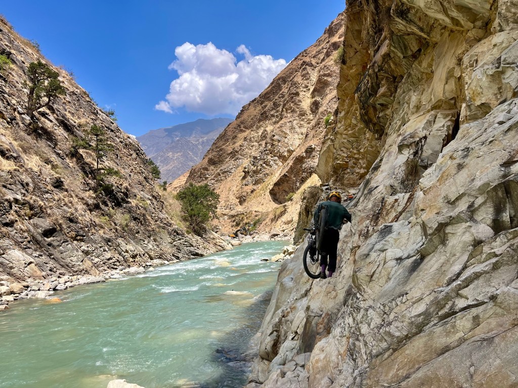
Canyon The canyon unfurls boldly before us. The river surges downward. The water level is thankfully not too high. While the tractors unload and goods are packed onto donkeys and humans, we fill our backpacks to the brim, preparing ourselves to carry the cycles up the canyon in two strong turns.
Route to the villages Bags of food, pipes, and building materials are carried up as they supply the remote villages of Dolpo. We follow the human and donkey-powered supply chain, trying to keep up with the pace. Chatting, smiling, and laughing, we navigate the riverbed together, united in our mission, each with our own motivations. Although they inform us that the route we’ve chosen is challenging and lengthy, their encouragement fuels our desire to explore the area. One of the men lifts Rolfi’s bike, helping us carry it with a broad smile up the canyon.
Champions Us, embarking on this tough route for “fun and adventure,” while for him, it signifies days spent away from the comfort of home and facing a challenging, often perilous path. Yet, with a genuine smile, he is eager to assist us, carrying yet another load. It’s difficult to articulate the depth of such situations and the kindness that is offered amidst the struggle.
Crossfit redefined 
Heavy load 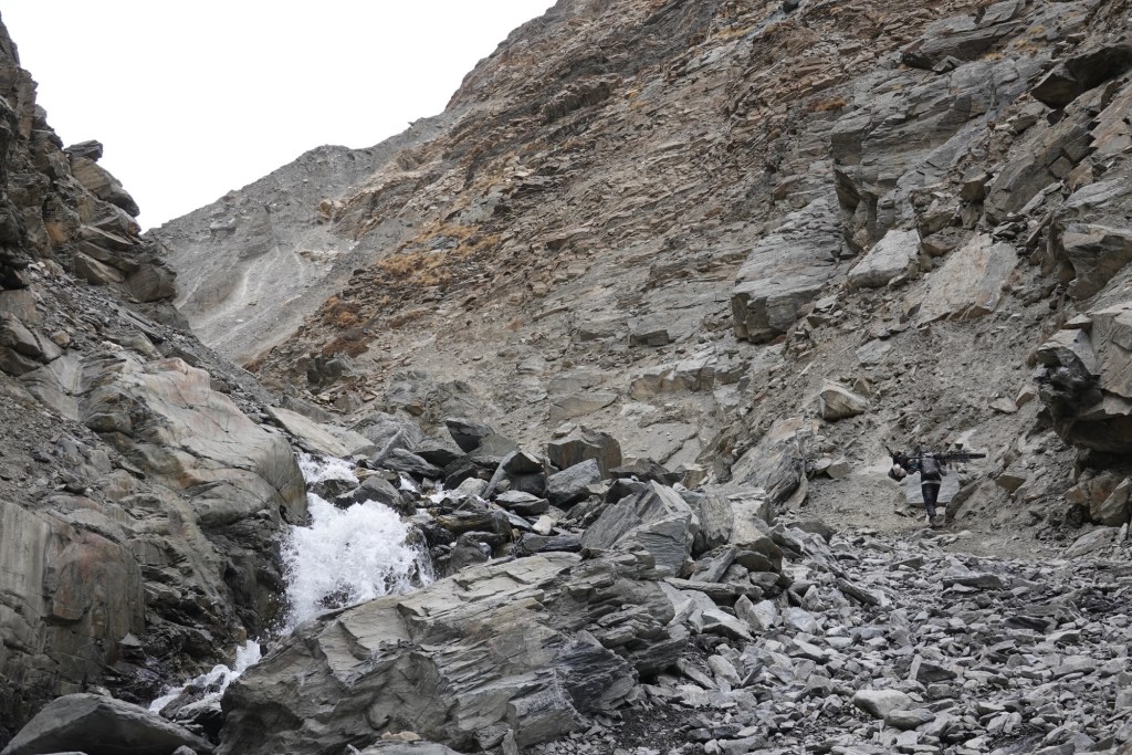
Slightly proud I am surprised by my physical capability to carry the heavy bike and bags up that challenging terrain. At over 4000 meters, the air is thin and our lungs feel the strain, but the thrill of experiencing this unique route makes it all worthwhile. We are discovering a different side of Nepal, far away from the tea houses and tourist trails. After carrying the bike, we push onward, navigating the steep and rocky slope as we gain altitude.
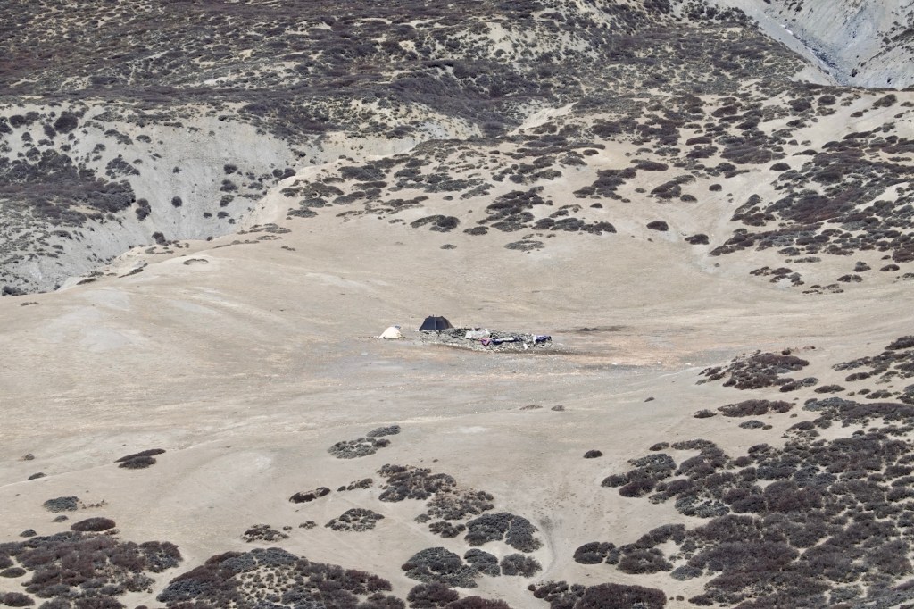
Then we reach a temporary camp where the guys and ladies are chilling out and getting some shut-eye for the night. This is where they load up all the gear onto vehicles, motorbikes, and donkeys to take it into the villages. They’re planning a road, but since the terrain’s very challenging, it’ll be ages before it’s done.
Camp and reloading spot We gather for some butter tea, a traditional Tibetan beverage made from hot water, salt, and Nak butter (female “yak” butter—Pure energy, right?). Rolfi isn’t quite the butter tea enthusiast and slyly swaps our cups. As we plod along a little further, the trail remains as steep, but the terrain is more forgiving. Hills are rolling, and so are our tires—thank goodness! We’ve managed to cover less than 20km today (not including those parts we walked twice). Though this might be our least “successful” cycling day, it’s definitely packed with unforgettable memories and those moments that you just can’t make up!
Camp above the canyon 
Pitchblack sky 
Happy cyclists The next morning we wake up to a breathtaking day full of promise. The canyon thrusts a magnificent, thick white wall of clouds toward our camp. Just a few meters in front of our resting place, the clouds dissolve in a dance of ethereal beauty. We sit, captivated by this spectacle, inhaling the thin, tranquil air that surrounds us, feeling so alive in this moment.
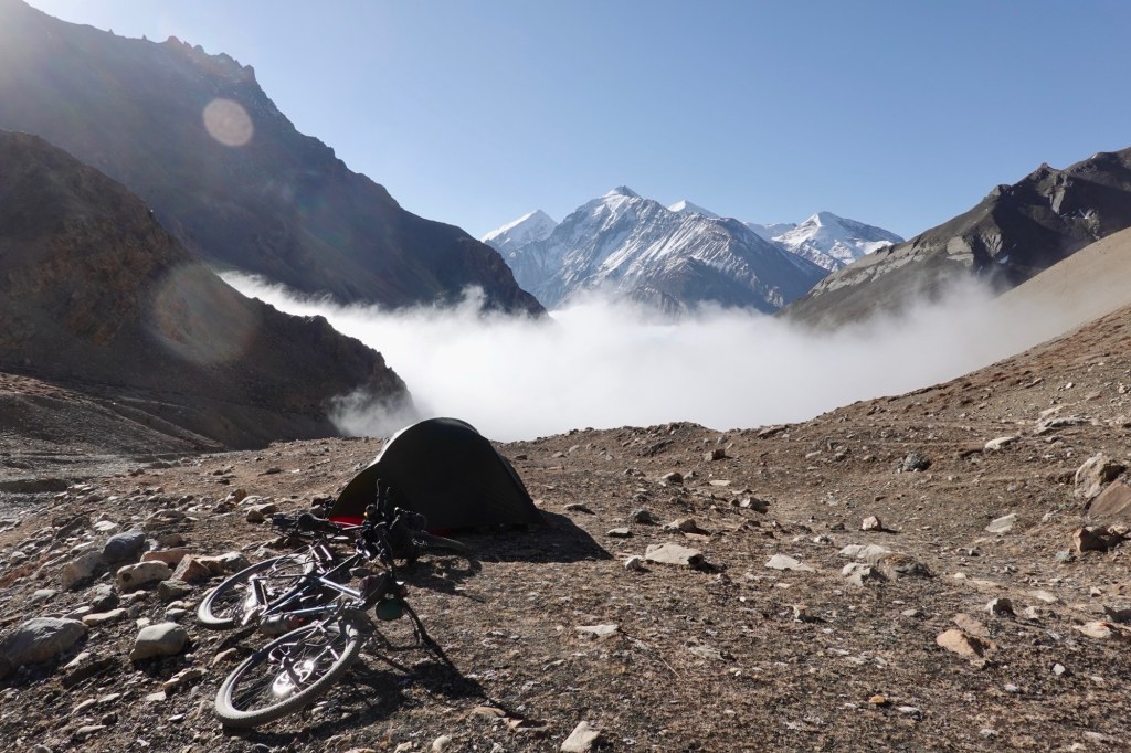
Could not have picked a better camp spot. After a slow breakfast we head to our first pass: Lapche Sharma La 5152 m.

Rolling around 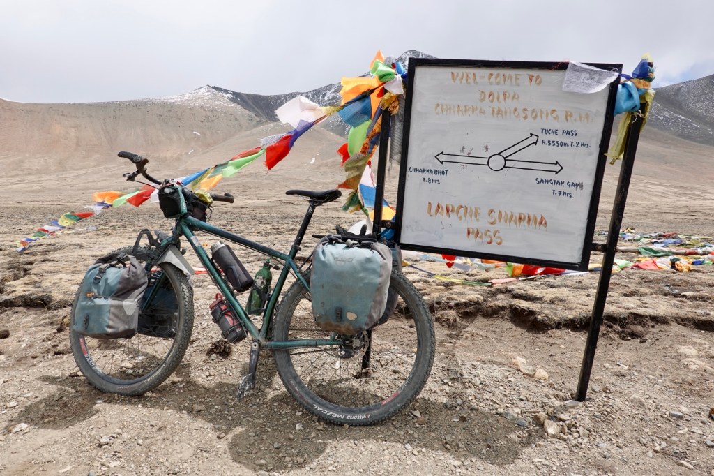
Traffic signs 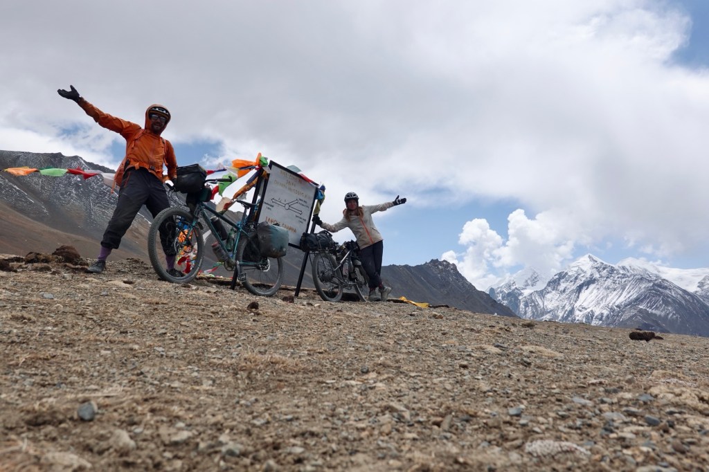
Pass A spectacular downhill rewards us for yesterday’s efforts.
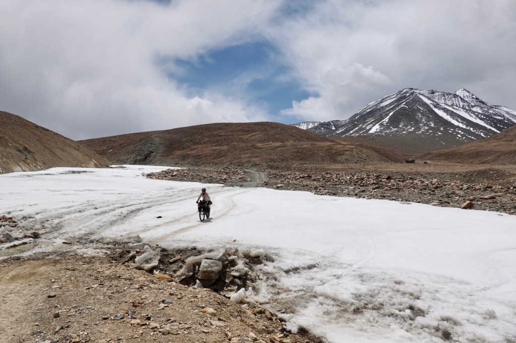
Crossing snowfields 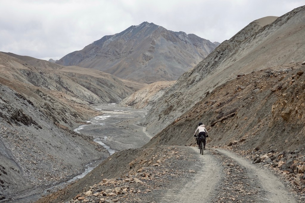
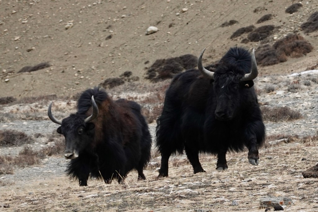
Rolling down A small herd of yaks ambles across our path, still dressed in their winter outfits like they just came from a mountain fashion show. They look so fluffy, but also massive!
Himalayan kings & queens After some counter climbs and river crossings, we arrive in the beautiful Chharka Bhot. Sitting at 4302 meters, this village is on the Great Himalayan Trail, a long hiking route through the stunning Himalayas. The local Dolpo-pa community is known for their traditional ‘Bhot,’ a cloth made from sheep and yak wool. Like most of northern Dolpo, the people are mostly Tibetan Buddhists. As we walk along the gravel roads, lovely Stupas dot the landscape, adding to the village’s charm.
Balancing over the stones but no wet feet! 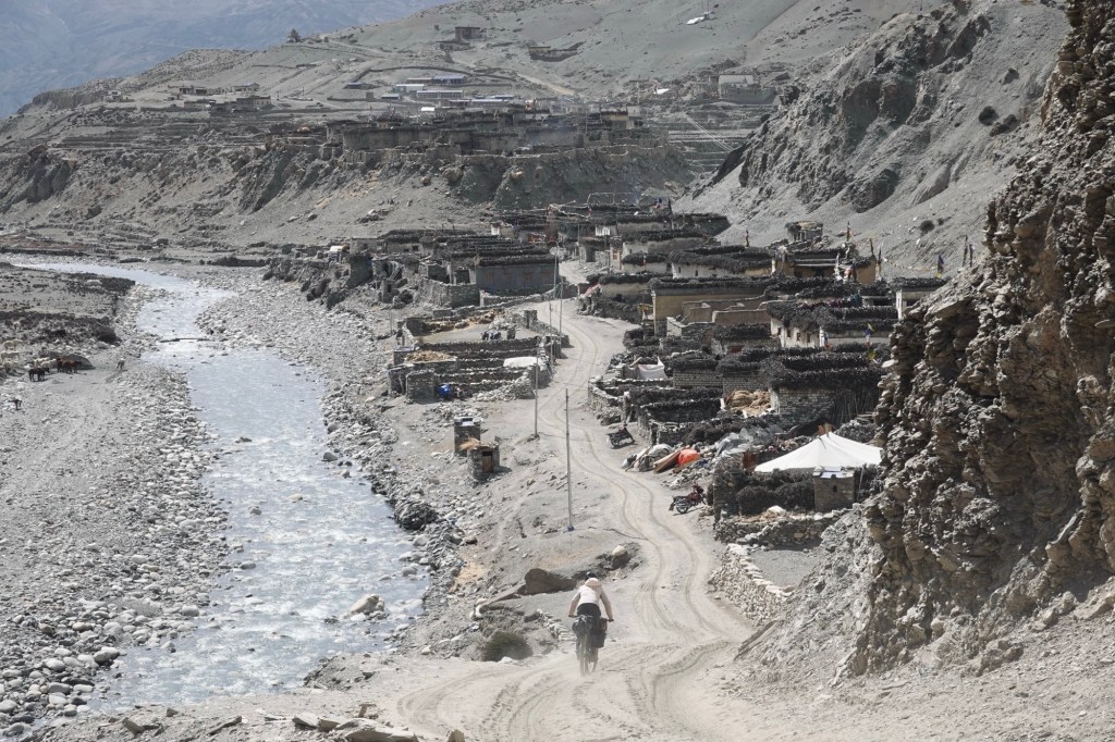
Rolling to Charka Bhot Here we find a small guesthouse. To be honest, we’re a little bit nervous to knock on doors without a guide and without a permit. But we are greeted with warmth and hospitality. Our host is taking us on a tour where we also meet a very young local teacher, who speaks amazingly well English.
Guesthouse 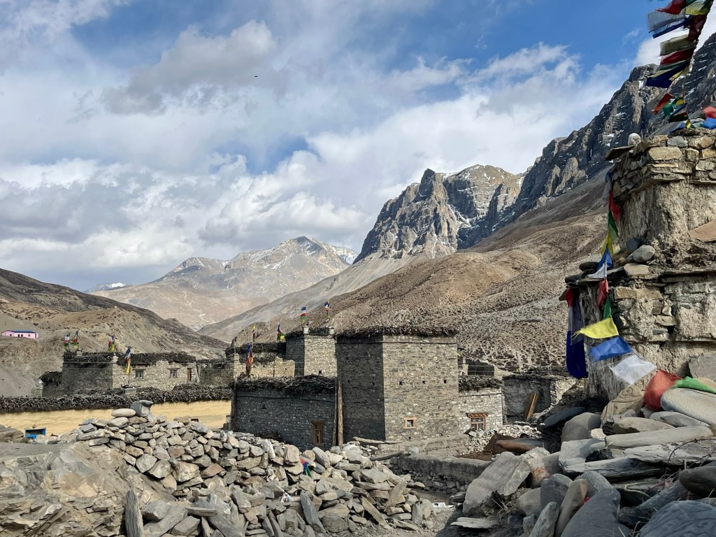
Village life 
100% 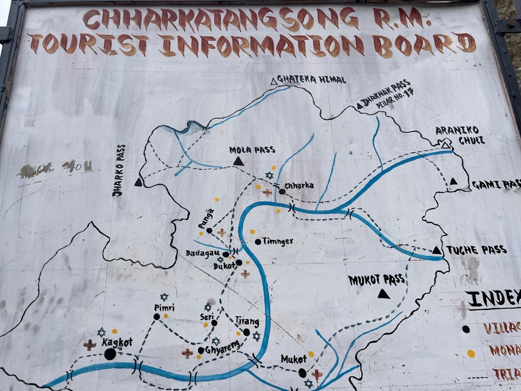
Information boards The parents of our host warmly join us for dinner, and the father captivates us with his curious gaze, his smile as he gestures stories to us, holding his mala—a beautiful prayer necklace made of 108 seeds. His long black hair is tied back in a ponytail, held in place by a vibrant red hairband, common for men in region. Though we’re too shy to ask for pictures, his enchanting presence and aura linger in our memories. With only “hands and feet” to communicate, we dive into an exchange, uncovering interesting insights. We learn that some cycling groups brave the terrain, though their bikes are typically carried on the backs of donkeys until the paths become smoother. In these days there is a 14-day trading window with the Tibetan Chinese border, where herds of resilient yaks transport goods and provisions to remote villages. Back in the days the borders were open and it was a very common trading route. The pass soars over 5500 meters, leading into Tibet, where the landscape softens into vast plains and plateaus, making it easier for motorcycles and horses to traverse. Interestingly, motorcycles here lack license plates, as they are imported from China and rarely venture beyond the region. Fields bursting with potatoes and barley await the new sowing season that has just begun. Summer is the prime time to explore this area, when the lush, green fields transform the barren landscape into a breathtaking spectacle. Many village children find their purpose and education in monasteries, and during winter, countless souls journey to Kathmandu, seeking warmth and work.

Chharka Bhot Originally, we had envisioned a journey southward from this point, but a sense of adventure compels us to venture north instead. We’ve discovered the existence of two exciting new roads, crafted for motorbikes (and so cyclists), that supposedly connect the villages. The following morning, filled with anticipation, we set off further north. On our route to the next pass, we encounter the teacher once more, returning to her village and school after a night spent tending to the goats and sheep.
Cycling out of the village Mo La 5170m – en route to Saldang
A little bit later, we find ourselves at the top of the pass. The way was smooth with the occasional smaller river crossing. Yet up in this elevation every tiny pebbles feels like an obstacle! Cycling feels tougher than hiking in the elevation. So, I choose the hiking option. One switchback hiking, one switchback pretending!
Push or cycling? 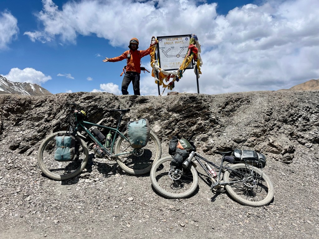
Rolfi at the pass After the pass snowfields are awaiting us and we make our way via a beautiful plateau.
Shepherd areas 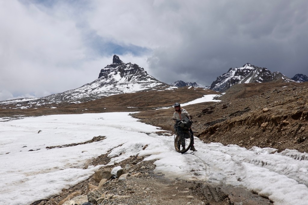
Snowfields with a view The area exudes a remarkable peace and serenity. We confidently traverse the expansive shepherd areas, admiring the stunning Mani Stones, and effortlessly share the path with the occasional marmot hopping gracefully across the plains beside us. Mani stones, which are stone plates, rocks, or pebbles inscribed with a mantra, are strategically placed along the roadsides and rivers or artfully grouped together on long walls as a respected offering.
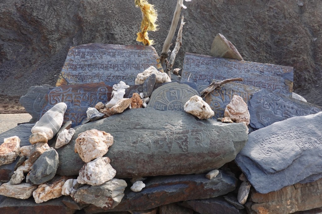
Mani stomes 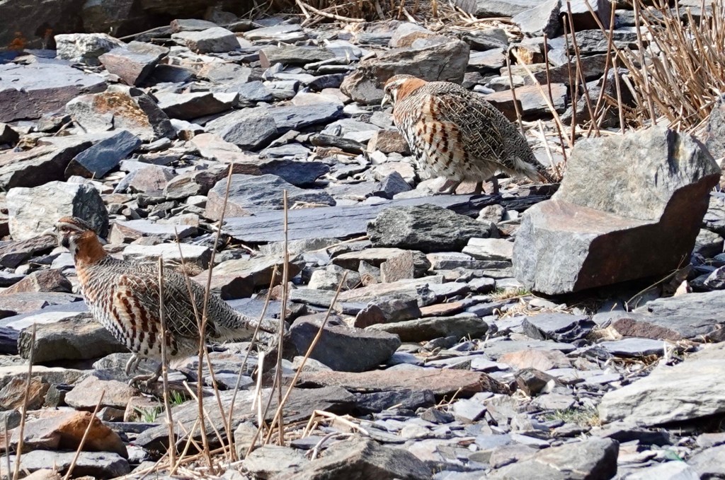
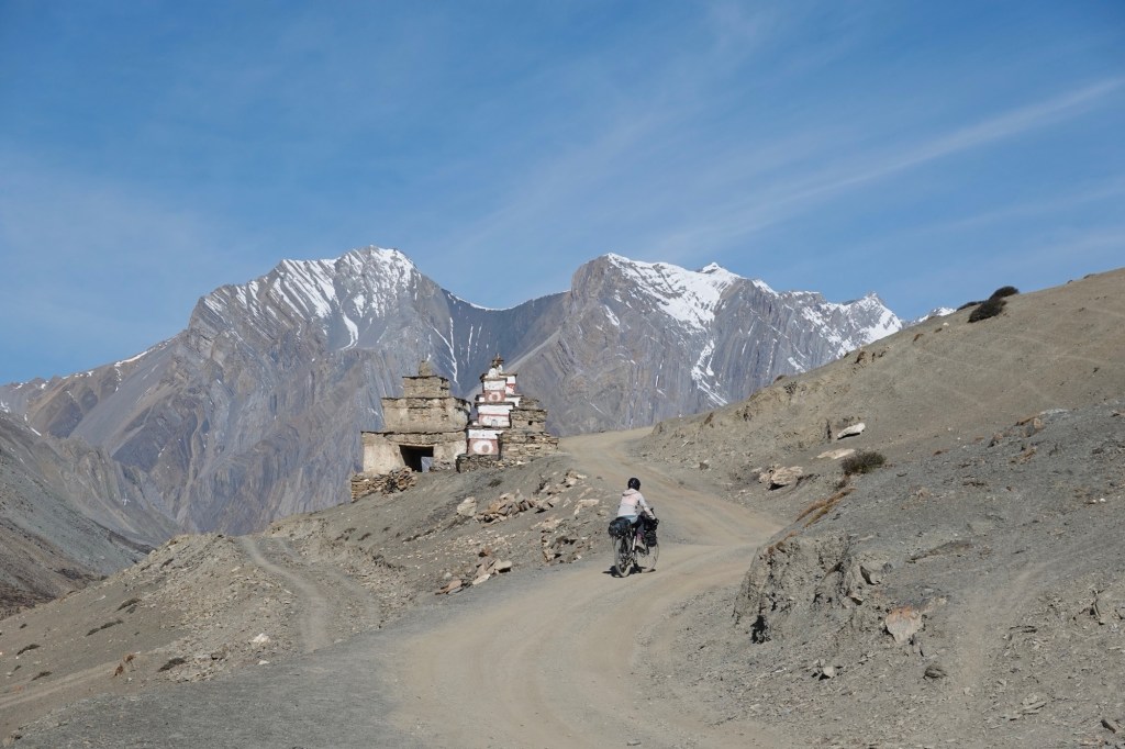
Wildlife After a few kilometres, the road transforms into a single trail motorbike path. To top it off, we arrive at a stunning junction adorned with beautiful old stupas by the riverside, and we make the decision to set up camp right here.

Single trail 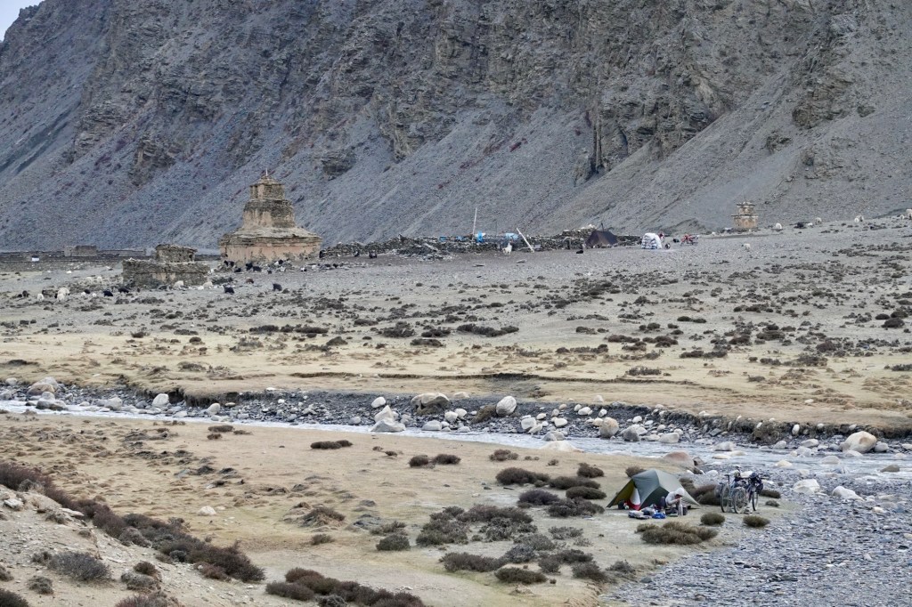
Camping place From here, we can either continue further north or head back towards the valley again.
At the guesthouse, we gathered what seemed to be valuable information, but a few hours later we cannot make sense any more of our notes. We’re uncertain about which passes are a “no-go” and which ones might actually be suitable for cycling; the sheer number of highlighted dots on our offline maps makes it hard to discern anything meaningful. In our cozy tent, we pore over our offline satellite imagery, trying to plan distances and resupply points.
I hastily sketched a “map” on paper, and Rolfi rushes for the next motorbike passing by to check if we could add another detour to our route!
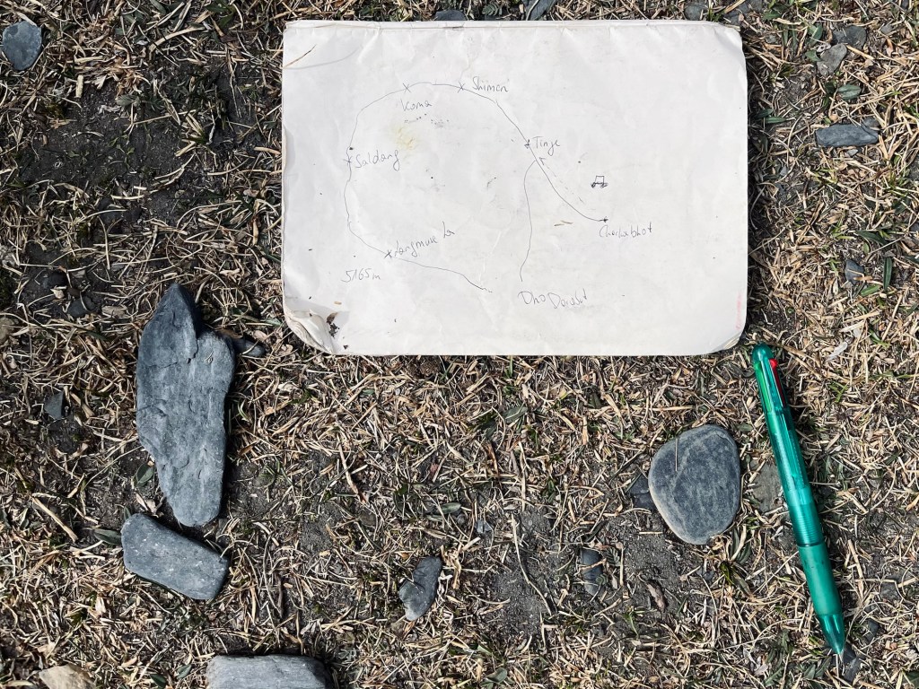
Map He didn’t appreciate my “map” but started drawing on the dusty ground. Like in so many countries, the dust maps have never failed us. Its a good omen and we are happy to go ahead.
A few herds gently wander past our camp. A shepherd is cradling a newborn kid, lovingly swaddled in a soft woollen cloth. It’s heartwarming to see how the mother stays close by, never straying far from her young one. Meanwhile, a dog watches us from a safe distance, a silent guardian—will he offer us protection through the night, or will his presence keep us on edge? Thankfully, the night and the dog are comfortingly quiet.
Under the sway of theTibetan villages passing through Shimen, Koma and Dho
The next day we extend our route further to the north and pass through Tinje. As we pass by a shepherd area a very very little goat would not leave my side and started following the bike. It has physically to be carried back to the nursery. The grown ups are out and about, only the fresh kids stay back in the safety and guardance of some ladies. In Phalwa village a young female school teacher greats us and guides us to a little shop. A shaky ladder leads up to the shop in the attic. We stag up in Pasta, rice, lentils and some emergency instant soups. For lunch the lady prepares buckwheat pancakes and some potatoes for us. Smells and tastes super good!
Tinje 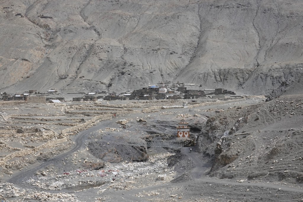
Tinje 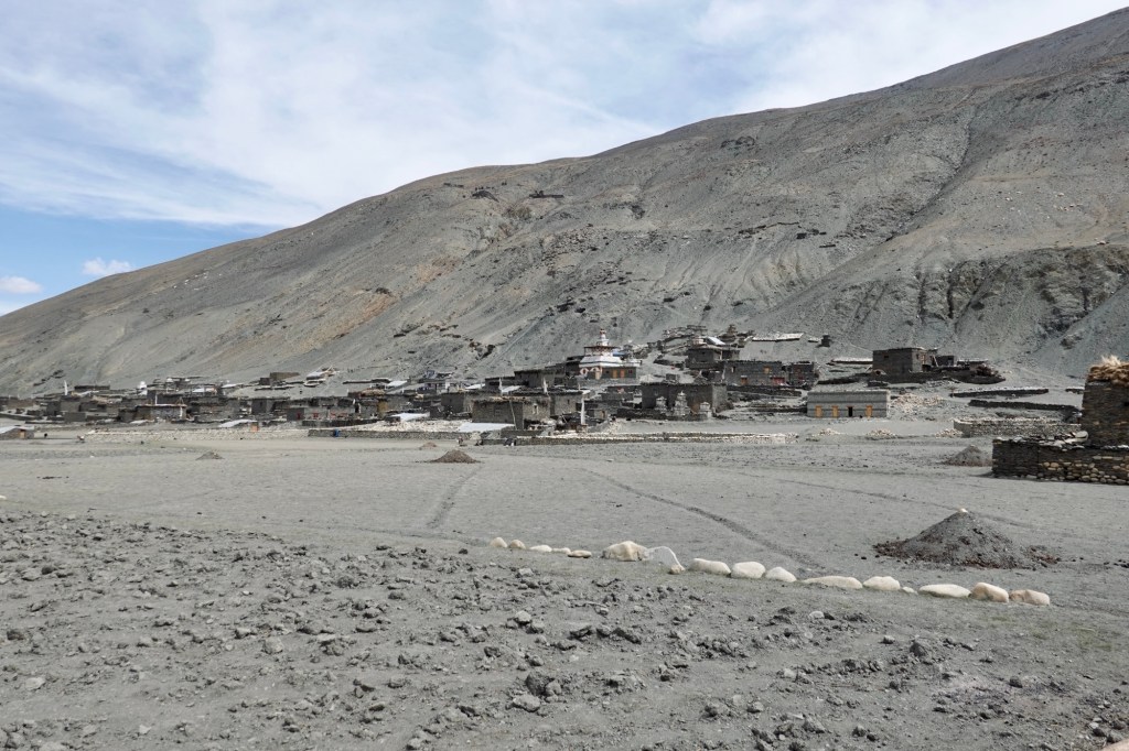
Tinje 
Tinje 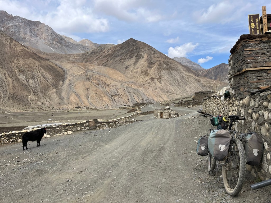
Road northwestwards Afterwards an even remoter path follows where we pass many mani stones and a beautiful monastery.
Wild goats are wandering up in the cliffs above us, and they really freak us out when they drop rocks right in front of us!
Monestary 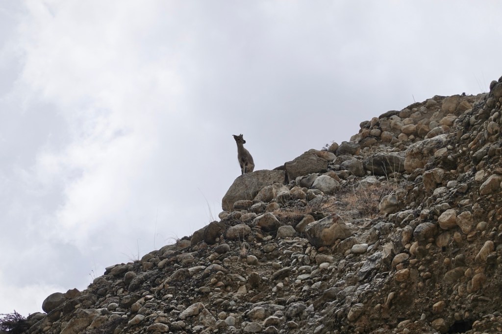
Scaregoats! Spring brings a vibrant energy to the fields. In Shimen, the fields are slowly transforming into lush greens, while trees are dressed in a juicy green already. We receive cheerful greetings and friendly waves from the locals as we pass. The atmosphere is filled with warmth and heartfullness. From here, we eagerly continue our journey to Shimen La along a delightful single trail.
Way to Shimen La The village looks absolutely stunning from above – with barren mountains lurking behind, fields scrambling like a confused maze on the slopes of the river, and those old stupas. A motorbike zips past and waits at the top, looking all smug. After some small talk and an offer of beers, the rider asks if we’ve spotted a box of speakers along the way, claiming he must have dropped them. Welcome to village life, where essentials like music somehow have to hitch a ride!
Rolfi is whipping up a delicious meals 
Camping Paradise Above Khoma, a stunning camp spot beckons us to experience nature’s embrace. For dinner: instant noodles and herbs! As dawn breaks, we ascend to Khoma La, where we can spot many more settlements, paths and winding roads, inviting for boundless exploration. This serene landscape pulses with tranquility, ready to inspire and uplift our souls.
View towards Tibet 
Moments of silence on the pass A spectacular single trail leads down to Saldang, where the houses are scattered on the high slopes typical for Tibetan villages. The motorbike paths are so easy to cycle and so much fun!
Trails Saldang 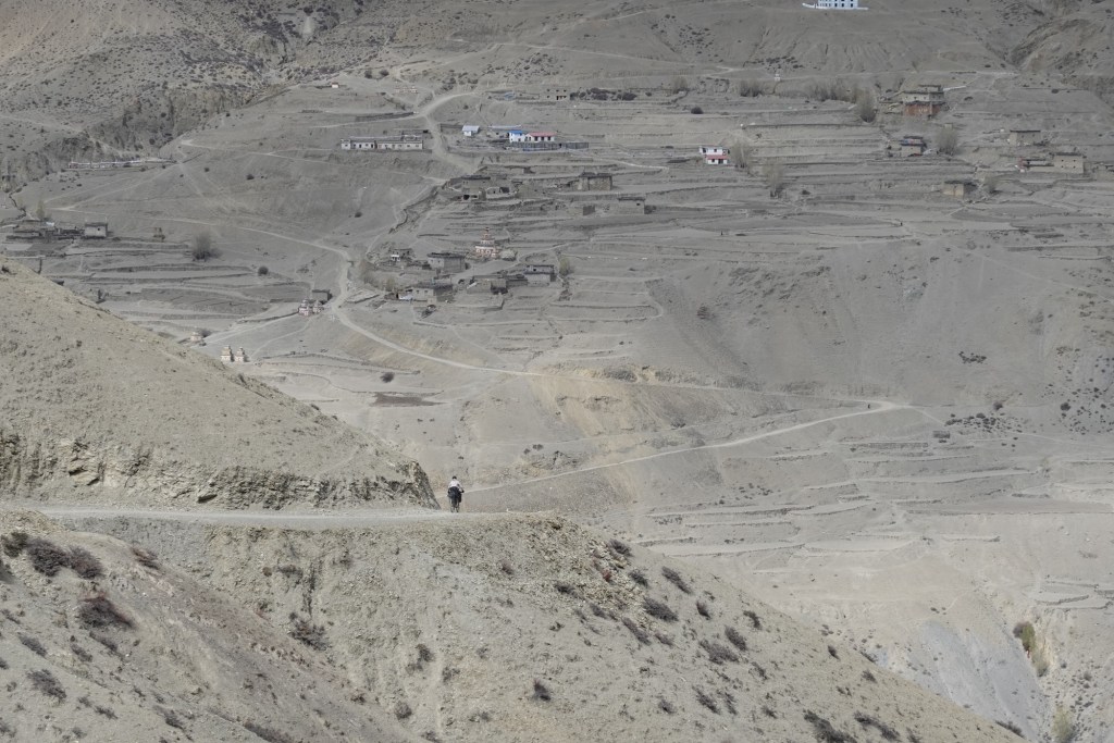
Saldang scattered on the slopes We pass the beautiful Salgompa.
Inside a Stupa 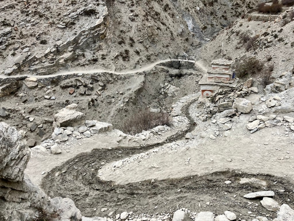
Trails 
Trails 
Dust drawings After a few kilometres we see the first tractors again. The road becomes wider. A guesthouse offers some much needed snacks and some supplies and a bit of petrol for our stove.
The only time someone asked to take a picture One last pass follows a new gravel road up the mountain. In the distance, the ancient hiking trail emerges, still alive with the rhythm of donkey caravans echoing through time. Majestic yaks roam freely, embodying the spirit of this untamed land. The snow-capped mountains tower nearby. The rivers dance wildly through the valley, narrating stories of nature’s raw power and beauty.
Last camp in the northern area 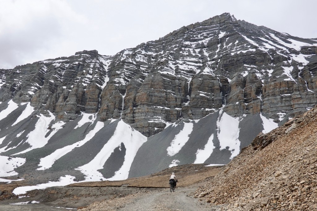
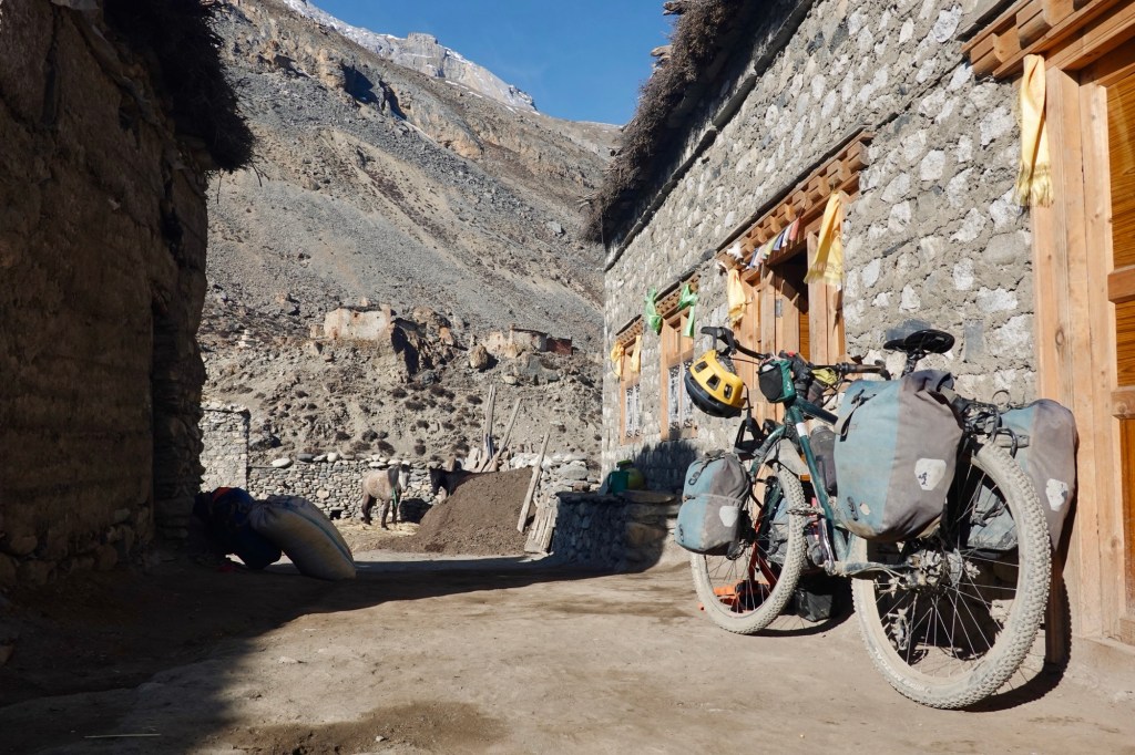
Descend The path to Dho is rough and rocky, so we’re glad to reach the guesthouse. Instead of camping, we choose to stay in a room this time. Nice! We’ll relax here for the afternoon.
Chilling hard Dho is a larger village with nearly 1000 residents, but aside from two shops and three guesthouses, it seems similar to the other villages we’ve passed. While sitting above the monastery overlooking the village, we hear the monks singing.
Monestary We were given the heads-up that the road to the southern Dolpo area is about as relaxing as a roller coaster ride!
Dho Tharap Valley – the gateway to the southern area or our hike-a-bike ultra
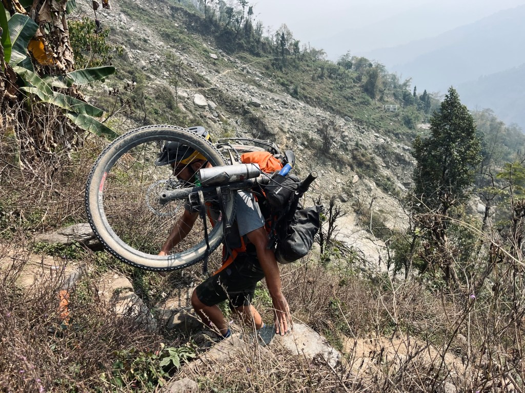
The next day, we set out with determination – 10 km of rolling, and then the thrilling challenge of pushing, dragging, and carrying our bikes begins!
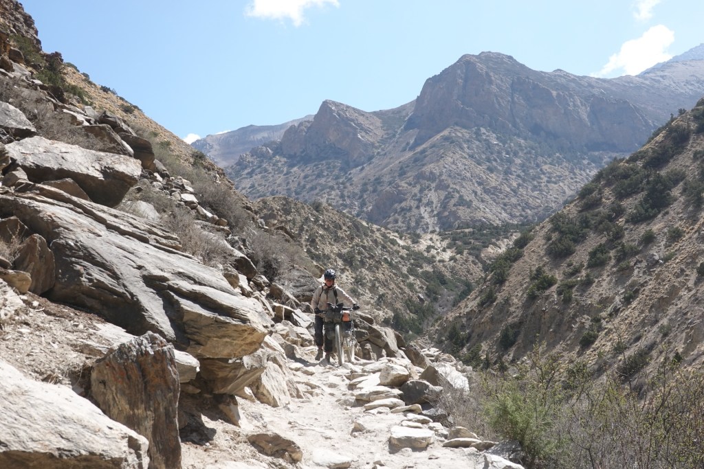
Rocky rocky The trail is narrow and leads through a spectacular canyon. Donkeys make their way up, carrying building materials, goods, tents and even bikes.

Bikes on their way up (the comfortable way for humans) 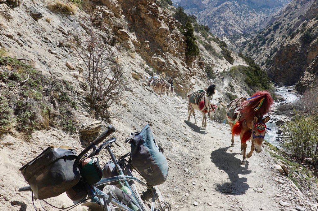
Donkeys Many of them supply the tents for the caterpillar fungus “search.” This parasitic fungus ophiocordyceps sinensis is used in traditional Tibetan medicine. The price can reach an astonishing 40,000 dollars per kg.
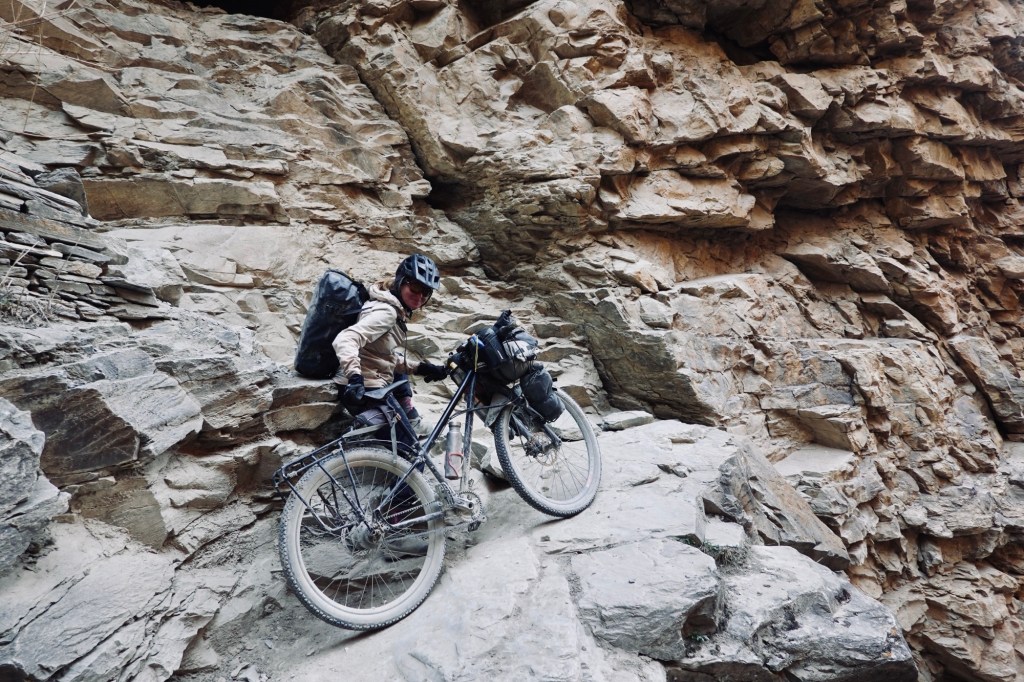
Push? The track is super rocky, it is hard to decide if pushing or carrying the bike is the better option.
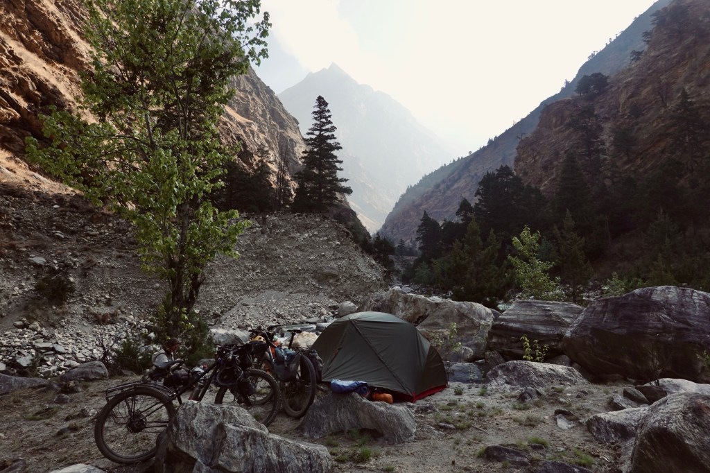
Carry? In the evening, we throw in the towel after what feels like an ultra endurance event of bike pushing for a few kilometres. A rock ledge pops up like a luxury campsite, perfect and dry! Rolfi is doing a happy dance, camping on a rock ledge feels about as exclusive as it gets—“boven”/ glamping, here we come!
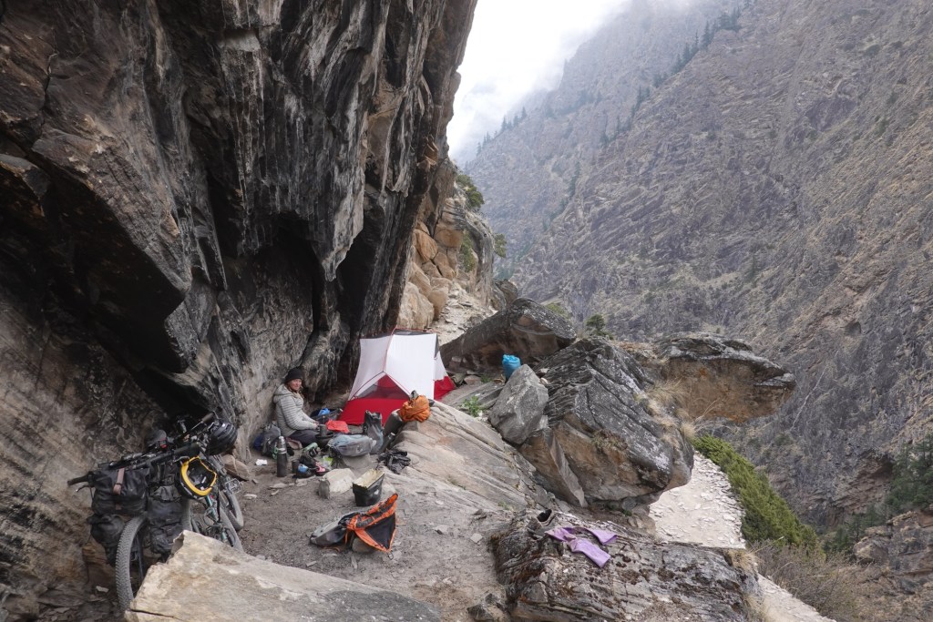
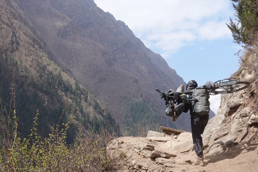
Elbsandstein feeling in Dolpo The next morning, it’s the same old routine—up and down the canyon. I carry the bike on my shoulders for the really steep sections and maybe push it over the flatter parts. Honestly, I can barely lift the bike over the bigger rocks anymore; my arms feel like they’re about to give out. Rolfi ends up having to cover some of the distance twice. Thirty kilometers, a load of altitude gains, and still no end in sight.
Will it ever end? 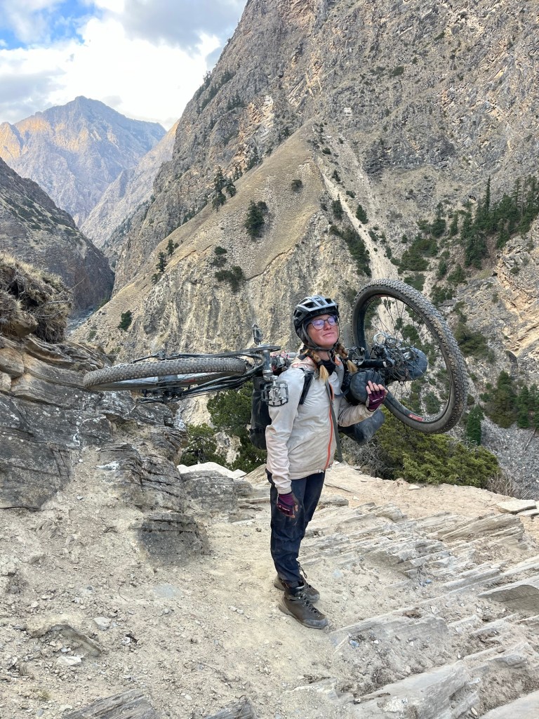
Dreaming about chocolate m In between, we wait an hour as the donkey caravans pass by. The donkeys are beautifully adorned with colorful head gowns, a vivid sight against the rugged backdrop. Yet, it often tugs at our hearts to see the burdens they carry along these challenging trails. Most of the shepherds treat them gently, sometimes going out of their way to guide each donkey through the tricky and exposed sections. However, it’s disheartening to witness that some are less compassionate. I find myself speaking softly to the donkeys as they pass, offering encouragement – perhaps also to uplift my own spirit as well.
Almost there – good job you girls and guys! At the end of the canyon the road gets wider but not easier. A few meters of cycling but mainly we continue pushing the bikes.
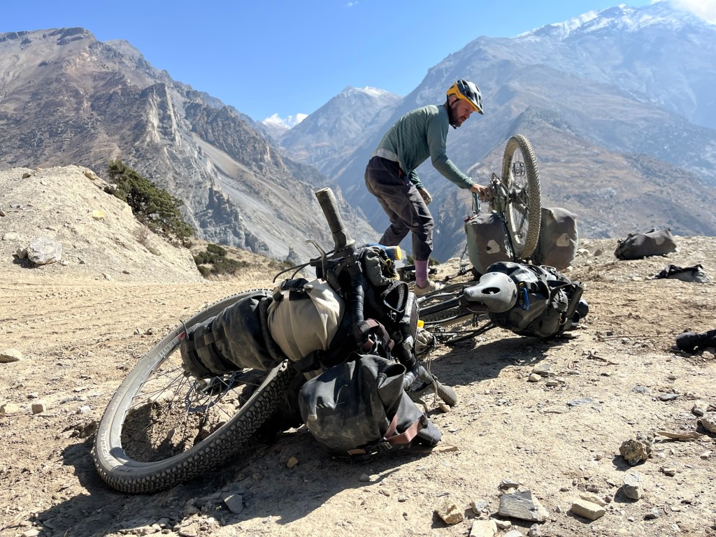
Evening mood! One last highlight was a climbing section next to the river. It’s amazing that our bikes are still intact after everything we’ve put them through. At first, I was worried that my gates belt would break as I dragged the bike over so many stones. But now we can confidently say that our setup is utterly adventure-proof! Also, the brake pads are still in decent shape. In the end this 50km stretch took us 2,5 days of hard work – what a challenge.
The climb redefined 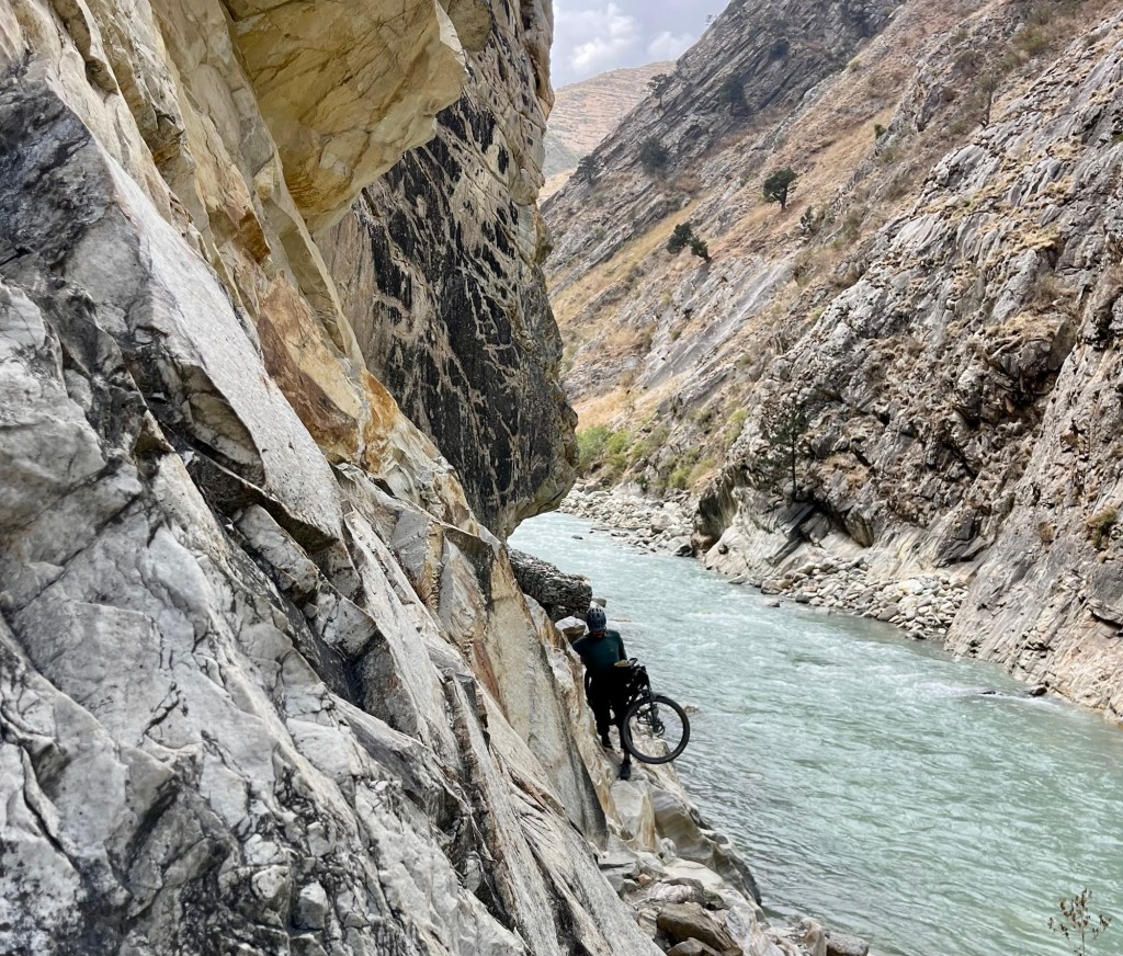
This champion is carrying both bikes over the tricky terrain. An elderly local man helped us for the last bit of this stretch 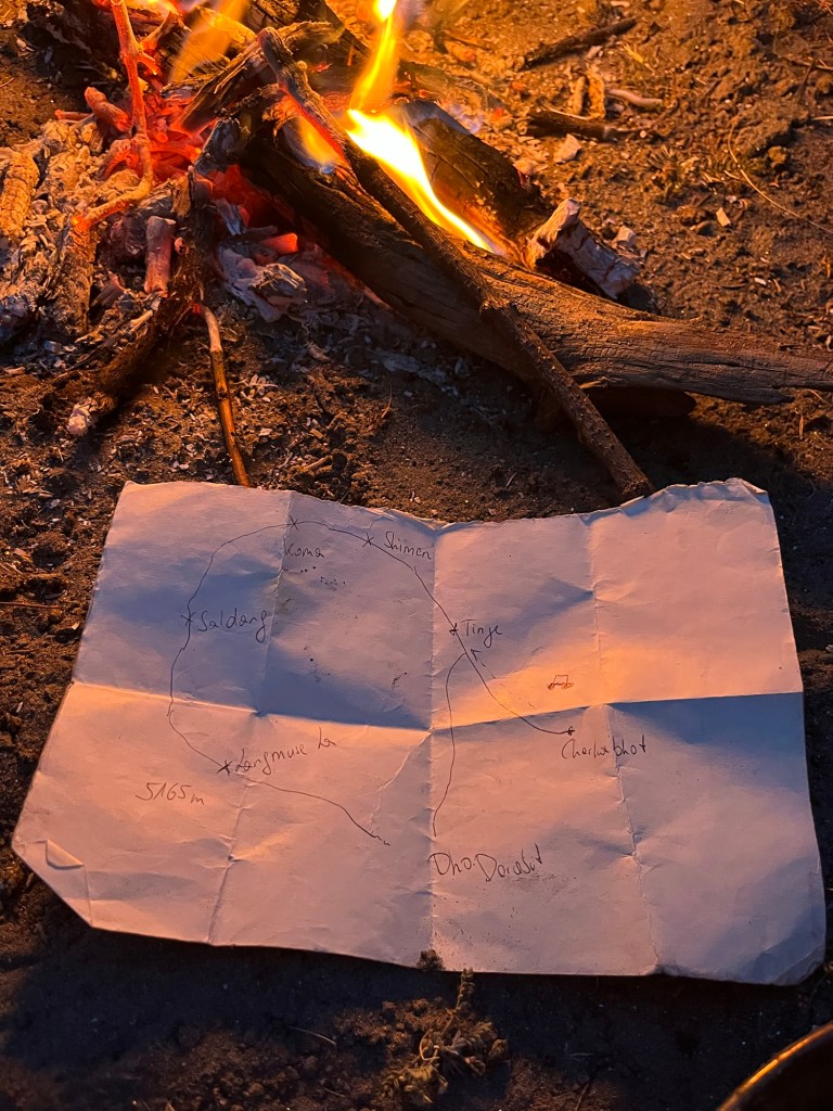
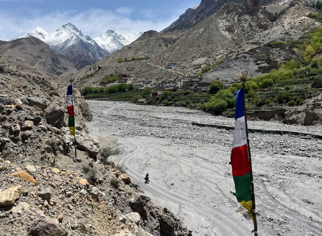
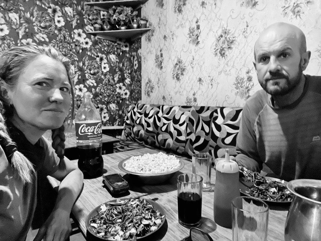
Done and dusted Only when we trudge into Dunai, with what feels like a half-broken spirit, do we spot the gravel roads. Dunai, the gateway to the Northern area, where goods are shipped to storage facilities. To celebrate our arrival, we waddle into the nearest restaurant, a true culinary and stylisch jackpot! Imagine leoprint wallpaper competing with flowery designs and the coziest sofa chairs begging us to sit and never leave. A delightful lady whips up not one, not two, but FOUR portions of chow mein for us, then plops a gigantic bowl of popcorn in front like we’re at a movie premiere! Apparently, every guest gets their VIP popcorn treatment, and peeking into her kitchen reveals a mountainside of popcorn!
Popcorn Time! Mood – drama series! We take a moment to ask ourselves- Was it worth it? Oh, yes absolutely! Was it tough? Uh, absolutely! Would we do this again knowing the challenge we just signed up for? Well, probably – but maybe with a slightly lighter load 😂.
The gravel road out of the valley is very dusty and rocky, with a lot of altitude gain. At a checkpoint, the police stop us and ask where we’re coming from. They laugh when we share our route. “From Lower Mustang? Alone? From Dho? Difficult!” They check our Annapurna permits and are excited that Rolfi shares the same age as the officer. They tell us they’ve never met someone cycling this whole route. Then we’re off. This was the checkpoint we feared. But we are certain that if we had done the route the other way around, they would not have let us pass! In another village, we ask about public transport back to Kathmandu and learn that direct “daily” buses aren’t running today, maybe tomorrow but only maybe. We can, however, take transport via southern Nepal. Since we left some belongings in Kathmandu and plan to trek in the Everest region, we choose this option.
The bus ride progresses at an excruciatingly slow pace, leaving us to reflect on our decision to abandon cycling. It is apparent that our lack of progress is met with indifference, as we linger for extended periods in villages and then halt again after merely 10 kilometers for dinner.All those awesome memories we’ve made cycling, the best route we’ve ever taken on this journey—are now kind odd buried under a pile of exhaustion and frustration.
After our canyon adventures, this experience feels particularly unbearable. One landslide, a flat tire and many many food and delivery stops (in the middle of the night) later we arrive in Nepalganj. We roll into the hottest city in Nepal, 8 or 10 hours behind schedule, and decide there’s no way we’re going any further. So, we grab a hotel room at 6am in the morning and take a power nap. Luckily they had an “early check” in option! After that, we rethink our route to Kathmandu. Our bikes take a break at the hotel while our tired bodies hop on a super VIP sleeper bus. A few hours later, we find ourselves sprawled across some seriously comfy beds, but choosing the sleeper option was a mistake—every bump in the road sends us flying to the ceiling (and trust me, there are tons of those in Nepal). The bus is mostly empty, so we manage to switch to the sofa seats. Where is the popcorn now?
Back in Kathmandu we stayed a bit longer to meet friends, enjoy a yoga session held by Bea from Soweit die Füße uns tragen and visit a beautiful small art gallery called Artudio. We met some of the artists and had a great exchange. Next to many beautiful paintings, we discovered a children’s book about the Dolpo region. It is a story about a brave young girl on a mission to find and protect the region’s cultural heritage, beautifully illustrated by Krisha Tamrakar.
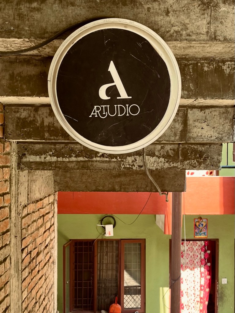
Artudio 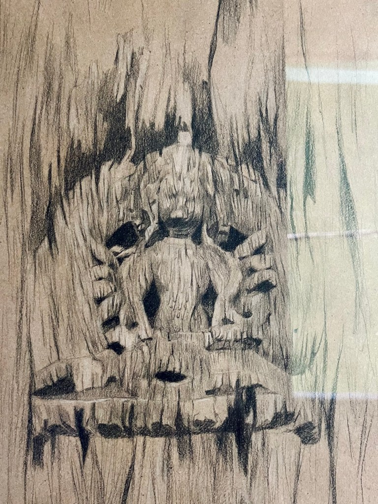
Art @ Artudio 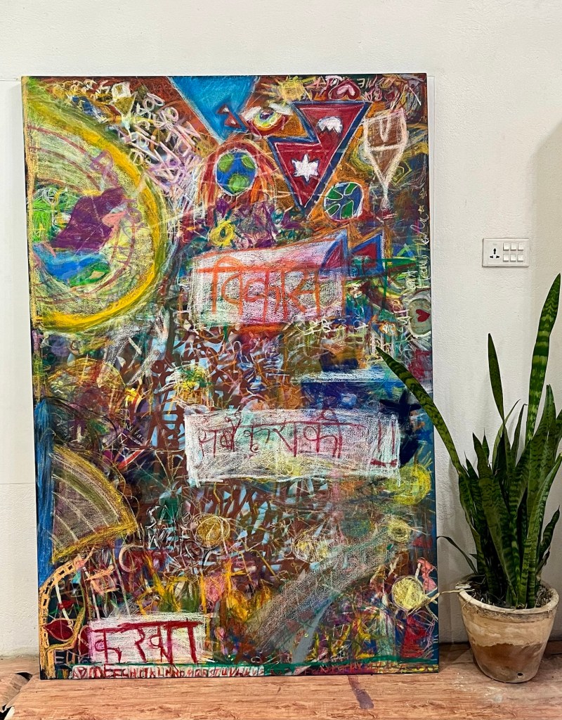
Art @ Artudio 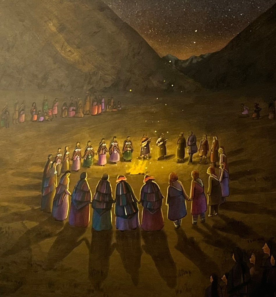
Art @ Artudio Afterwards we head to the Everest region for some hiking.
3 passes track
We picked a fairly popular trek this time. Since Rolfi’s knee is acting up, we’re putting off our alpine tour for our next trip to Nepal. With just our light backpacks, skipping the camping gear, and only bringing along a couple of snacks, we’re off to explore the Khumbu Valley!
Himalaya backdrop The epic views of the Himalayan range are just ahead! We zoom past the craziest part of the trail and end up at some chill guesthouses since it’s pretty late in the season. The first village, Thame, suffered from a flash flood last year that swept away parts of the village along with several guesthouses. Our guesthouse was set up provisionally, but nevertheless was a wonderful place, which was run by an amazing lovely couple.
Views At the passes, we didn’t have the best luck with the views.
A lion in a glacier 
Gokyo Lake But, we did catch some sun rays lighting up those fresh, snowy mountains! And guess what? We were lucky enough to spot the highest mountain in the world from one of the Gokyo Lakes.
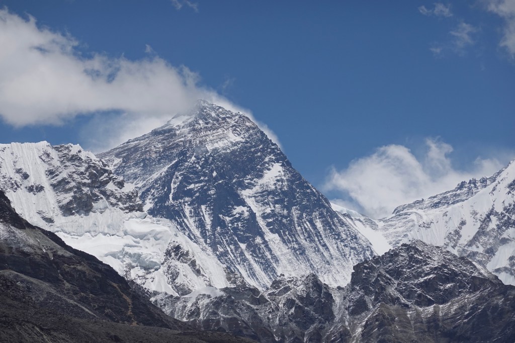
Everest 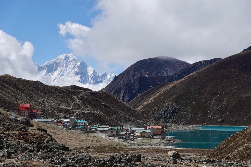
Gokyo 
Glacier crossings As we approached the Everest route, helicopters flew continuously. The scenery is stunning, but the air traffic is chaotic! It’s a contradiction: local people carry beds, mattresses, and even doors out of base camp while tourists are flown out. We can’t quite understand it.
Guesthouses 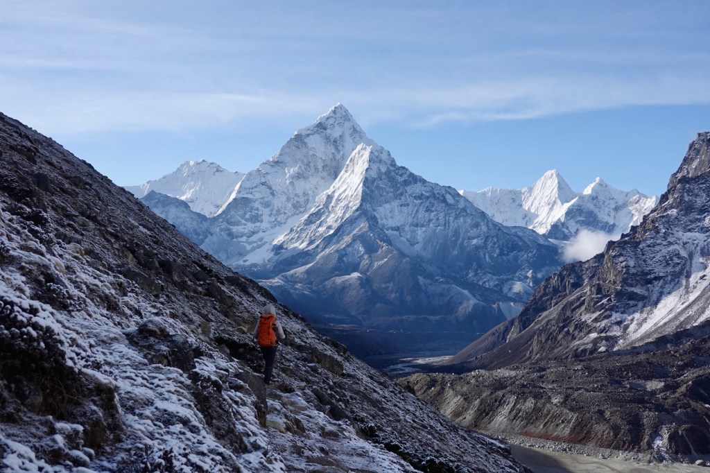
Views 
Views 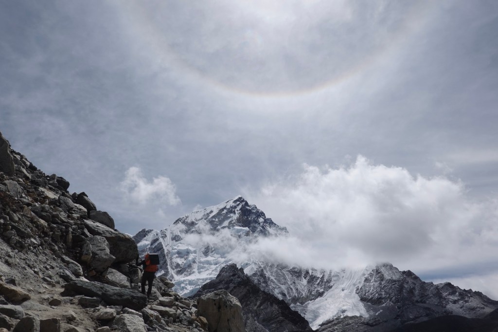
Views 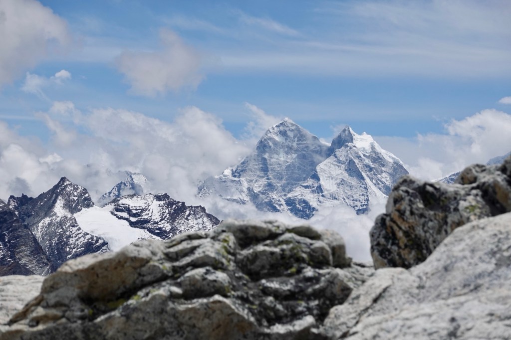
Views 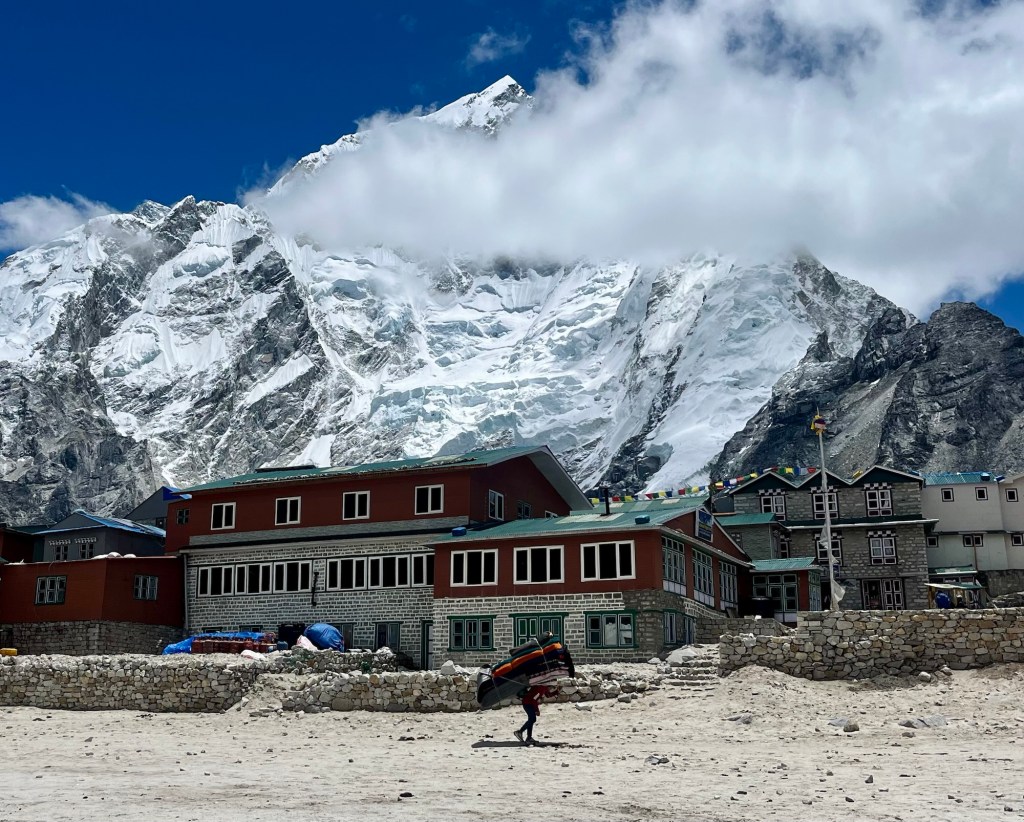
Difficult to see 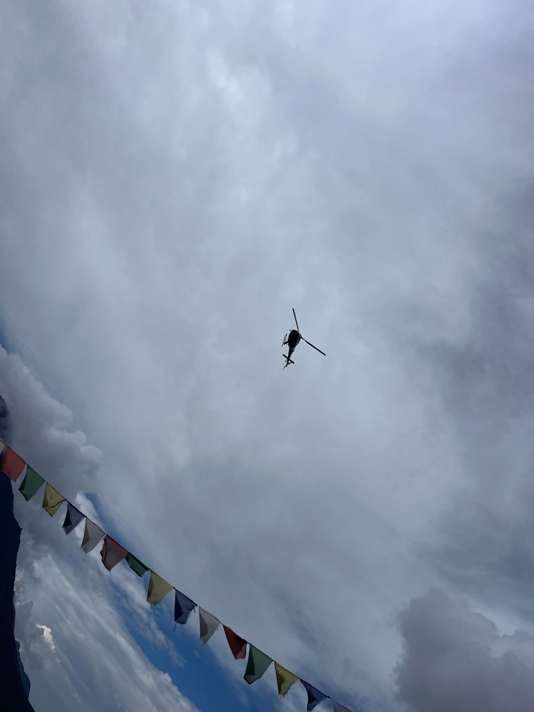
Helicopters keep on flying 
No view! At Kala Patthar 5675m we get another glimpse of the mighty Everest and the huge Basecamp!
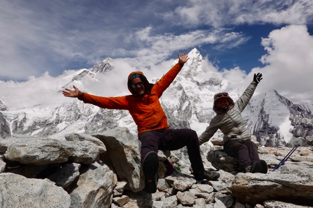
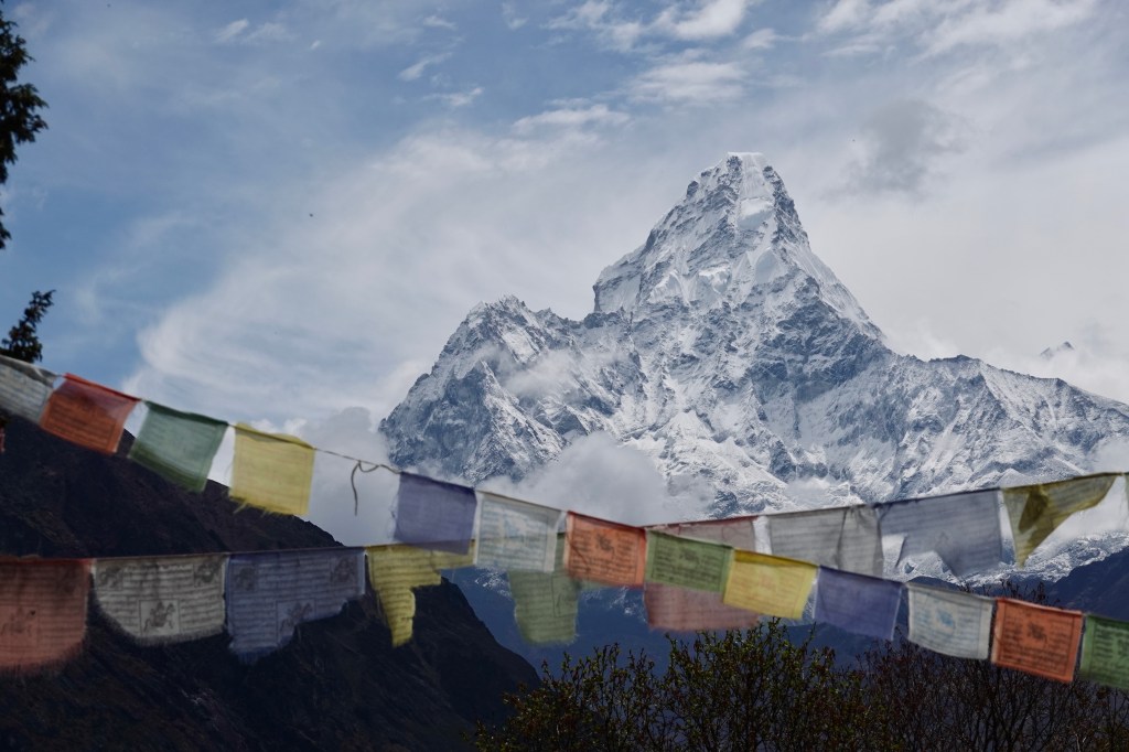
Viewpoint with a view One detour to Phortse and to Mong La brings us in the breathtaking yet terrifying presence of Ama Dablan, where we lose ourselves for over an hour, mesmerized by its stunning beauty. Bumblebees dance around us as we relish every moment, completely captivated by the magnificent view.
Ama Dablan We spent 10 days of most beautiful trekking crossing a few passes:
Renjo La 5360m, Cho La 5420m, Kongma La 5535m, Mong La 3985m
As we decided to stay at tea houses instead of camping, we were a bit afraid if we like the “more comfortable” and less adventurous way to do it. But we shared the trail with a lot of amazing people, spent nice and cozy evenings with great conversations. As we were so late in the season the guesthouse were not busy at all and it was very nice to chat with the locals and the owners of the huts and get some insight in daily life. Everyone was super friendly and welcoming and the food was incredibly good. A few museums next to the town of Namche Bazar, the trading and tourist hub in this area, were already closed for summer bream but we were quite impressed by the visitor center and the Sargamartha Next Initiative exibition, addressing the social and environmental efforts and challenges in this area. Furthermore we absolutely loved to loose ourselves in the photography collection of Lhakpa Sonam Sherpa at the Sherpa Culture Museum.
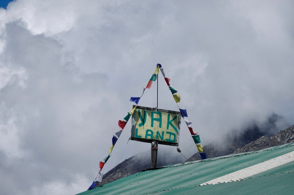
Yakland 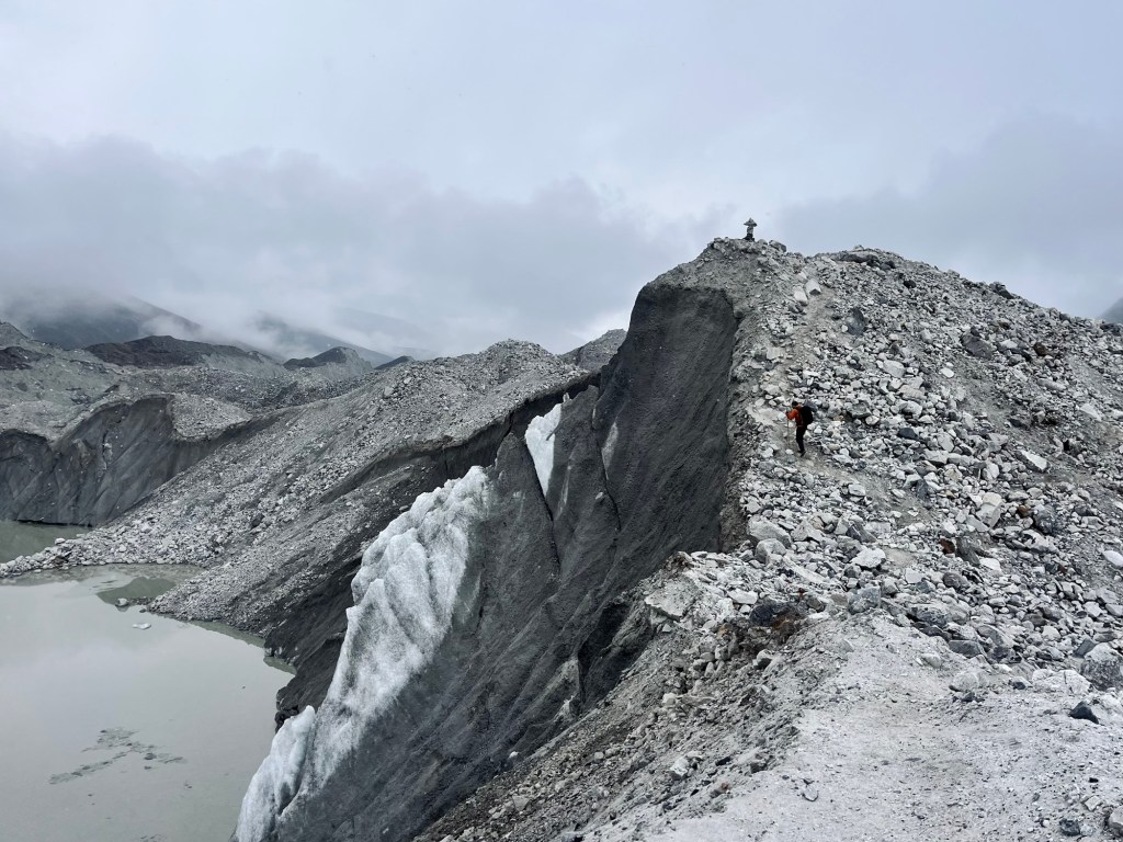
Glaciers 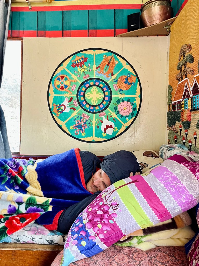
Cosy afternoons 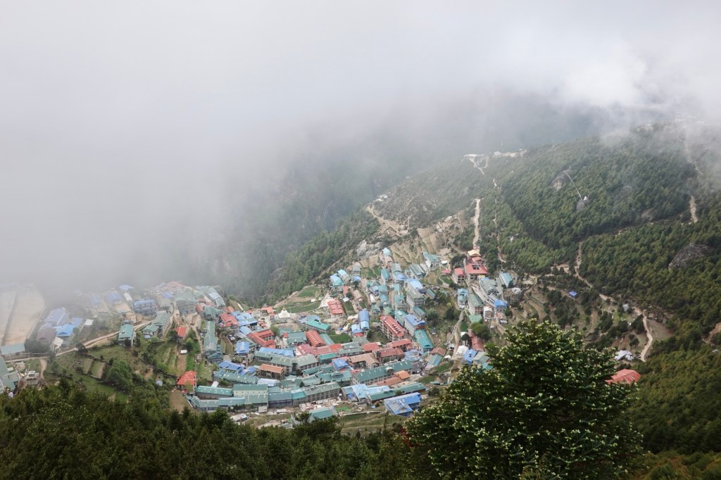
Namche Bazar 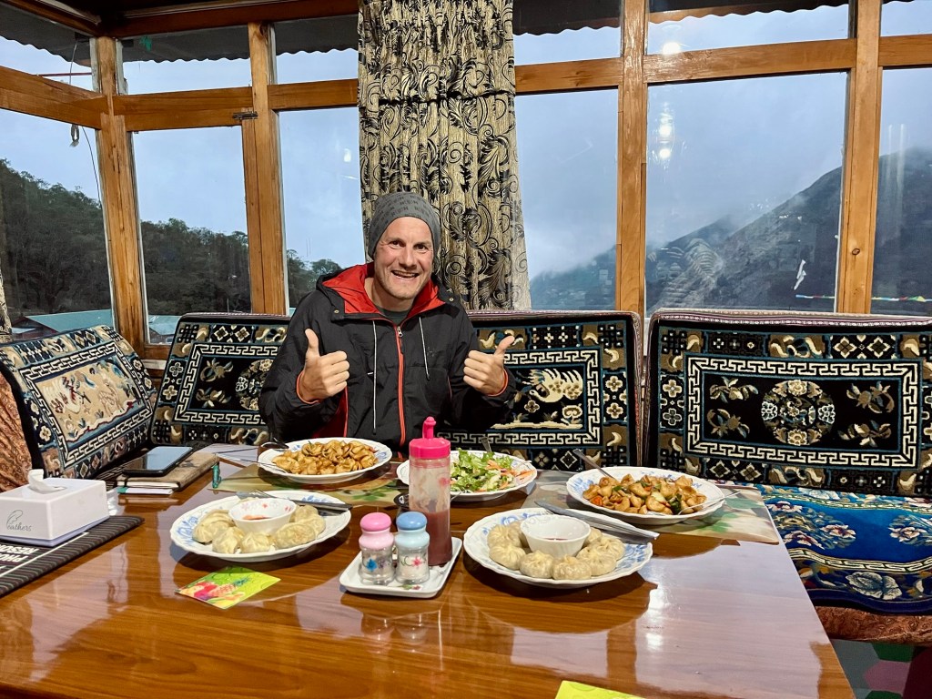
Food 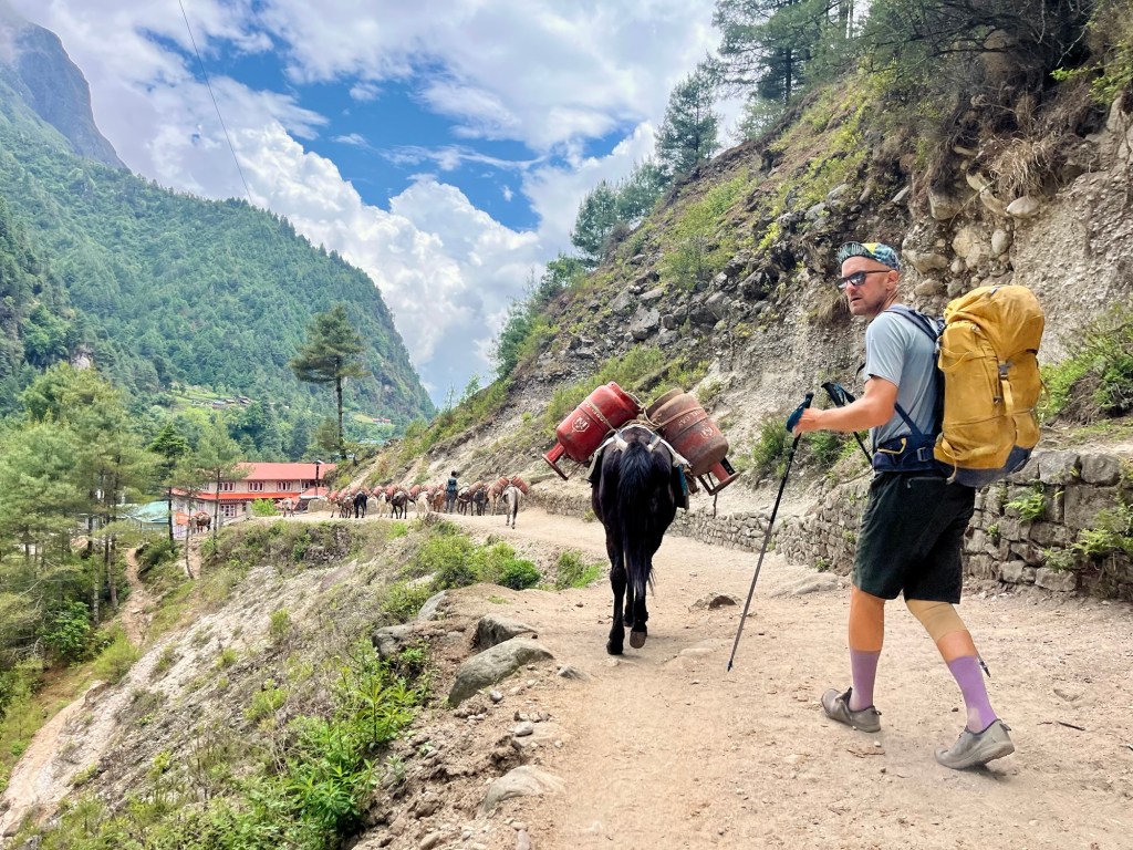
Rolfi has a new hiking buddy Back in Kathmandu there is a mountain film festival going on and so we spend one day in the cinemas and theatre halls of Kathmandu, watching beautiful short movies by talented local and international artists. One way to escape the heat!
Bardyia Nationalpark
Then embark on another bus ride back to Nepalganj. We left Kathmandu at 8 PM, and by 3 AM, we are still on the outskirts of the city because of traffic jams and/ or a strike, who knows.
One day of cycling brings us to the breathtaking Bardyia National Park, where adventure awaits in the form of a Hiking tour and a thrilling Jeep Safari. Our guide, Krishna, who grew up amidst this stunning landscape and has been guiding since his teenage years, warmly welcomes us. With a passion for the wild, he emphasizes that our safety and that of the animals come first as we prepare to enter the national park. Here, in their world, sightings can’t be guaranteed, but the respect we show for each creature is our greatest priority!
The first day we head into the national park by foot carrying a long stick. The stick is there to make us seem bigger and in the case of emergency smack an animal on the nose – let’s hope it won’t come to that.
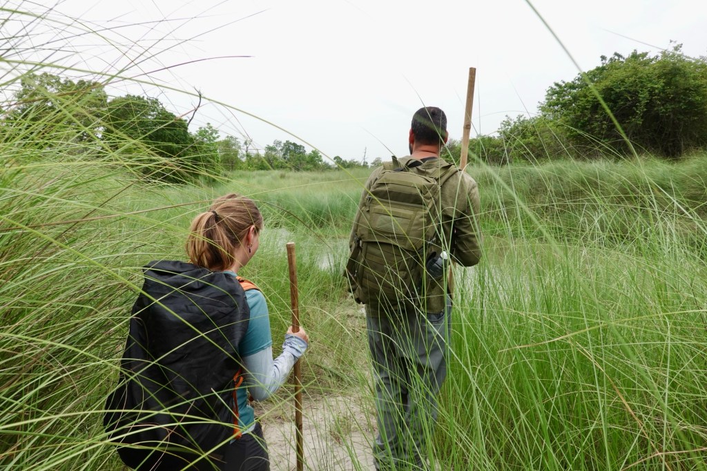
Safari Time We roam through high grass and stay at a watch point. On the way we saw footprints of tigers, rhinos and elephants. Super excited!
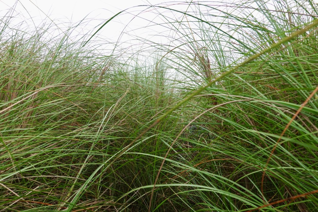
Maybe a tiger is hiding in the grass? 
Found him – next to tiger scratch marks on the tree Deers pass by, many birds and even more monkeys.
Kingfisher 
Spotted deer 
Deer 
Bird life At another watchpoint we spot a rhino family in the distance. One highlight! In Bardyia there are only 37 Rhinos as the Tiger population increases.
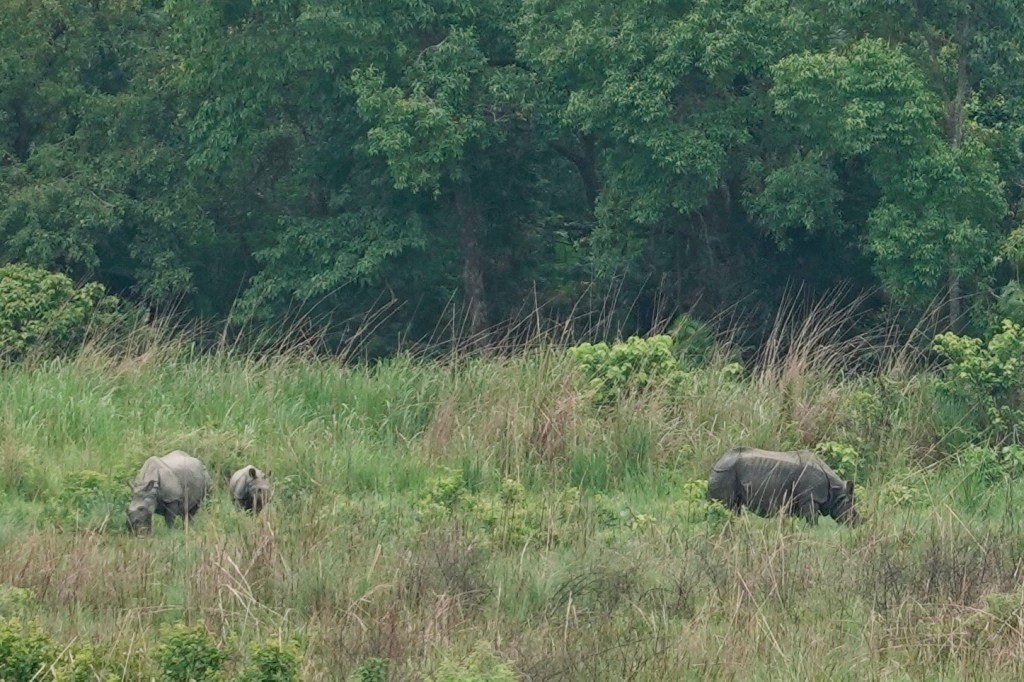
Rhino Family 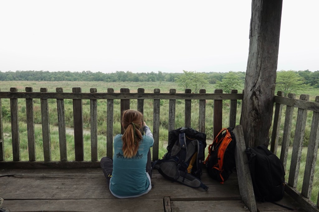
Along the watchtower The next morning, we eagerly set off in a jeep. Kirshna, incredibly knowledgeable and enthusiastic, suddenly urges us out of the vehicle, leading us to the river—a playful otter crew frolicking on a river island! These delightful creatures, with their curious noses buried in the sand, are so funny to look at, as they shake their tails against the grass, marking their territory. They look like cats dressed in a dinosaur costumes!
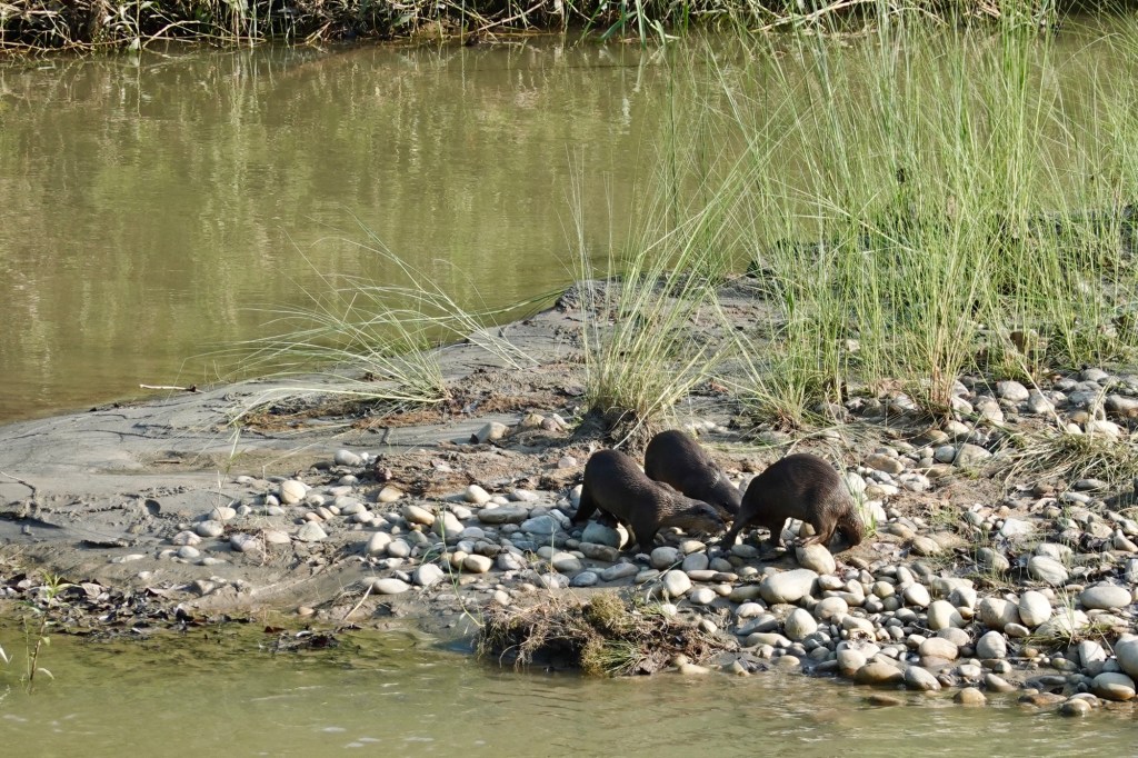
Otter Gang 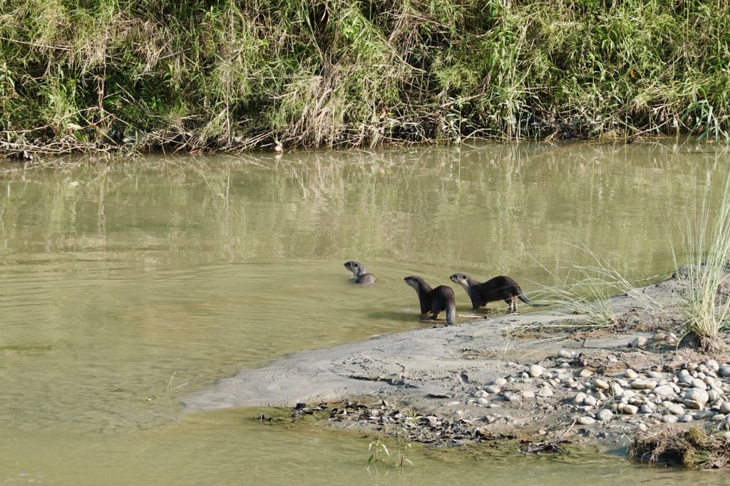
Otter Gang We traverse the rugged dirt roads of the park, where the majestic castles of termites rise impressively, towering like tiny fortresses across the landscape. High above in the trees, the bee hives nestle away, skillfully hidden from any predator that dares to approach.
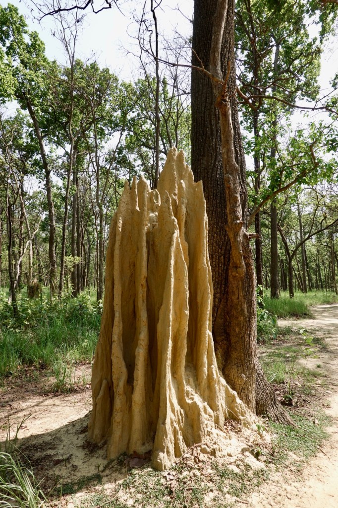
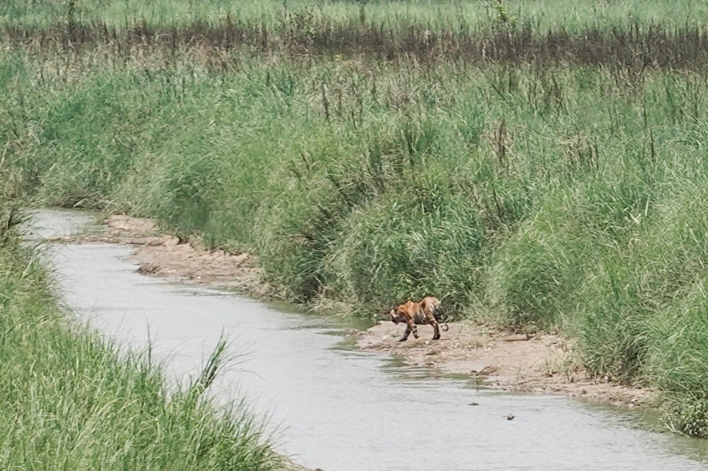
Termite castles Thereafter, we move from one water hole to another, eagerly hoping to spot tigers, elephants, and more. During lunch, while everyone enjoys some downtime, Kirshna suddenly gets excited and points to the river. There she is – I just assume it’s a female – but we don’t really know! Her majesty, the tigress! A good distance away, she walks gracefully through the river, glancing at us as if she knows we are admiring her. Elegantly, she crosses the river and hides in the grass on the other side. What a magical moment in the national park! All of us are absolutely thrilled!
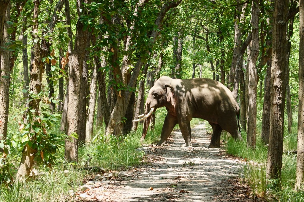
Tiger in the distance As we roll along, a massive male elephant is just trying to hide behind the trees.
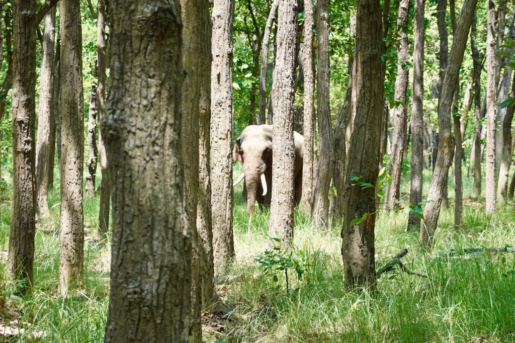
Elephant disguised as a tree We found out that these big guys like their personal space, so we back off in the car while he makes his way towards us. It’s mating season, and every time he flaps his ears, those pheromones are hitting us hard – and nope, it’s not exactly turning us on.
Massive male bull On our way out, Krishna noticed two crocodiles in the river.

At a pond 
Lucky charms 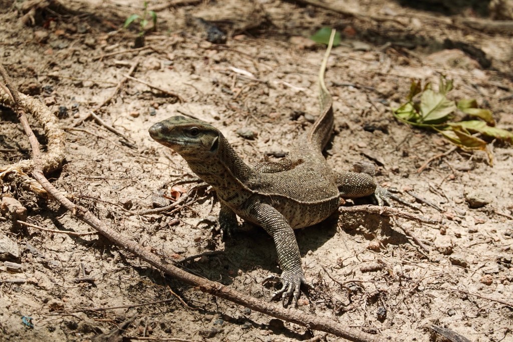
Waiting for our lunch leftovers 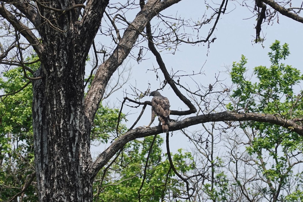
Birdlife 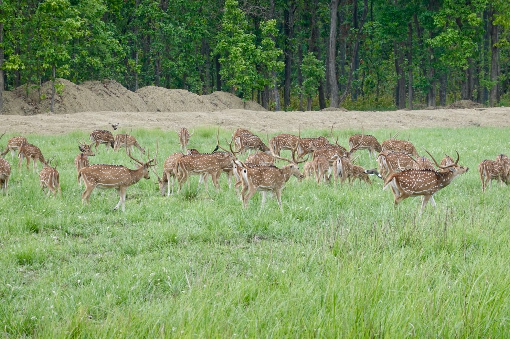
Deer The next morning we leave the little paradise and head towards the Indian border.
Little paradise Final thoughts
Cycling and exploring the breathtaking landscapes of Nepal has been an unforgettable adventure that has touched us in countless ways. We embarked on the iconic Annapurna Circuit with our bicycles, a dream we both held dear, and found ourselves unexpectedly wandering through stunning, less-trodden regions. We found ourselves at the foot of some of the majestic peaks, including the highest mountain in the world, alongside countless other beautiful giants. We’ve had the privilege of immersing ourselves in the rich wildlife of southern Nepal. As many tourism ads put it: people come first for the awe-inspiring mountains, but they return for the warmth and spirit of the people. Yes, it may sound cheesy, and perhaps even cliché, but it is undeniably true. Our time here was filled with joyous moments and delightful encounters. We cannot help to wonder how tourism especially in the mountain areas will develop over the future. Though it may be a small country compared to its immense neighbours, Nepal still holds a treasure trove of wonders waiting to be explored. I have the feeling that at some point in my life I would love to come back.
Our Path
Nepal in total: 1500km | 49.000 altitude meters cycling and hiking
- The Annapurna Circuit – Nepal Part 1
The Annapurna Circuit – Nepal Part 1
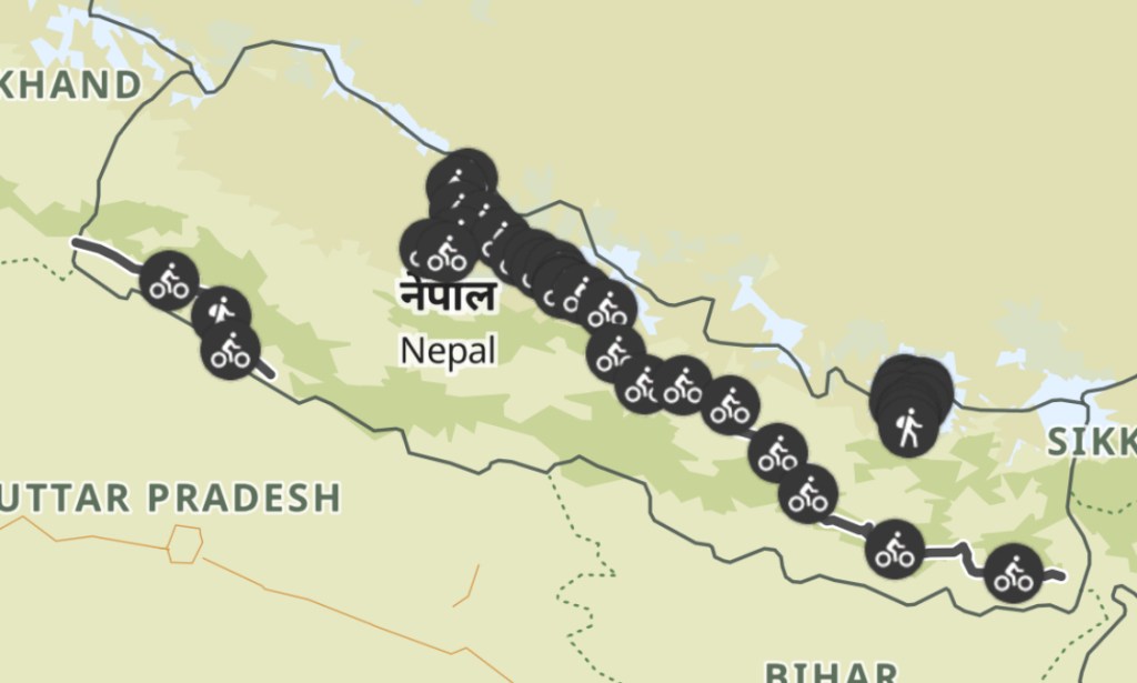
Nepal Route so far En Route to Kathmandu
Hello Nepal!
Crossing the Indian Border into Nepal was big for us. Nepal was our goal from the start – from the Altai to the central Himalayas. Lots of detours in between but we finally cross this border. It took more than 10 minutes of explaining and wikipedia searches at the Indian side that: “No Austria is not the same as Australia” and “Yes Austria is a country and yes it exists”. Once in Nepal the roads didn’t really improve but the camping option where plentiful. A few long thunderstorms, flooded bridges, many construction sites, 50+ momos, one nice pass and a 100% wild camping quota later we arrive in Kathmandu.

Passes 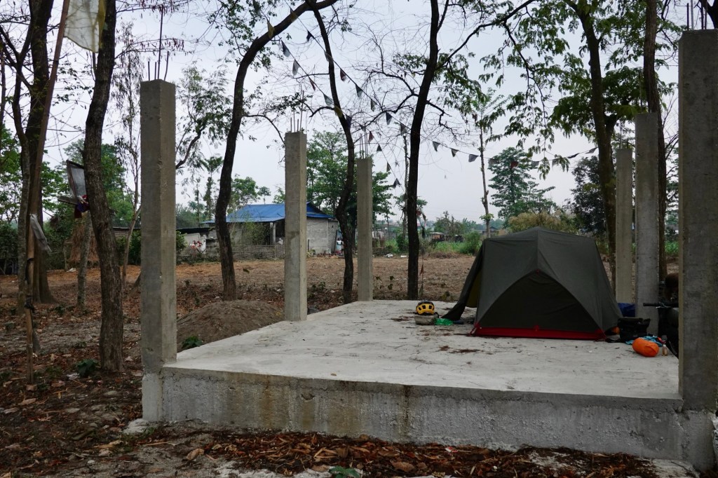
Camping 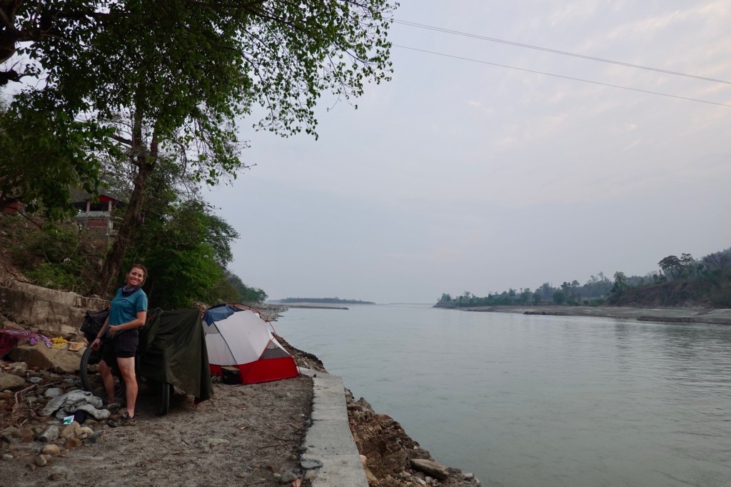
Camping 
Camping 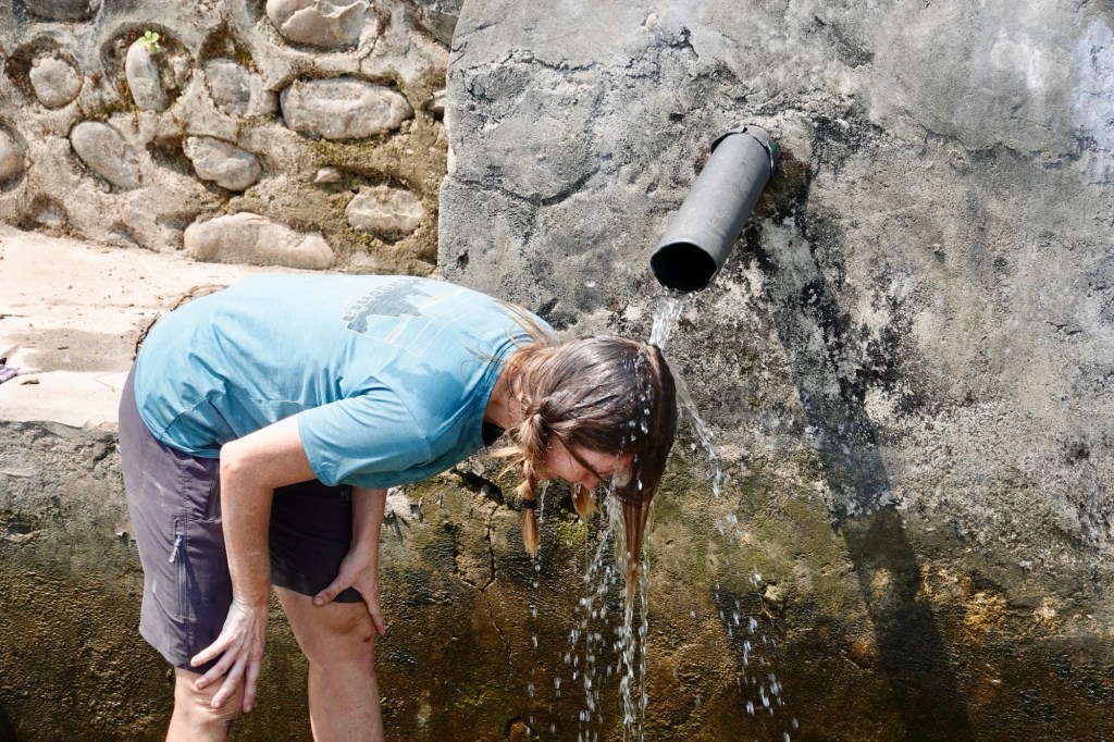
Dealing with the heat 
We love Momos 
Iced americano 
Crazy birds 
Crazy birds 
Mirror mirror on the wall, who s the sweatiest cyclist of them all? Kathmandu – Monkeys, city buzz and lots of amazing food
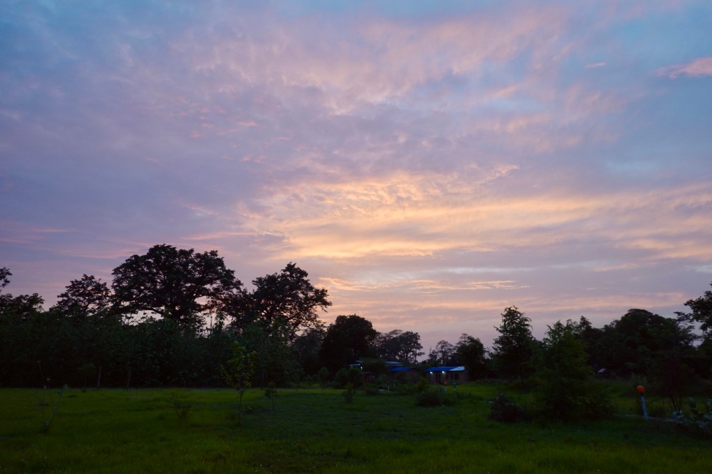
We arrive in the evening hours in the capital. Flashlights reflect in the untypically hazy sky.
Lalitpur 
Lalitpur We are staying in the Monkey Bunky hostel in Kathmandu which is a little bit outside next to the Swamboo or as tourist call it the monkey temple.
Monkey business 
Monkey hangouts 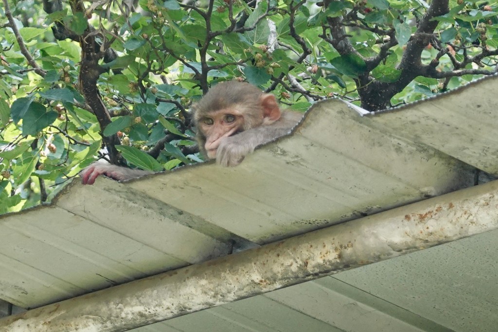
Monkey curiosity 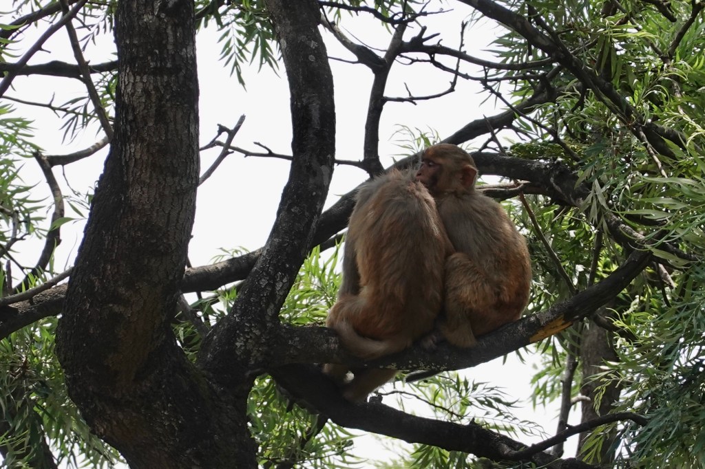
Monkey love The area is quiet(er) with nice Cafés, many temples and monkeys performing gymnastics in front of our windows. In the morning our alarm clock starts at 5ish with the prayers from the monastery, later the laughing sequence of a free yoga class in the park and thereafter warriors shouts from an exercise sessions. We meet up with friends, do some sightseeing, get lost in the small alleys of Lalitpur (the former old capital) and celebrate our third new year, this time the Nepalese New Year – happy 2082!
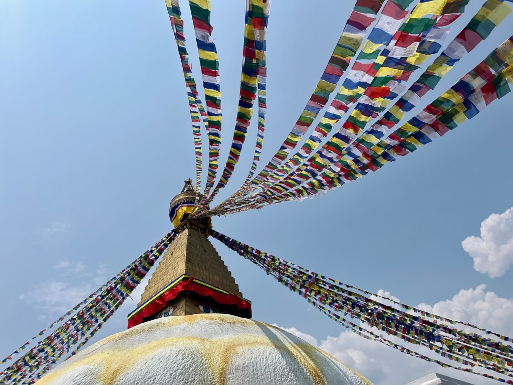
Bouddhanath Stupa 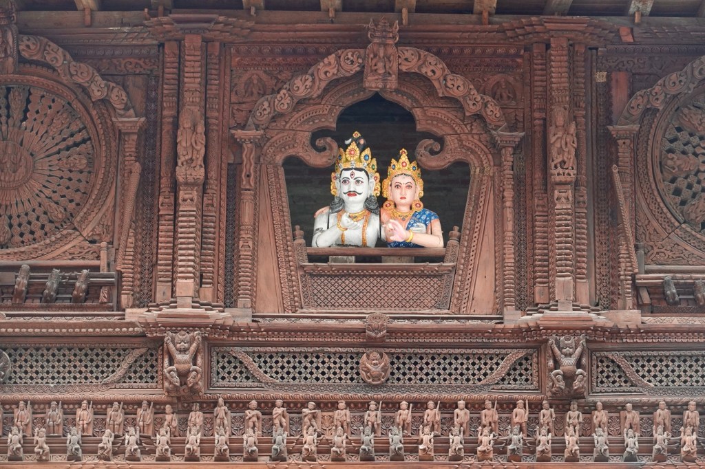
Wood carvings 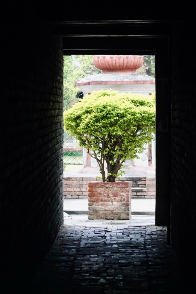
Alleys of Lalitpur 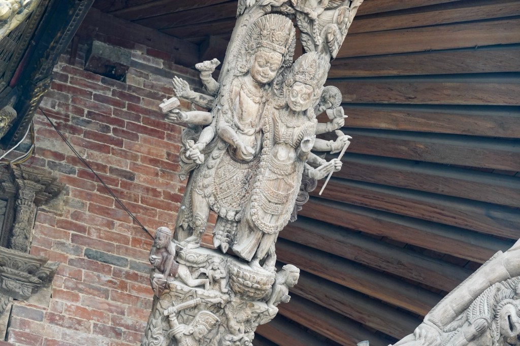
Details 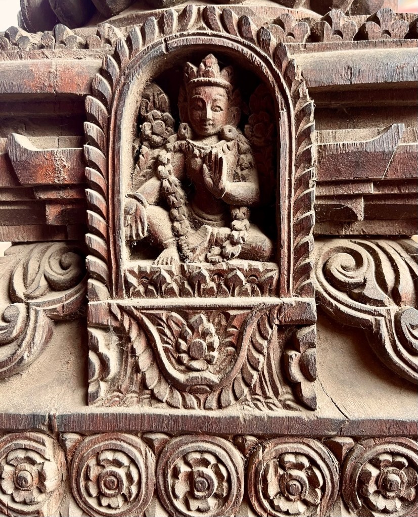
Details 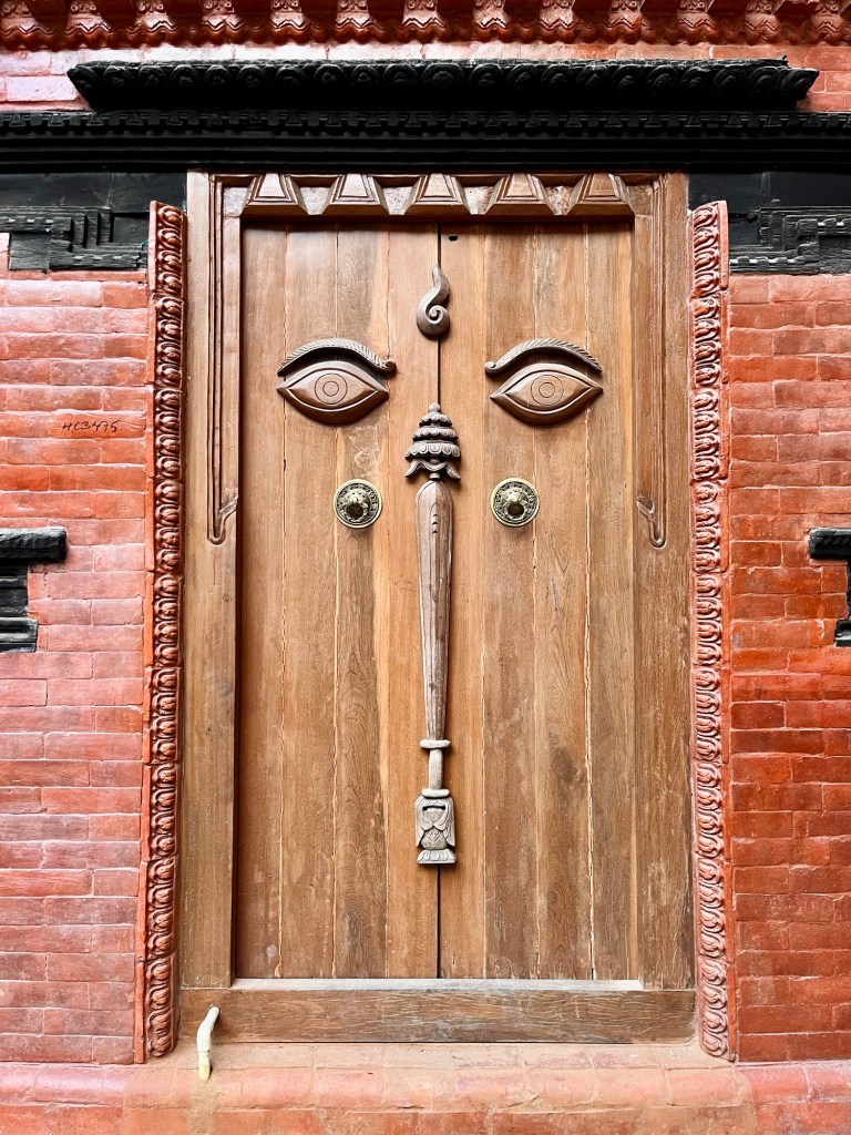
Doors 
Shrines 
Streets of Lalitpur 
Streets of Lalitpur 
Bouddhanath Stupa Initially we planned to go hiking but since Rolfi’s knee is not in the best shape we decide to pivot these plans and saddle the bikes again. Light set up this time – only necessities will come along on this stretch of the journey. Bye Kathmandu – for now!
Annapurna Circuit
Towards the Annapurna Circuit
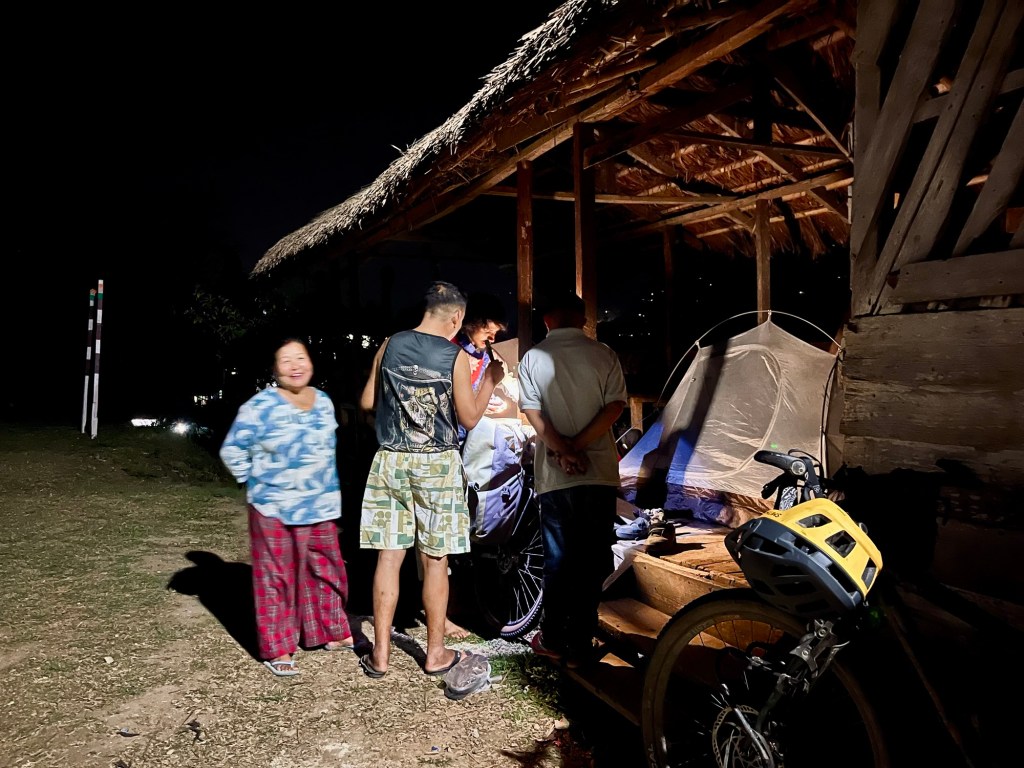
Right on the first day we get caught in a quite bad thunderstorm and got saved by a lovely family who offered us shelter for a night.
Haze over Kathmandu 
This lovely family saved us from a thunderstorm offering dinner and a bed to sleep to us The next day greets us with an crystal clear sky, muddy tracks and a fun route. Riding through lush green valleys with juicy fields, glowing in the brightest green and yellow tones.
Fields 
Green 
Tracks 
Another rainy day 
Camp Site 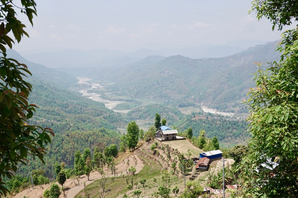
Valley Passing through Gorkha, the birthplace of Prithvi Narayan Shah – the last king of the Gorkha empire and the one who started the unification of Nepal.
Outside Gorkha Museum 
Outside Gorkha Museum 
Trails down from Gorkha 
Track from Gorkha down Beautiful camp spots all along the route! In the small village of Kharpan we can see the white majestic mountains rising up in the distance. We are super excited to see those giants, first time since long.
Hazy mountains 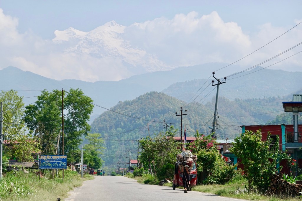
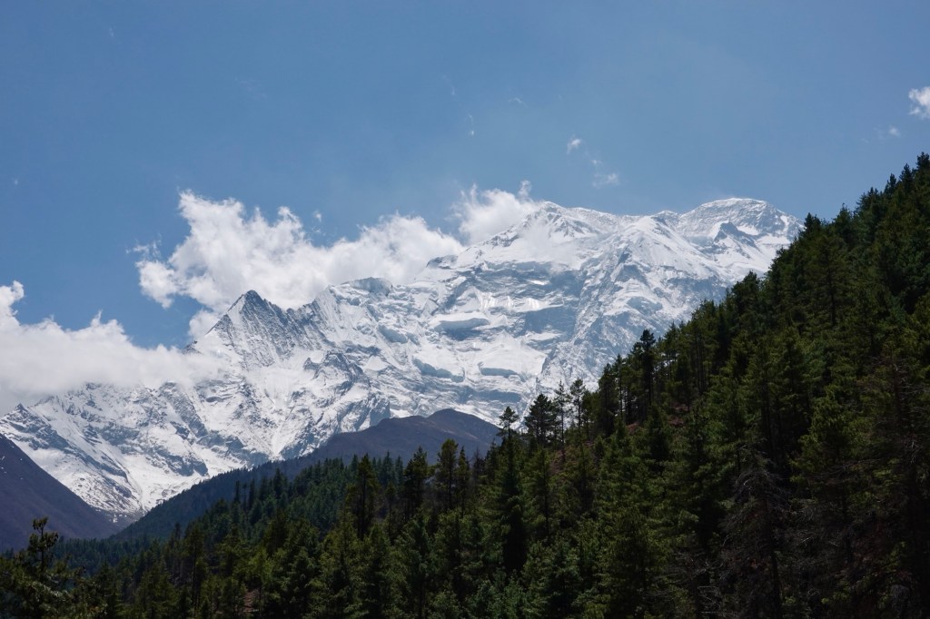
In the clouds Disguised and cloaked in a cloud, hiding behind the haze but if you look closely enough you can see the Annapurna Range on the one side and Manaslu Range on the other.
On track – hello Annapurna Circuit
In Besisahar we join the widely known bikepacking route: the mighty Annapurna Circuit. The circuit lies in the largest conservation area of Nepal. The route became popular internationally after Nepal opened up for Tourism in the 1960s. Before it was a trading route, linking the lush forest to the Tibetan plateau.
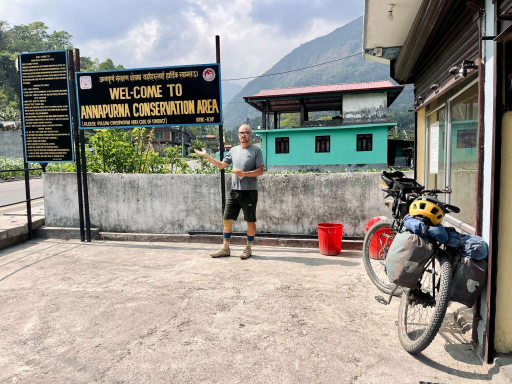
Hello Annapurna Conservation Area Yep we are excited and ready for some challenging riding after the long hot days on tarmac! And so we follow, like many other hikers and a few cyclist the Marsyangardi River upstream. Its a gravel road – the steepest parts are coated with concrete. Hikers usually take some side paths these days. The first night we check in at the Mont Blanc Hotel and quickly hop 200 altitude meters down to relax in nice hot springs. What a treat after a hard day. The next day we head further into the valley.
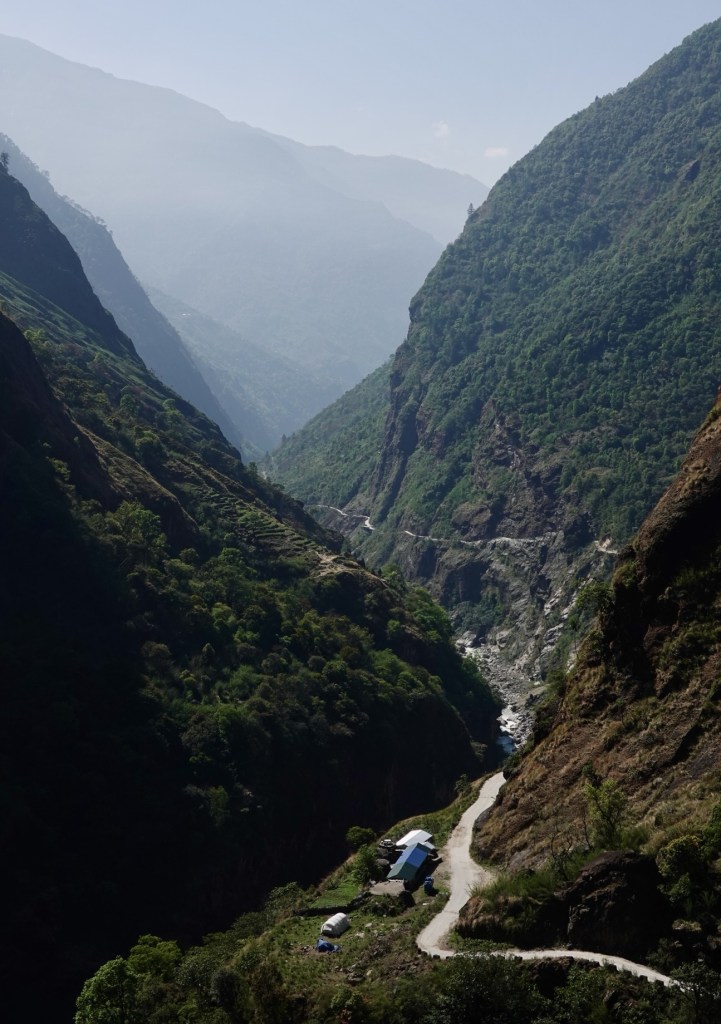
Valley roads 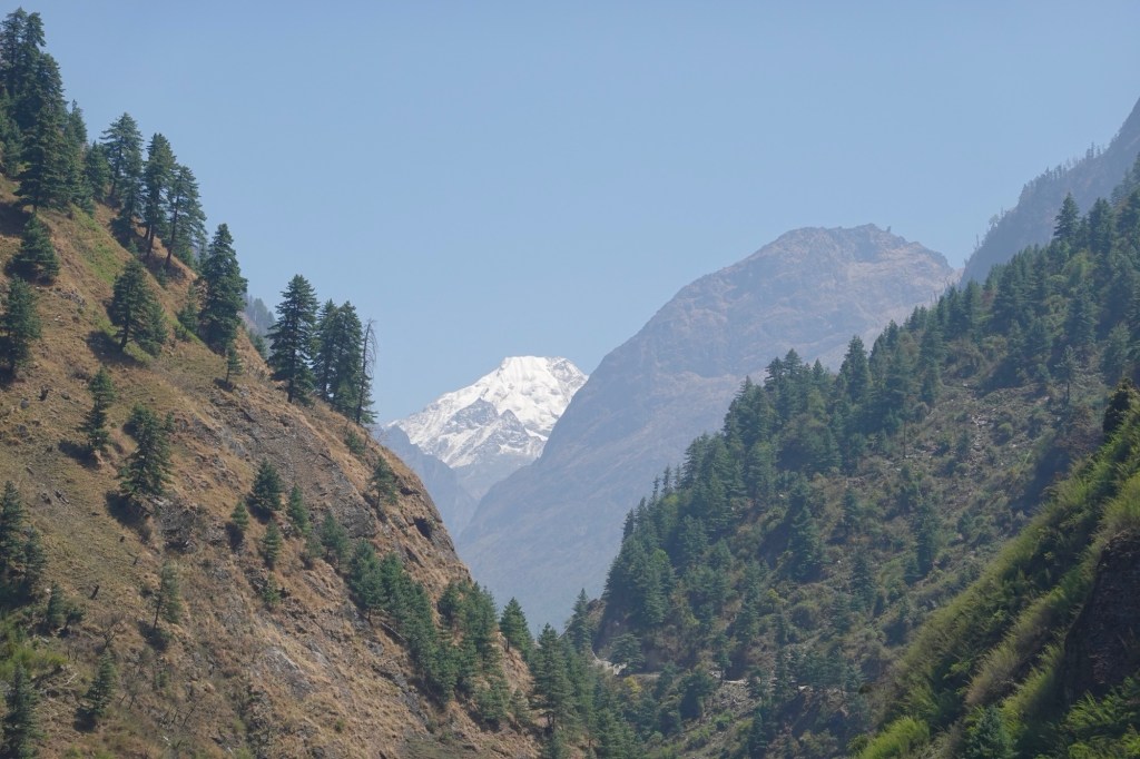
Valley views Lizards peak out between the mossy walls next to the dusty road. Guesthouses and restaurants string together in the villages. A few motorbikes, a few trucks and some construction vehicles pass our ways. Some switchbacks feel smooth and easy, yet most of the climbs are very steep and exhausting. The first kilometres we spend riding through a canyon and after a while the valley opens up.
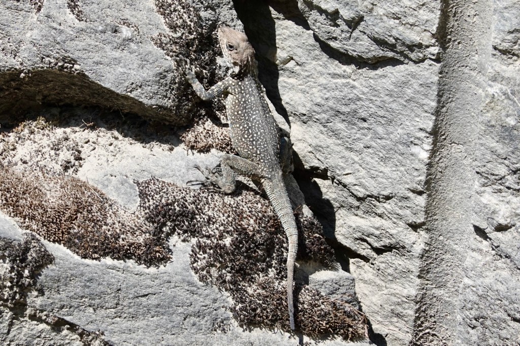
Lizard 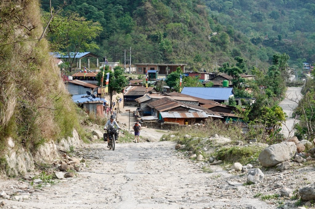
Villages At the end of our second day of the loop the Great Wall of Pisang appears, shining in the afternoon light. The wall is the westface of the Paungda Dandaholy or Swarga Dwar mountain and is considered as holy.
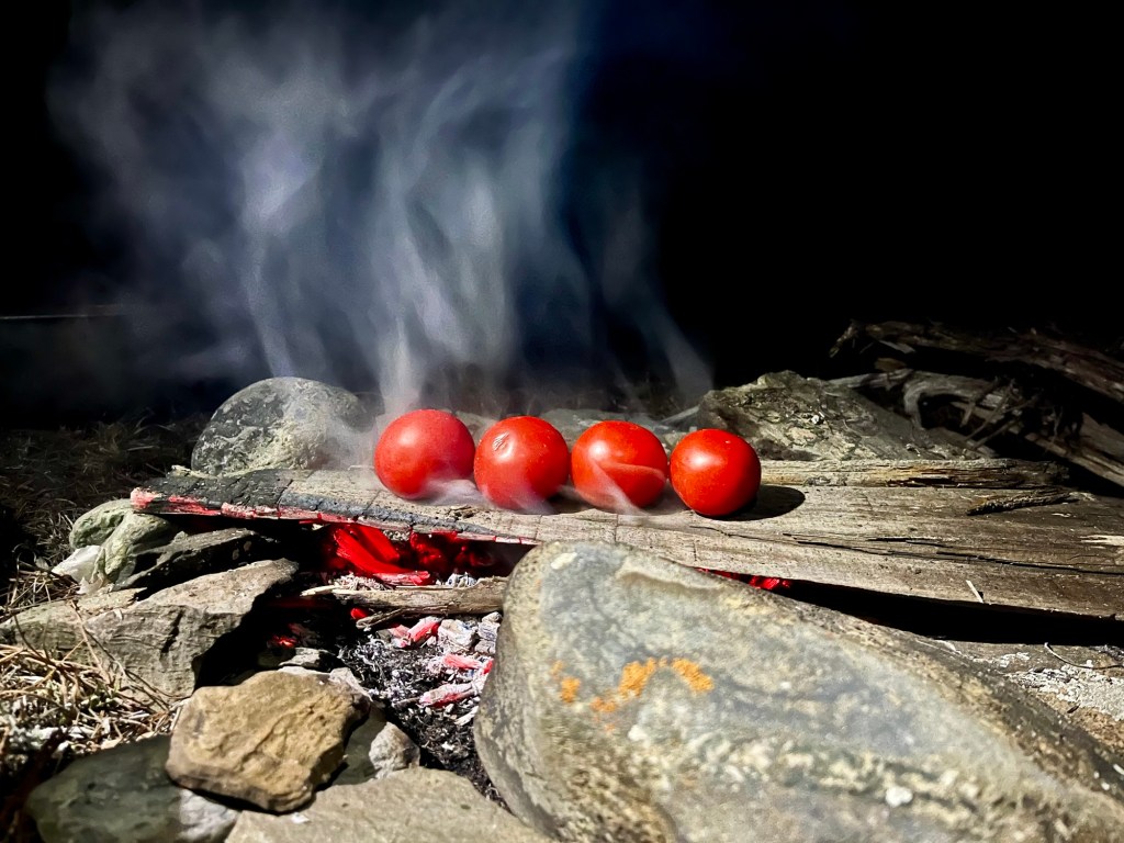
In the comfort of trees we find a beautiful campspot. Smoked tomatoes spice up the pasta for dinner.
Gourmet Pasta in the making 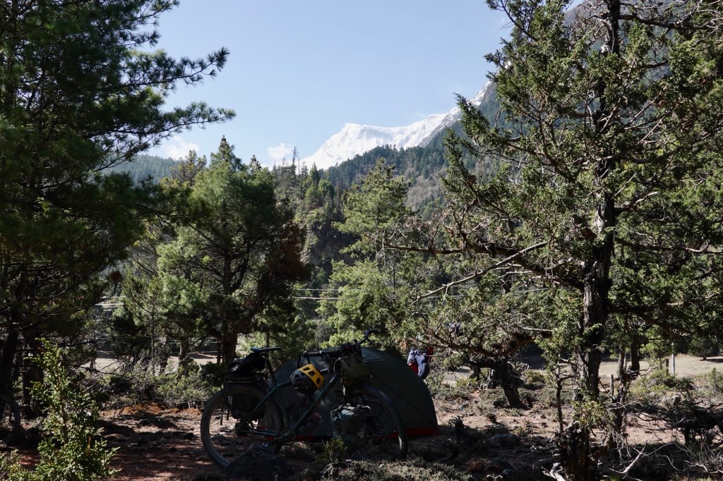
Camp Spot We take a little detour through Upper Pisang.
Stupas on the way 
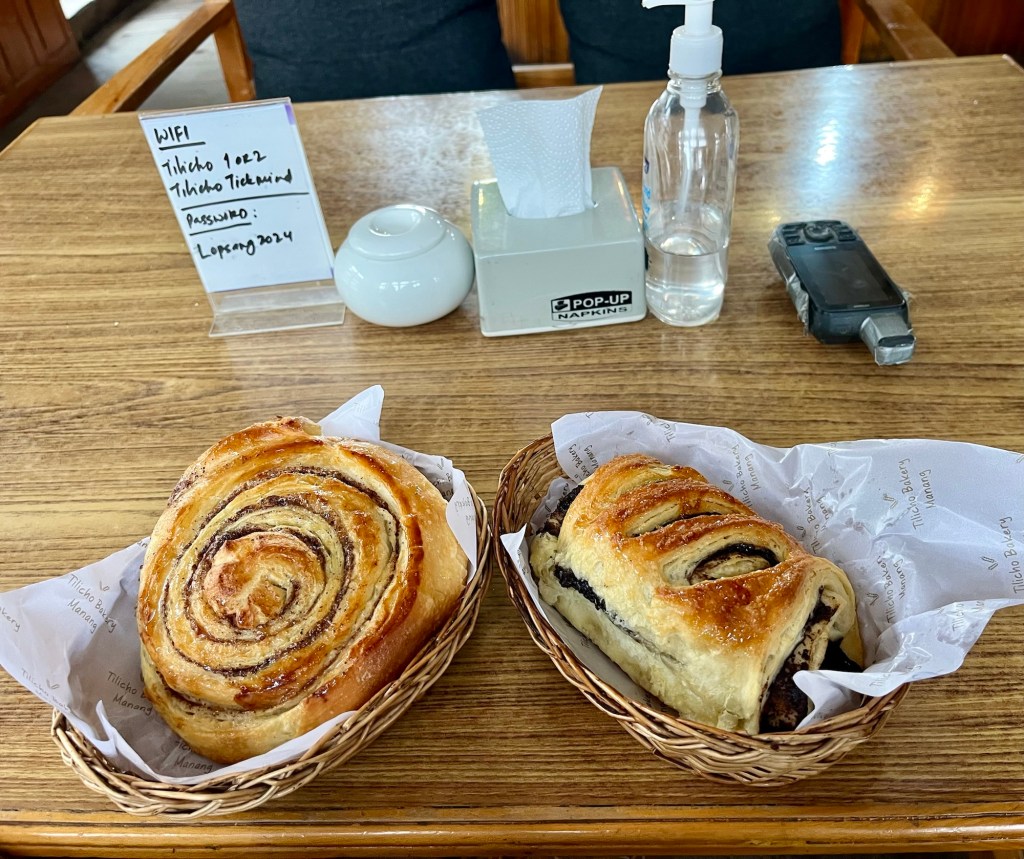
Uphills with views We pass Braga Gompa, an 600 year old monestary hiding in the sharp rock faces. Then we reach Manang. Here the road ends. Although Manang is the epicenter of Tourism in this valley it maintained a nice atmosphere. Every guesthouse seems to have its own bakery and every other house is serving as an accommodation. The smell of the cinnamon rolls is all too tempting!
Bakeries 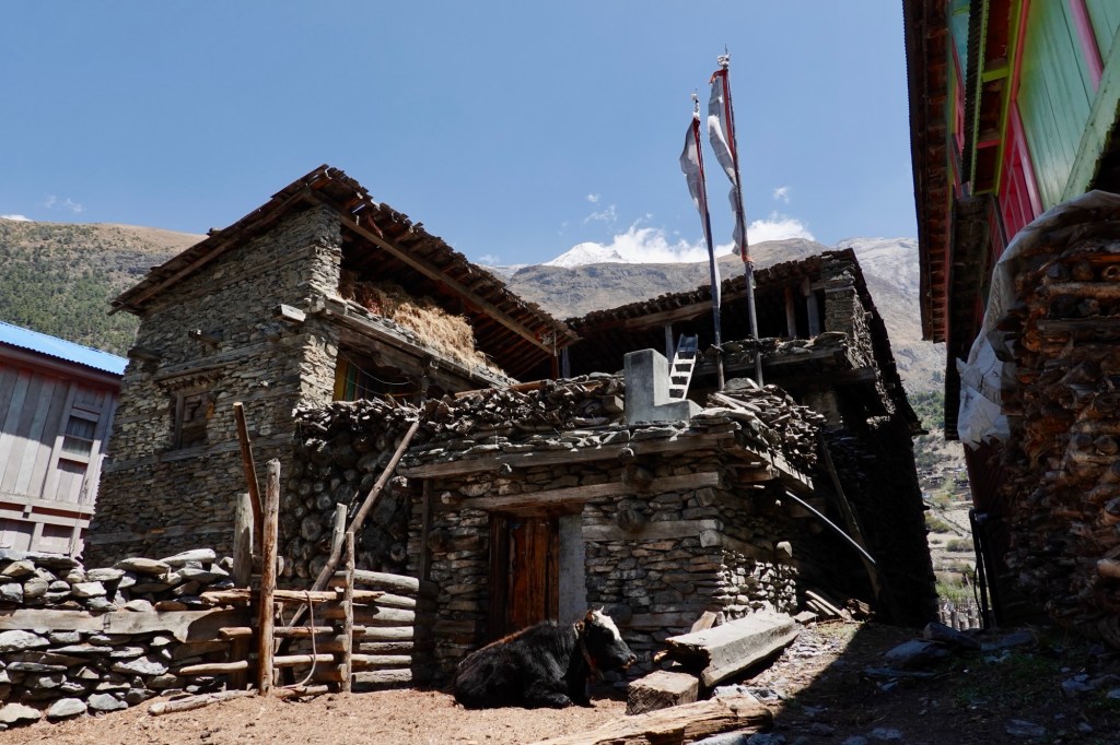
Houses Tilicho Lake – Hike’n’Bike
The next day we head out with the bikes for an acclimization tour to the “Tilicho Basecamp”. Until the little village of Khangshar it is perfectly bike-able. Afterwards a small narrow hiking trail leads up to 4400 meters. Followed by some sketchy meters next to steep slopes with loads of loose rubble.
Views 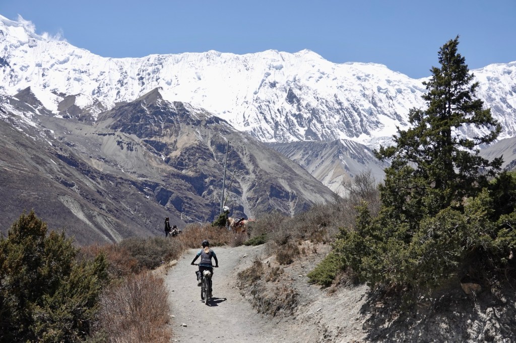
Tracks 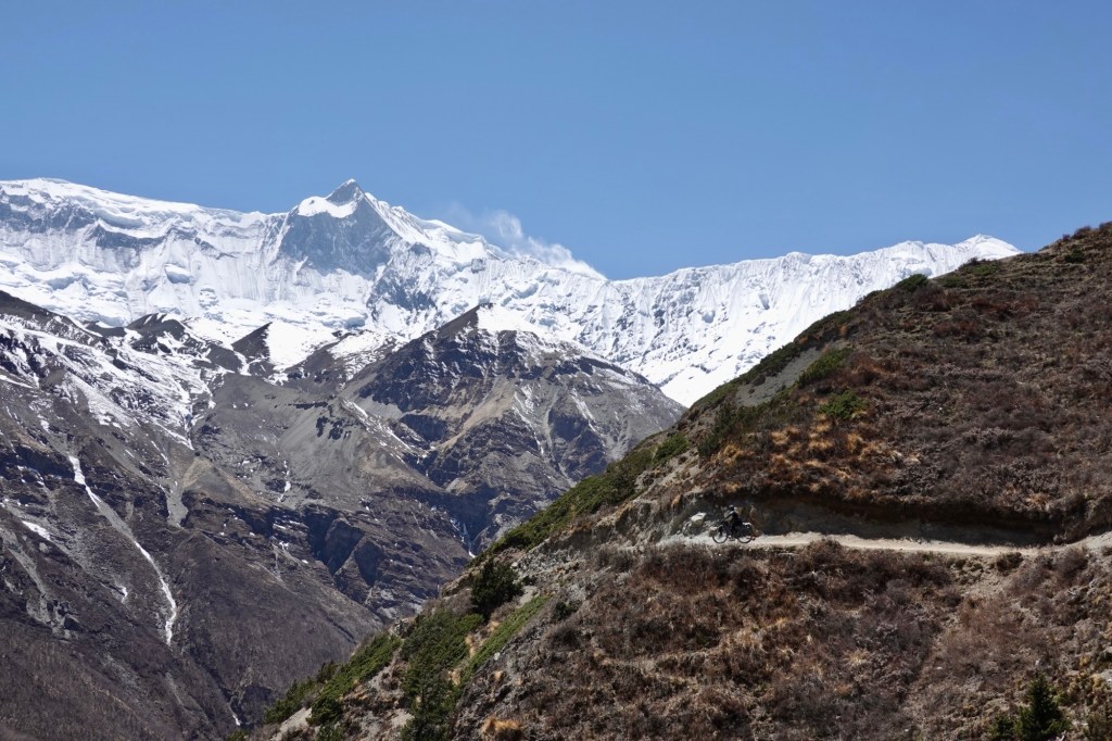
Just wow 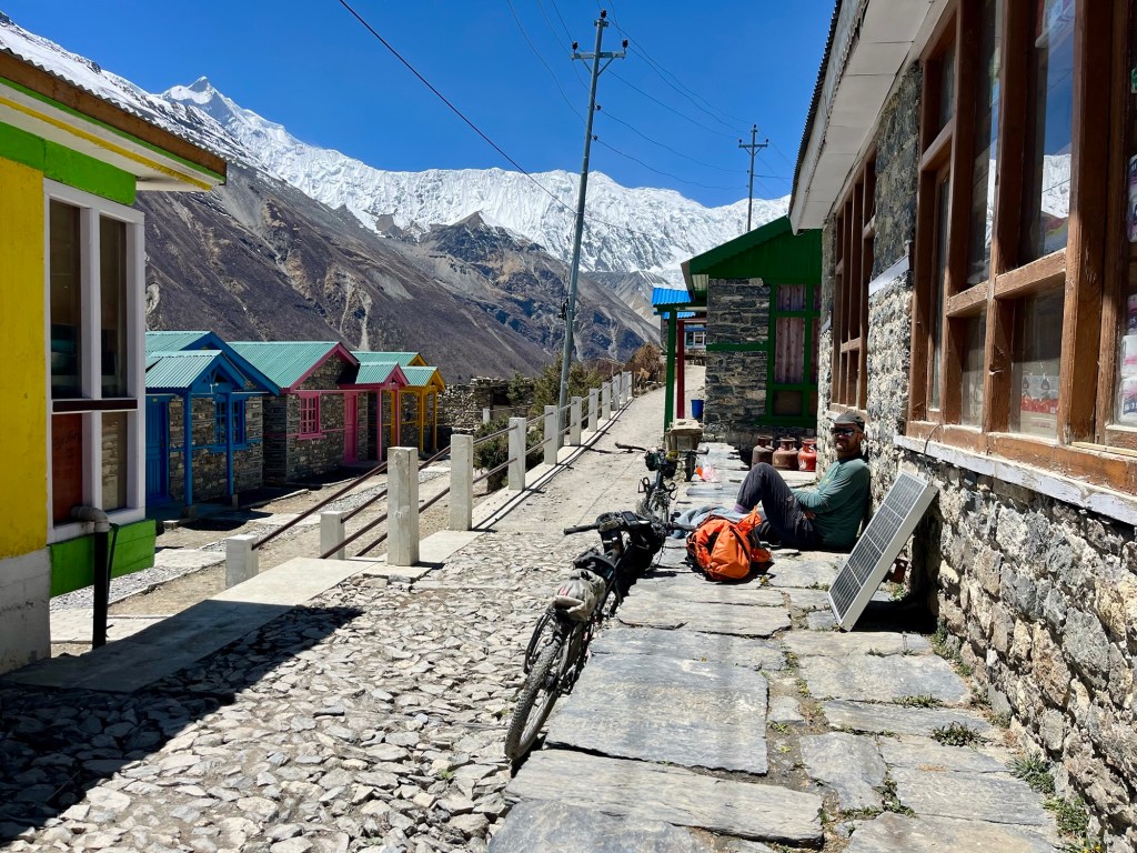
Breaks 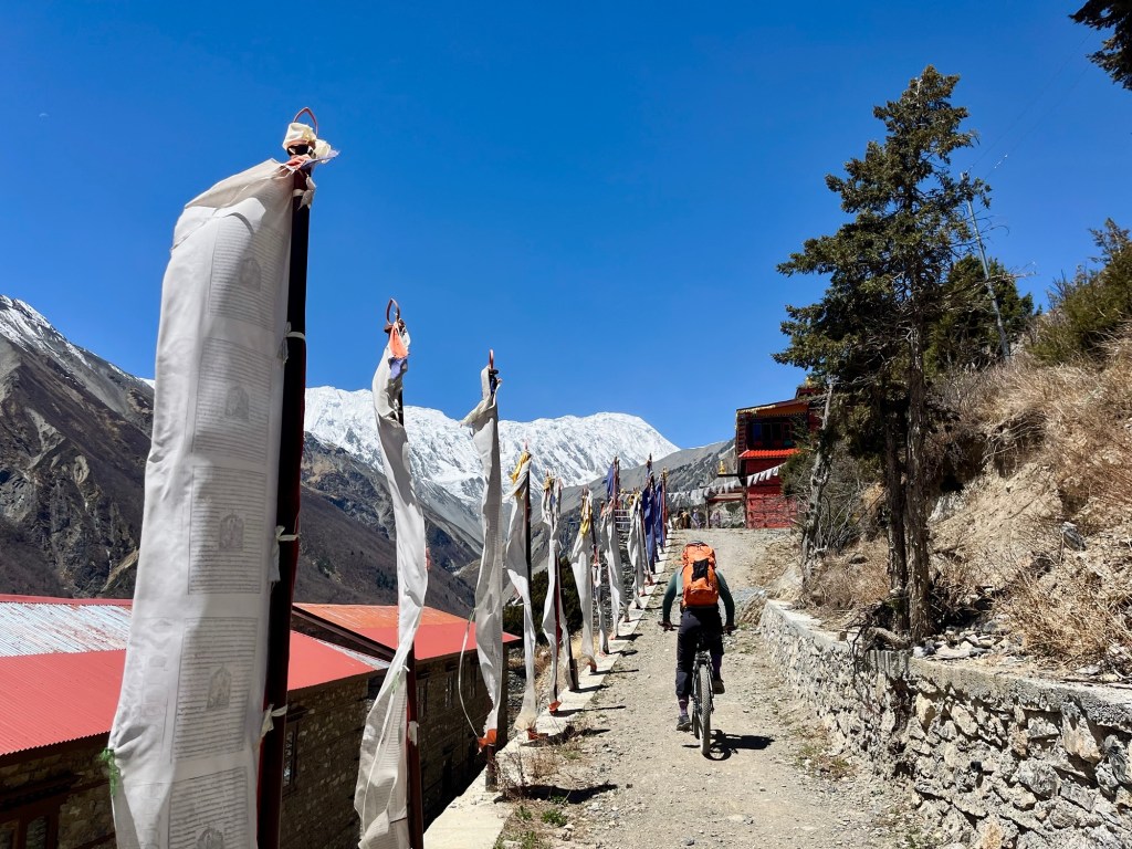
Monastery 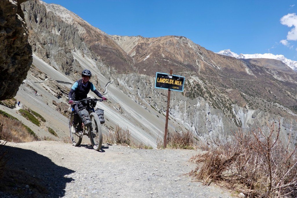
Careful! 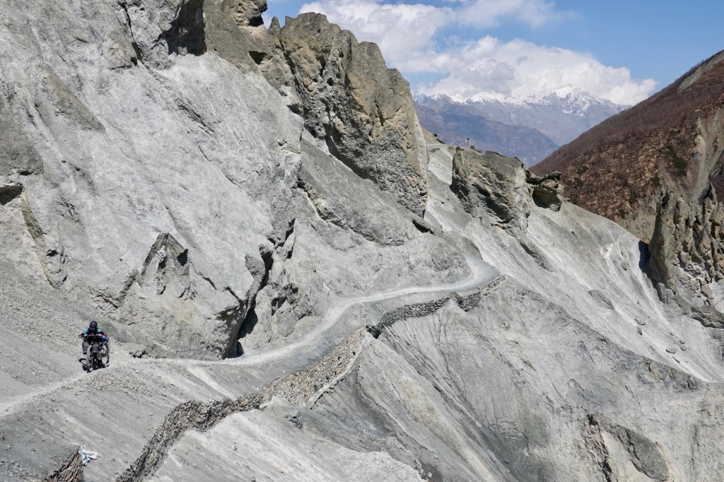
Bit narrow 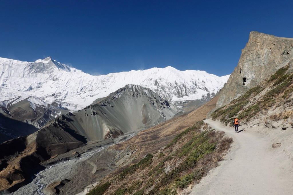
Views The trail is shared with donkeys and many lovely hikers. The hierarchy on the trail should not be ignored: Donkey, guides and porters (both usually crazy fast), hikers and then cyclists. Yet on the whole trail we were only greeted with smiles and sometimes astonishment but never anger or annoyance!
Trail buddies The next day we hike up to Tilicho Lake (4919 m), bedded in between beautiful mountains.
The lake, covered with ice 
Long overdue headstand 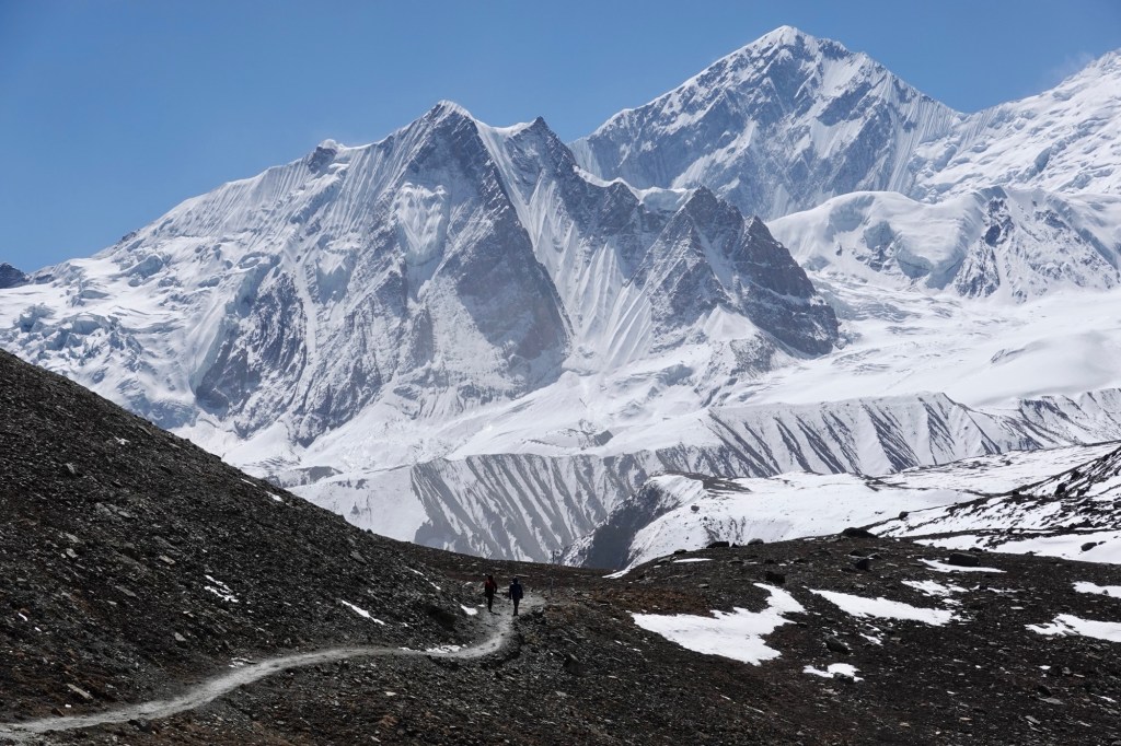
Just unbelievably beautiful The grand finale (for now) – Thorung La
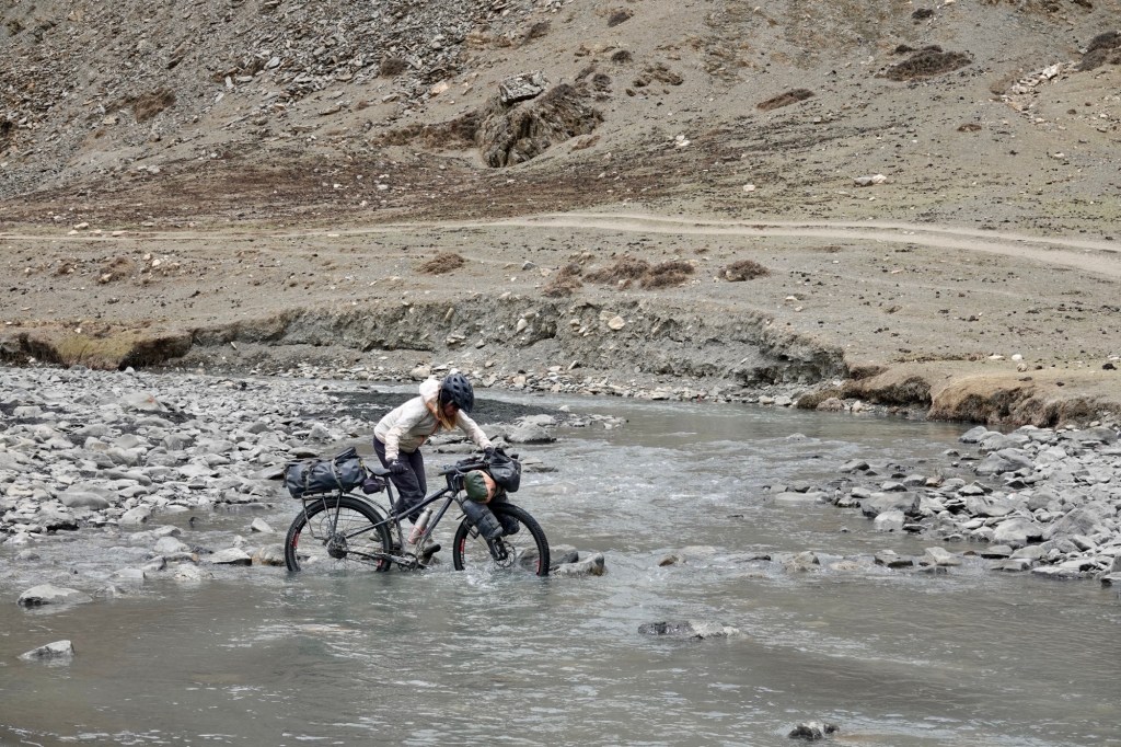
The next day we head further into the valley. Some pushing but most of the time we can cycle the broad hiking path. Suspension bridges keep our feet dry during the river crossings – fun but sketchy in the wind!
Bridge with a view 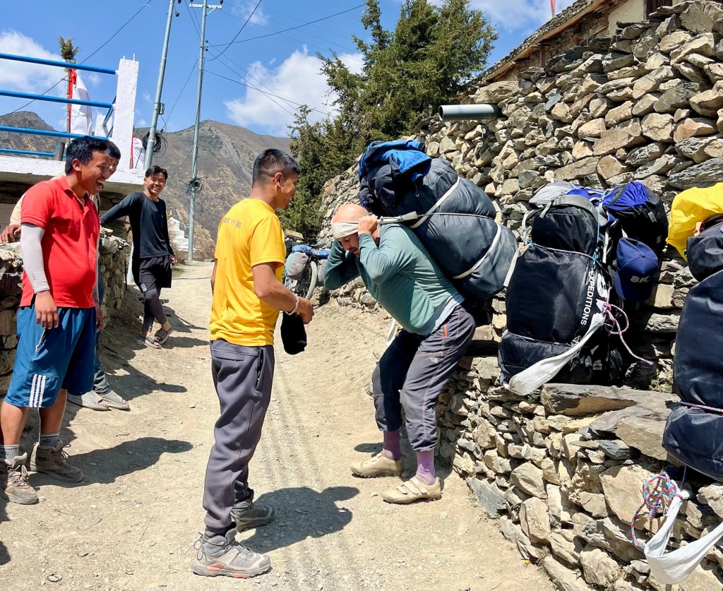
Probably as heavy as our bikes with luggage- biggest respect! 
Views 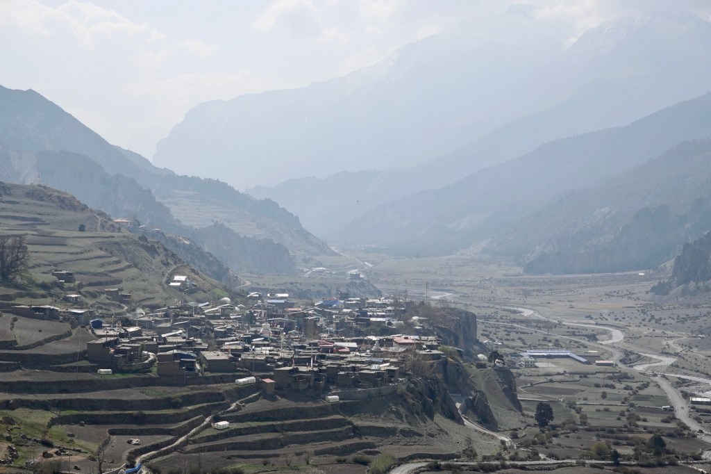
Manang 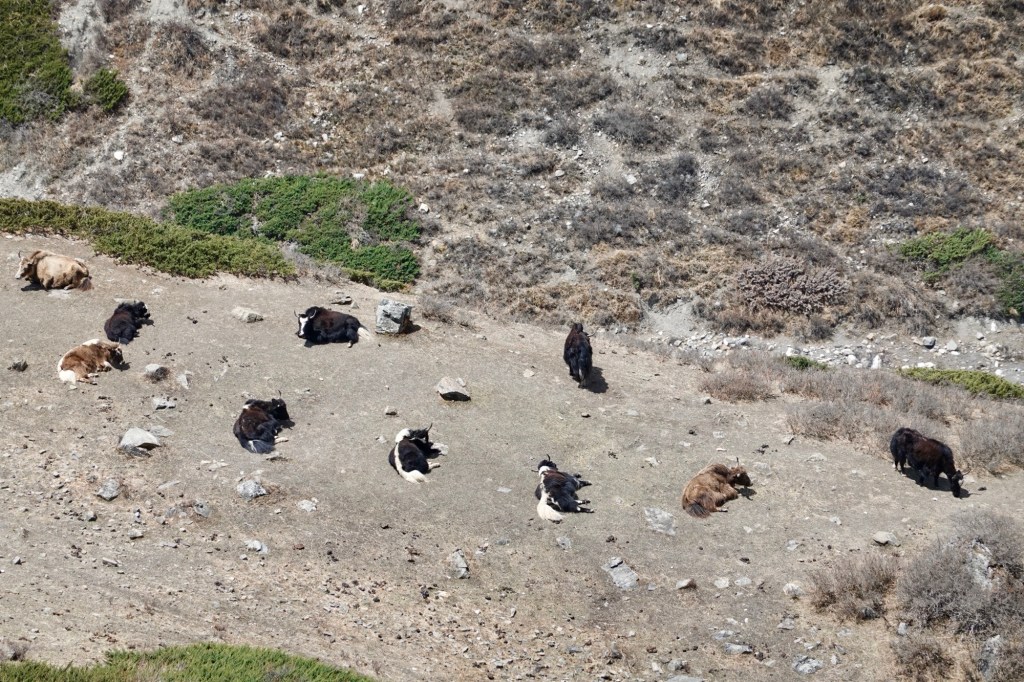
Yaks We arrive in Phedi by early afternoon. Our legs and our head feel good, so we decide to go up to the high-camp.
„Road“ to Phedi From here onwards we will have to push the bikes which is surprisingly easy given the terrain and the altitude. One the way up something is moving between rocks and snow – maybe a snow leopard? Turns out the wildlife starts above 4500 meters and we spotted some Thibetian cocks, hopping up and down on the slope while wild goats are grazing on the other side of the trail.

Wildlife 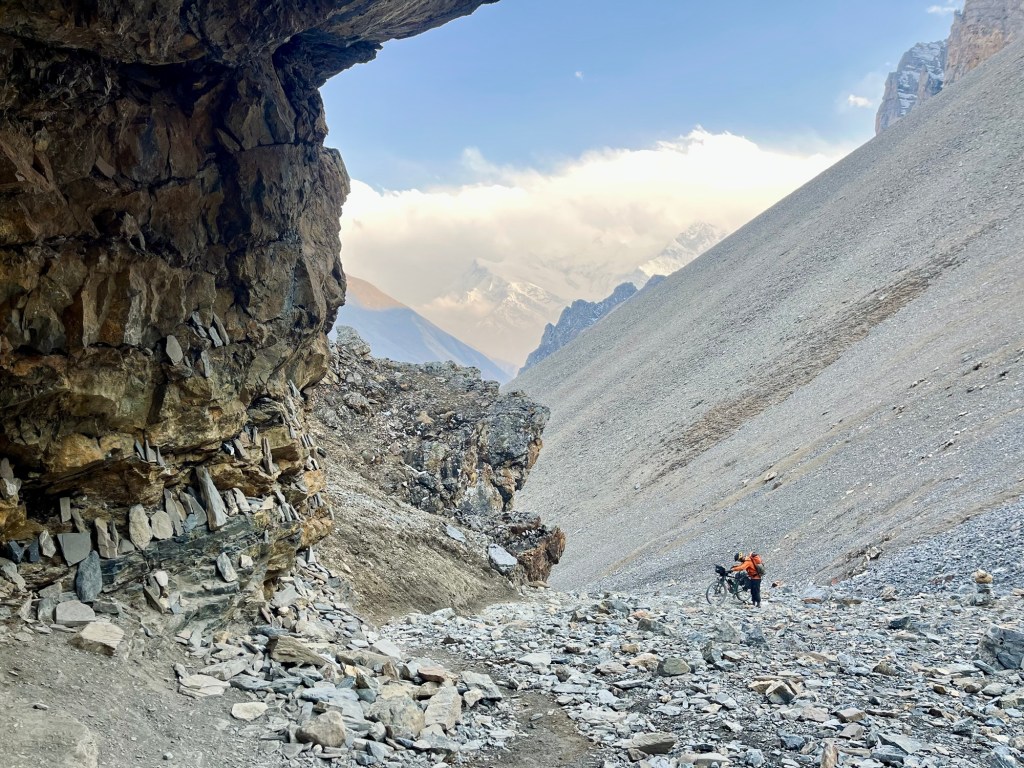
Push 
Push 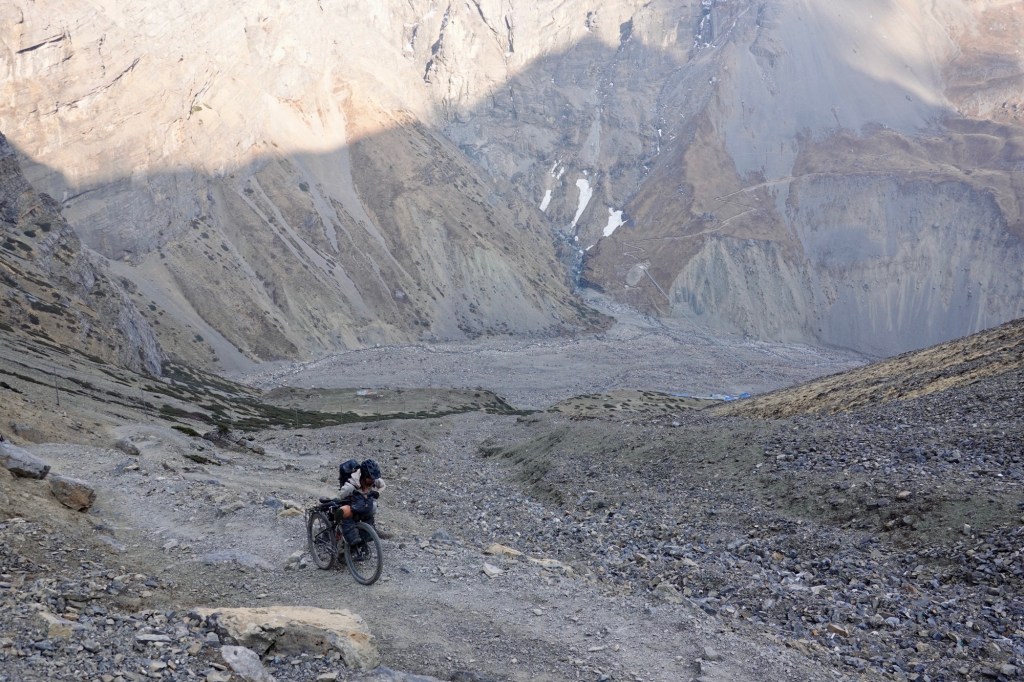
Push 400 altitude meters of bike pushing later we arrive at High-Camp. Huts and restaurants lie next to a massive garbage pit.
High Camp We set up our camp a little bit aside and celebrate our first Bike Camp above 5000 meters! The evening light sharply cuts the sky in thirds. Clouds move rapidly and blend with the glaciers.
Mystical 
Celebration dance 
Cozy Tent 
Blurry stars 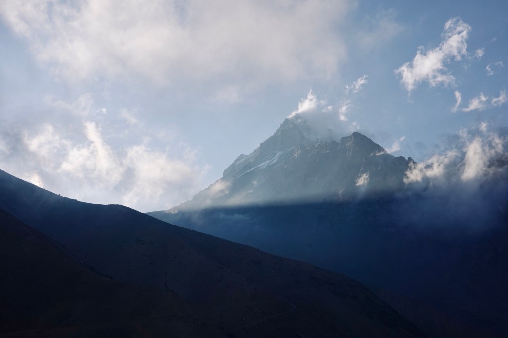
View 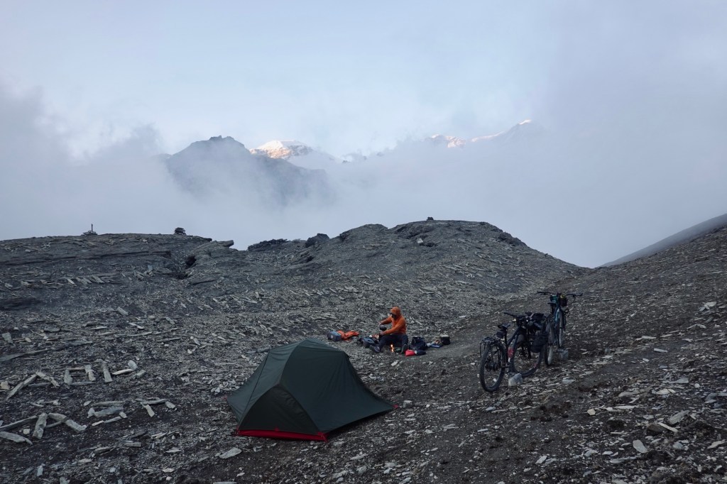
High Camp 5000 m The night is surprisingly quiet, warm and comfortable and next morning we skip the alpin start, wait until the sun hits the tent and have a long breakfast. We let the people pass and start our „pass push“ later in the morning. Today we feel the altitude, our bodies feel weaker.
The air – thin and brittle, each breath a fragile, tentative sail, against the high-mountain gale.
20 Steps walking and pushing the bike – 5 breaths for the last 400 Altitude meters to the Pass.

Views make up for the effort 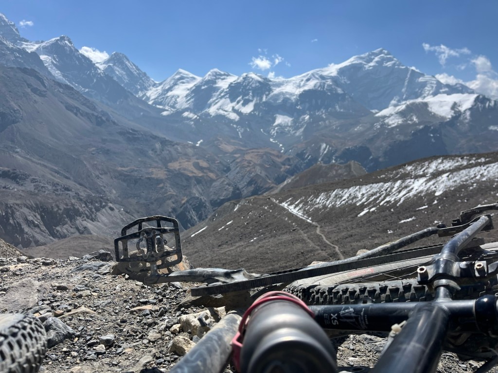
Tatzen with a view 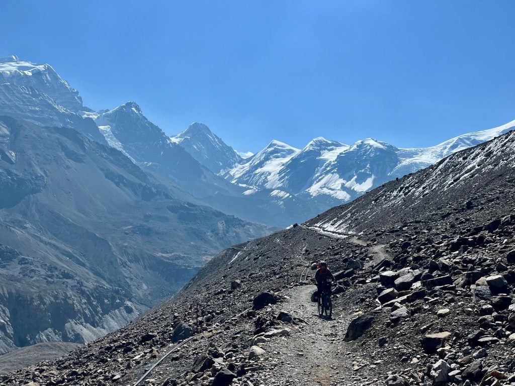
Rolfi pretending to cycle… 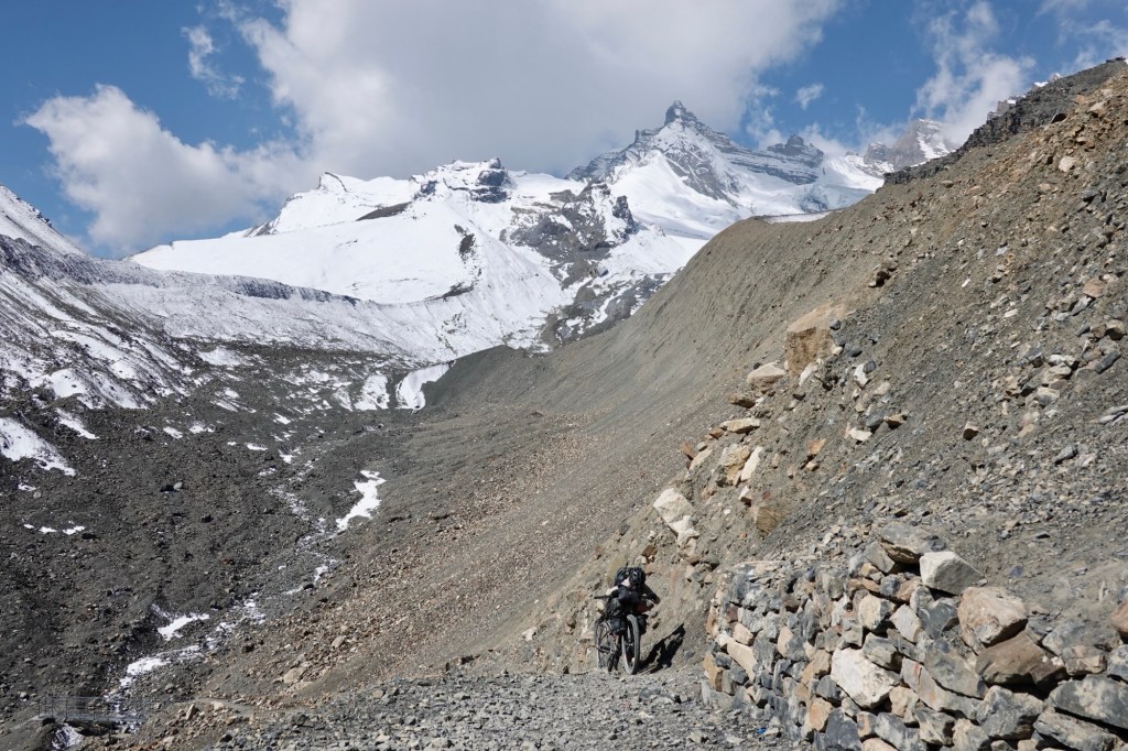
….and thats the reality And all of a sudden the pass is here: 5416 meters. Surrounded by glaciers and 6000 meter peaks overlooking the edge of the Tibetan plateau. Highest point with bikes for both of us! We are exhausted and happy!
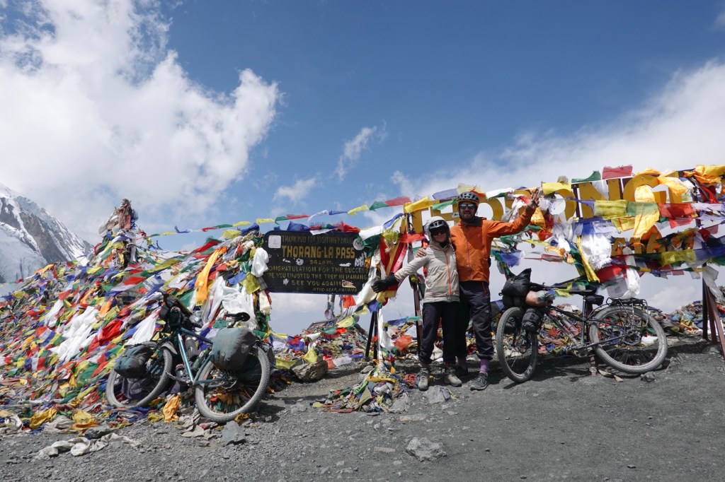
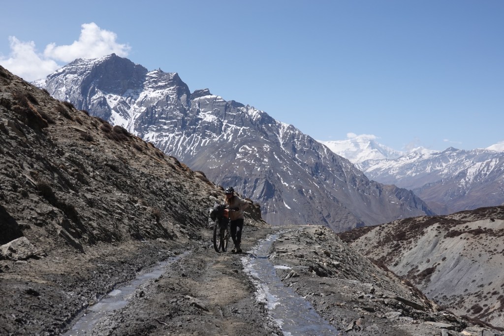
Happy hikers, äh bikers Weather is about to change and we put our winter gear on. Downhill from here. The scenery changes dramatically as we are entering Lower Mustang. Now we are riding through thea moon-like, dry and rough landscapes. The first kilometers: easy and steady.
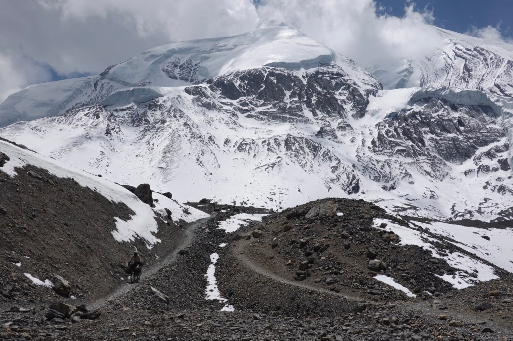
Easy Trails 
Snowy section 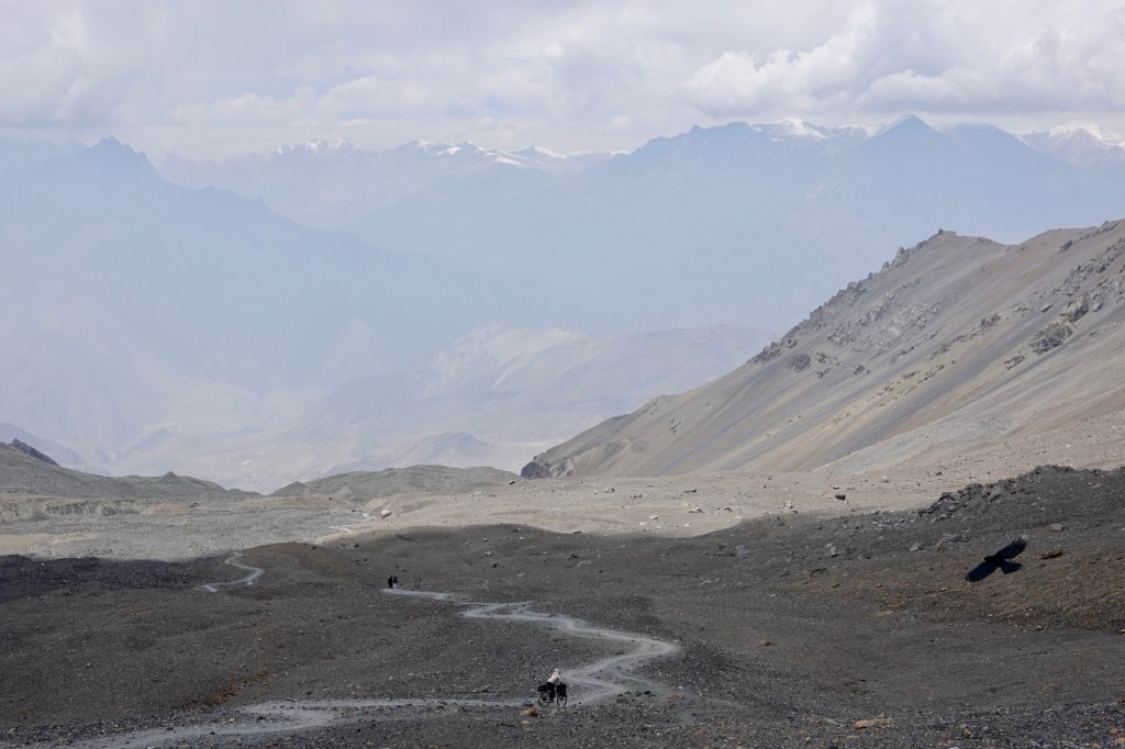
Flowy curves Afterwards: narrow curves and loose rocks. Rolfi manoeuvres his heavy donkey (the bike) through the curves, elegantly like an elephant on an iceskating ring. I am pushing the bike down over the trickier bits. The mind is blocked by fear and tiredness. Me (slightly disencouraged), Rolfi (impatient), and so we reach the first hut from here it is not far to the next town. Snow is starting to fall. The path improves and little later we arrive in Muktinah just behind the Buddha statue overlooking the valley.
Oh – we did not expect the buzz! The stairs leading up to the temples are packed with people. Young nepali men carry pilgrims up the stairs and through the narrow dirt paths leading through the houses. Some of the pilgrims have scaringly blue faces – deprived of oxygen. We are still on almost 4000 – probably people come from the lowlands up here in one day. Muktinah is an important pilgram place for Hindus and Buddhists. In Buddhism it is know as “Hundred Waters,” and it is considered a sacred place. It is also one of the 24 Tantric places. Furthermore here is one of the 108 sacred temples for Vaishnavism,(in which Vishnu is the supreme being) making it an important place for Hindus.
We manoeuvre through the alleys and the crowd and arrive in our guesthouse. Its been 10 days since we left Kathmandu and we need a day off! More importantly we need time to plan our next adventure – because back in Kathmandu someone put a bug in our ears about a route heading further west.
Temples 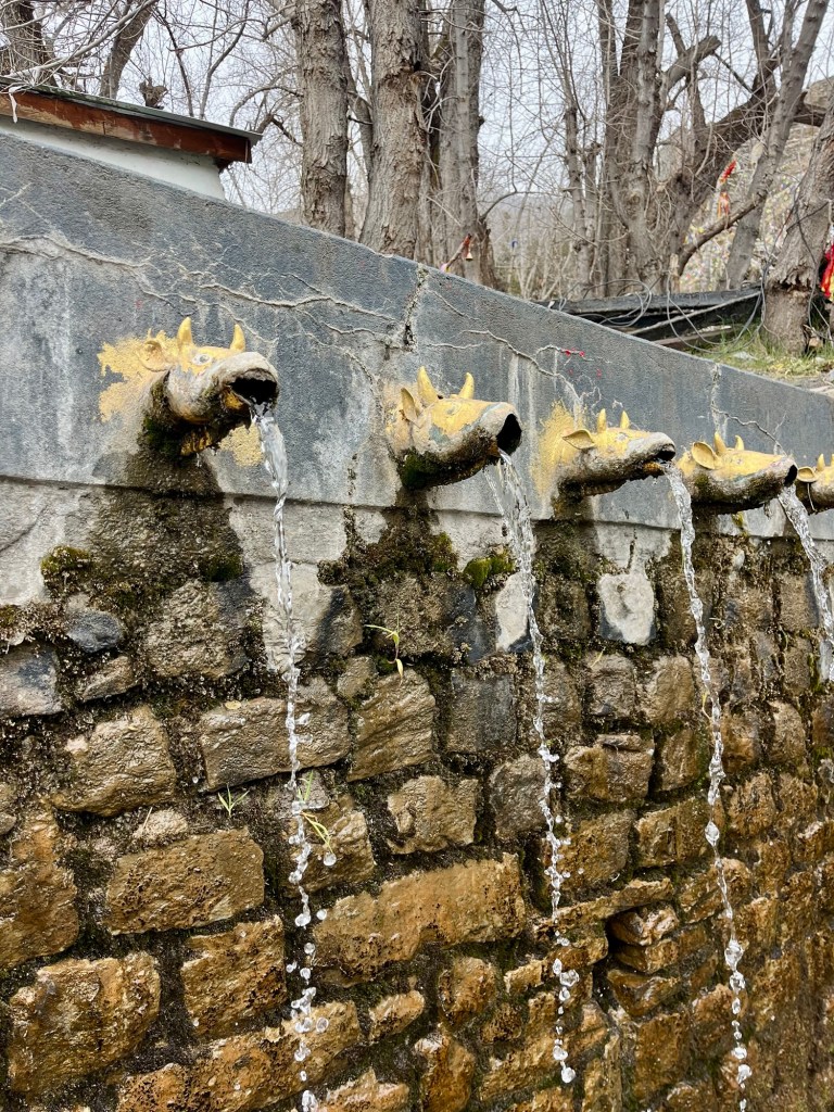
108 waterfountains 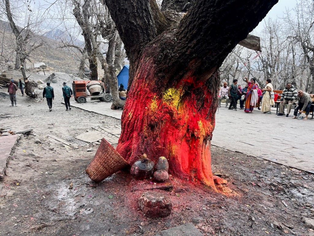
Holy trees 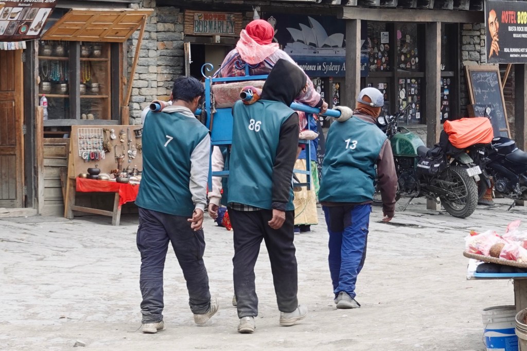
Pilgrims 
Holy waters 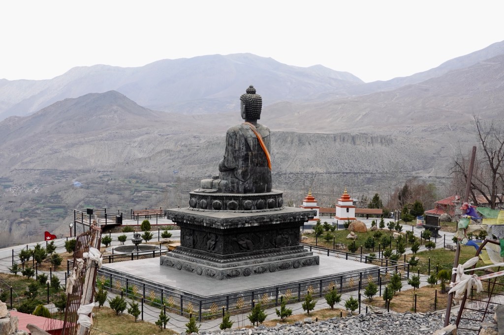
Buddha Statue overlooking lower Mustang Two days later we are on the way to what will become one of our most adventurous routes so far.
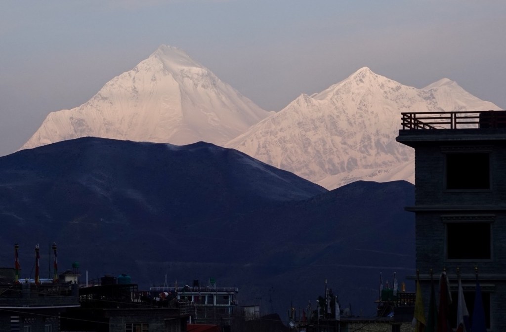
Dhaulagiri at sunrise, view from our hostel
Our Path
Nepal stats so far: 820 km | 20000 altitude meter
- Forest & Tea garden turns – Northeast India Part 2
We continue our journey in the Northeast of India, exploring Nagaland, Meghalaya, Assam, West Bengal, and Sikkim.
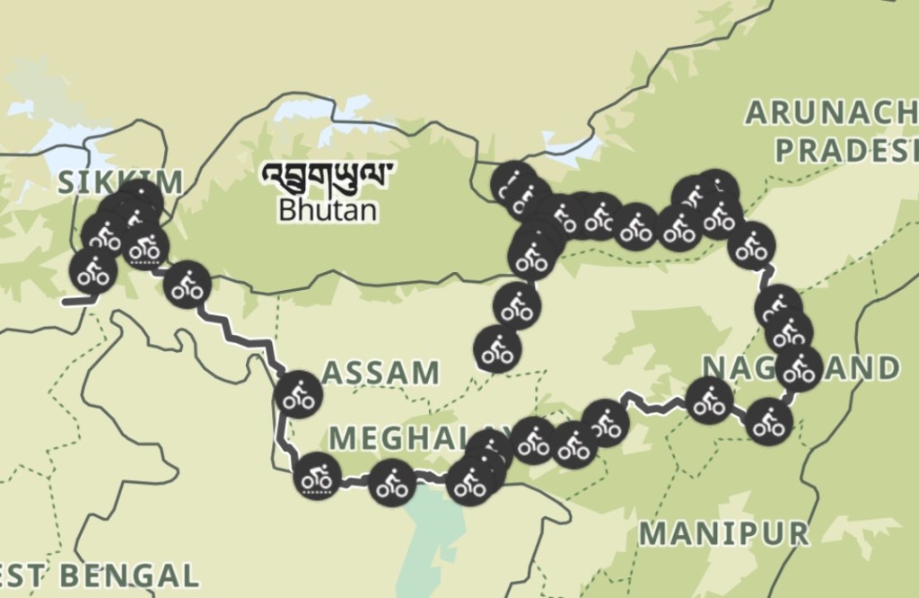
Route in India (so far) Majuli Island – River Island Paradise
Majuli Island is a fragile “little” land in the middle of the mighty Brahmaputra River. It is one of the biggest river islands on this globe. On the way to the island, we pass tea gardens. We have to cross the Brahmaputra by boat to get to the island.
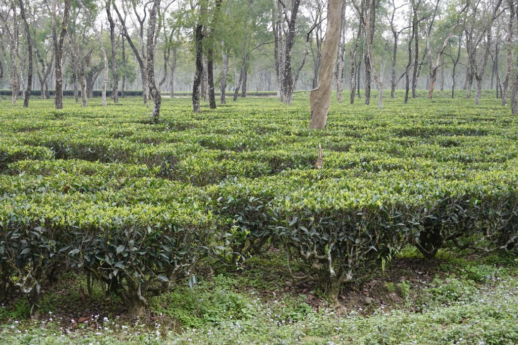
Tea Gardens 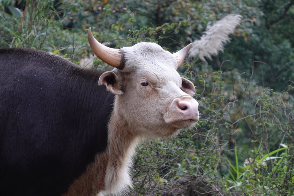
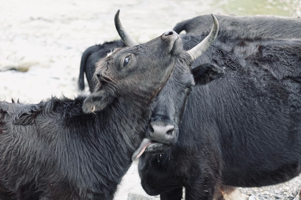
Mituns 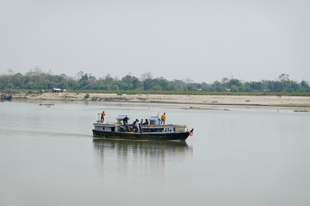
Ferry 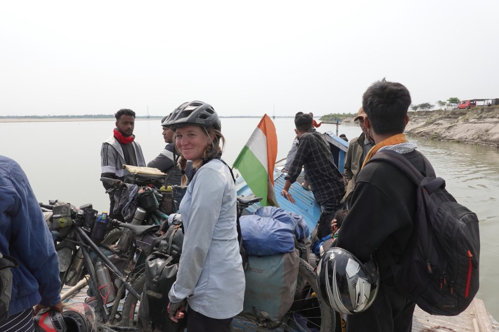
Ferry Ride 
Bridges 
Bridges The island is a green heart – shimmering like a pearl in the middle of the river. Each monsoon carves deeper scars in its shore, making it a fragile habitat for its inhabitants. Our home for a few days: a cute bamboo hut where fireflies dance on the doorstep. And an even cuter puppy keeps us company.
Our hut 
Blooming 
Hanging out 
Puppy s favourite sleeping place Majuli Island is also the place where one man shows how much difference a single person can make. The “forest man” planted trees over an area of 550 hectares, fighting against erosion and hence the disappearance of the land.
Exploring the Naga Hills
One detour to the wrong ferry port and then we are on our way to Nagaland. Nagaland borders with Myamar. It is home to 16 “major” tribes with numerous subtribes.
A little bit of asphalt and then the fun starts. As we make our way up one of the worst roads we’ve had so far on our trip, thunderstorms grumble above us. The road feels like trying to roller-skate on pearls scattered on the ground, with the occasional huge pothole and the cherry on top: a soap-like mud.
Rainy 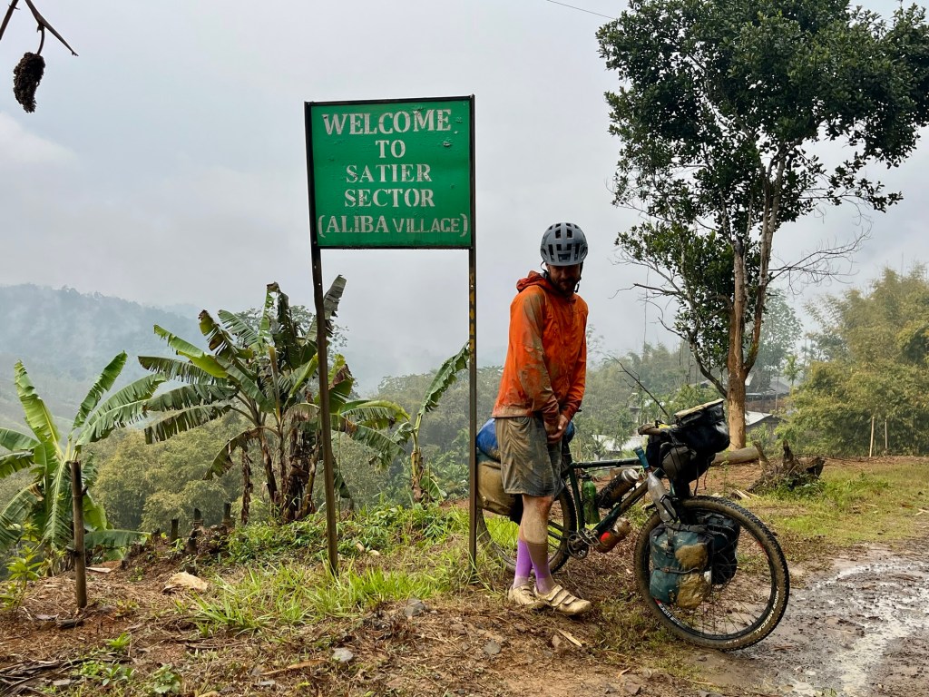
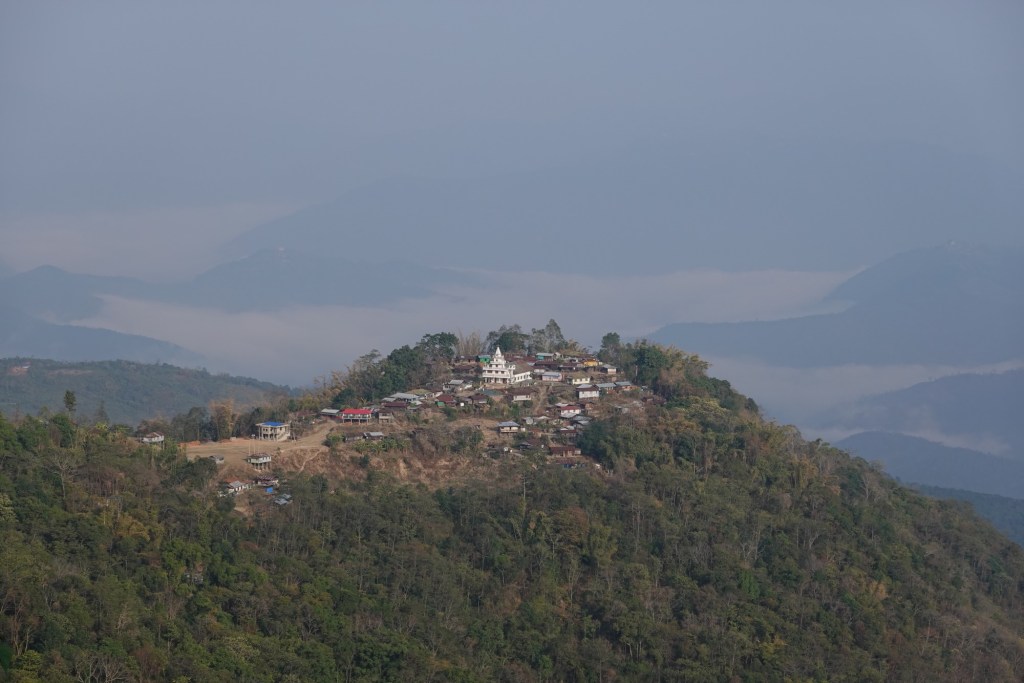
Muddy Villages lie on the top of hills, like castle and the churches can usually be seen from far away.
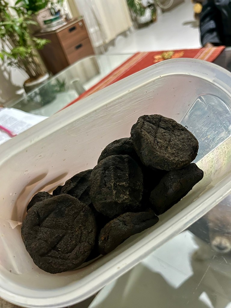
In Mokokchung we find a lovely homestay and learn a lot about the Ao heritage (a regional tribe) and get to taste the unique flavour of Akhuni – fermented soybeans which are used for flavouring. Looks strange but tastes amazing and so we add a few of the black pieces to our herbs bag. The local Nagaland coffee is also a treat we get to try.

Weather slightly improves. Finally we get a view over the ocean of green of the Naga Hills.
Naga Hills 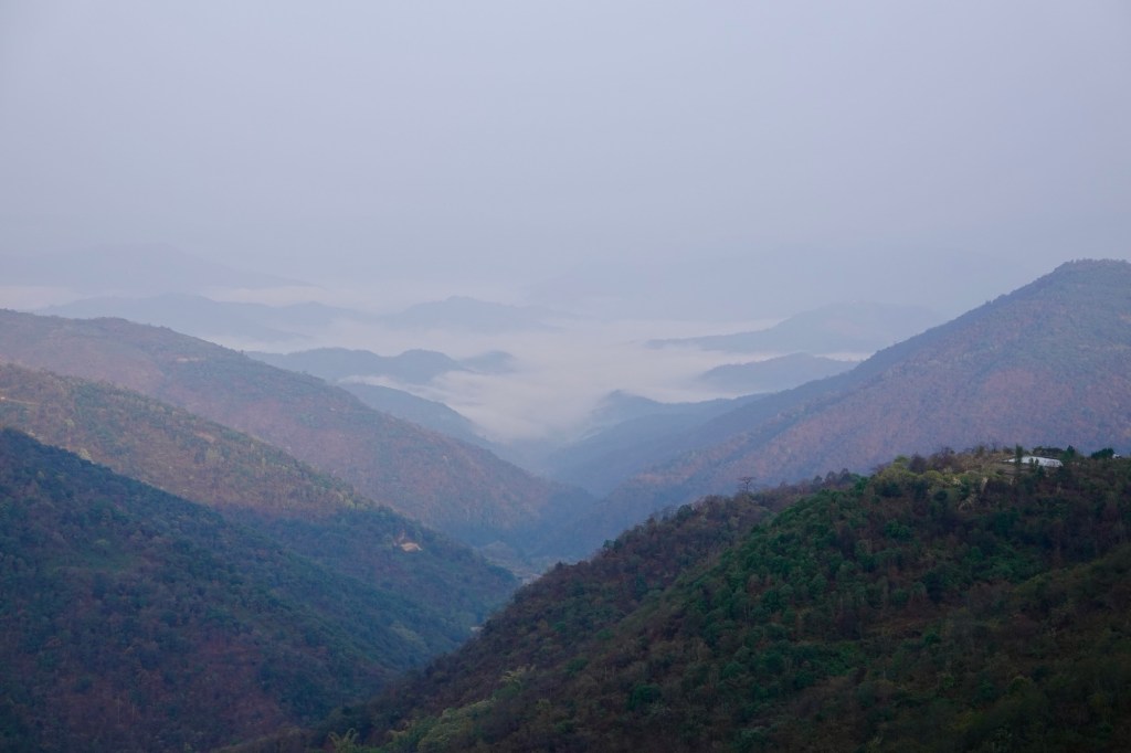
Naga Hills We had our first dry tent night in a long time. Waking up without the cheek sticking to the condense water on the sleeping bag – what a luxury!!
One of the few campspots Zohnebote has one of the biggest churches we have ever seen. Soft green terraces are painted on the hills, rising from the rivers on the steep hills like stairs.
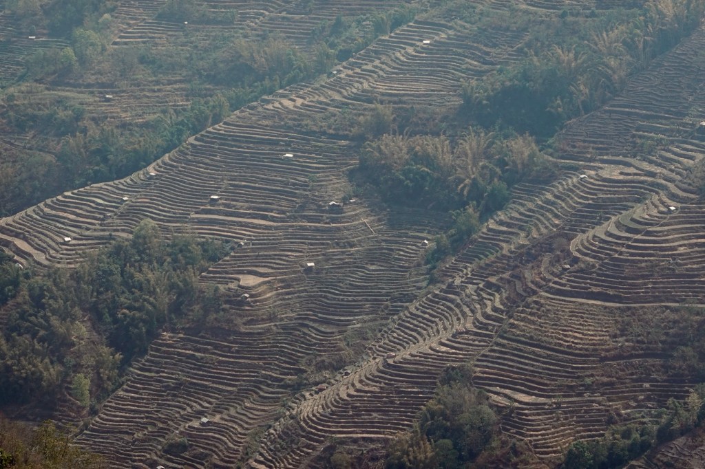
Terrace 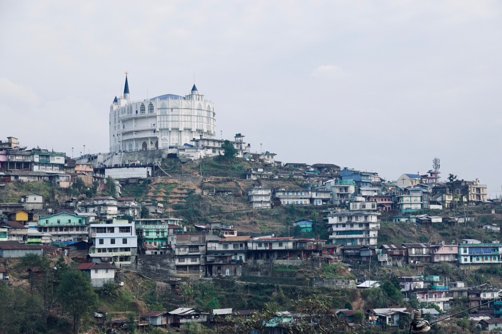
Zohnebote After a gentle descent, the heat hits us like a desert storm taking our breaths away. Like we entered a different climate zone. Then we make our way to Kohima, the capital, which is our last stop in lovely Nagaland. Kohima is spread over the green hills in the landscape – looking like 5 different cities. It was the place of a cruel some battleground in 1944. Now it appears like a vibrant city where people dress unbelievable fashionably from beautiful colourful traditional clothing to sharp styles. We feel very out of place in the coffee shop with our dusty attire. The Nagaland area would be an interesting places to spend some time and get to know the heritage.
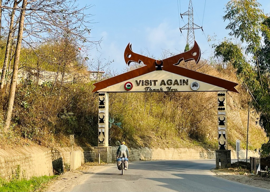
Bye Nagaland First Stopover in Assam
After a nerve-racking downhill from Kohima where one construction sight follows the next one, we arrive back in Assam. We enter again a flatter area and cycle fields and little villages.
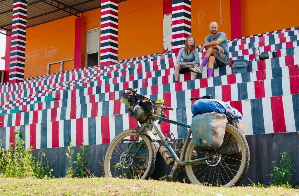
Breakfast in a colourful stadium 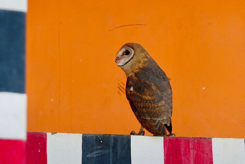
Breakfast company The national highways do not make up for their names. The good thing: no traffic, the bad thing: the “road” conditions. We continue bouncing over potholes and stones.
Massage 
The Highway We ride towards Diphu when some locals stop to tell us to continue fast because there is a “riot between two different local groups” in the town. When we leave the town – in a hurry – we learn that it was actually a fight at a fish market and not a “tribal conflict”. Our path leads through the Marat Longri wildlife sanctuary where at dawn we get to spot some elephants in the tense forest. Animal corridors follow us along the route. Underpasses with lush forests, offer safe passing for animals, cars are advised to drive slowly and with dimmed lights. The corridors stretch over kilometres and give the sense that conservation is of high importance.
The road improves as we advance westwards. As if the heat would not be enough, little controlled forest fires to fertilise the ground give us an extra sauna feeling.
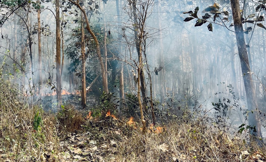
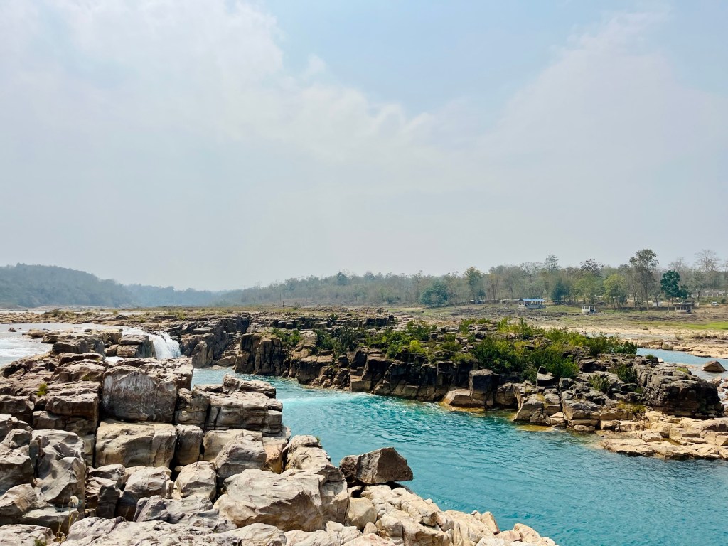
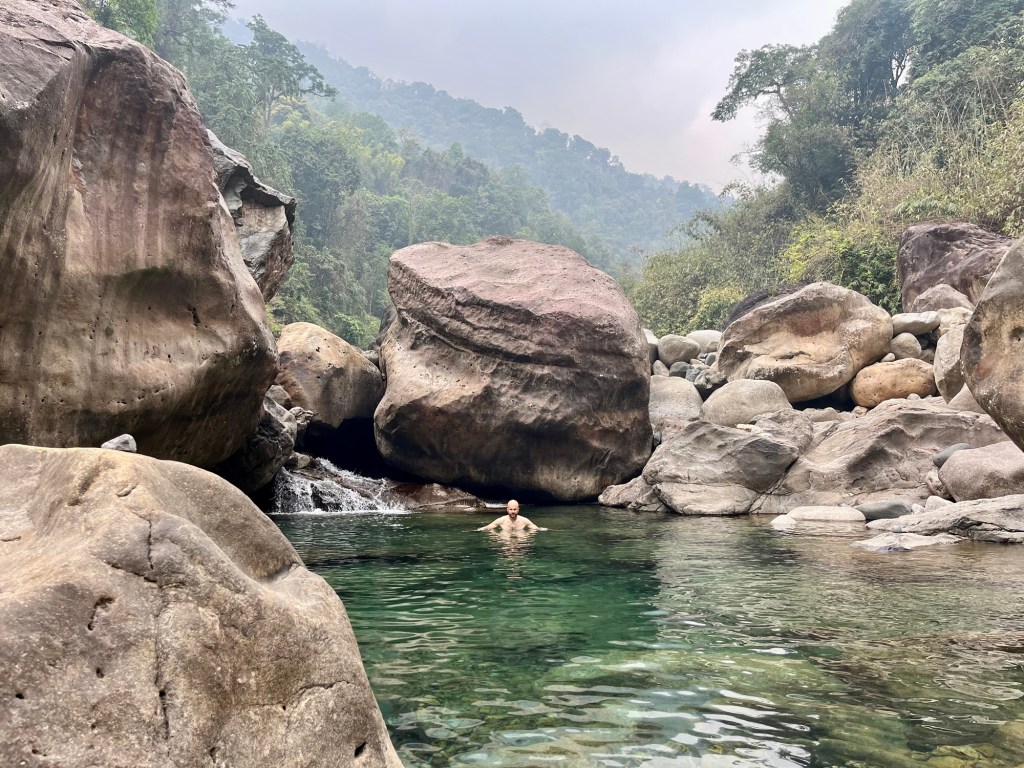
Fires everywhere So we’re happy to find the Panimir waterfalls with a surprisingly caribbean blue water. Swimming: not allowed but a nice place to have a short break. After seeing all the other rivers where layers of dirt and garbage float, this one is a beautiful contrast.
Waterfalls 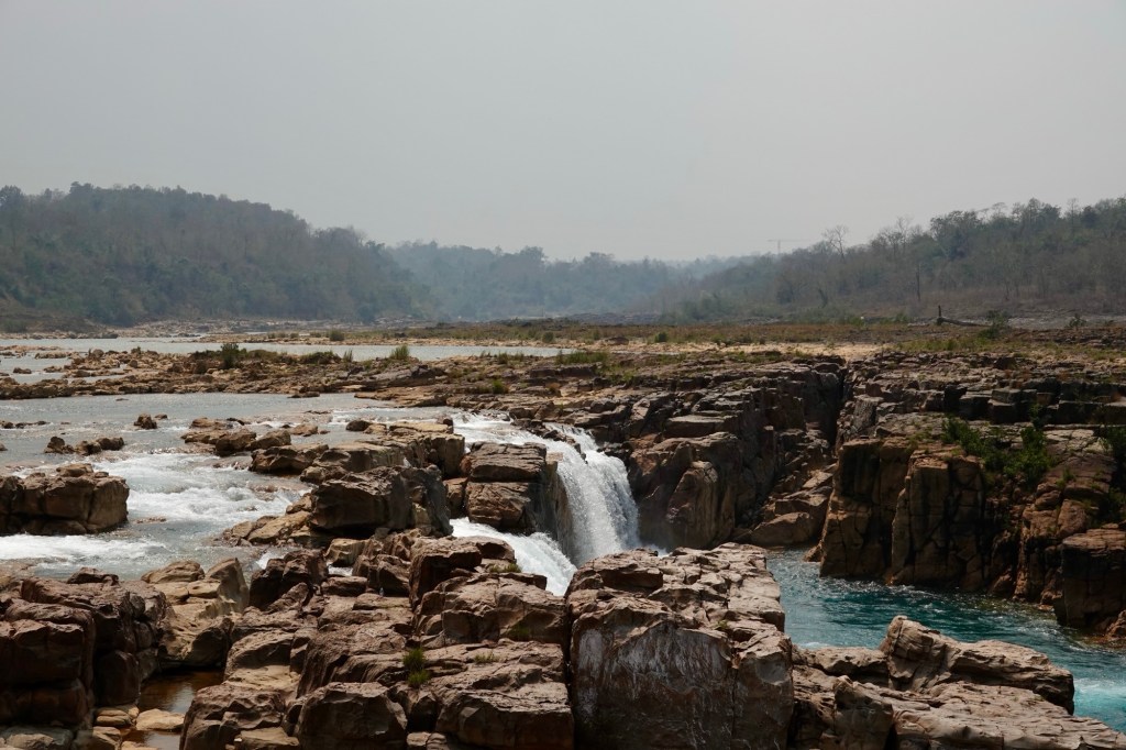
Waterfalls 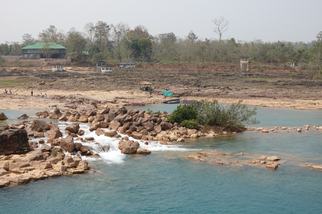
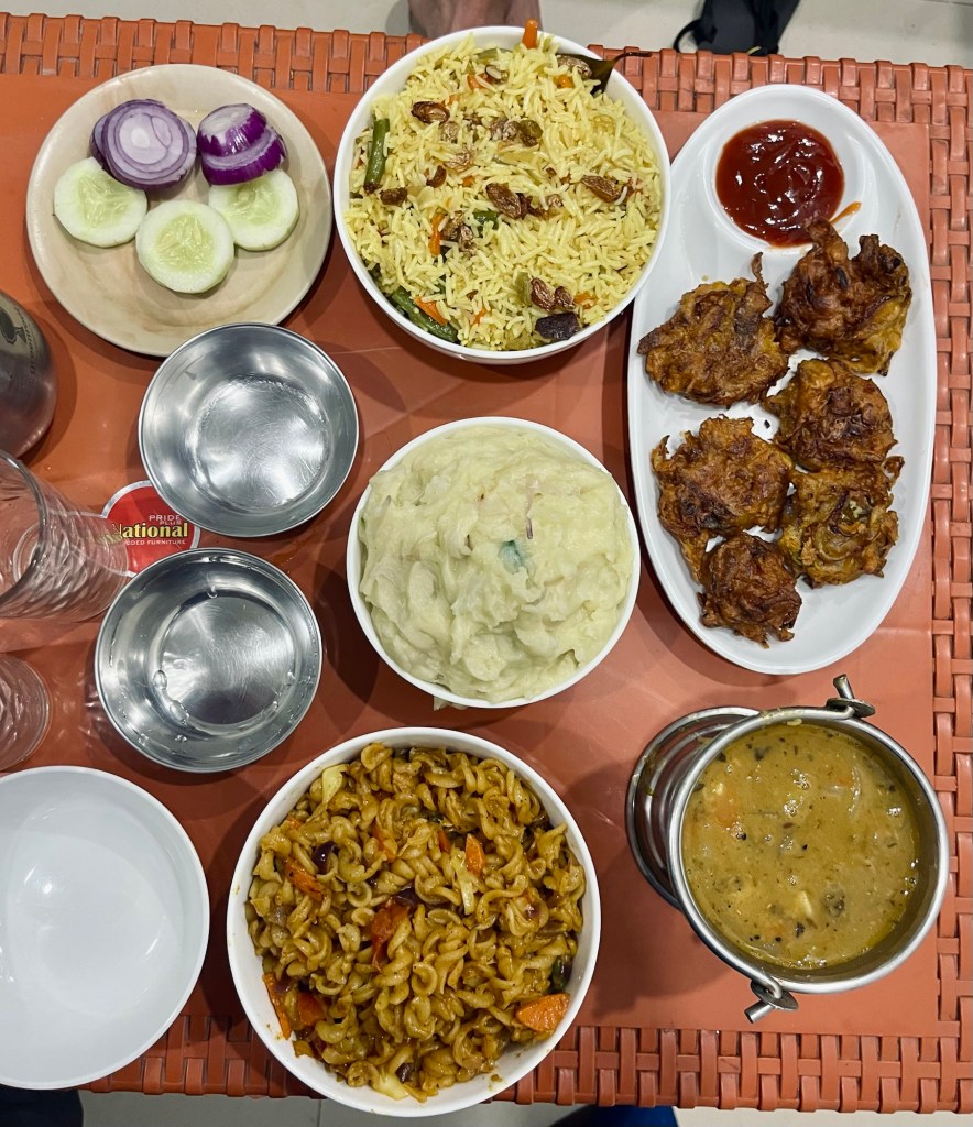
Crystal clear Our lunch breaks are usually spend in small roadside restaurants. Our favourites: Momos, Veg Chow Mein and the local Thalis. The latter one is a blend of Daal (lentils), rice, pickles and some greens. It’s always a surprise and a perfect nutritious meals.
Open Kitchen 
Many spices Once we arrive at the Kupli Dam our little stopover in Assam is over and we enter Megalaya.
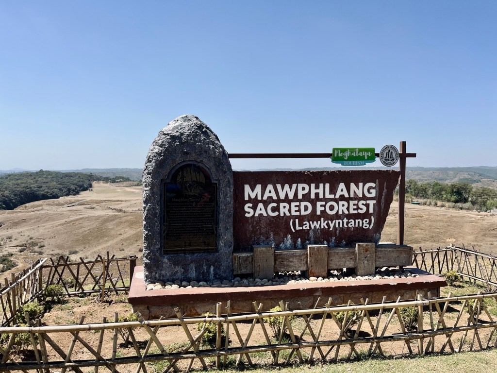
Megalaya – sacred forests and nature’s architectural wonderland
The Kupli Dam is shared by Assam and Megalaya. As soon as we entered Megalaya, the road conditions improved massively.
Dam 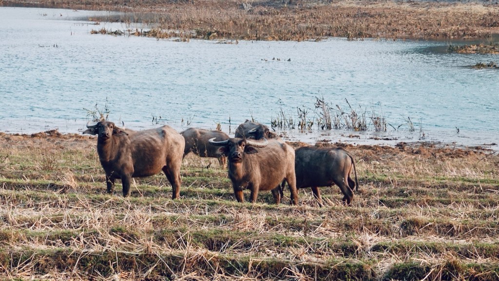
Waterbufallos 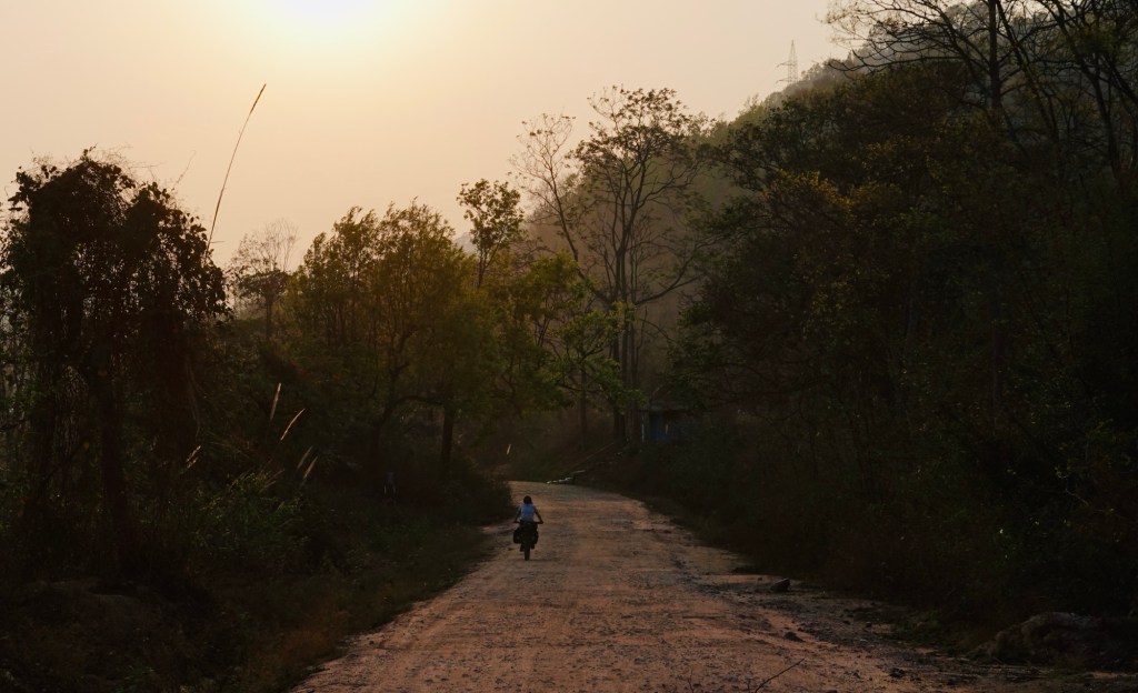
Golden hours Next to the dam we find our first official campground – a holiday park with a designated campsite.
Kupli Dam 
Dry Riverbeds 
Breakfast A few kilometres on a very busy highway later we arrive at a lovely tea garden and guesthouse.
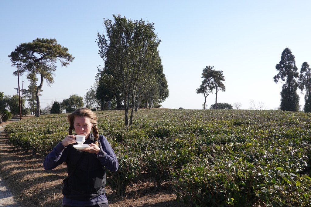
Tea Time 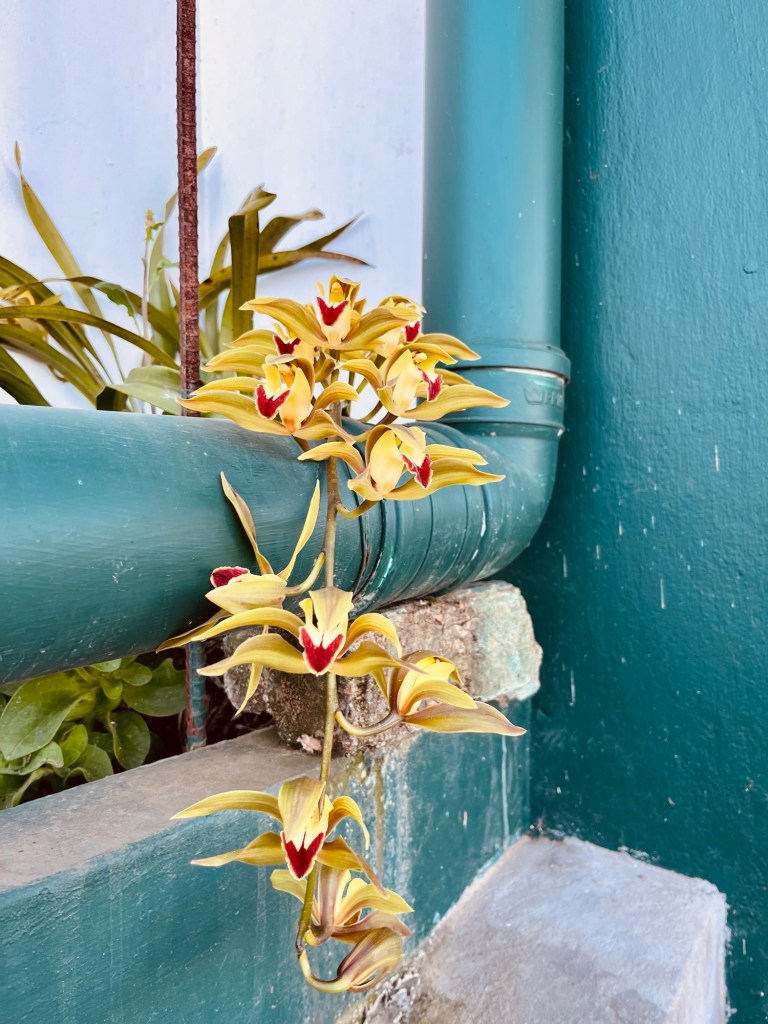
Orchids 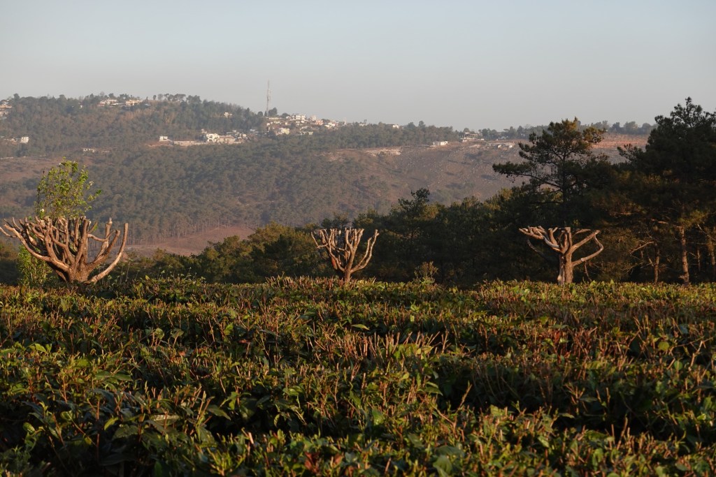
Teagarden Afterwards we are heading to our next highlight – well a highlight for me.
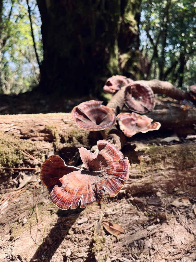
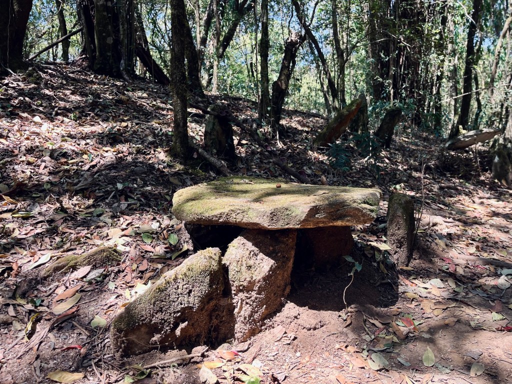
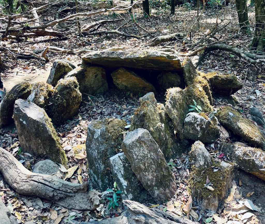
I insisted on a little detour to visit the only sacred forests outsiders are allowed to visit.
In the Khasi culture of Megalaya untouched forest are part of their heritage. Nothing should be left or taken out of the forest. The forests themselves are used for rituals where the villages elders perform sacrifices. During thirty minute a young music enthusiast guides us through the forest. A path out of stones leads to the sacrifice places. Other than that the forest is not managed and not maintained. It is a touristic places, yet it was a nice to get some insights.
Our tour guide also advises us on an alternative route to our next destination. A short cut that would make up for the detour we took.
A shortcut via the David Scott Trail
So we find ourselves on the David Scott Trail, who was the first British Administrator in Assam. The horse cart trail was laid down across the Khasi hills and jungles from Assam to Bangladesh for trading. The route was developed with the promise to keep peace between the hill tribes, yet this promise was supposedly broken in the light of trading. We will only cover 16km.
First the trail leads via cobblestones down to the beautiful Umiew river which we cross via a shaky suspension bridge.
Tracks 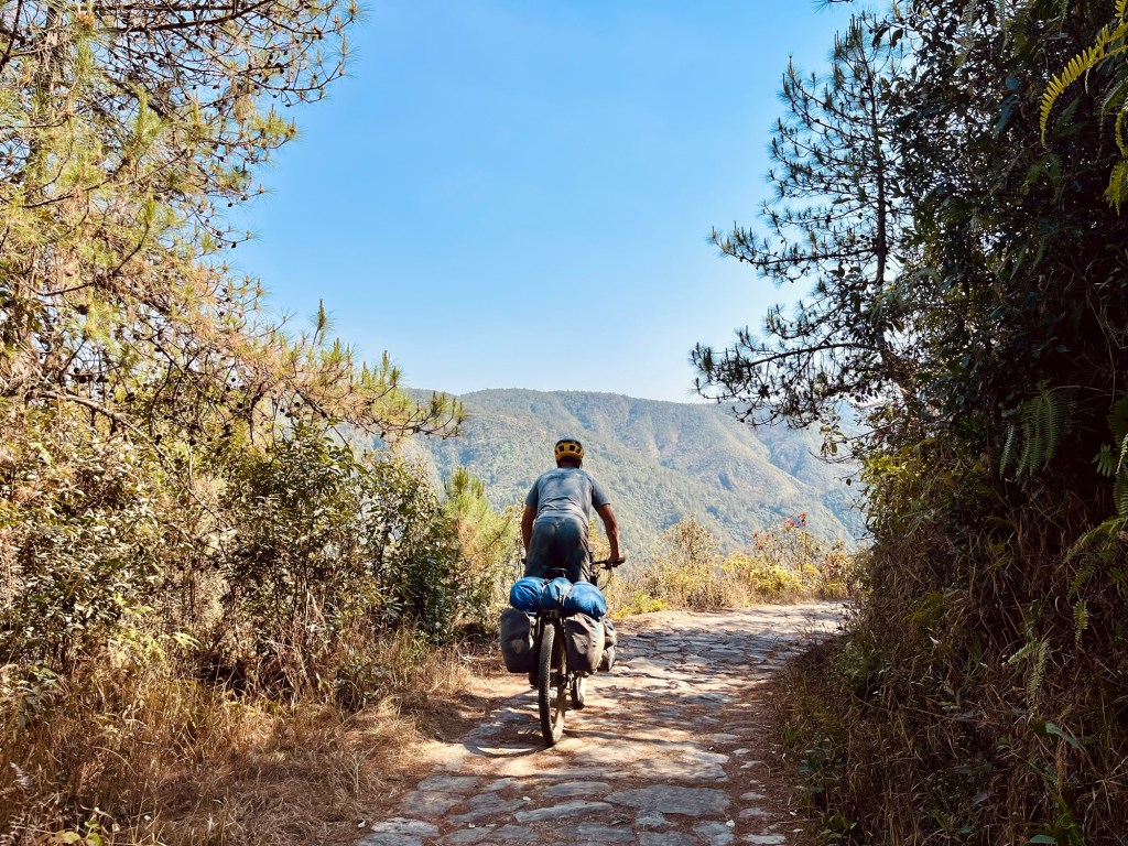
Views 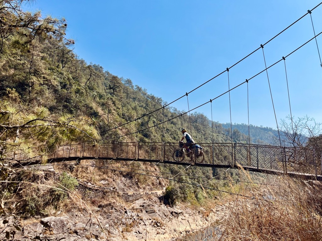
Bridges 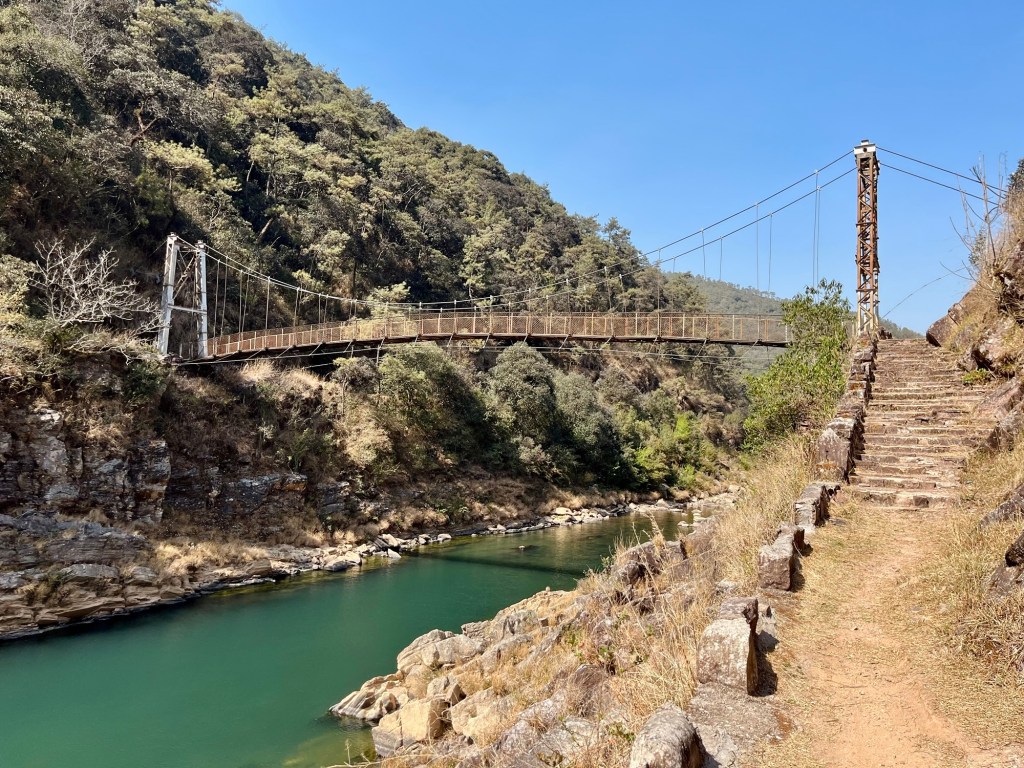
Bridge A crystal clear stream appears. We cross the river and later we find ourselves in a lush “farnland” of the Wahtham Valley. The gigantic leaves brush our faces as we push the bikes uphill.
Views 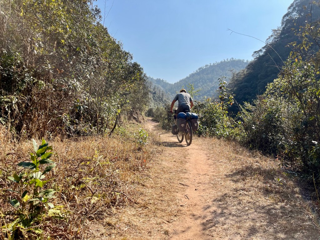
Paths 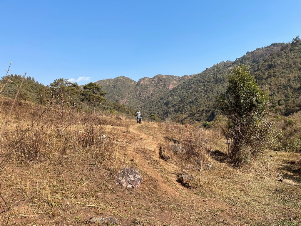
Tracks 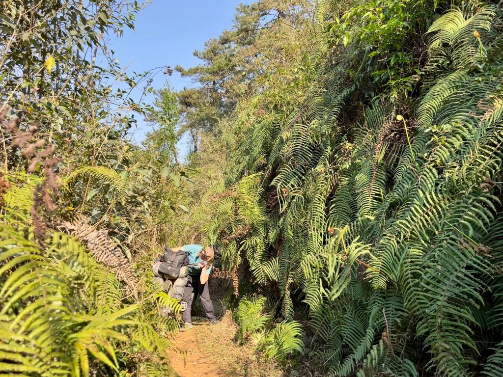
Eat your greens! We pass Laitsohma village – with little houses and wheelbarrows lying around. Afterwards we find ourselves in a beautiful valley with naturally carved stones and a majestic stone bridge. Such a cool shortcut especially after riding for a few days on dusty and damaged tarmac!
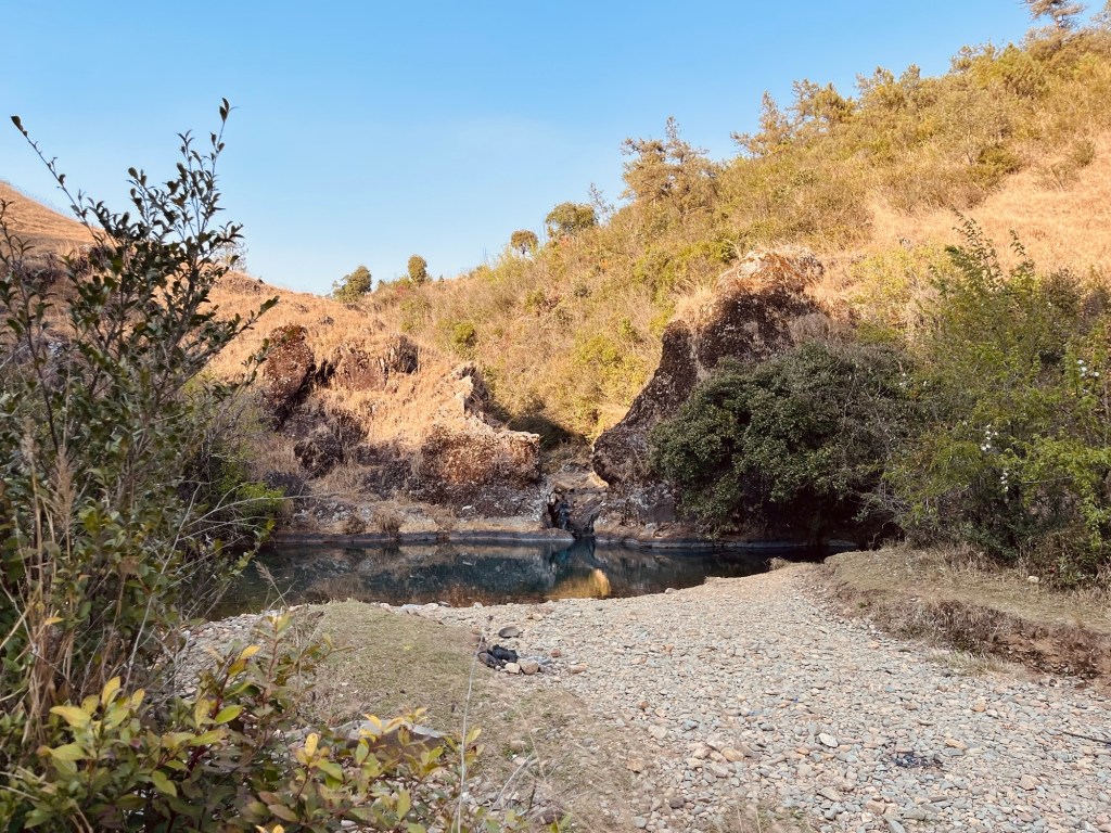
Beautiful pools 
Stone bridges While finding the trail was fairly easy the exit and connection to our next destination was rather difficult. It would have been camping paradise on the trail but we haven’t calculated the food to do so and so we re forced to continue. A newly build road brings confusion on how do to continue to the next village. One local is sending us right the other one left and so we end up riding the wrong way three times. Afterwards we decide that a trail is the safer option than a road which is not on our maps and push the bikes down some stairs and continue next to the river. In the evening we arrive in Tyrna.
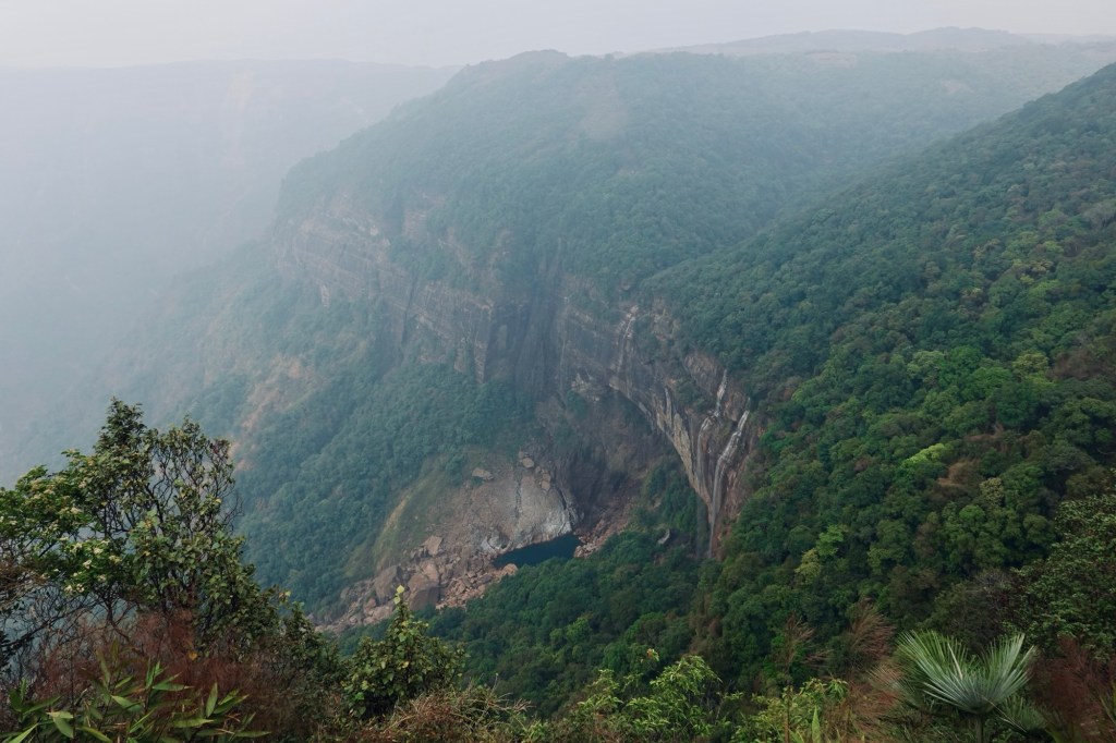
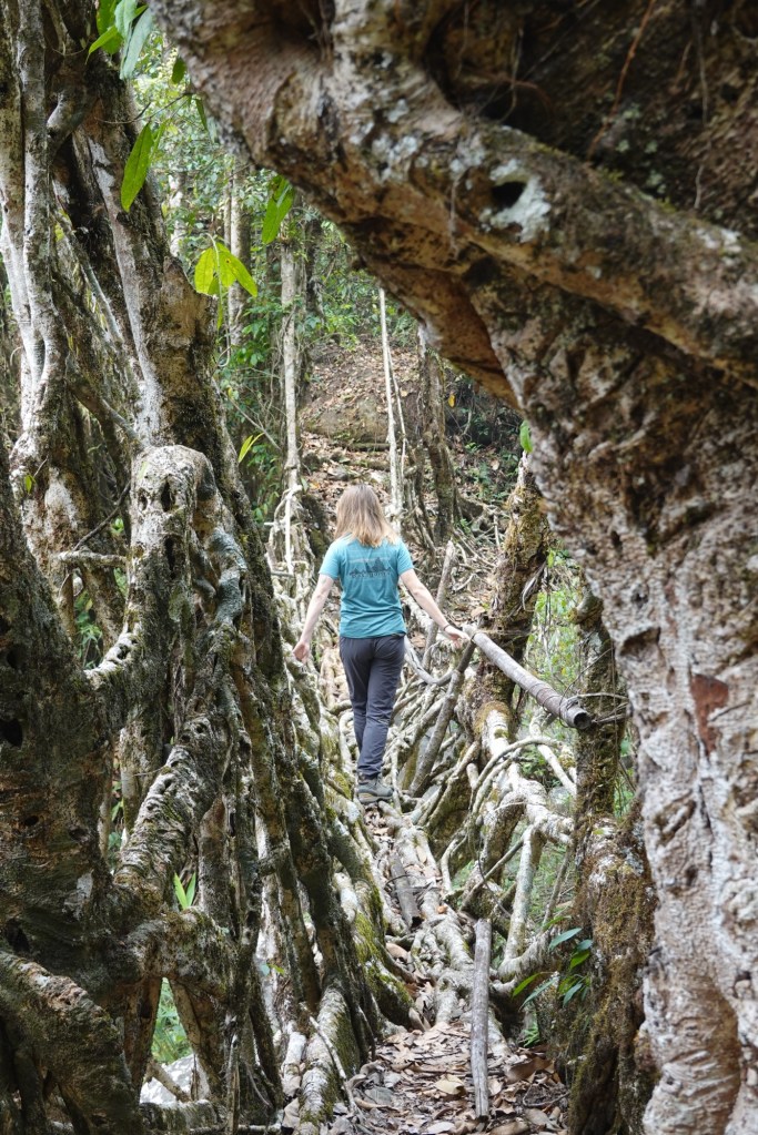
The next day we take a shared cab up to the city of Cherrapunji – and hike to the highest waterfall of India – the NohKaLikai falls. Since it is not the rain season yet the waterfall is rather a stream but the surrounding nature is breathtaking.
Waterfall From the waterfall we descend a 900 meters on an overgrown path with many slippery steps to the river bed. Here we get a glimpse of the first living root bridge. The local Khasi and Jaintias people have “built” these bridges for centuries. Yet building here does not mean to put brick on brick but rather to “train” the areal roots of rubber fig trees to intertwine in an ensemble of magic and chaos.
Bridges that are alive and growing, entwined in purpose – with earth.
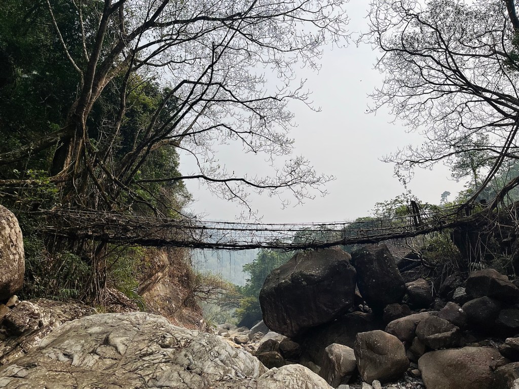
Root bridge 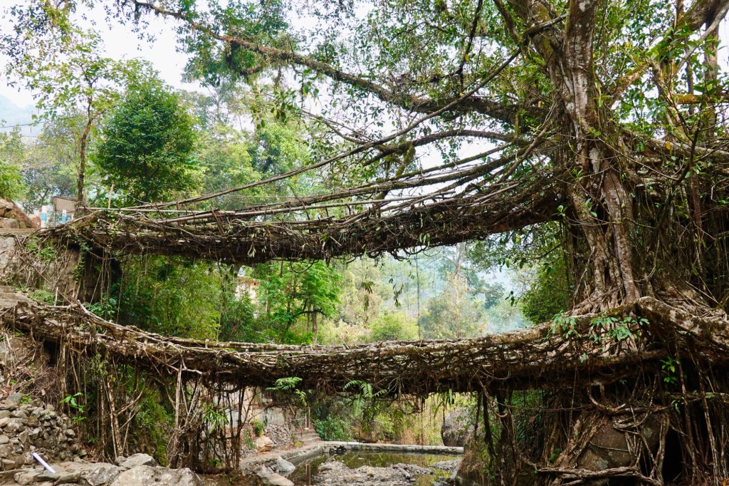
Double rooutbridge The bridges serve as pathways during the monsoon season. The first bridges we encounter are stabilised with wires (many more people are crossing the bridges for tourism reason lately).
Nature Art 
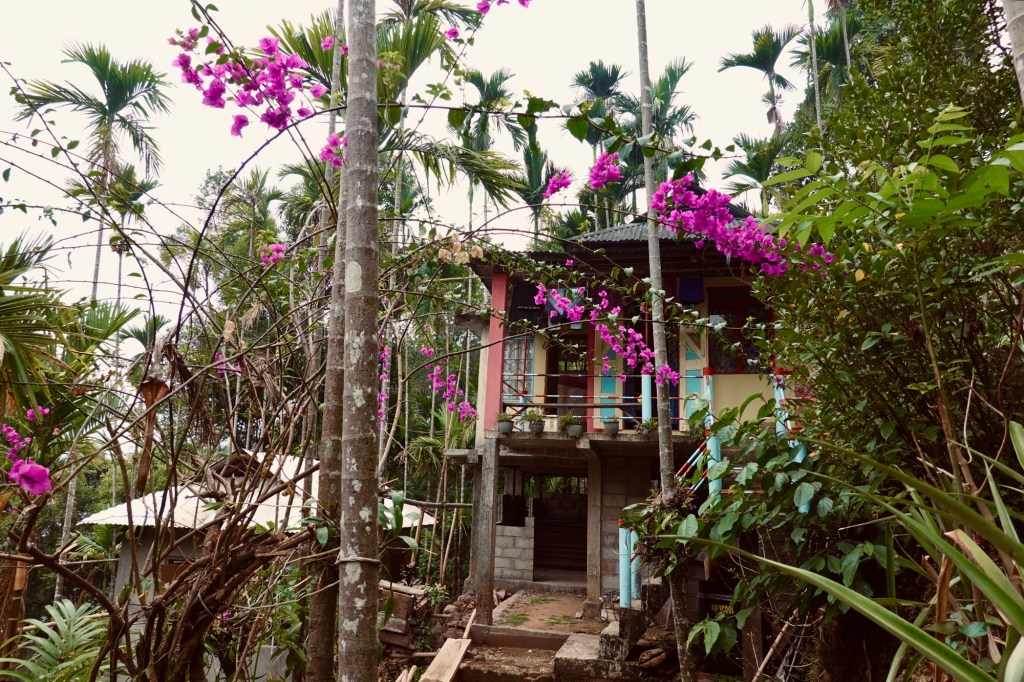
Steps We pass the touristy village of Nongriat and continue to our beautiful homestay in Mynteng. The tiny village is hidden in the depth of the forest. It’s only reached via 90 minutes walk on steep tracks.
Homestay The next morning we head to a lesser visited rootbridge passing by pineapple plants and jackfruits.
The lesser visited route bridges 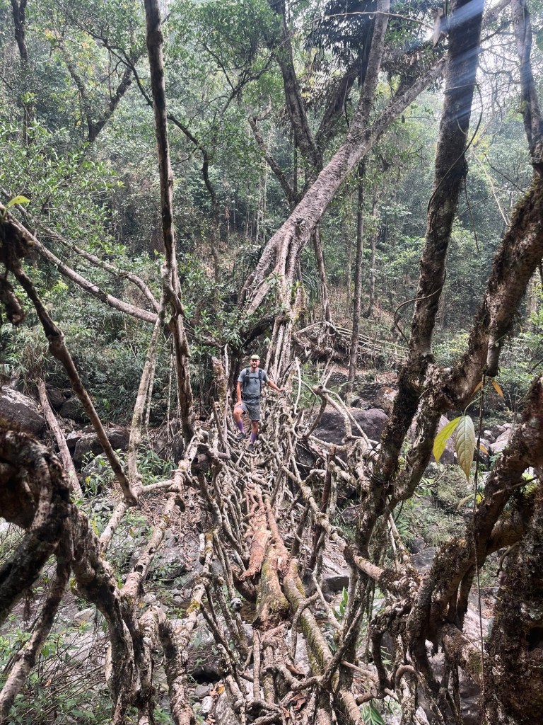
“Spatzen aus der Hölle” – Sparrows from hell dribble in our legs. The downhill hike from the previous day left its marks. Our legs are very sore!
More steps 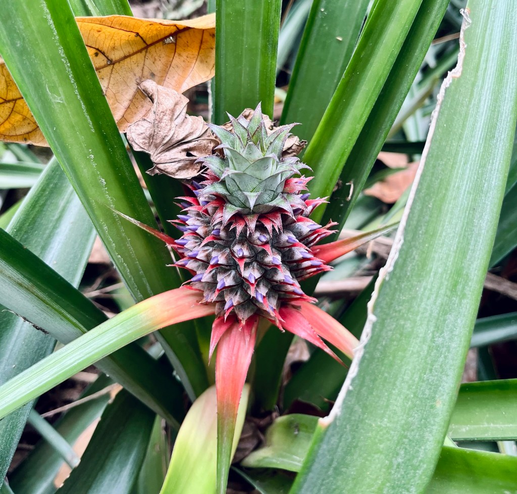
Pineapple 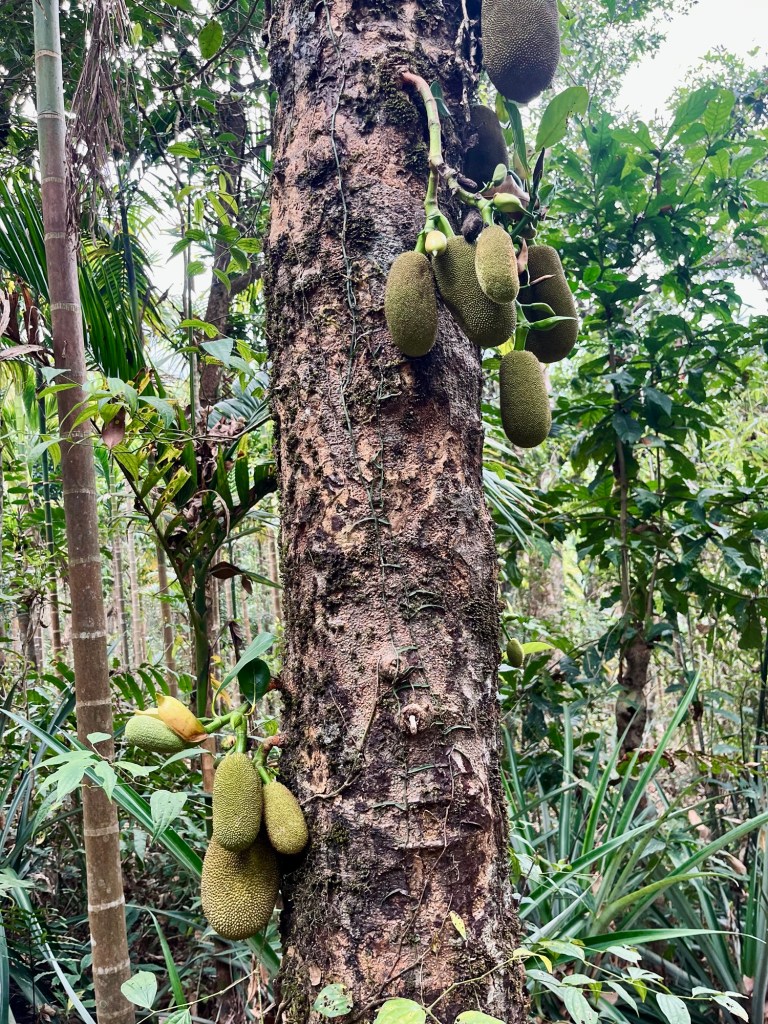
Jackfruits 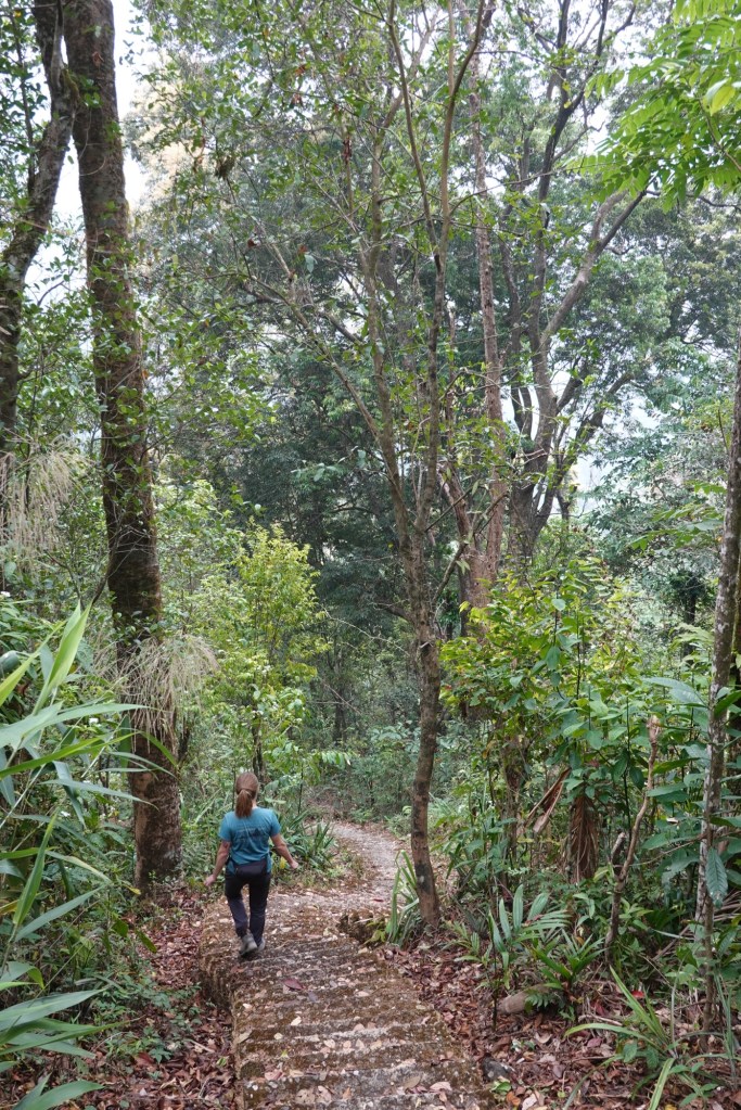
Ouch! After some more steps we arrive at a lovely waterfall. And then head back to Tyrna via a long steel hanging bridge.
Bathing 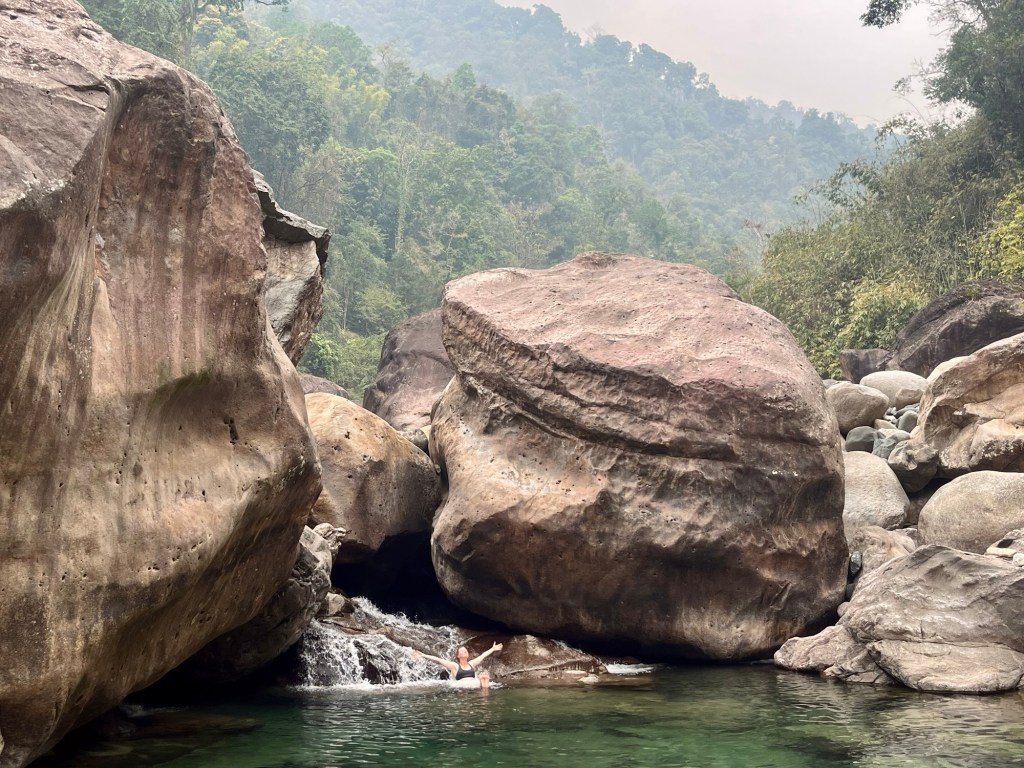
Massages 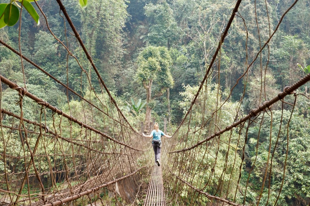
Shaky bridges In Tyrna we meet many other local travellers that make their way to the rootbridges. Up to Tyrna again and the sky is shedding its biggest tears. Streams turn into rivers, water bottles, balls and pineapple surf down with the stream. We’re happy to have found some paths away from the masses. We head towards southern Meghalaya. Papayas for breakfast and fresh pineapple juice for refuelling! As we cycle down the road the smell of Jasmin catches our noses and we pass young boys with slingshots. The places we have visited here, were so unique and breathtaking. While we are usually most stunned by alpine and mountainous areas the forests of Meghalaya bewitched us.
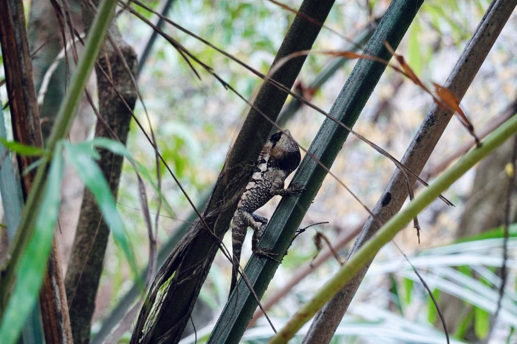
Lizards chilling 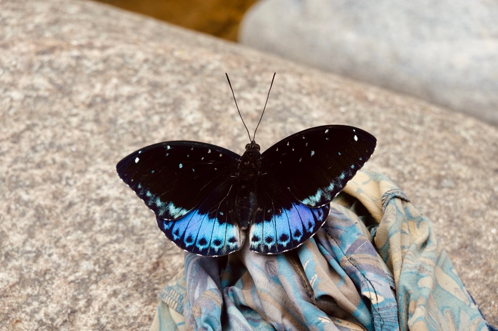
Butterflies dancing Border Roads of Megalaya
We head towards Shella and Ranikor. The route follows the border of Bangladesh. While in Arunachal Pradesh which is bordering with China, we were not allowed to come closer than approx 100km to the border, here the roads just follow the border fence. Small tracks lead through the country side, shaky and broken bridges over the rivers and cobble stone paths through villages.
Later on every other step was missing 🤯 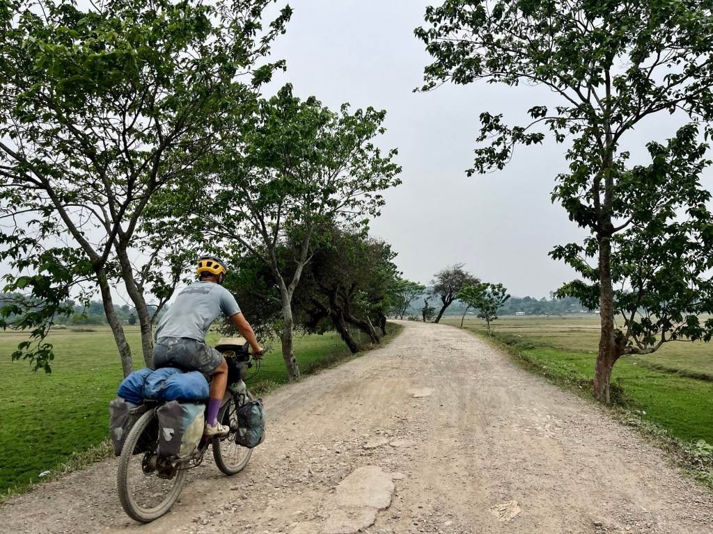
Tracks On the road we find people improving the tarmac by hand. Fires on the roadside burn the tarmac and female workers with little brooms straighten the road and fill the holes with cobbles. We have probably entered an area where human labour is cheaper than machinery. We’re cycling past the construction sites with great dignity and reverence.
In Ranikor we find a beautiful campground with a swimming pool. Our route looked fairly flat when we planned it. Once we entered the Garo hill area we realised: it was all a lie!

Jadukata River So so many short uphills sum up to almost 3000 altitude meters on one day. All of that in the burning heat!

Garo Hills The roadside is covered with elephant poo. While we sweat our way up the hills we’re getting filmed and photographed by local by-passers. We haven’t had this in a long time and we get to feel more like we’re the animals crossing the wildlife passages. The soldiers at the border checkpoints are more worried about us getting run down by elephants than the border itself.
Lush Hills 
Border Roads Another stopover in Assam
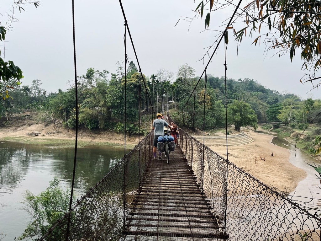
A few kilometers and many uphill meters later we arrive again in Assam. One turn and we are entering chaos. Goodbye idyllic Megalaya. The road is merely a road anymore but consists of more holes than tarmac. Tuk-tuks tetris and eardrum bursting honking. Many, many friendly faces and so many questions asked. How to manoeuvre our bikes in this mess? In Phulbari we search for the ferry which will bring us dry across the Brahmaputra river. Following the pillars of an unfinished massive bridge project we finally find the first ferry port. Then the next one.
Captain oh captain 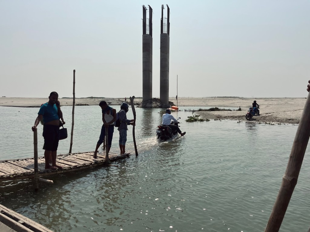
Bike washing 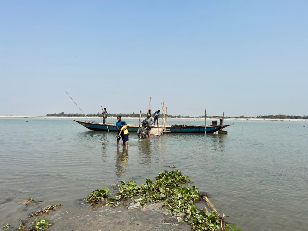
Refreshing in the heat 
Wish to be there Stop over in Westbengal
After a long day we arrive in a Koch Bihar – which used to be a princely state. In a nice hotel we enjoy one of the most delicious meals we had in a while. Camping is still not an option for us, as the area is densely populated. And the solid shower after the hot and long days is a treat!
Yummy 
Rama statue On our way to Lava we pass many many tea gardens. We find a lovely camp spot in one of them.
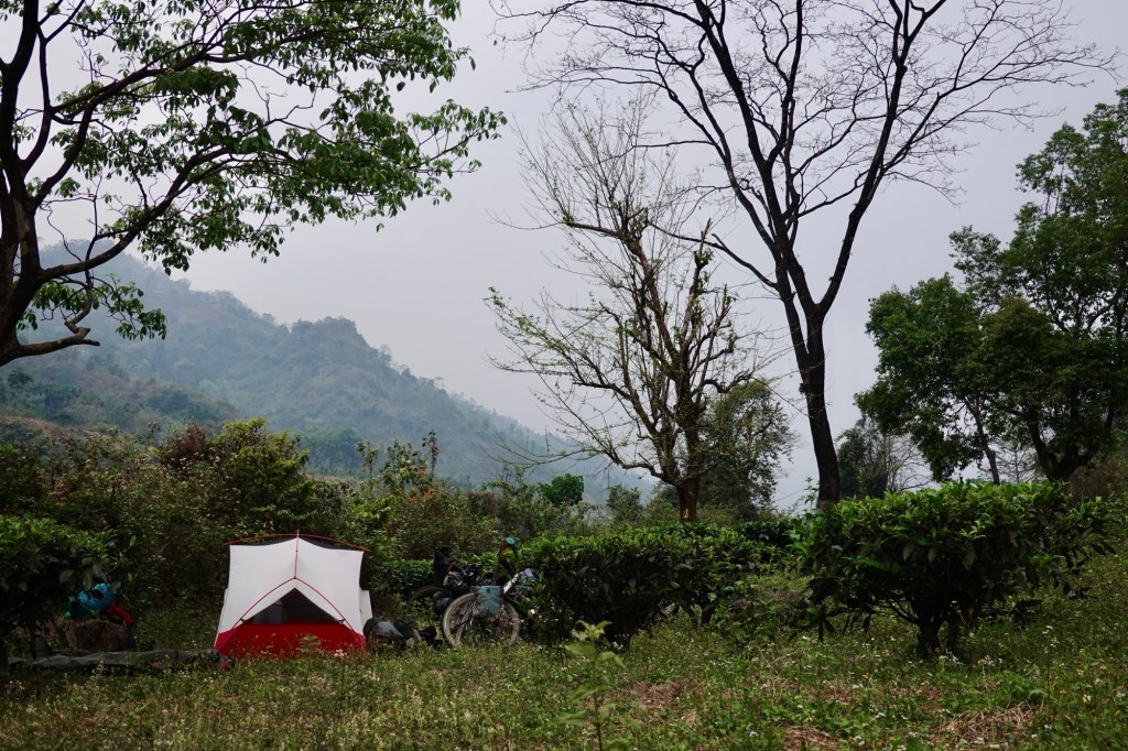
Camp In a small teahouse we enjoy the best Momos and Veg Thali so far. Fresh farn (Nigri) and nettles as greens this time. Coconut icecream for dessert!

Lovely ladies and lovely chats 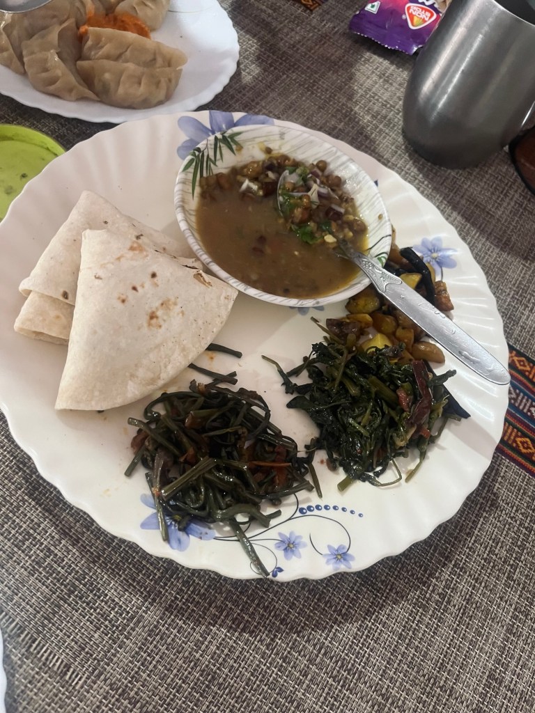
So yummy On the pass itself we get caught in the clouds. So no views again – but we meet a nice Nepali cyclist and shared a camp spot on a football field. The head of the village welcomes us for breakfast to her house, just before giving a briefing to the villagers. Each day villagers harvest Cinchona, which is used as an anti-malaria remedy.
Curious conversation 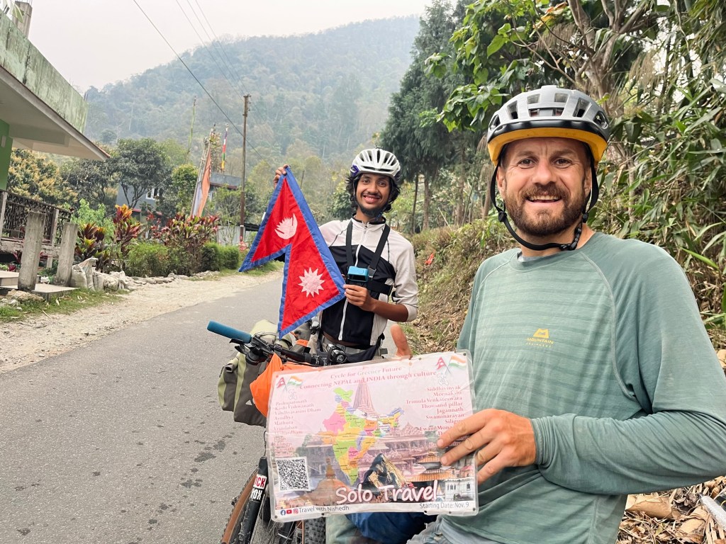
Looking so much forward to riding in Nepal 
Our campspot later that night Sikkim – many hills and no views
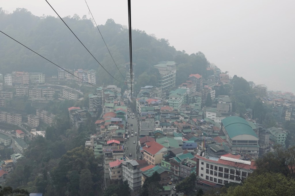
The next morning we arrive at the checkpoint for Sikkim in Rangpo. Another permit and off we go to a destination Rolfi was eager to explore for a long time. Sikkim is supposedly mostly engaged in organic agriculture. In contrast to the other states, Sikkim is banning small plastic bottles and tries to reduce trash. Also we would hope to get a glimpse of one of the 8000m peaks Kachengucha. The road that leads up to Gangtok the capital of the state was anything but nice. Trucks, dust and hills. The streets in Gangtok even steeper and the rain made it so slippery. The honking beyond annoying. Not a good start!
Please!!! 
Monkey checkpoint 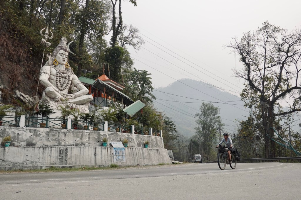
Roadside We are sitting out a bit of rain in Gangtok and hop from one cool cafe to the other.
Gangtok mist 
Breakfast 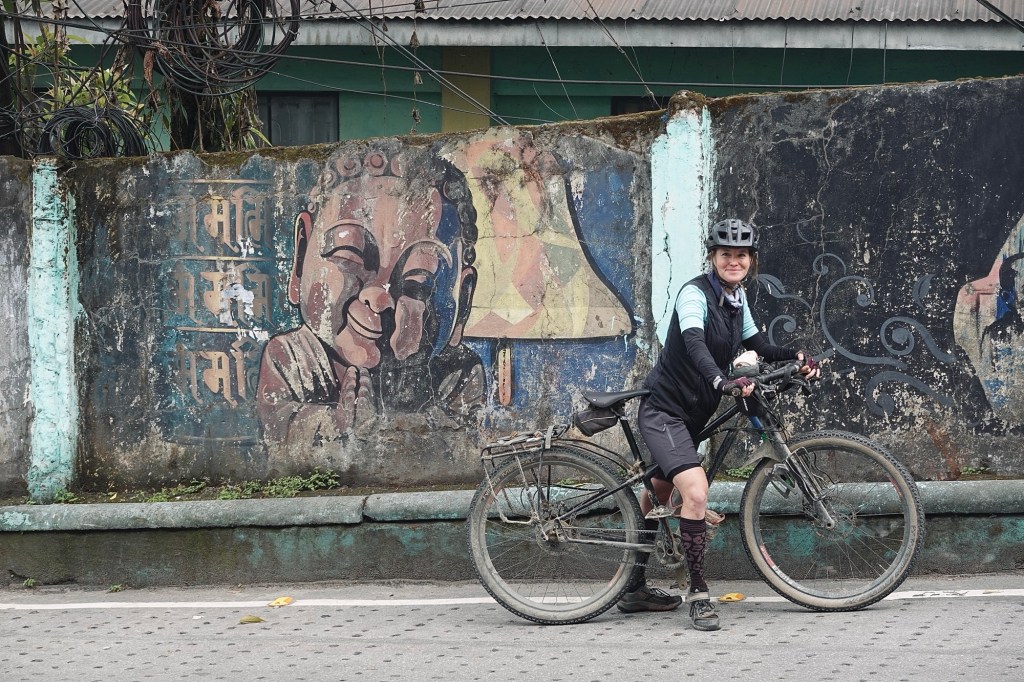
Gangtok street art We pass by a bikeshop and invite ourselves for a community ride the next day.
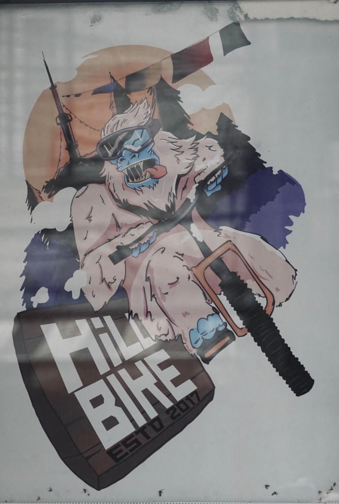
Hillbike 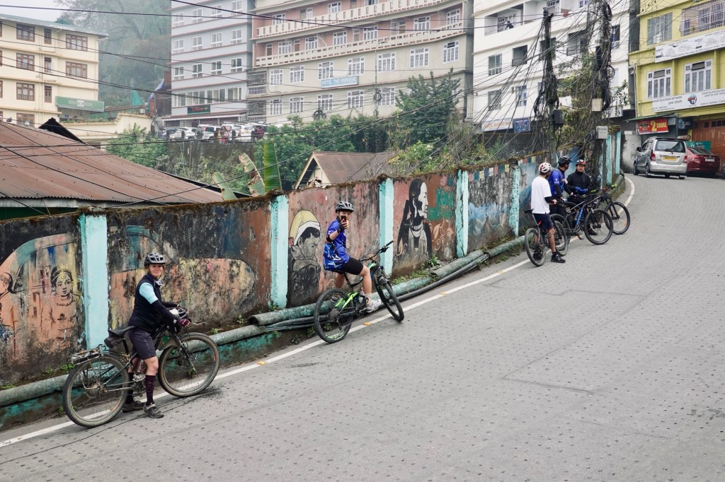
Community rides 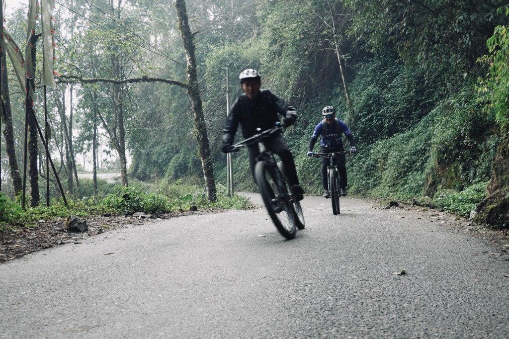
Speedies 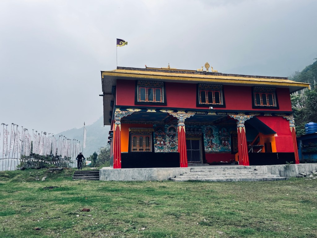
Monestary With high hopes for weather improvement we continue towards west of Sikkim. Passing by Kabi Lungchok a historical landmark where Treaty of Blood Brotherhood between the Lepchas and Buthias was signed.
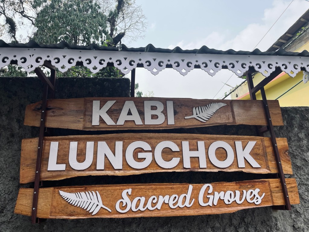
Kabi Lungchok 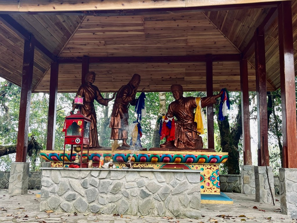
Treaty of brotherhood Passing by lovely waterfalls, friendly people and amazing momo street food.
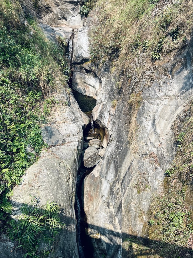
Small waterfall 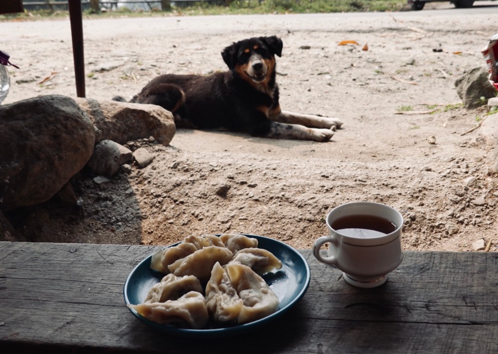
Momos 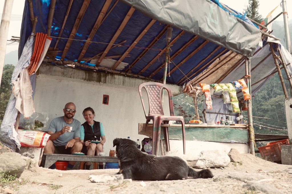
Roadside Lunch Our rough route leads over a landslide area where the road was completely ripped away. Just in the morning we were discussing that the tarmac is getting a little bit boring and – voila we get what we wished for.
Landslide area 
Uff 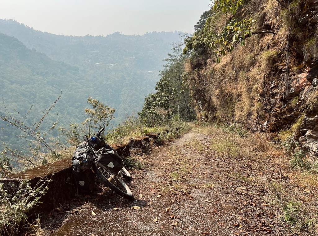
Within 2 years the road is overgrown 
Nature takeback 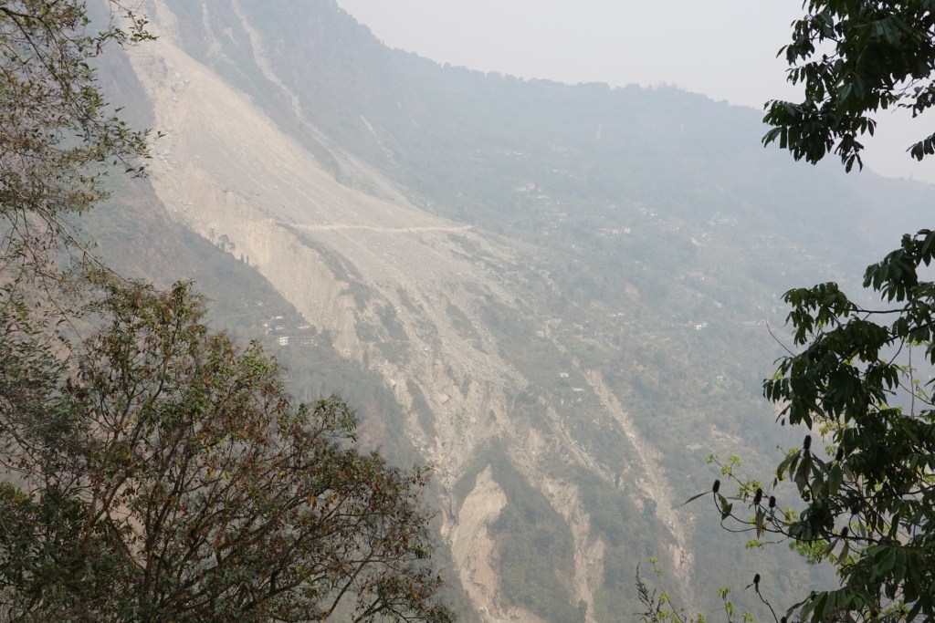
Landslide In Ravangla we take some rest for Rolfi’s knee to get better. The hike-a-bike left a mark on the joint or ligament. And we visit the touristic Buddha Park.
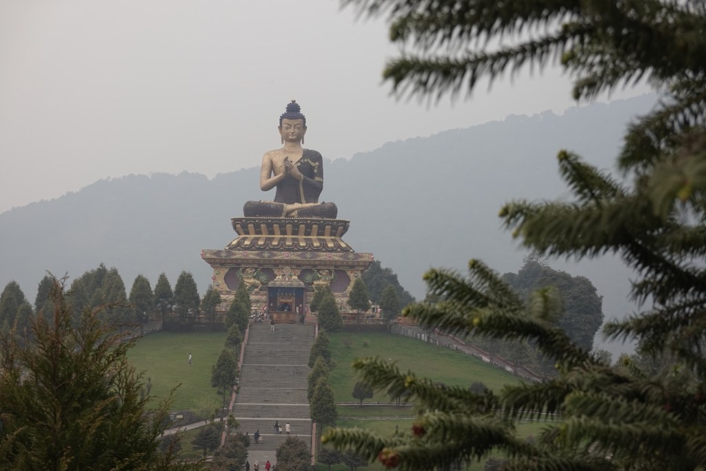
Buddha Park Sikkim hasn’t treated us with the best weather and so we leave without getting a glimpse of the famous Himalayan backdrop. A bit disappointed we head to Darjeeling in West Bengal.
A few more turns through the tea gardens of West Bengal and we find ourselves at the border of Nepal!
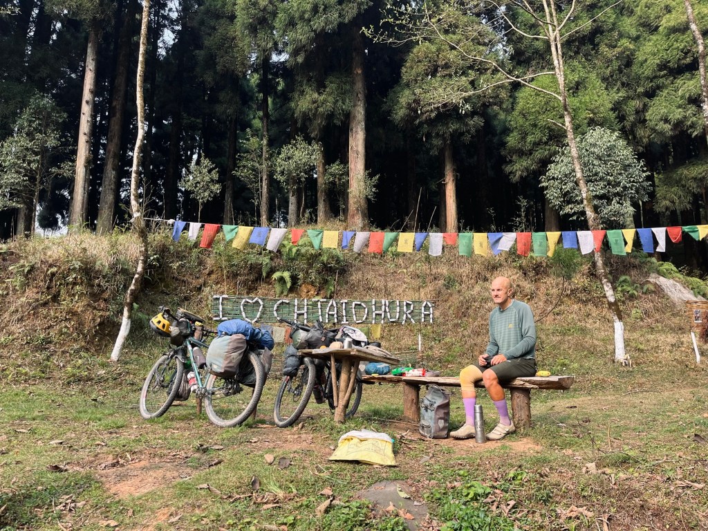
Breakfast spot 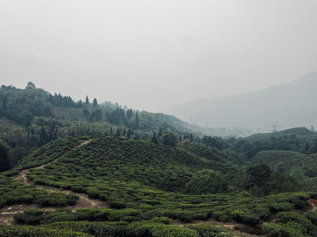
Tea gardens 
Tea turns 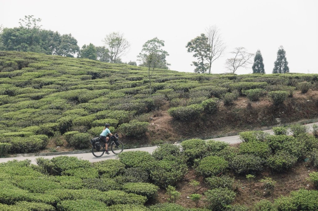
Clouds of tea 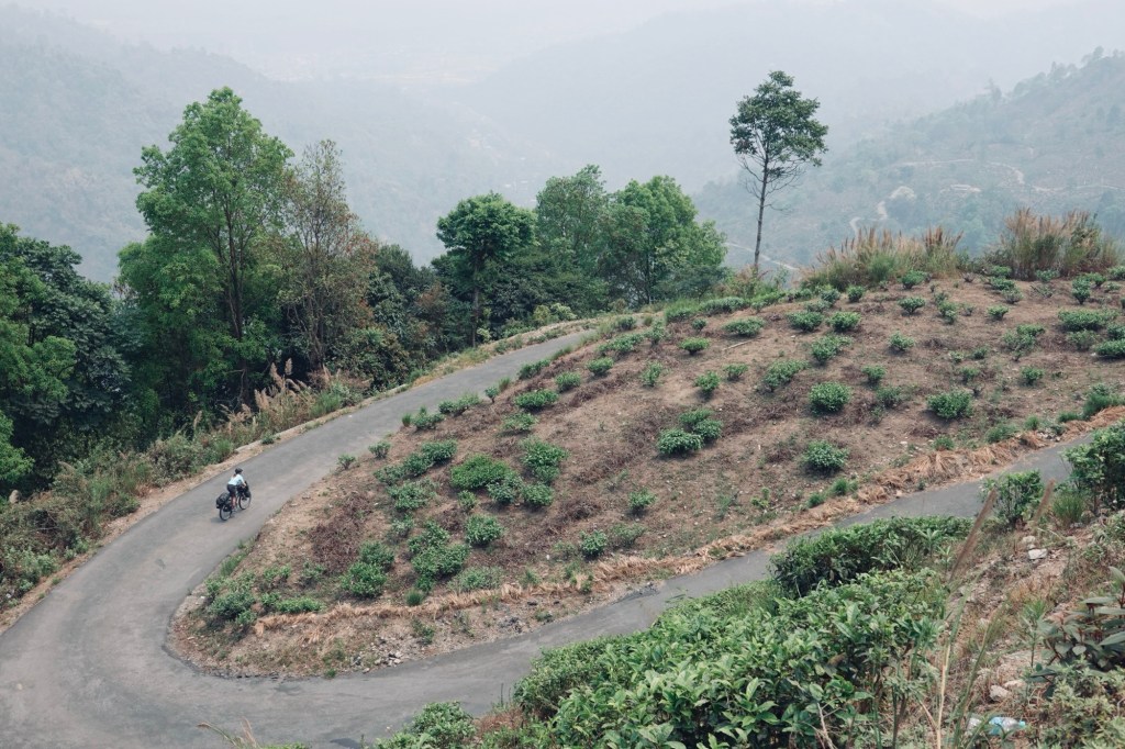
Tea Turns After almost one year and so many detours we are finally arriving where we originally planned to go! Goosebumps 🙂 We are so excited for this part of the journey!
Our Path
India in total: 3200km | 48000 altitude meters
- Delhi Haze & the far Northeast of India
Jungle of Delhi
Before heading to the Northeast of India we are spending a few days in Dehli. We arrive early morning in New Dehli. The city is what you would expect: noisy, dirty and smelly. It’s inhabitants and visitors spit plastic, shit, piss and other nasty fluids on the streets. The city wears it gracefully – like an expensive carpet on an exotic wooden floor. Yet there are corners which feel lush green with its gigantic trees. Some alleys feel like a walk in a jungle, not the concrete jungle, but the real one.

Cows and trash everywhere 
Streets in front of our guesthouse 
From the balcony of the guesthouse Trees frame arches, rootes overgrow the pathways, leaves hiss at the traffic. We are lucky to visit during a time the sky is even visible. Our intention to go easy on the street food for the sake of our stomachs is broken, as soon as we get our eyes on all the goodies. Stomachs are fine. One short train to Agra, to visit the Red Fort.
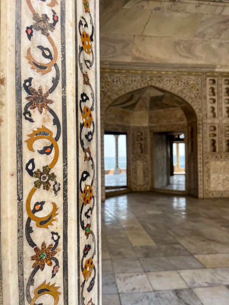
Details 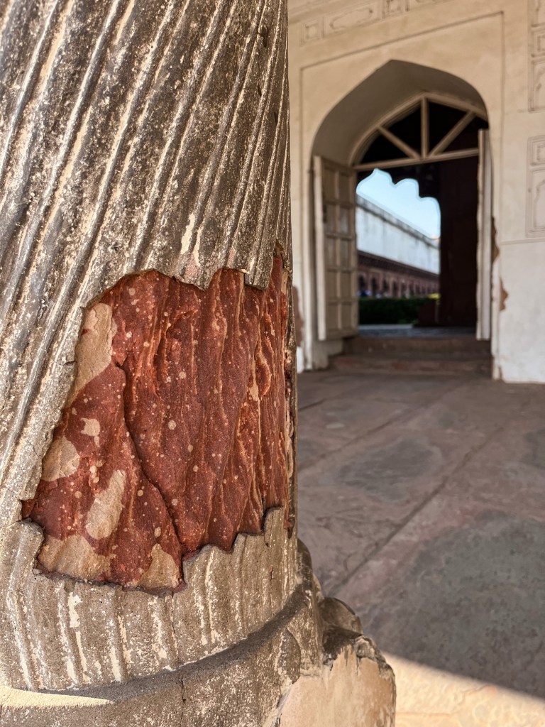
Layers 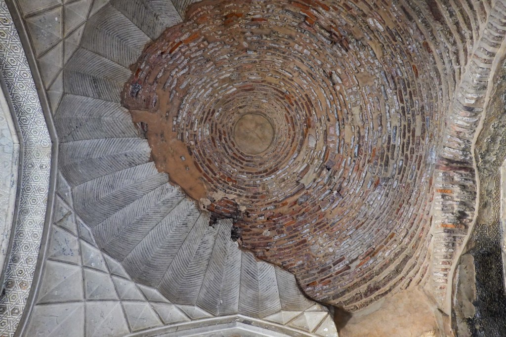
Ceiling 
What a tree! And of course the fort is also not too shabby! 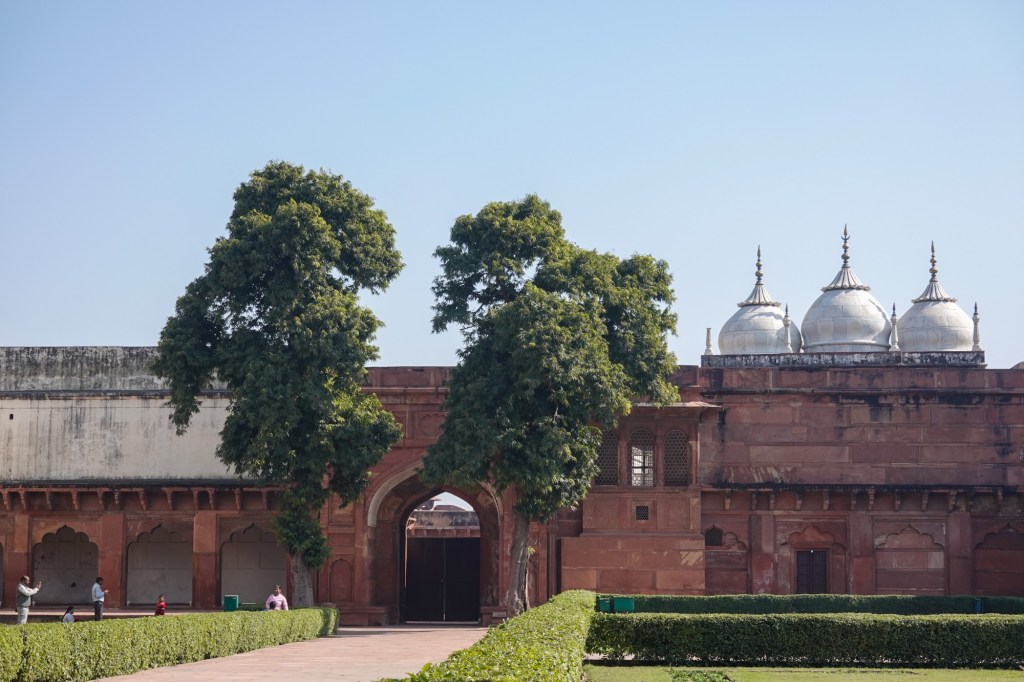
Red Fort 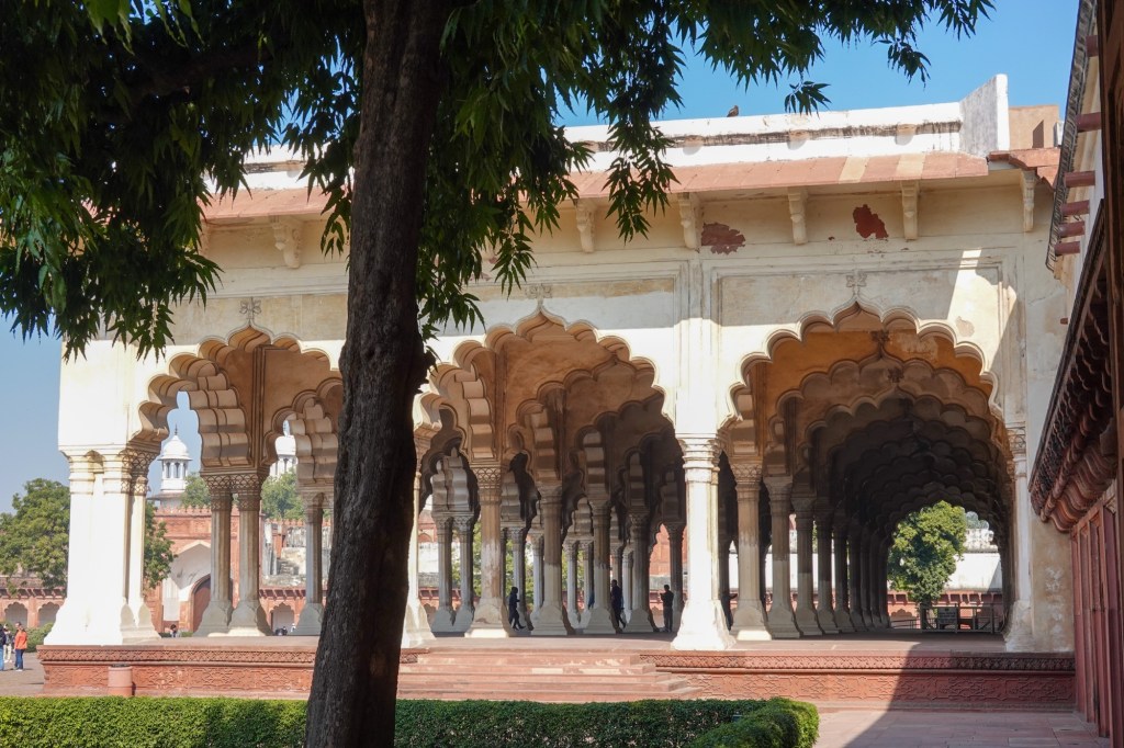
Red Fort 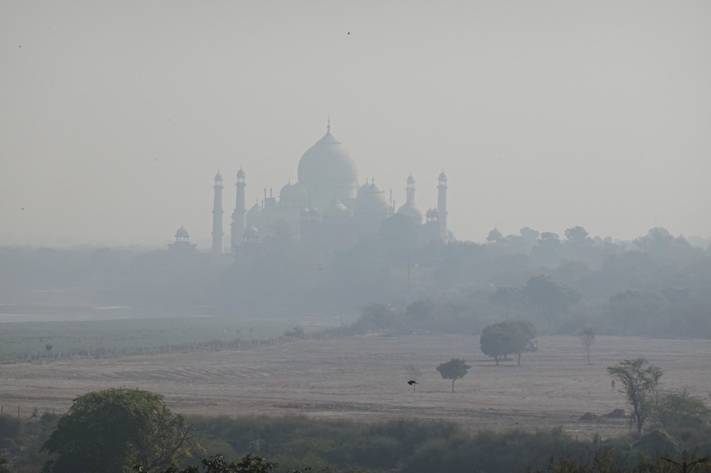
Taj Mahal from the distance As well as the mighty Taj Mahal. Little did we know that it was the day of free entrance at the Taj Mahal and so this day was a truly overwhelming and a unique experience. Huge lines, kids being lifted over barriers and fences, lots of pushing but also lots of smiles and some selfies.
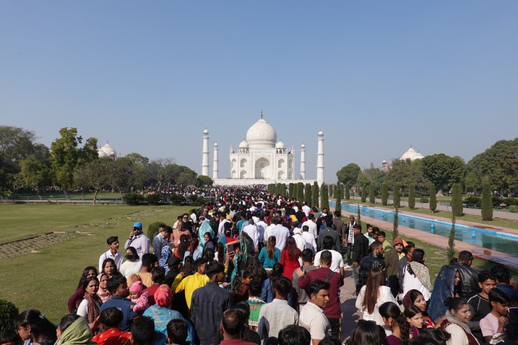
Crowds at the entrance 
Taj Mahal 
Evening light, after standing in lines for 3+ hours The other day we do some New Delhi Sightseeing (by metro) and restaurant hopping.
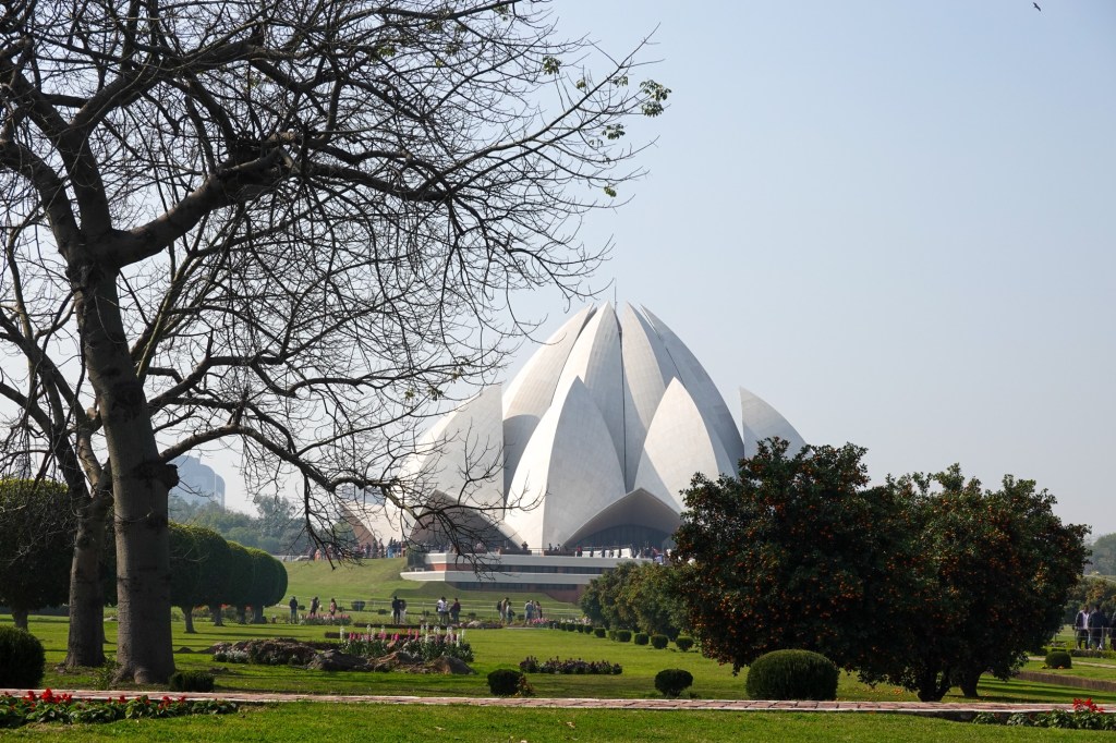
Lotus Temple 
Lotus Temple 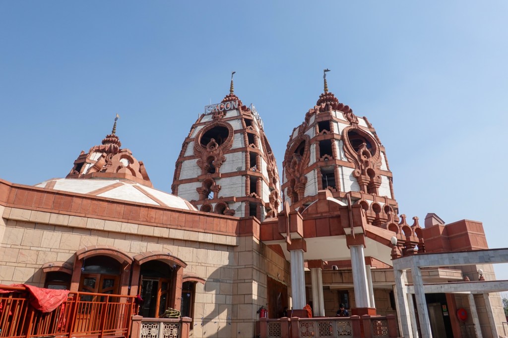
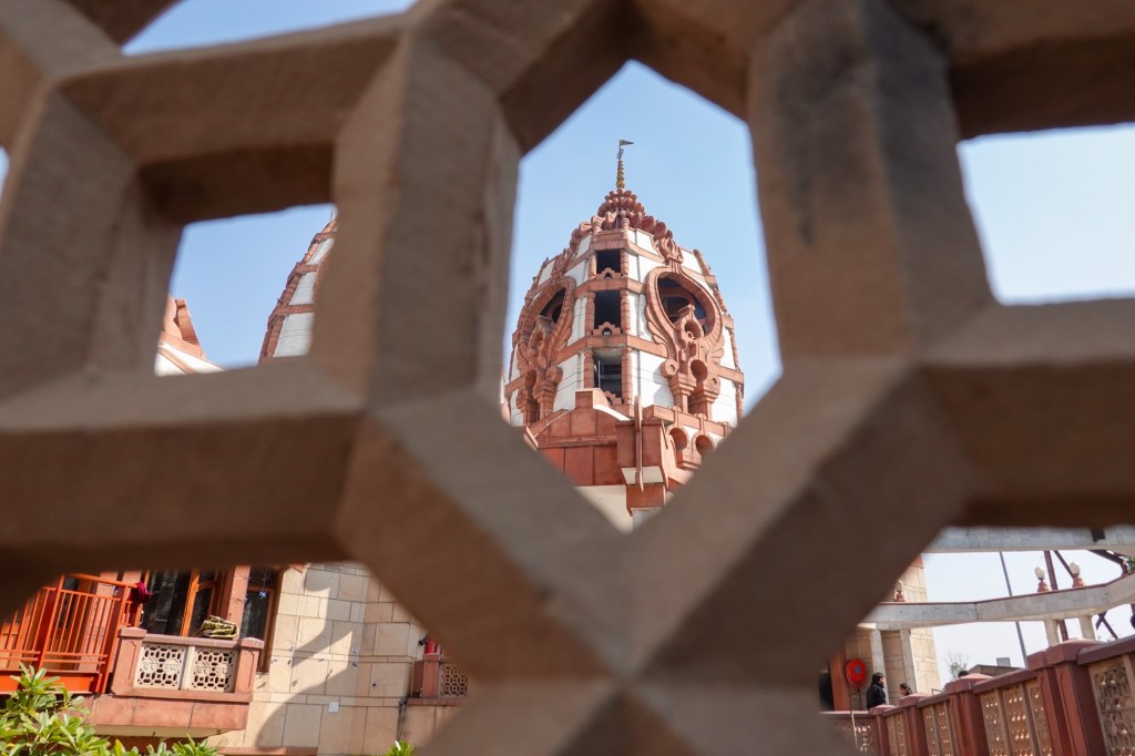
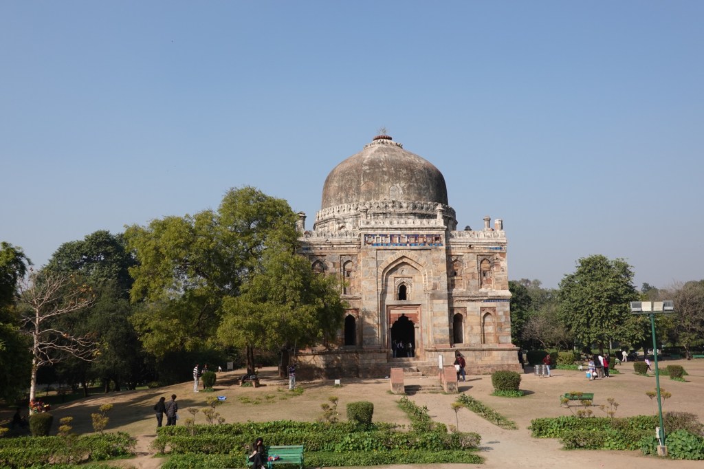
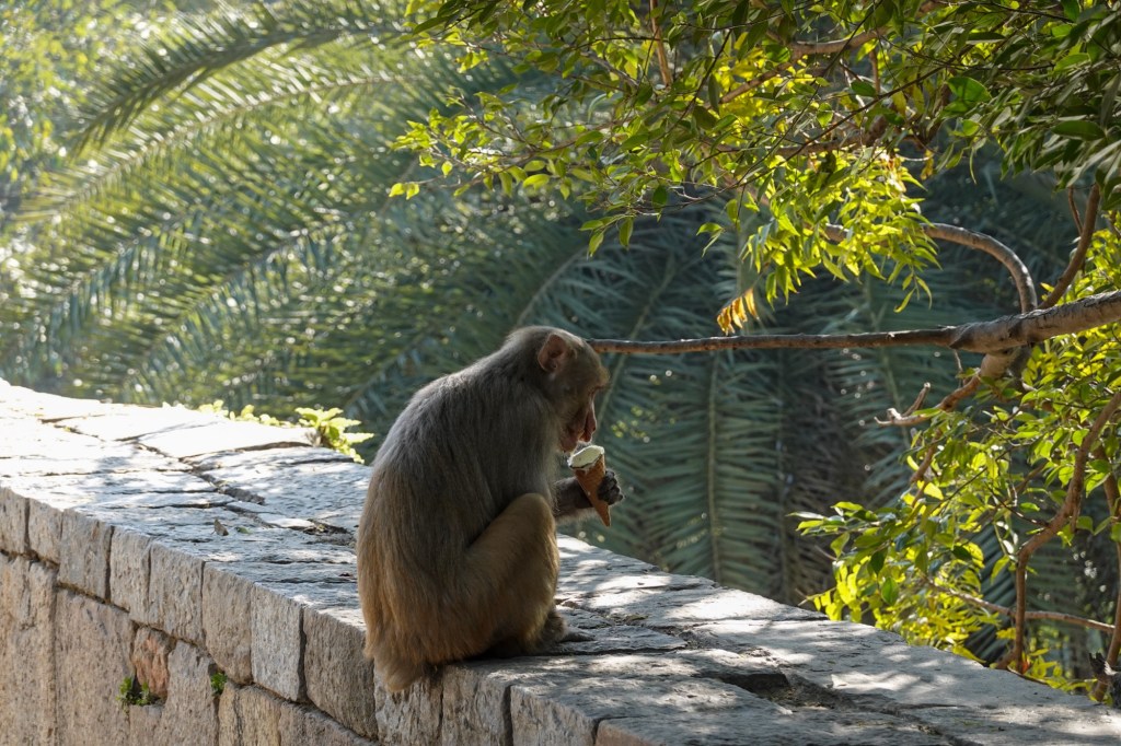
Ice-Cream 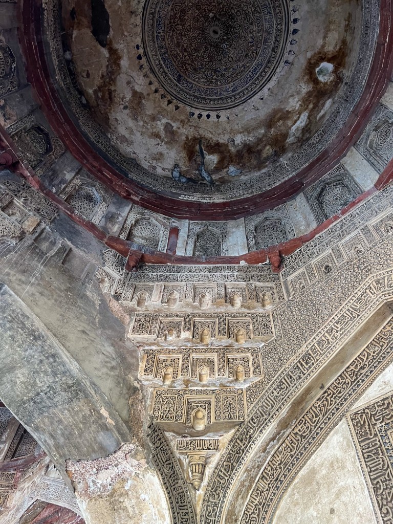
Lodi Garden 
Lodi Garden 
Art district 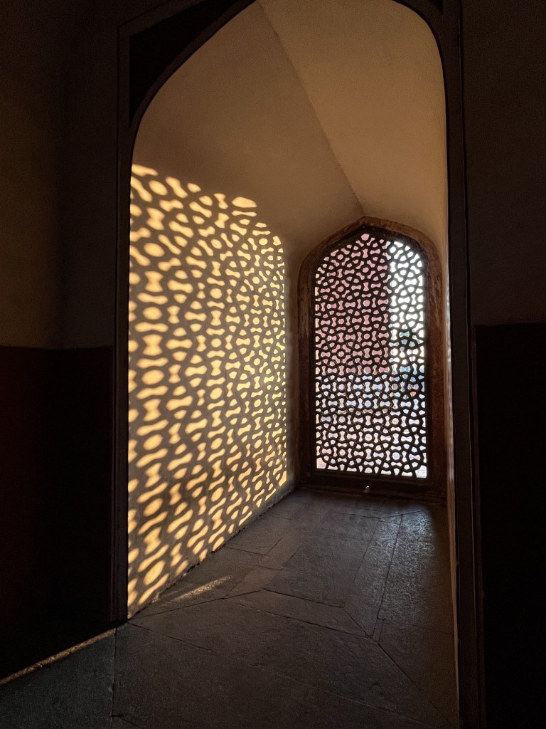
Shadow and light 
Enough city buzzing for now!
Off to the train 
The train ride The bikes, still safely packed in the boxes, are ready for a 30 hour train ride to Guwahati, in Assam, the Northeast of India. Our bikes, divas as they are, need one bunk bed for themselves. Us, squeezed together, take place in the other one. And so it goes… by the end of the train ride, I receive sad news from home and decide to interrupt the journey for a while.
„To see things as they are“
In the meantime Rolfi takes the opportunity to join a Vipassana course close to Guwahati. In an intense 10 day course he gets to know this ancient form of meditation. 10 hours per day of meditating – no communication or eye contact is allowed in this time.
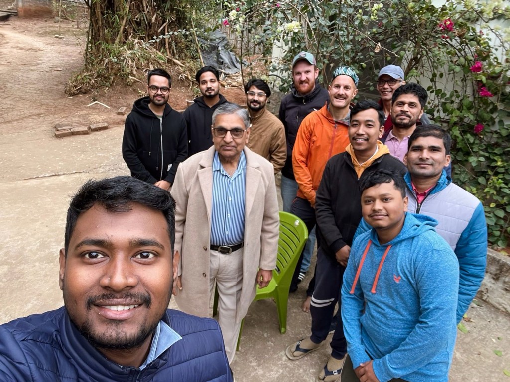
Vipassana course After the course Rolfi can stay with a local warm-showers host and his family who welcome him warmly in their home in Guwahati.
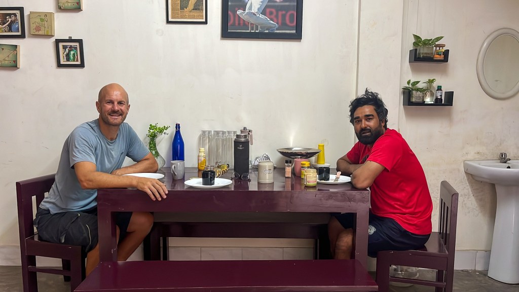
Warmshowers connections 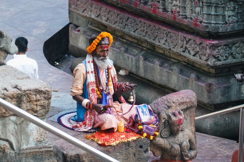
Tantra Temple 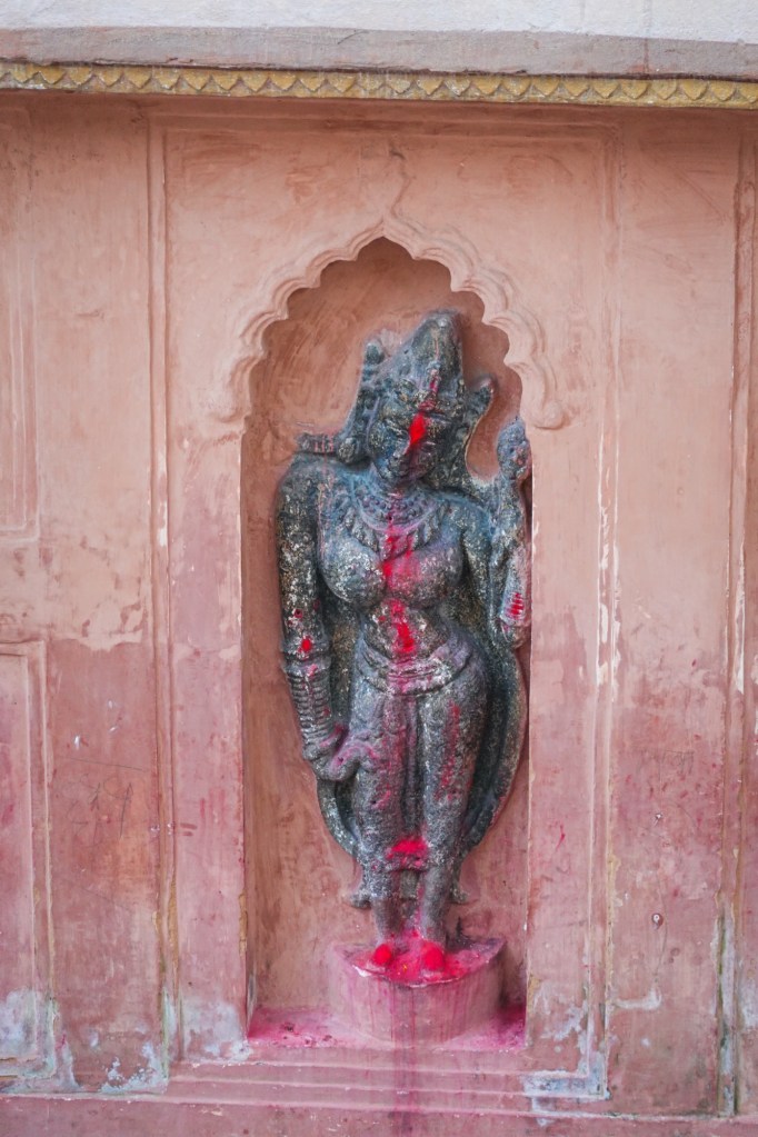
Tantra Temple 
Visit of the most important Tantra Temple in Guwahati Later on he is doing a 3 days loop to check out the state of Meghalaya. Exploring the banks of the Brahmaputra and the hills in the south. In those 3 days he cycles beautiful small and quiet roads we were not expecting to find in India so easy. But luckily in the next weeks it’ll be like this most of the time.
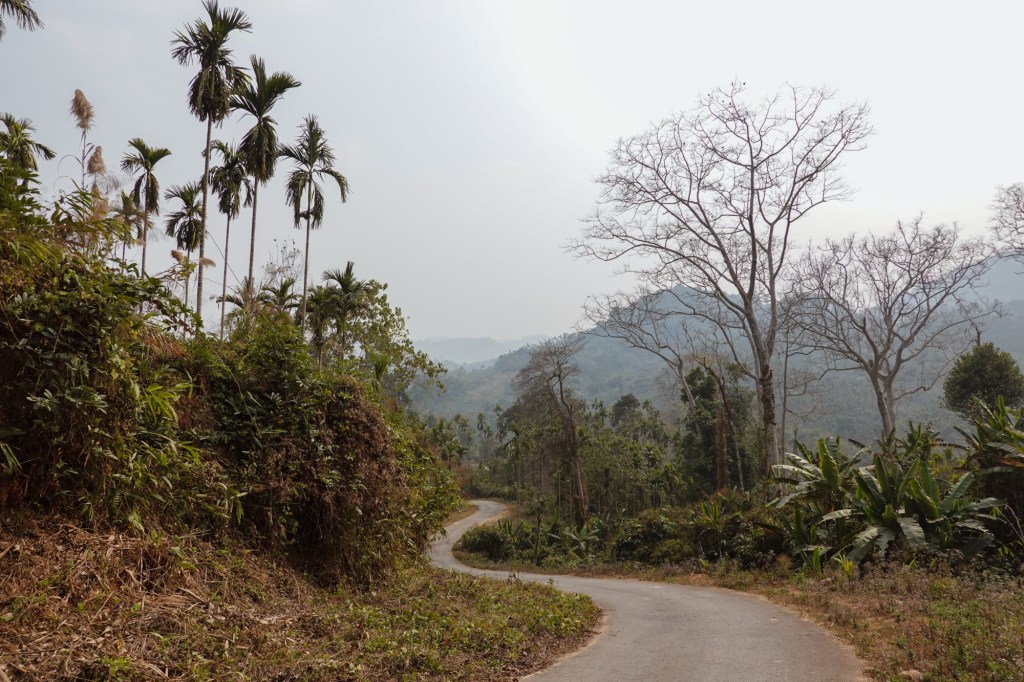
Meghalaya 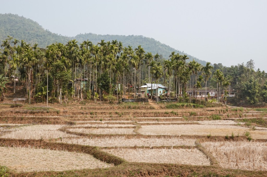
Meghalaya 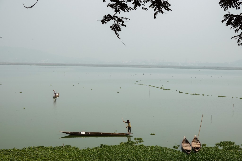
Fishing During another warm-showers stay (platform like couch surfing for touring cyclists) he gets to know a local school and the students. The school was built by an australian missionary couple. The couple is not living in India anymore but touring cyclists can stay at their little wooden house/school. In the morning one teacher organises a little meet and greet with the students and then they can ask some questions to Rolfi.
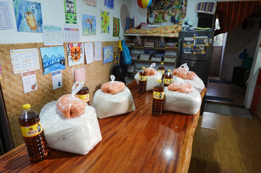
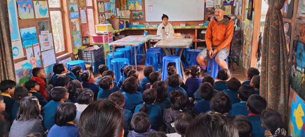
Class introductions 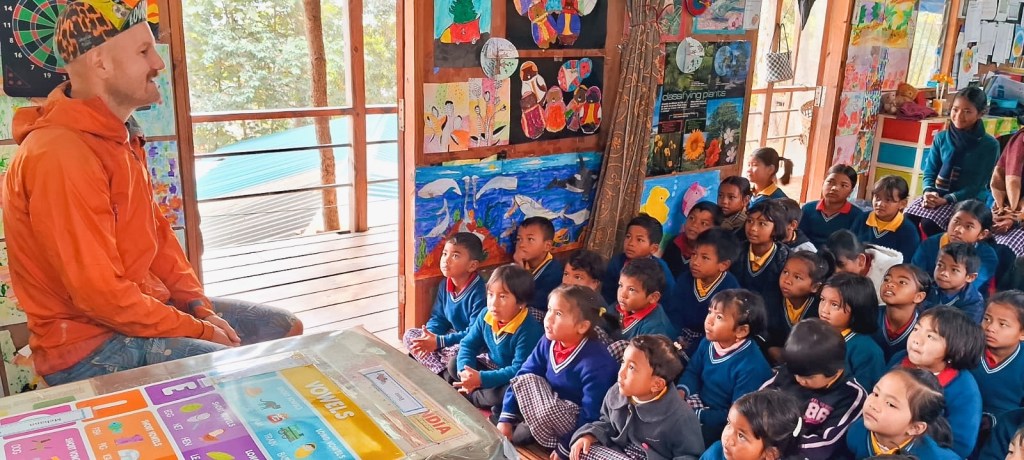
Class introductions After a almost 3 weeks we meet again in Guwahati and continue our journey together.
Arunachal Pradesh – Road to Tawang
It is time to go to destinations we are so eager to get to know. The North of the Northeast – Arunachal Pradesh. The state is bordering Bhutan and China. Due to an ongoing border dispute there is a special permit needed for the region. We follow the Brahmaputra river eastwards for a little while. With 2900km it is one of the largest rivers in South Asia. Originating from the Chemayungdung Glacier in Tibet, it fans over the northeast, heading to West Bengal and through Bangladesh where it enters the Indian ocean in the Bengali Bay. Millions depend on the river for water, agriculture, food and electricity. Many people are affected when the now so calm river turns into a roaring beast.
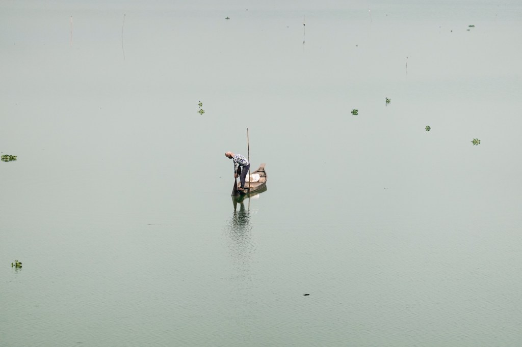
Calm River Cycling out of Guwahati certainly was not the funniest part but two days later we exit Assam and enter Arunachal Pradesh. On the way we meet the cheerful group of cyclist of North by Northeast (a tour provider specialised on the Northeast). They follow the same route us and we shall share a few more moments with them in the future.
The BRO (the border road organisation of India) makes sure we have a safe, entertaining and very very smooth ride by placing signs with cheesy slogans on the side of the gentle roads. The gradient is never more than 7 % and so we roll up the hills with moderate heart rate and not so much effort.
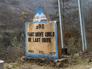
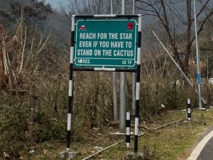
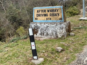
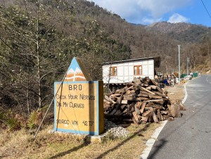
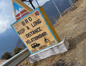
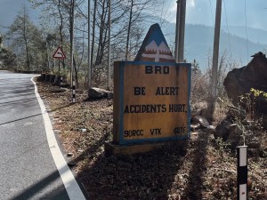

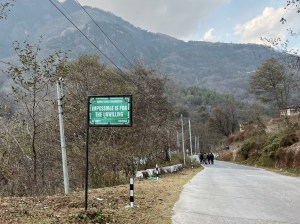
We arrive in Tenzin Gong, a buddhist village nested deep in the lush forest of the area.
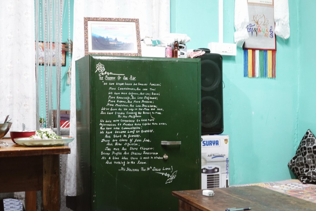
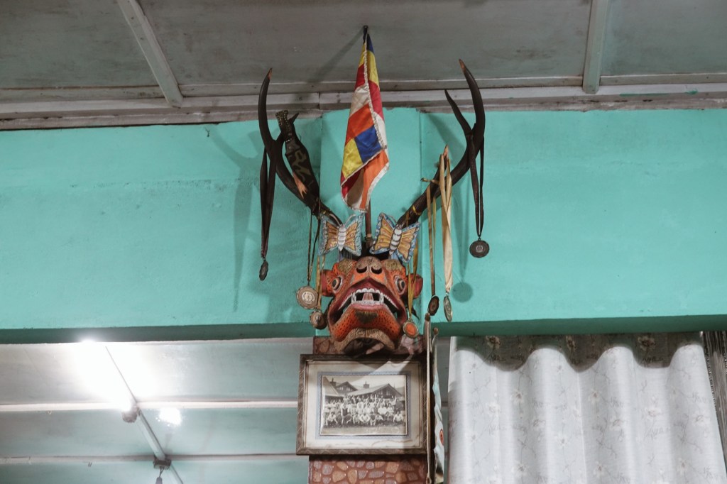
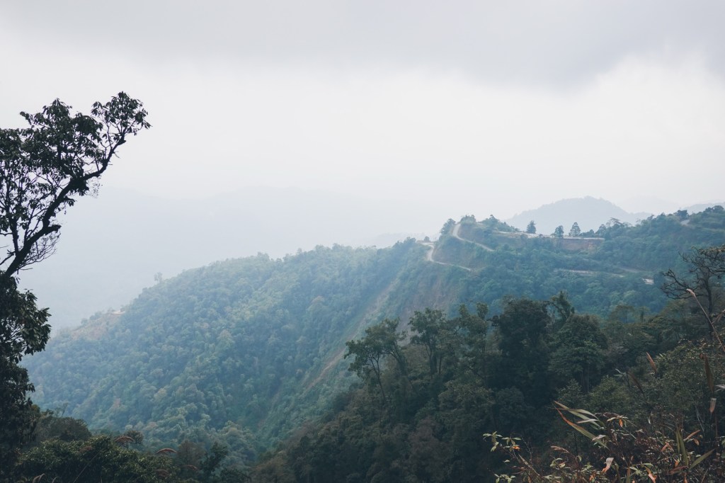
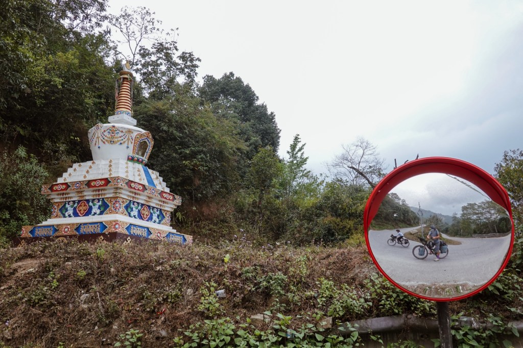
Many more switchbacks curl over the hills. Up and down, pass by small villages and monasteries. Prayer flags swaying in the wind. The air is humid and misty. Everything feels calm and peaceful.
I personally love switchbacks.
Every turn gives a new perspective. Every altitude meter gained, a new horizon. Each hairpin, opens a whole new world.
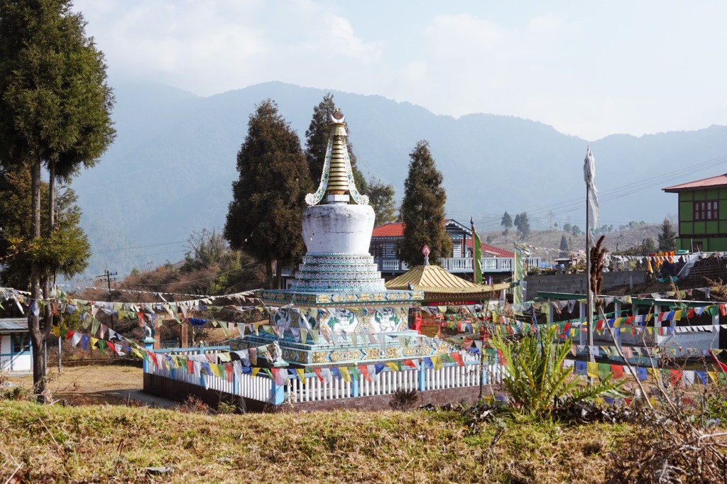
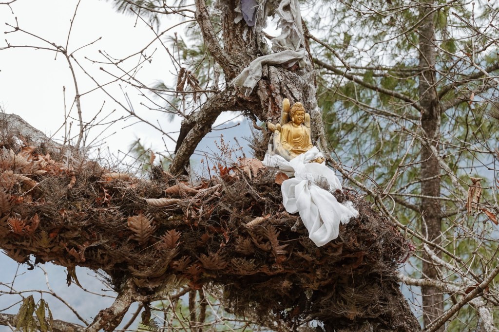
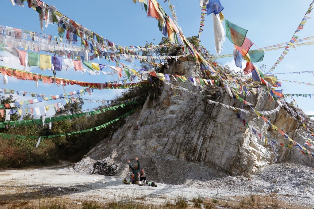
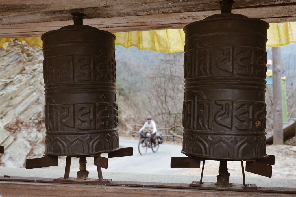
When on our prior selected flat camp spot on the ridge of the mountain a monastery appears, we got invited to camp on the soccer field as well as for dinner and breakfast.
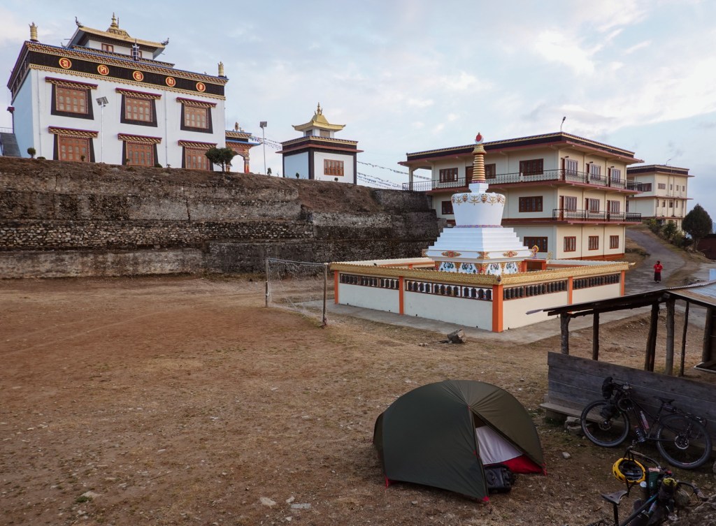
Camp 
Kitchen 
Path The next day we pass 3000 altitude meters and touch the first snow. At Mandala Pass a giant Buddha statue sits enthroned over the little settlement. Mystic, black trees sting through the grey and thick air.
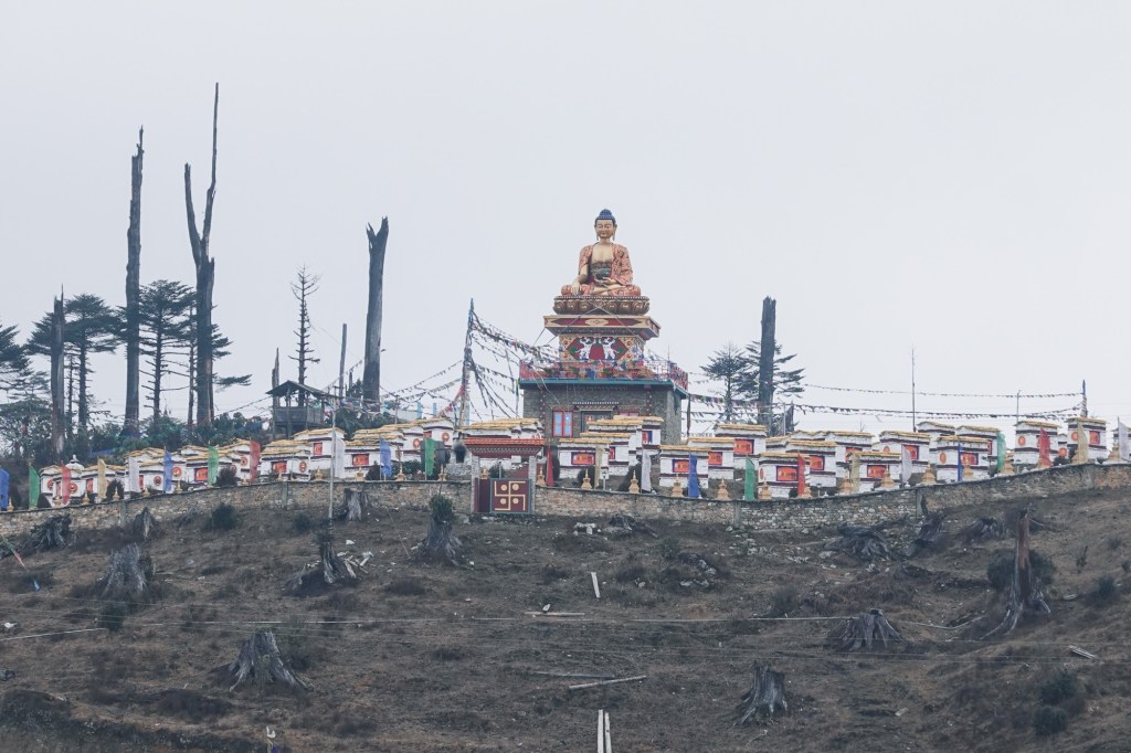
Mandala Top 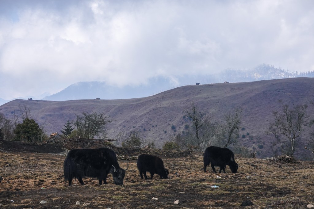
Yaks 
Snow 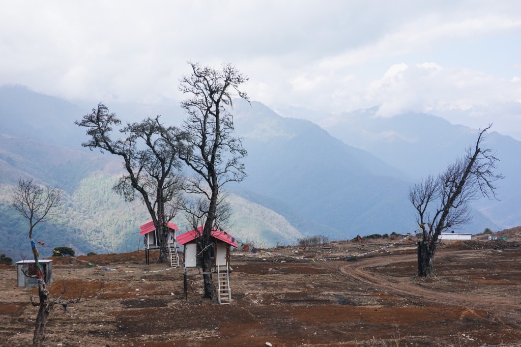
Tree houses We pass through Dirang and visit a museum. There are 26 major tribes and more than 100 sub tribes in the state of Arunachal Pradesh. In the “small” region we are cycling through there are at least 6 tribes. Passing through the smaller villages we would see a blend of different clothing, various traditional and non-traditional clothing.

Bugun 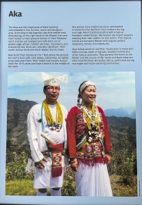
Aka 
Miji 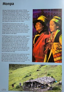
Monpa 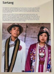
Sartang 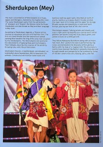
Mey Then it is time to make our way up to Se La (La meaning pass), to 4170 meters.

True true Like all the roads here the incline is gentle and the switchbacks are easy to ride. Pedalling up we feel the temperature is dropping and our breath is shortening. The clouds pass through us, stinging through our fingers, fogging the view.
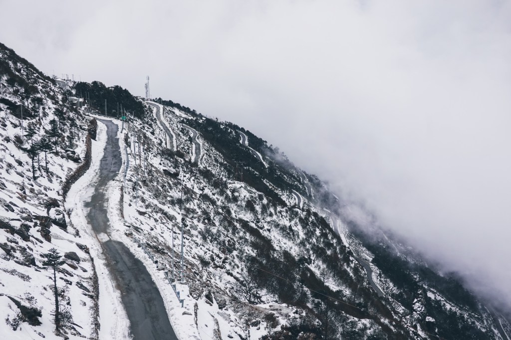
Road 
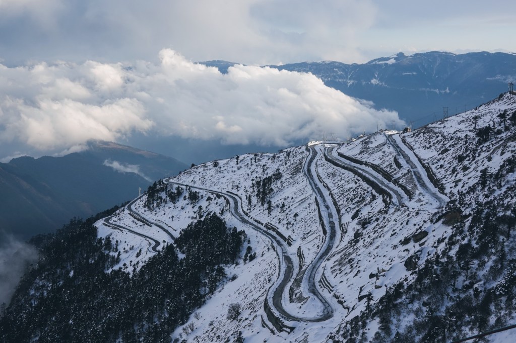
Switchbacks Snow, slush and ice is covering the road. Occasionally we get a glimpse of the valley. We arrive at the pass and friendly military moustaches great us. The military presence on the pass is like on the entire road quite high – and the camp is just behind the pass. On the way up Rolfi has already spotted a little cottage, which is perfect for camping and provides shelter from the angry storm. So we decide to ride back down again a few altitudes meters and set up our little camp inside the shelter.
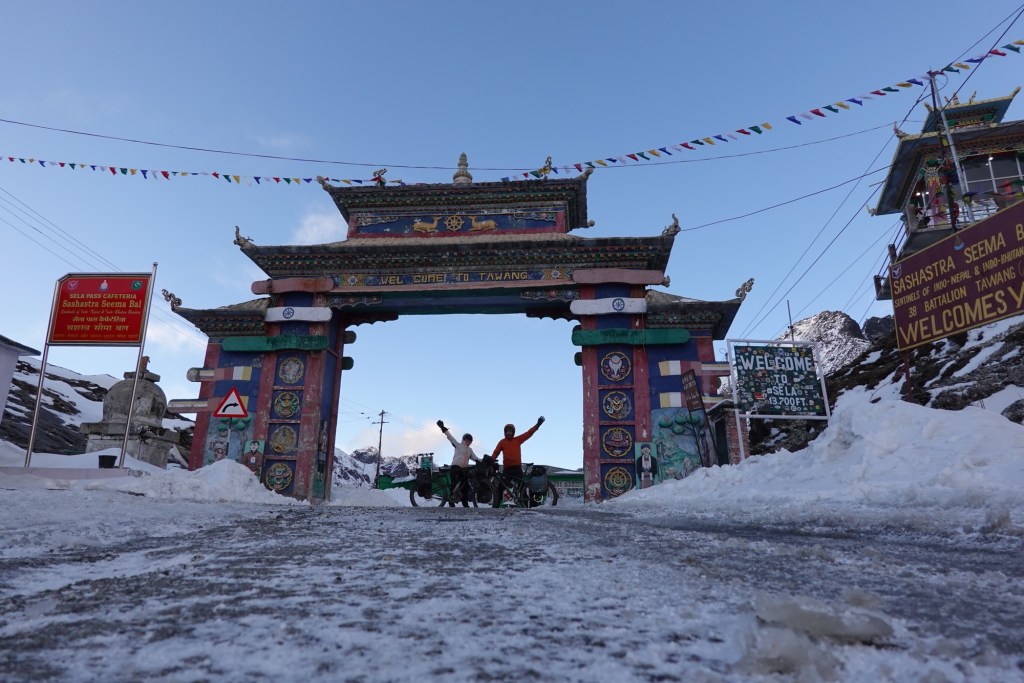
Se La (4170 meters) 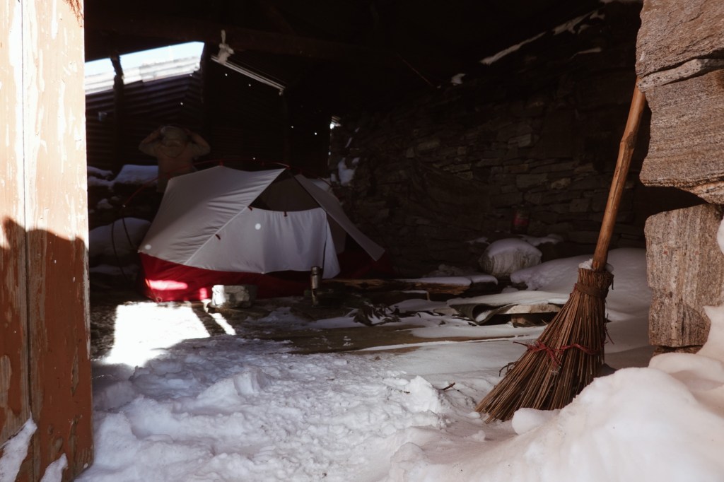
Shelter at 4000 meters After a stormy night the morning greets us with a beautiful sunrise and a crystal clear blue sky. Coffee and breakfast above the clouds before pedalling up to the pass (again).
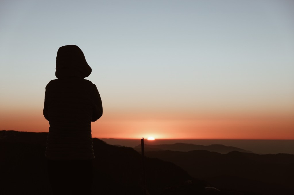
Sunrise 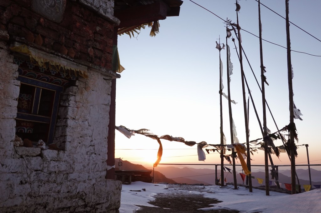
Calm mornings 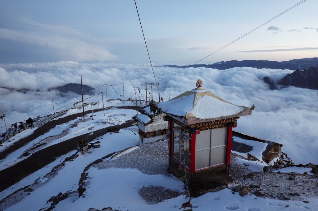
Above the clouds 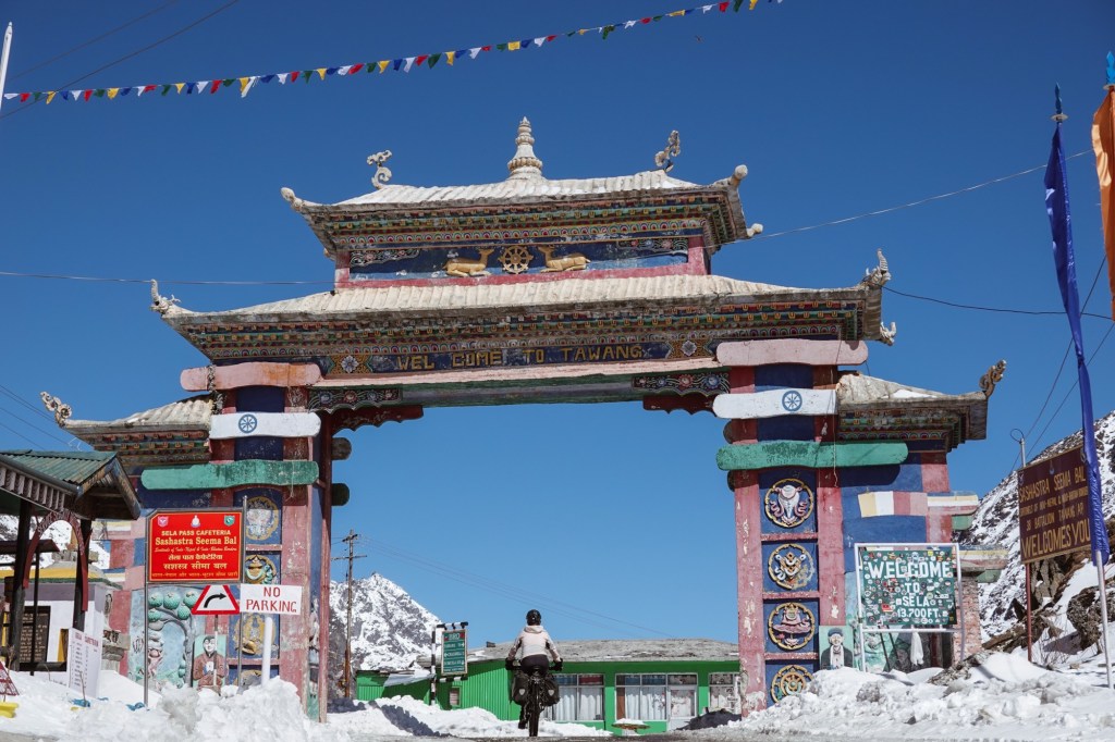
Se La – for the second time 🙂 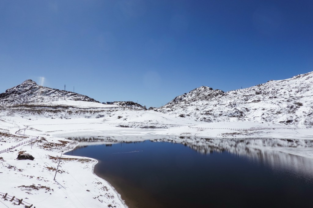
Lake A long downhill awards us for the effort and by the end of the day we have climbed up again 1500 meters to Tawang (3048m). Aside from its location, Tawang is famous for its monastery which is the largest of India.
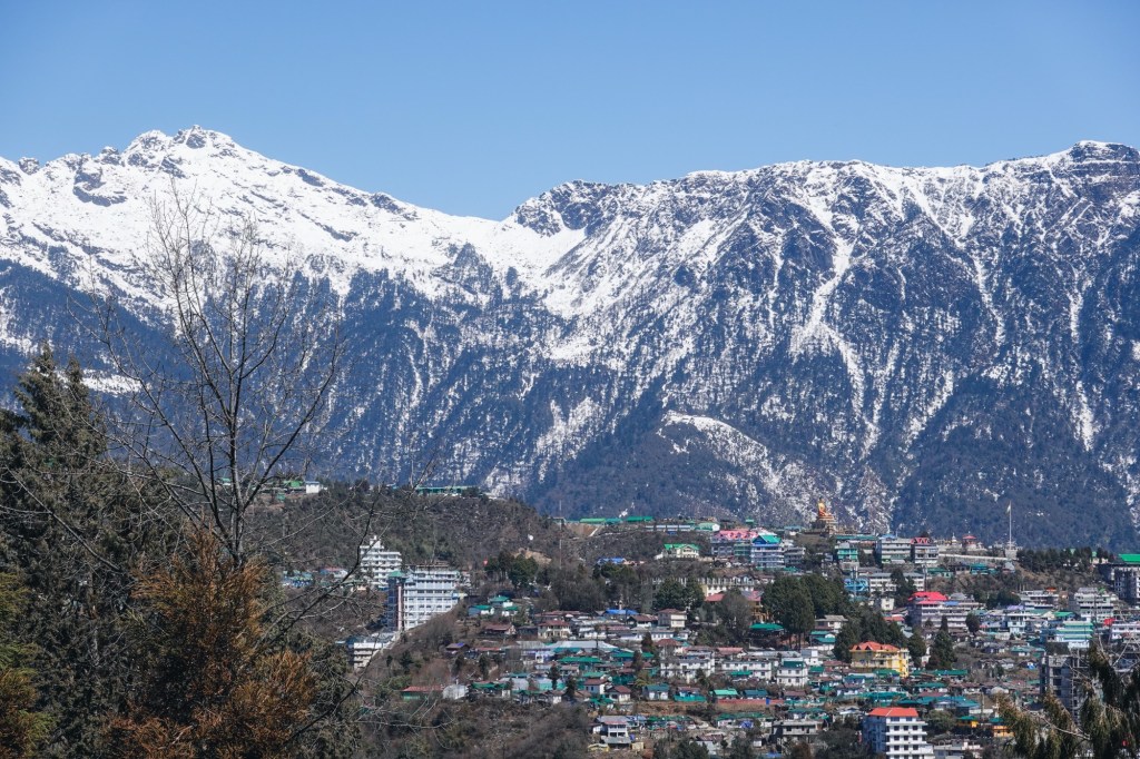
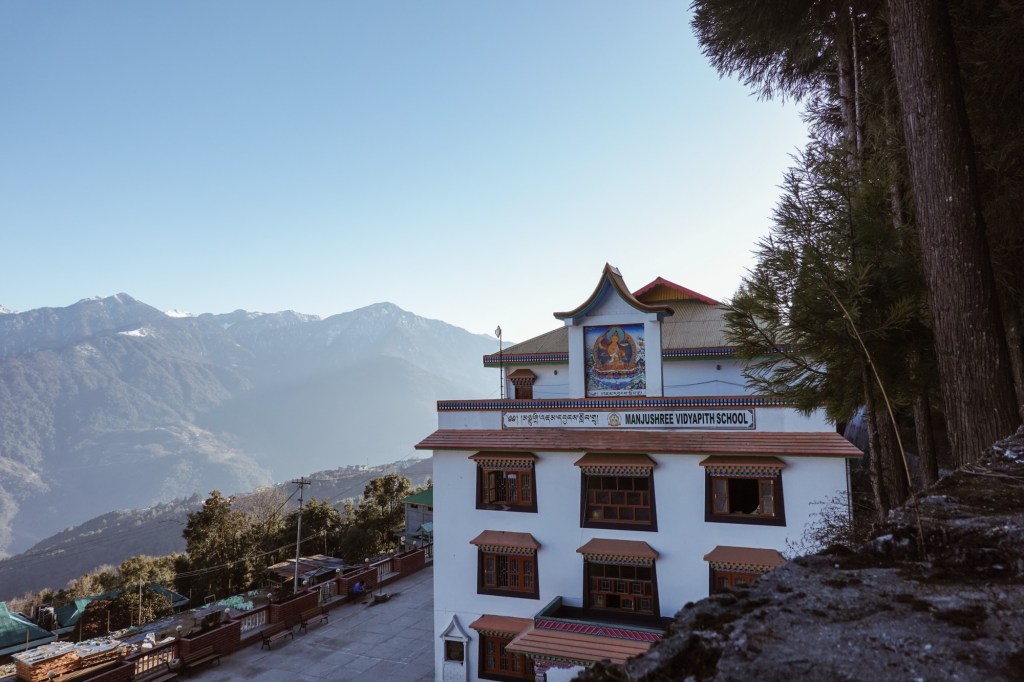
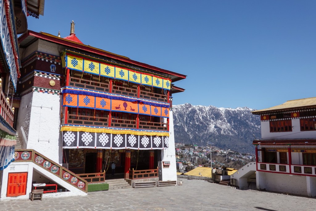
Tawang monastery 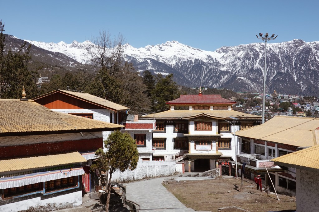
Beautiful 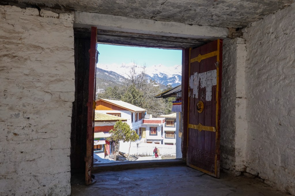
Inside view 
Inside Tawang Monastery 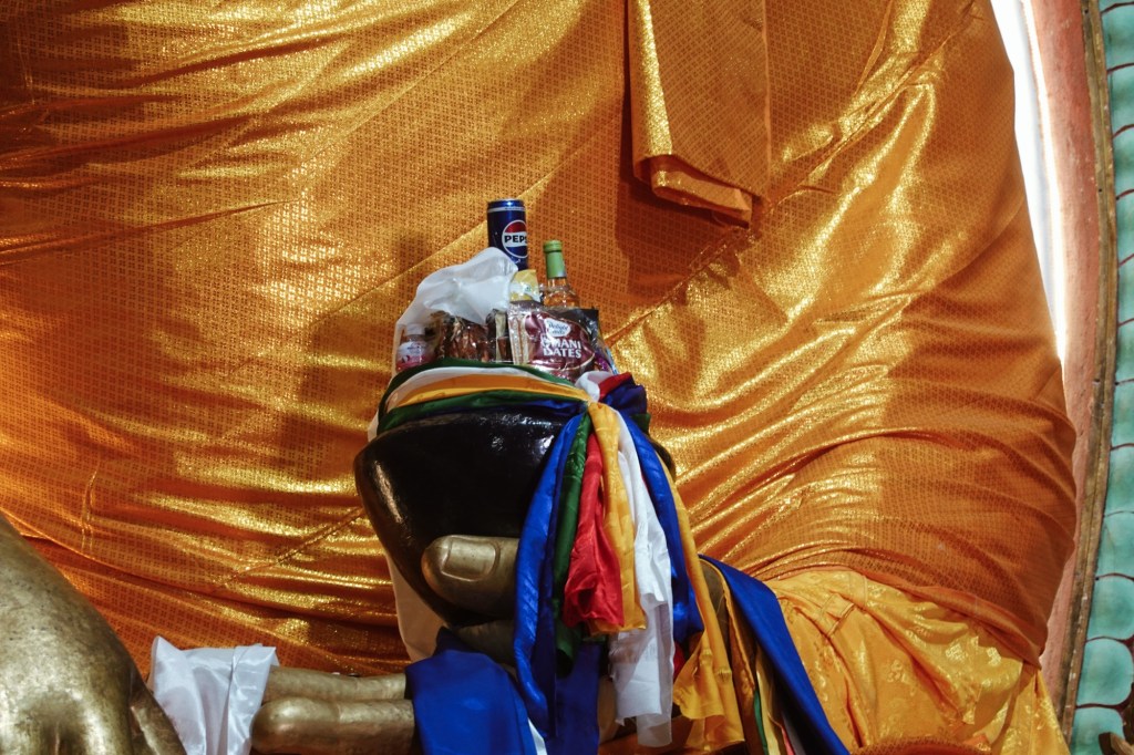
Inside the monastery The 14th Dalai Lama passed through Tawang when he fled Tibet from in 1959 and the 6th Dalai Lama was born in this area. When we arrive Tawang it is busy with its Losar preparations. Losar is the buddhist New Year and for the Monpas it is a family celebration. Each member of the family invites to their own house on different days – for prayers, food, wine and singing. The buddhistic new year celebrations start at the end of february and will last for about two weeks. The roads fill up with cars searching for parking to rush to the monastery.
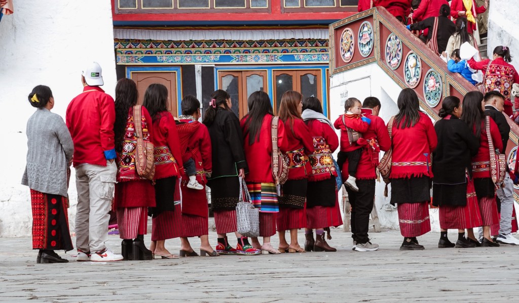
People standing in line to receive the Losar prayer 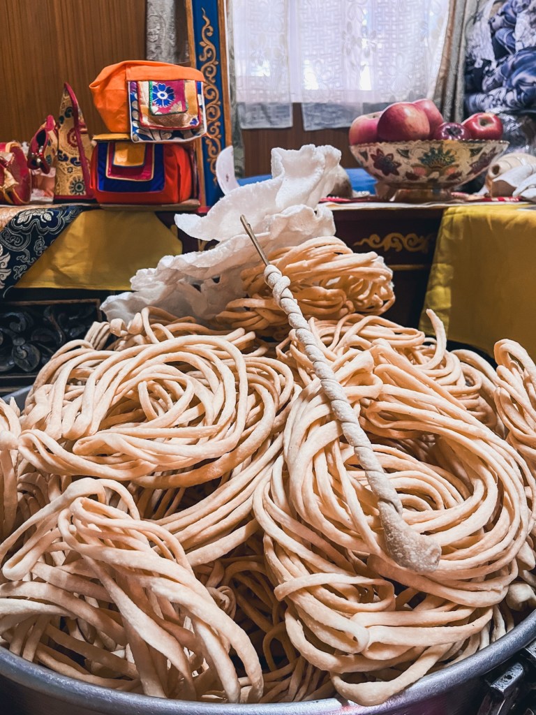
Losar preparations 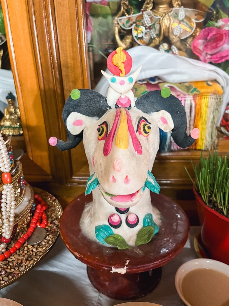
Losar preparations 
Losar preparations 
Flag Our host invites us to cheer the New Year with a few sips of the local millet wine in the early morning. The wine fogged our mind the entire day (not being used to drink at all).

Wine 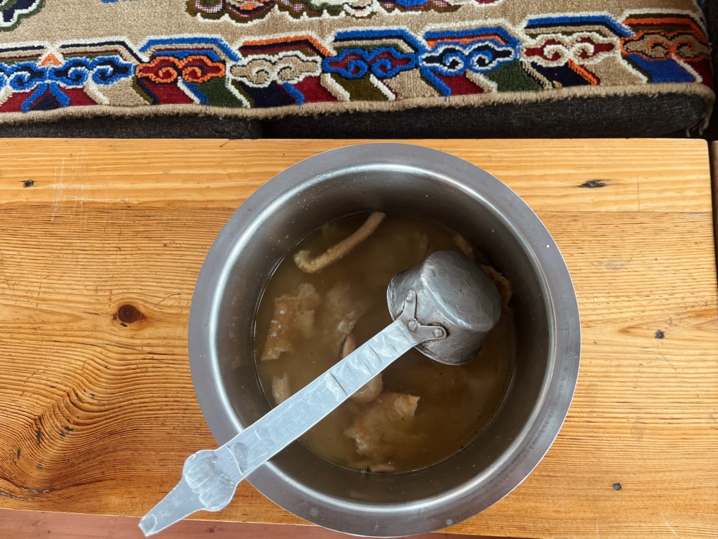
Wine We take the chance to join the cheerful group of North by Northeast for a transport back. Our bikes hop on the back of Rohin’s tiny Suzuki. A miracle car braving all the passes of the northeast as well as deep river crossings. It reminds me of “Sternschnuppe”, the pocket sized swissknife of a car of a dear friend! We hop in the support vehicle with the rest of the group, enjoying the chats and all the things we learn about the different regions.
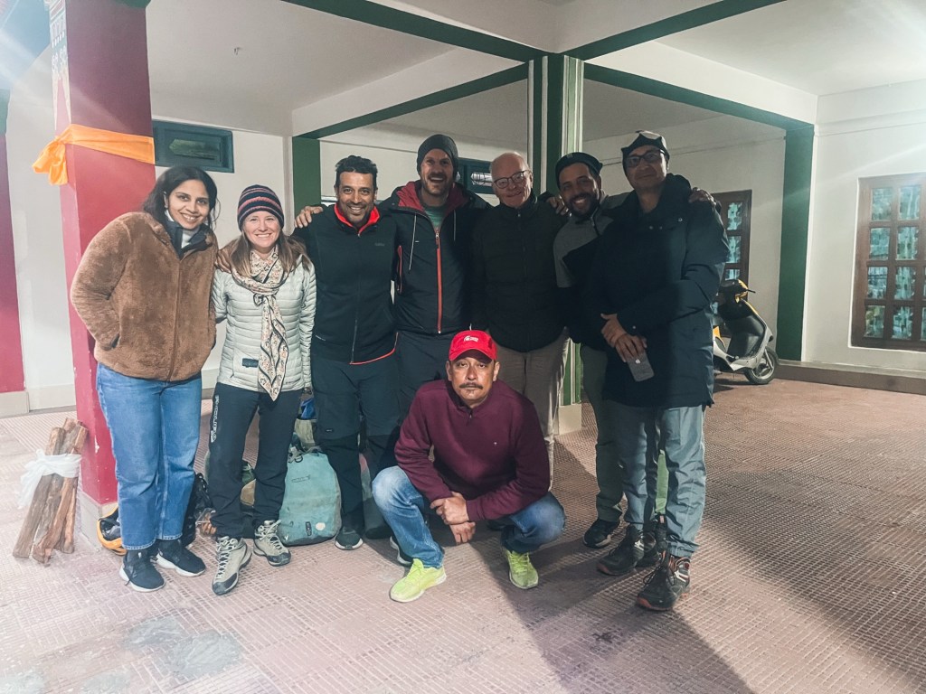
The group – Rohin is missing! Arunachal Pradesh – Road to Ziro
As soon as we leave busy Dirang the landscape changes. The forest is lush. Humidity increases as we go east. It’s a constant up and down. The road is becoming more of a track, and we are happy to be back on gravel after the smooth passes towards Tawang.
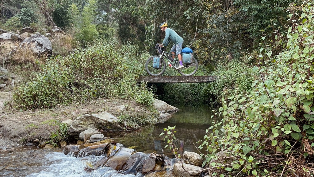
Fun detour 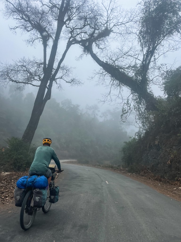
Misty rides With elevation gain the mist becomes so thick that one time we got surprised by a horse just appearing out of nowhere 10 meters in front of us. Spooky!! A few horses shred down a trail because we scare them on the quest for a camp spot. Camping here becomes easier yet it is still hard to find a spot which is flat and not populated.
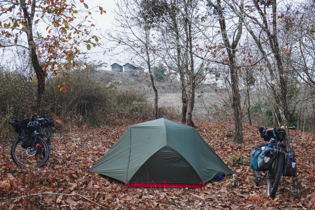
Camp We follow the Bichom river until a damm. Our trail is damaged by a huge landslide and it takes a bit of searching to find the way to the other side.
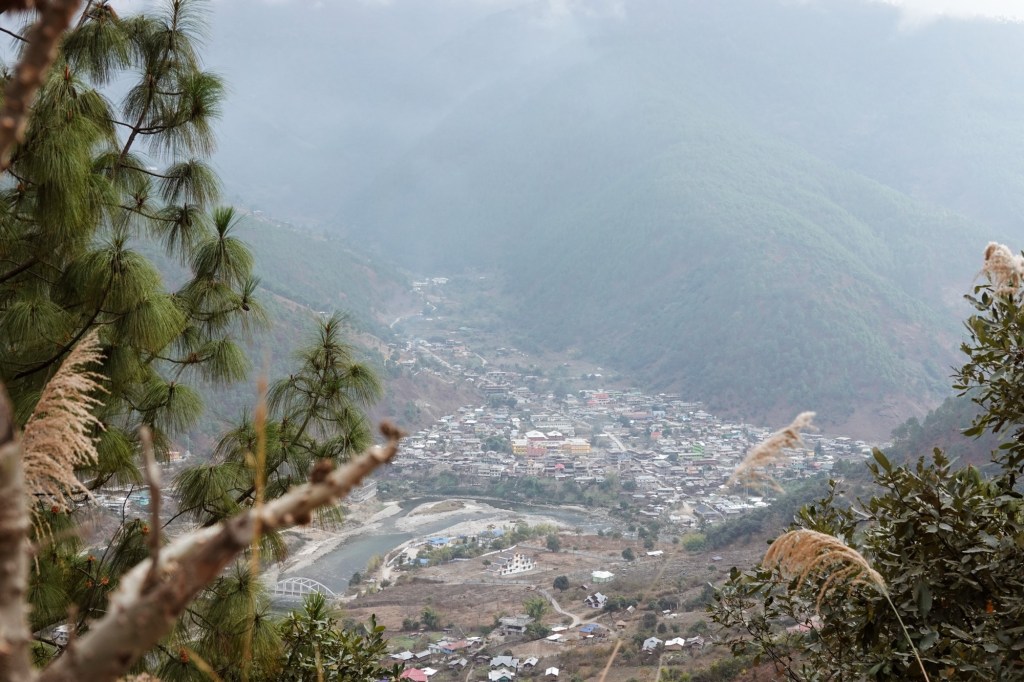
Overlooking Nafra 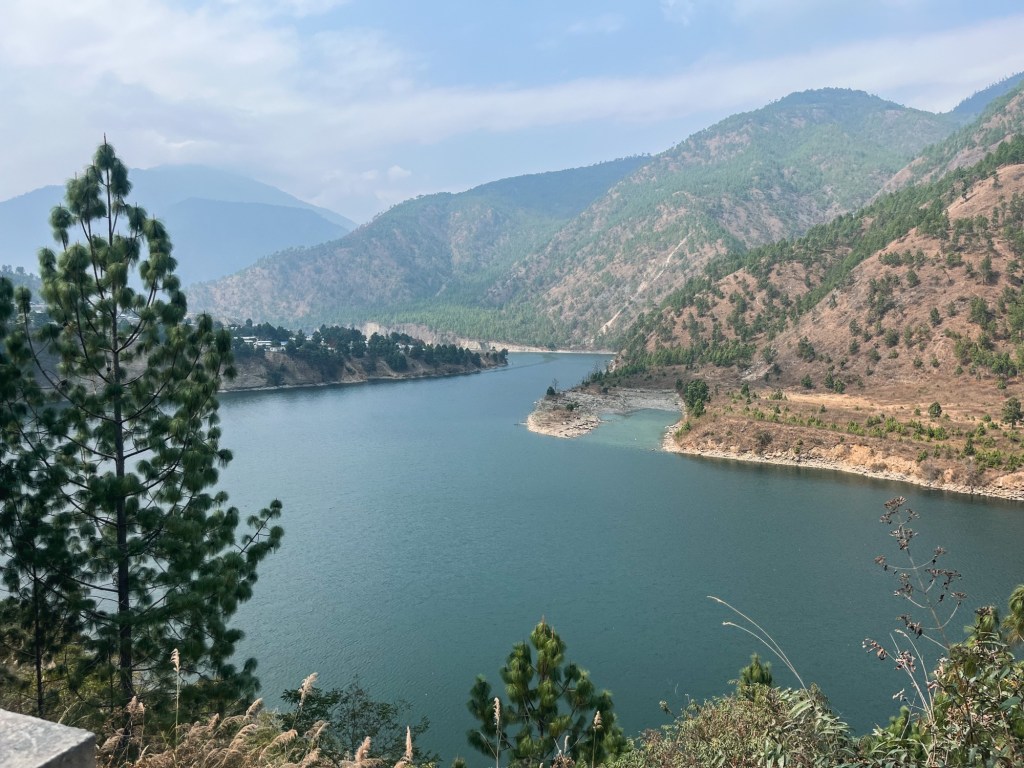
Bichom River 
Our path A steep track leads to the villages Thrizini and Palizi. It is quiet and remote. A few motorbikes pass by, Mituns greet us from the side of the roads and friendly yet often confused faces of people collecting wood turn towards or shake their heads.
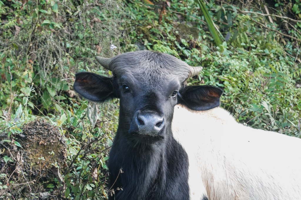
Mituns 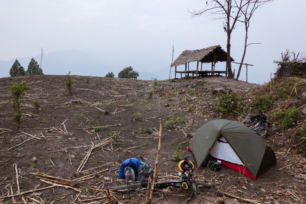
Camp spot 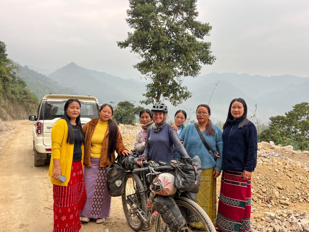
Encounters 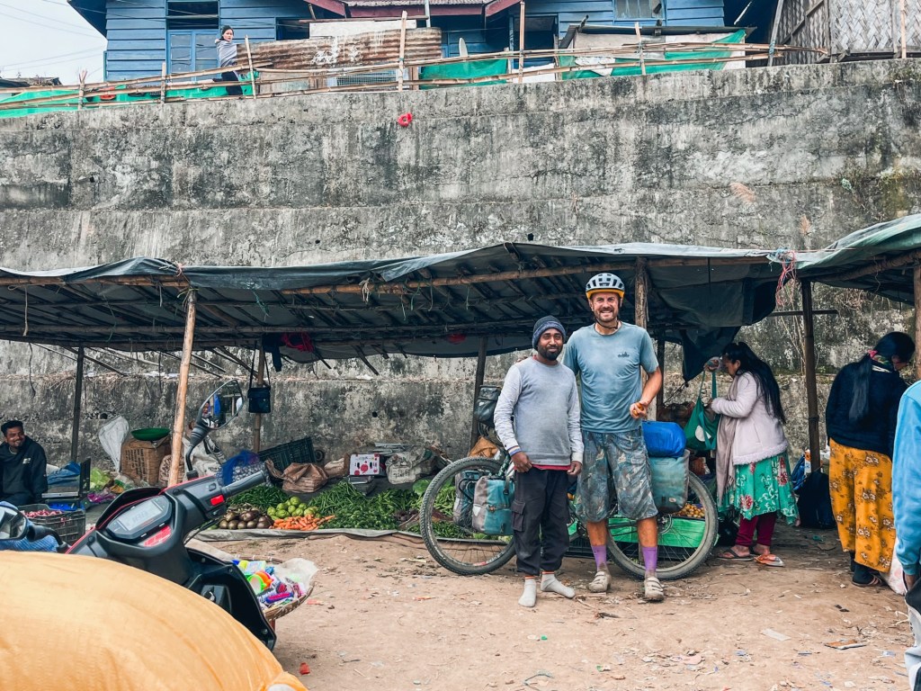
Market The air is thick, the humidity enters every pore of our bodies and sleeping bags. Mystic mist is laying over the valleys.
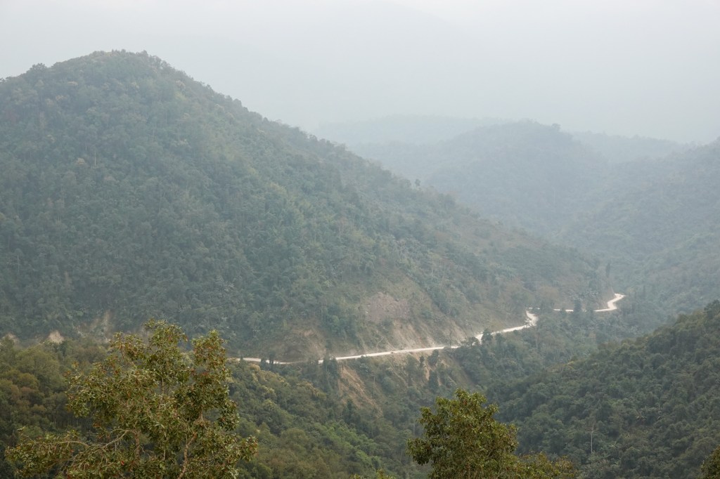

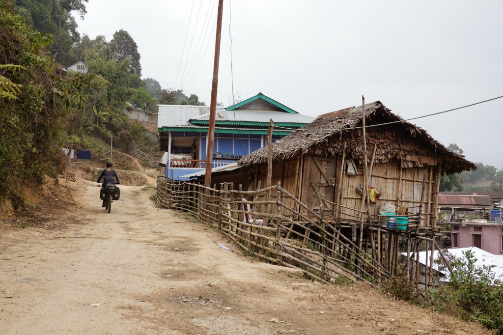
Our bikes were pretty easy to handle the past weeks but and now a new issue occurred. My back rack becomes loose again and again and we realised the thread is completely worn out. Superglue does the job for now…

Good breaks 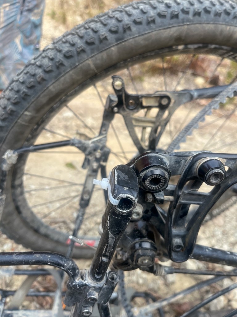
Forced breaks The way down to Seppa is rainy. Seppa means swamp and that’s exactly how it feels. The road is a maze of potholes and puddles.
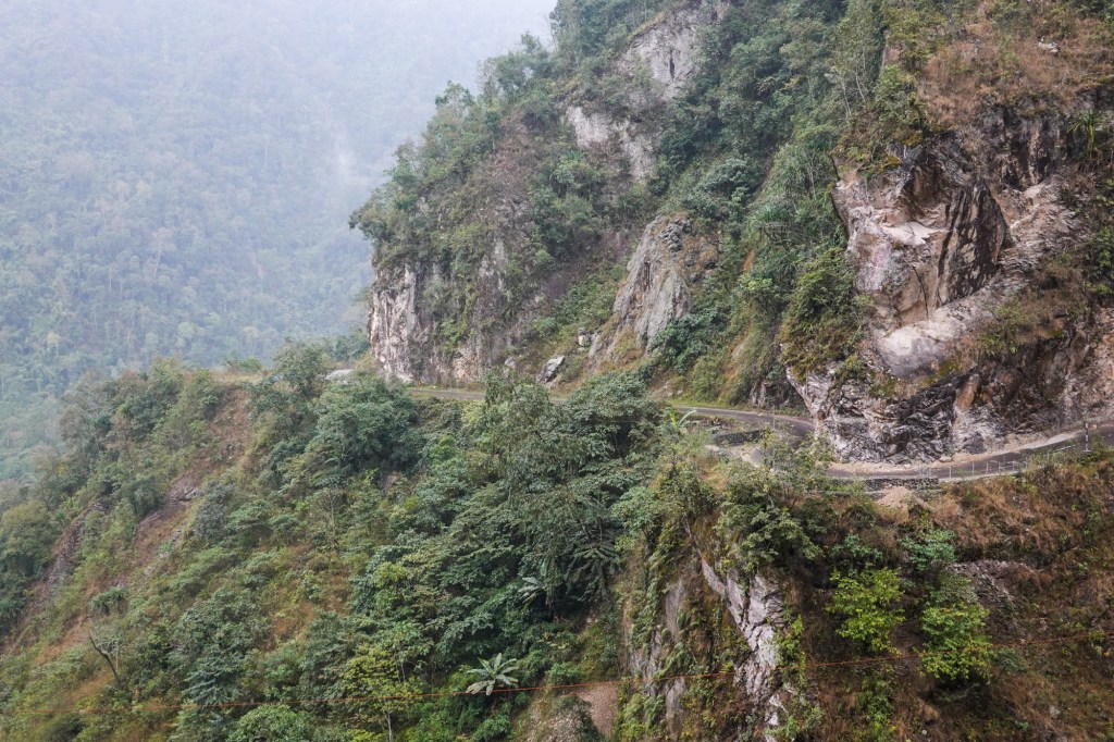
Road to Seppa 
?! 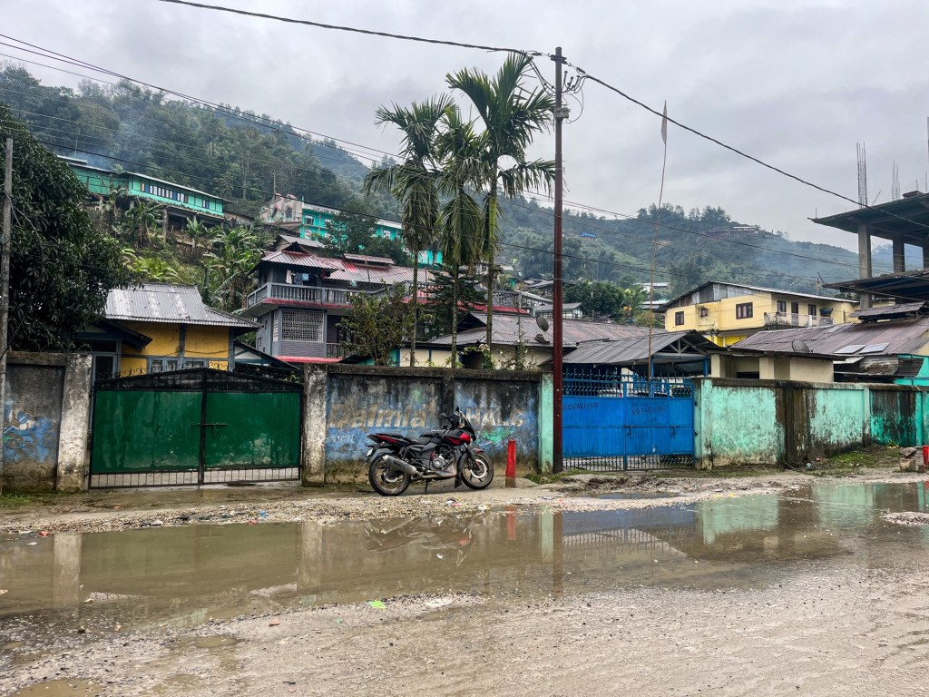
Seppa Another pass and we enter a different landscape. Fields are flooded, probably almost ready for sowing rice. We cross the Papu River and pass by the typical long Bamboo Houses.
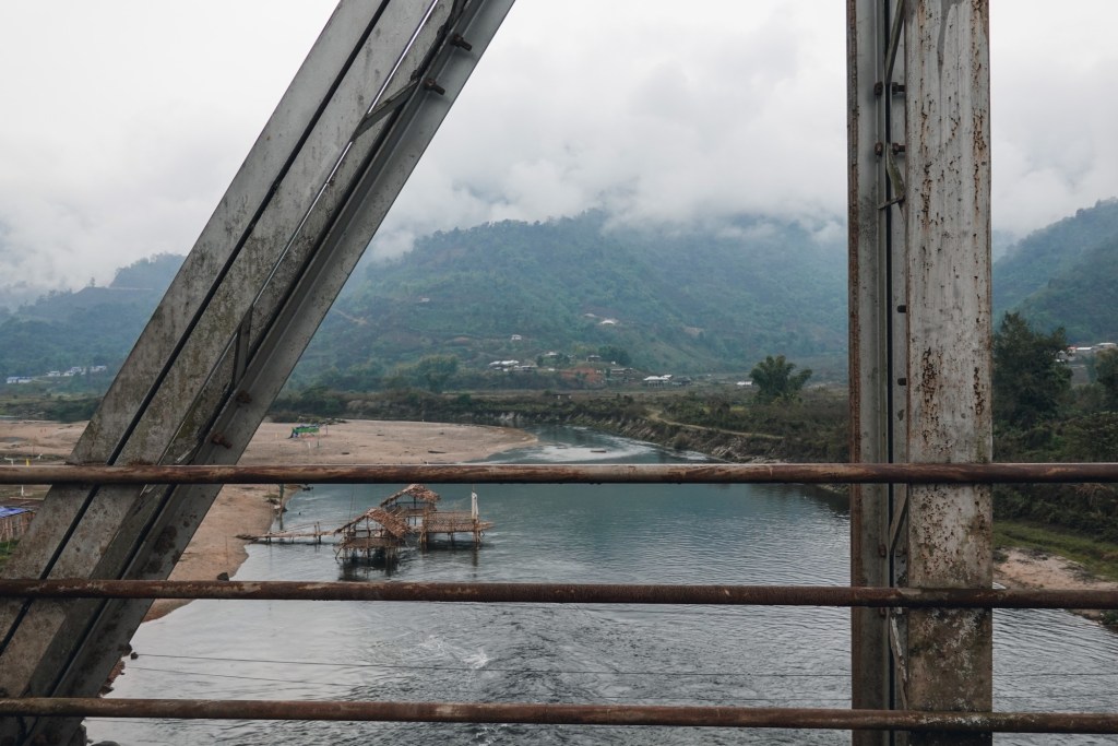
Papu River 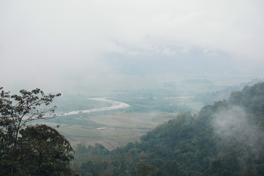
Fields 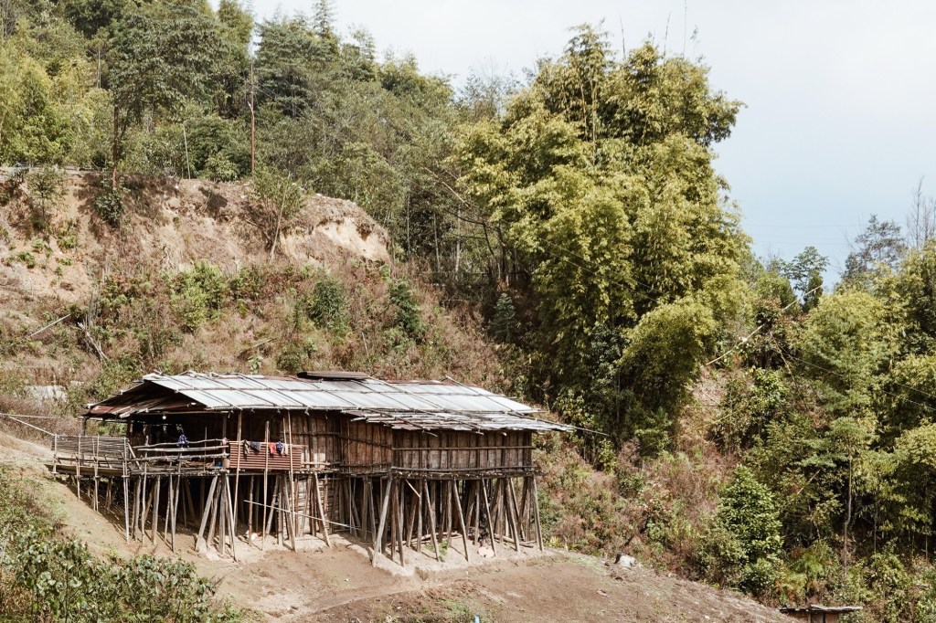
Bamboo Houses Spiderwebs squint towards the sunrays. The jungle lies on the steep slopes, overgrown with every kind of exotic green we like to have in our homes. It’s sounds – sometimes small, like those of a little mouse, sometime big like a marching band of elephants – indicating the vast life that must hide in it’s depths. We only get to encounter some birds, monkeys, a Himalayan squirrel and of course spiders and bugs.
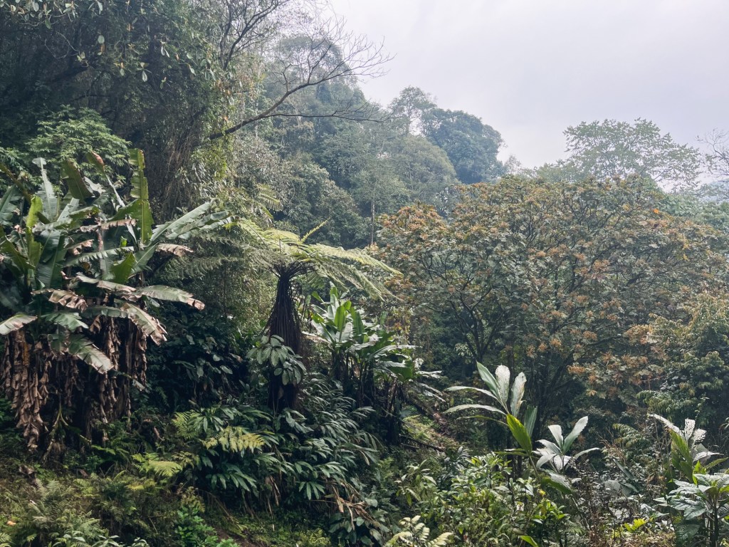
Lush oh so Lush 
Waterfalls 
Flowy jungle rides The little markets offer a variety of local greens, eco- friendly packed in banana leafs. We cannot resist the baby pineapples on the road side. And local mushrooms to add a new recipe to our camping cook book!
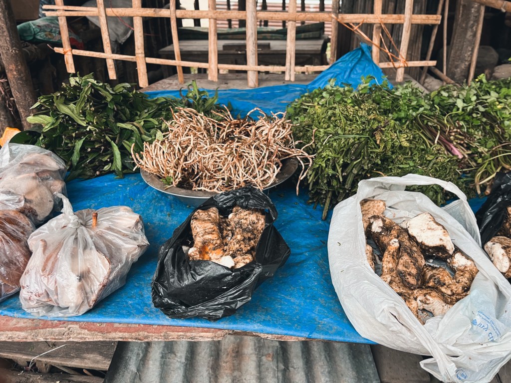
All kind of roots and greeens 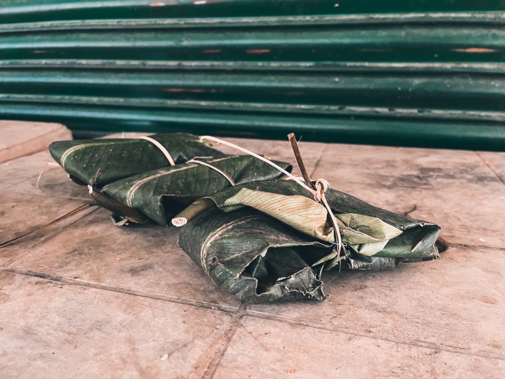
Mushrooms packed in banana leafs 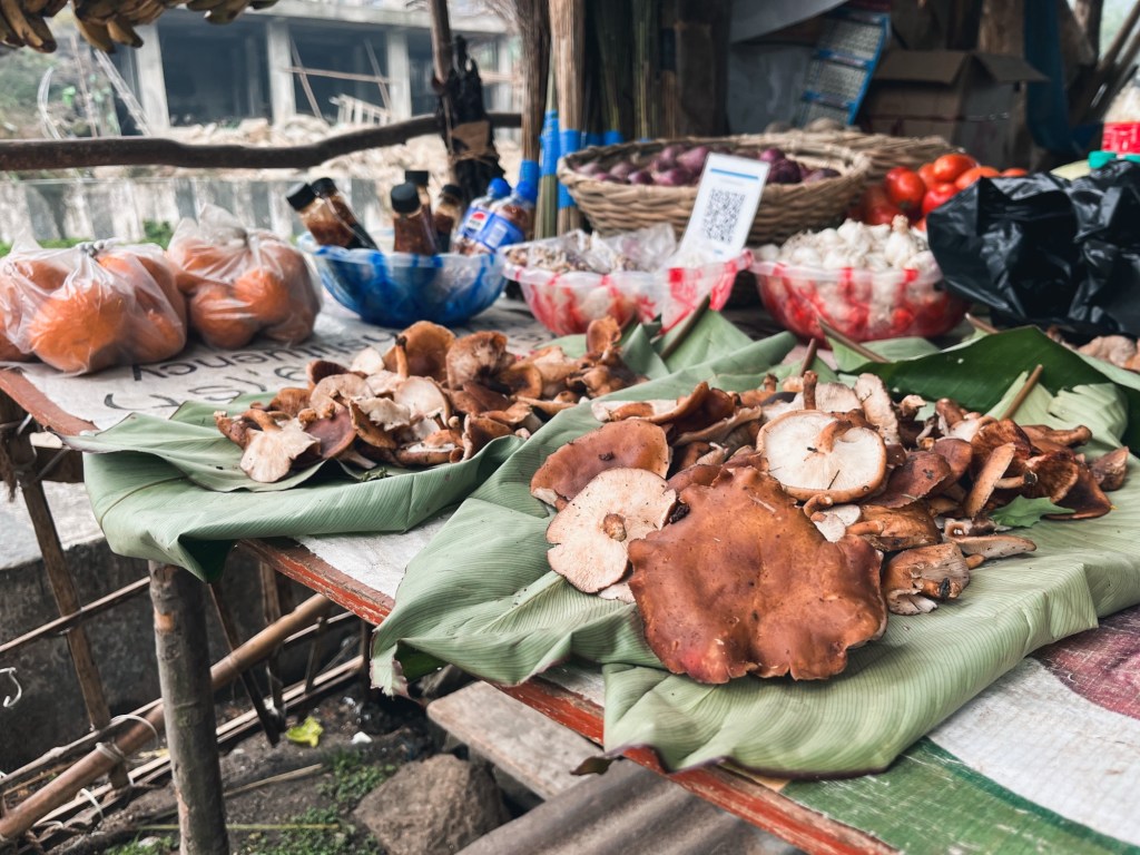
Mushroom 
Pineapple Inspired by the track of longest MTB race of India we head north at Sagalee and take the small road towards Ziro. On the way we pass through many Nyishi villages (one of the largest tribes of Arunachal). We see many Christian churches, on the way. Many people converted to Christianity, yet keeping their ancient traditions.
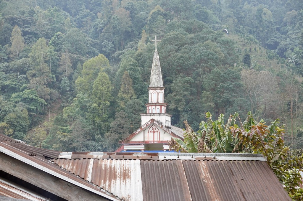
Church in Sagalee The green curtain of the forest opens the stage for a new chapter as a brown carpet unfolds infront of us: Mudmasters redefined! It is a beautiful road yet but is hard to cycle. It rained every night and so the roads turned into puddles of mud and deep thick sludge. We make slow progress as we climb one hill after another. Our km to elevation gain ratio is about 100km to +2000m. Four days already and the legs and the lungs feel tired! The humidity provokes a cough during the last days. And so we huff and puff – still smiling – through the beautiful landscape. Yet Ziro is coming closer as we pass through Pistana.
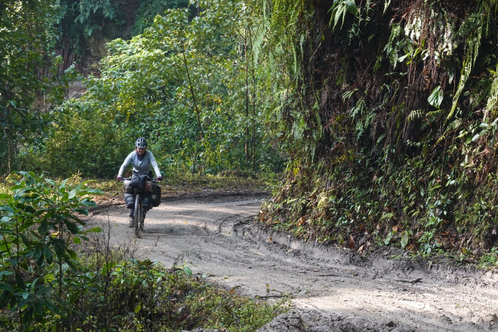
Mudmasters 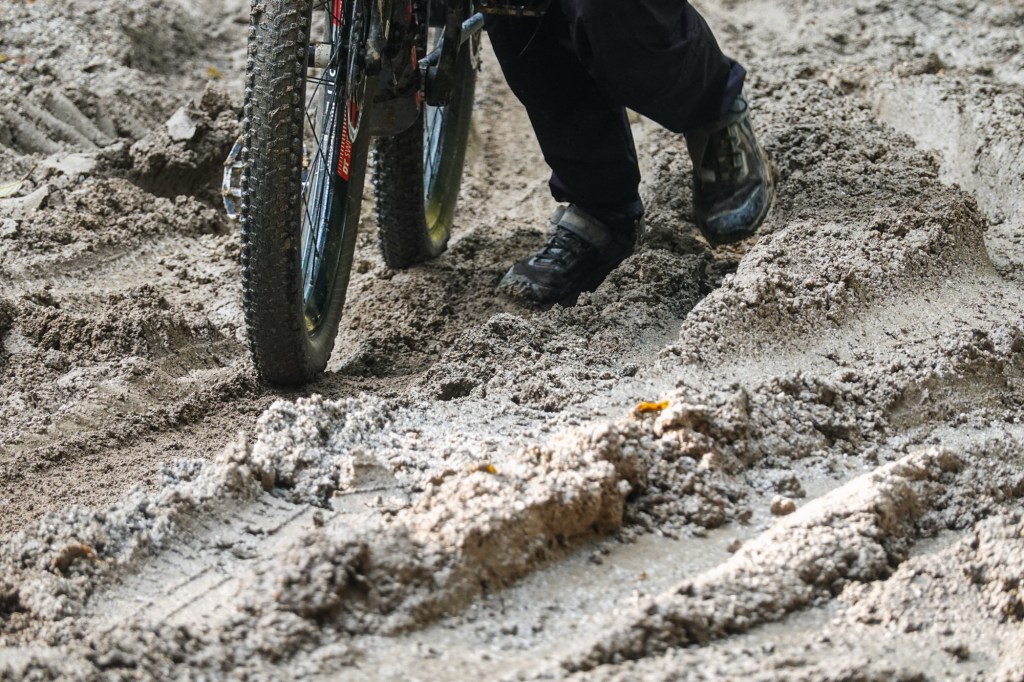
…. Happy to arrive in Ziro, we find a place where we can eat Dosas and a nice little cafe. Rain drizzles over the busy town. Honestly we didn’t expect Ziro to be that big. But our homestay is a in old Ziro, in a quiet area. New houses mixed with old traditional bamboo huts. Our host gives us a tour through the village and we ride to the lake and a viewpoint.
Houses 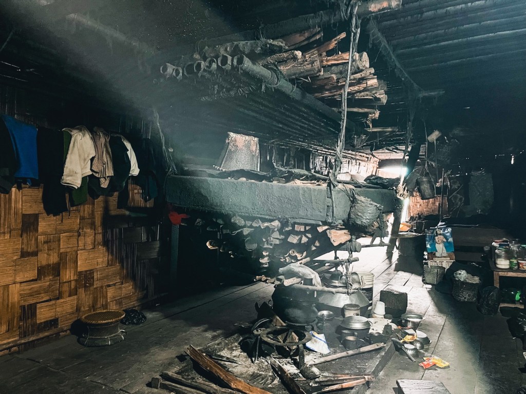
Houses 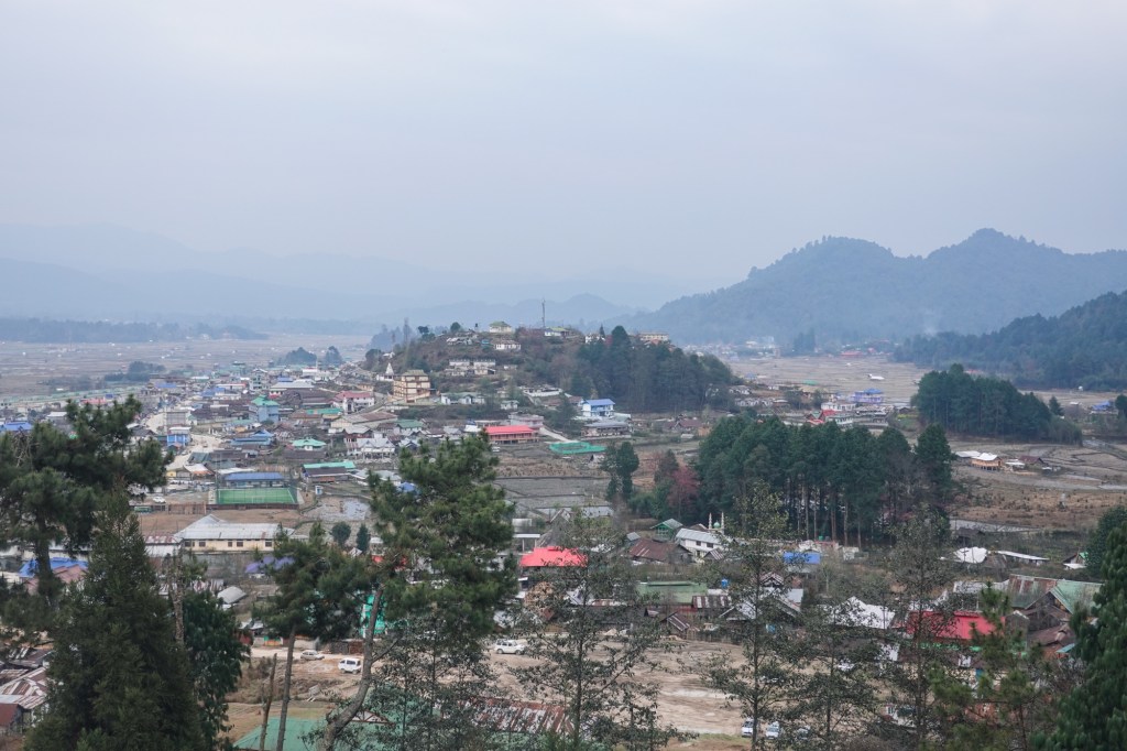
Old Zirk 
Fields In the evening we enjoy the warmth of the fire. The houses here have a central fireplace – in the middle of the room – where everyone gathers.
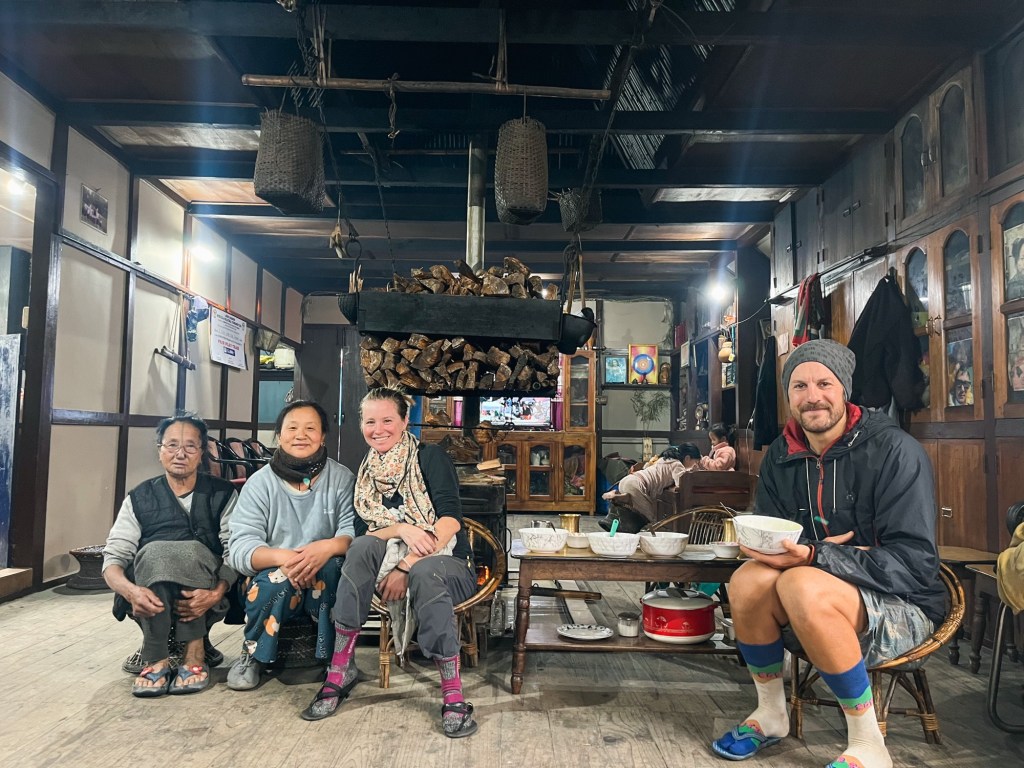
Homestay Our last day in Arunachal has come. Looking at a map we realise we only crossed 1/3 of the region. There would be so many places to explore as the region is so big. We head back to Assam and plan to dry our sleeping bags in the lowlands for a few days as we bike to Majuli Island, a river island in the Brahmaputra.
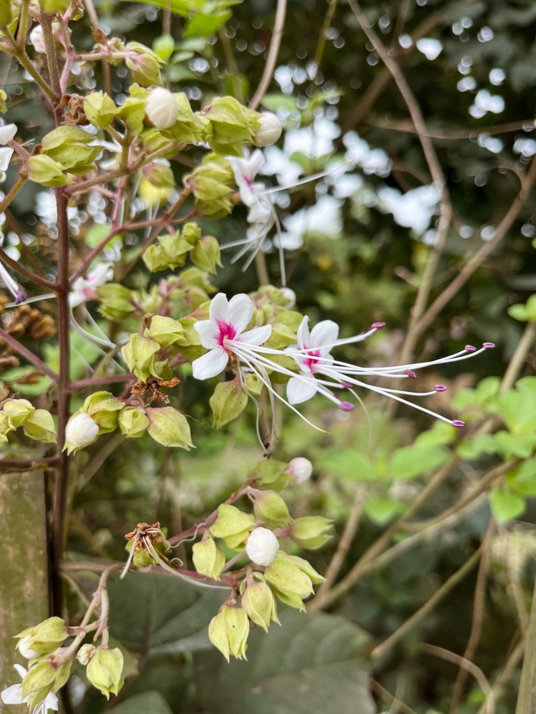
Assam 
Assam 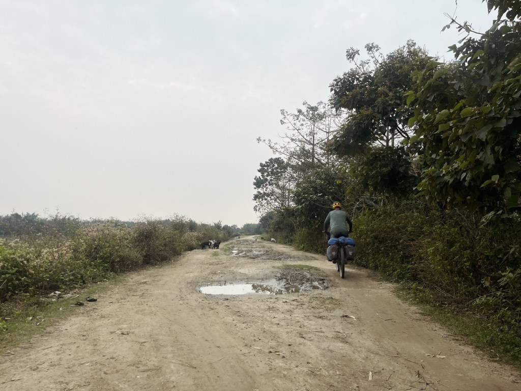
Tracks 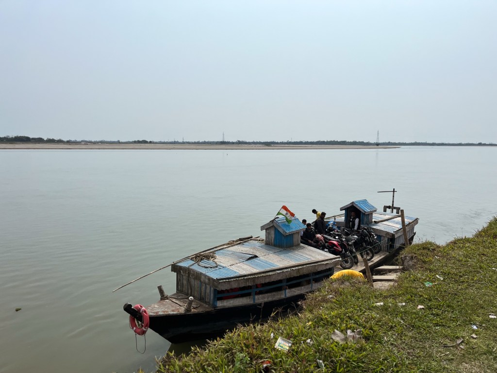
Ferry rides A few more Kilometers of dirt roads, one broken chain and a ferry ride later, we arrive in our little bamboo cottage. Route planing, research, washing, !drying! and relaxing is on our agenda here.
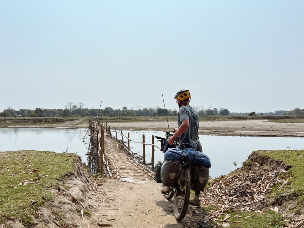
Toll Bridges 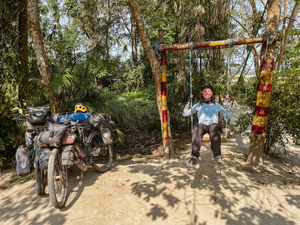
Hanging out

