Nepal Adventures continued
Better late than never – welcome to our tardy travel diary from May and June 2025, where we pedaled our way through a stunning region and potentially uncovered our most adventurous cycling routes so far. We also managed to do some trekking in the Khumbu Region and stumbled upon a decent amount of wildlife in southern Nepal!
Dolpo – The Hidden Land
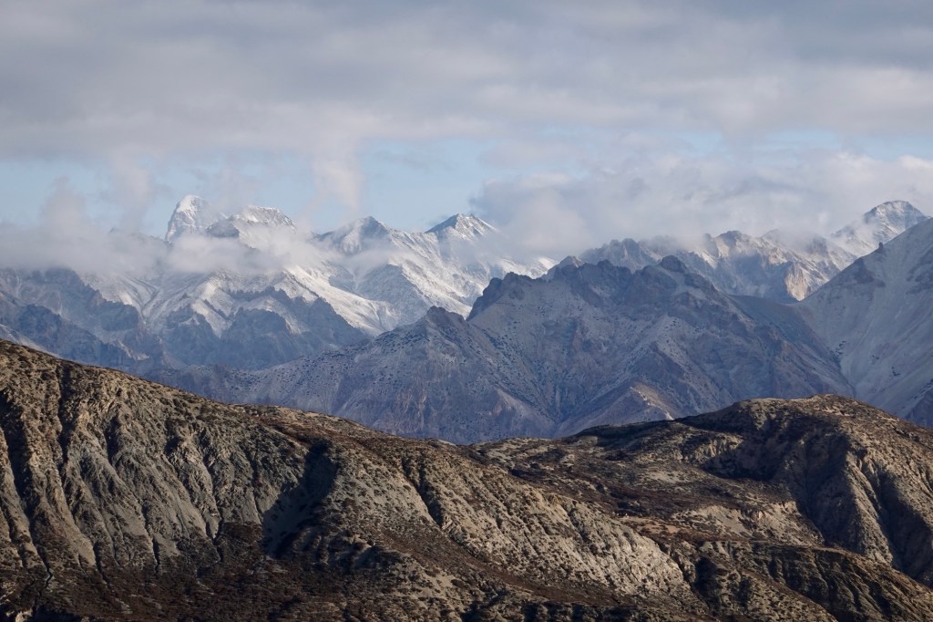
Dolpo, a breathtaking area nestled between lush hills and the majestic Himalayan giants, sits on the edge of the Tibetan plateau. Known as the hidden land, it presents an exciting adventure, as reaching it, particularly its northern part, offers a challenge. How hard? We will uncover that soon enough!
Planning Game
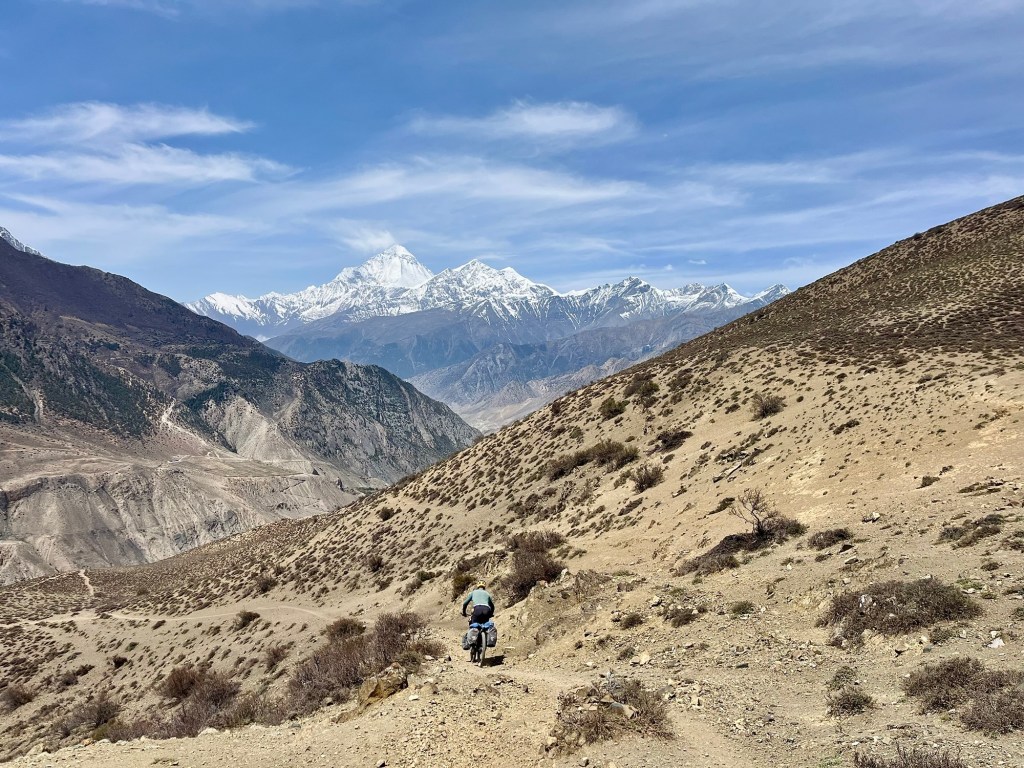
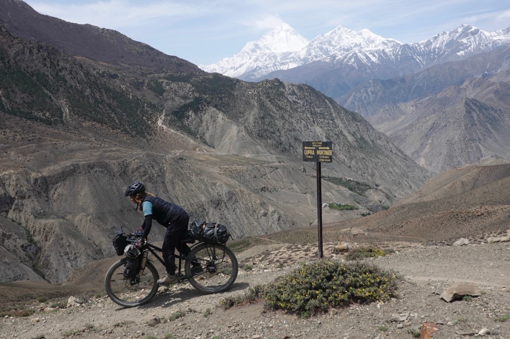
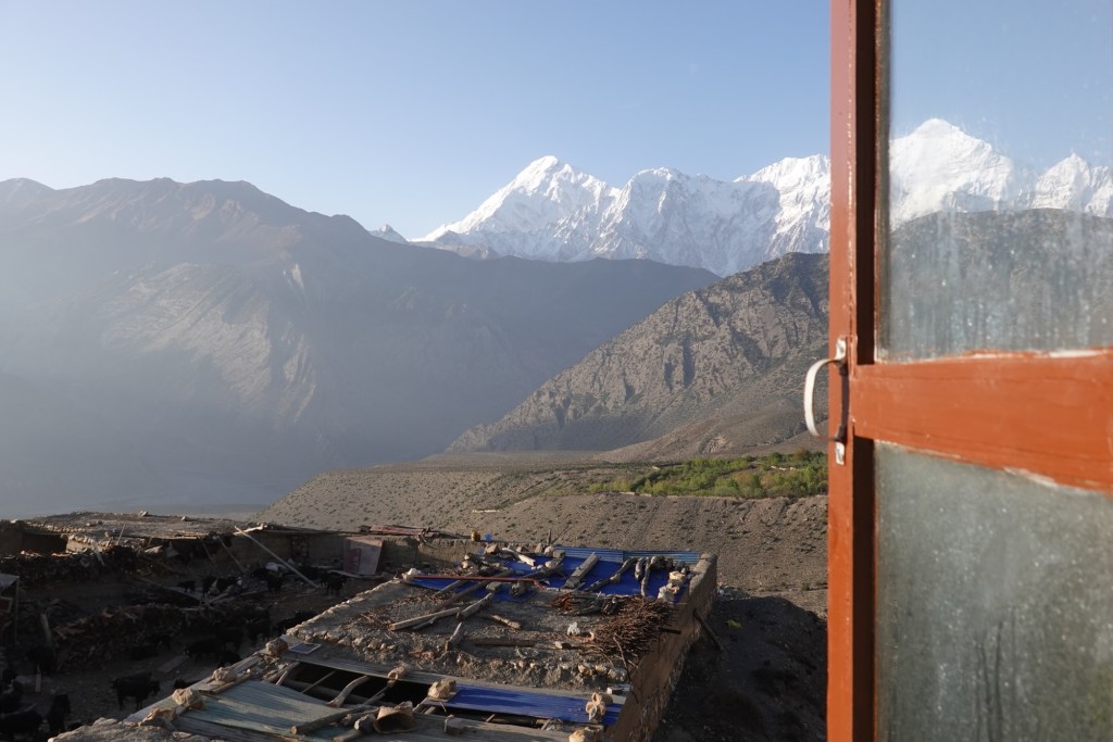
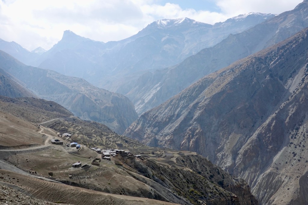
It all began a few weeks ago in Kathmandu, right in front of a map of Nepal. Where else would any adventure story commence? The hostel owner pointed at the map, revealing an exciting option to traverse the Himalayan range westwards towards the hidden valley of Dolpo. The challenge is that there’s no road marked on the map—only a network of trading trails that have become hiking paths for tourist. Some bigger, some smaller – from a distance it is impossible to say what is a challenging hiking trail and what is a gravel road, as all of the trails have the same category! This area was completely off-limits to tourism until the 1980s. Naturally, our curiosity was piqued. Now that we’ve reached Muktinath, there’s no way we’re going back down to the flatlands on fresh tarmac. We are surrounded by majestic peaks and on the brink of the Tibetan plateau, truly in biking paradise. While information about our plan is scarce, local bike shop owners have connected us with a MTB rider from Kathmandu who has triumphantly completed the Great Himalayan Trail on bicycle (what a champion!). Here you can check out his epic adventure! Thanks to them, we’re piecing together the missing links.
After countless hours of Google Satellite Images and grilling locals about those “new roads” and cycle friendly hiking paths we still find ourselves staring at a map full of black spots. Turning back isn’t just a possibility; it feels like it might happen to 50%! We’re mentally prepping for the prospect of being sent back due to restrictions or getting stuck in a terrain better suited for a goat than a human. And let’s not forget the joy of packing hamster food. After two days of planning we finally gear up and head out of Muktinah. Our excitement is bubbling, giving us that delightful flutter in the stomach, while a tiny little voice in our heads seems to be saying, “Are you sure this is a good idea?”
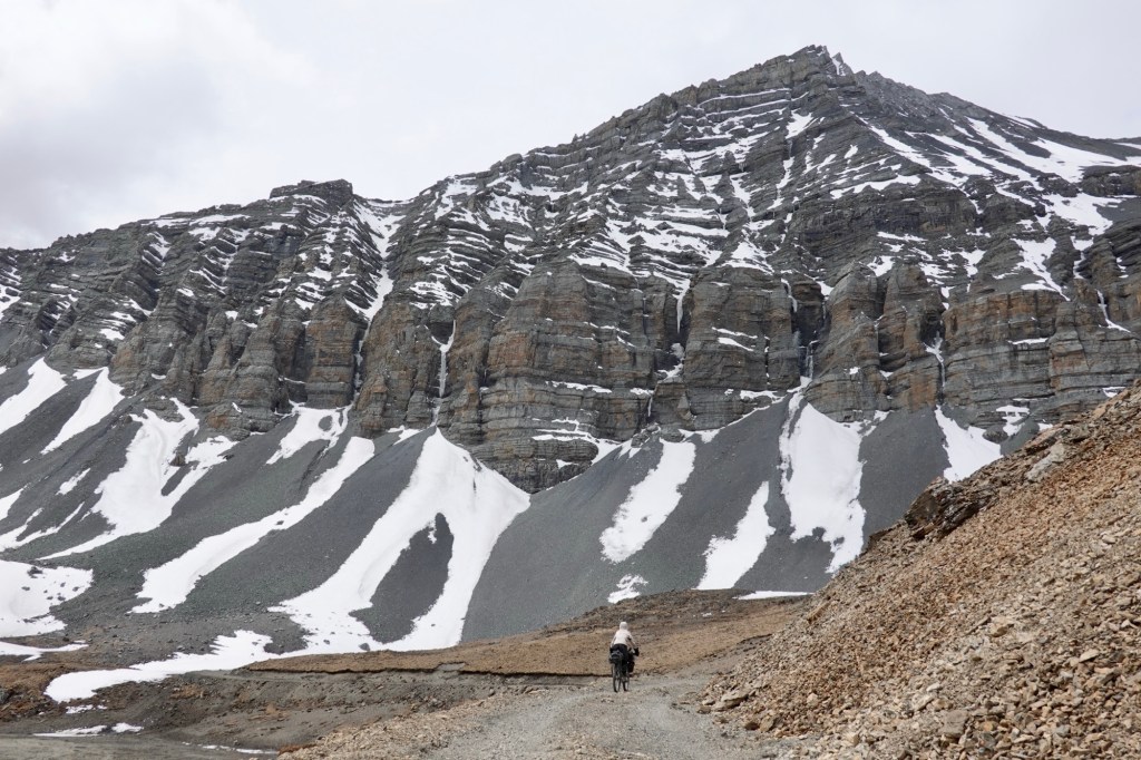
Magic Trail
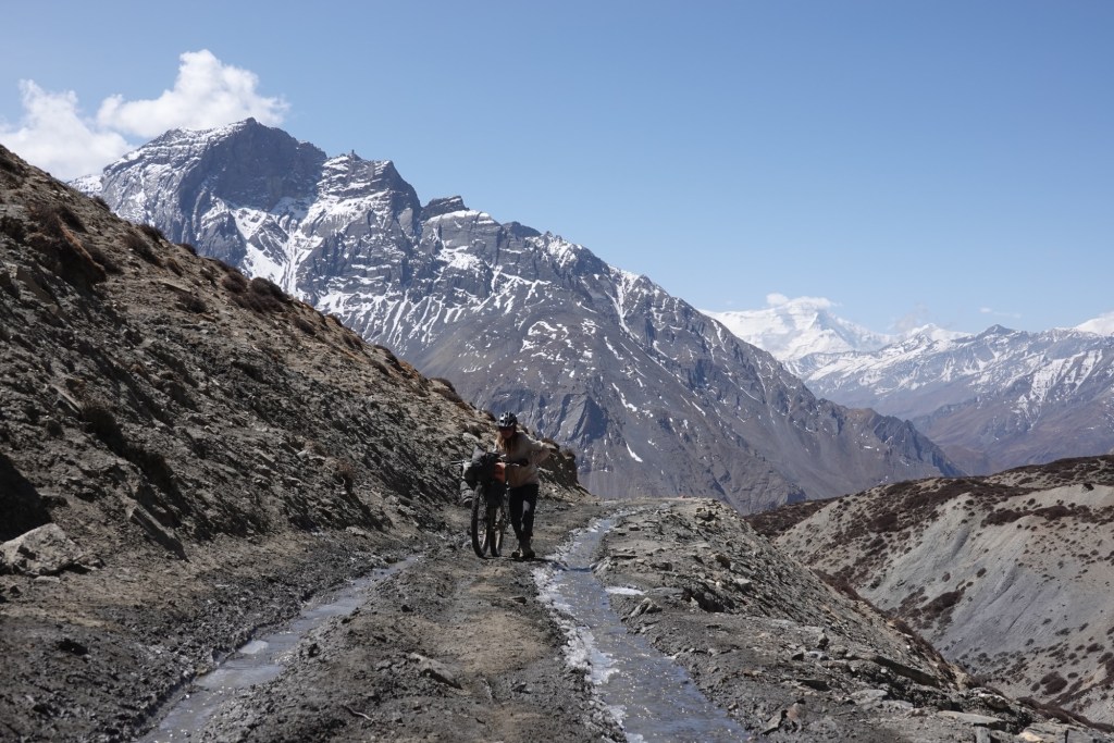
The morning dawns as we prepare to leave enchanting Muktinah, embarking on what is revered as the magic trail which is leading us to Lupa. Awe-inspiring vistas of Daulagiri unfold before us, each turn is an adventure filled with exhilarating twists, while we embrace the challenges of washed-out paths that seem to vanish into the breathtaking landscape.
We pass through Lupa and briefly check out an ancient meditation cave.
In Kagbeni we indulge in a much-needed food and supply stop. The menu gleams with excitement: cabbage rolls—what a delightful surprise! After one final shopping session, we pack away food for five days with meticulous care, readying ourselves for the thrilling unknown ahead—tracing the tracks to the west. However, our eagerness is met with a challenge as the first day is abruptly cut short; the heavy winds roar, making riding nearly impossible, and we find solace in the cozy guesthouse in Phalyak village.
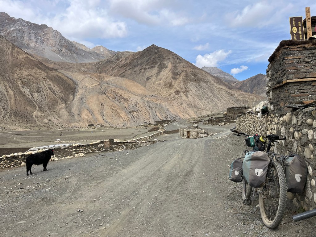
As we progress the next day we get wonderful views over the mountain range. Tracks are empty only a few tractors pass our path.
We pass by sleepy Sangda and follow the newly constructed dirt roads which are not yet marked in our maps.
Camping options are plentiful. We find a beautiful spot overlooking the valley!


Entering the “hidden land” – where the road ends and the fun starts
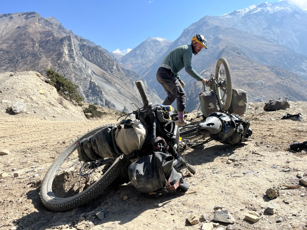
The next morning kicks off with a bit of drama! One brake pad apparently decided it was time to retire early and went on strike, blocking the disc. We both reminisce about that debate in the hostel in Kathmandu while tinkering with our bikes: “Should we bring brake pads or not?” “But we just replaced them!” “Yes, no, maybe, okay, YES!” (I do not know why we even had this discussion – it is a must have in a repair kit) And where the heck are they anyway? Maybe the cheeky Kathmandu monkey gang nabbed them while we weren’t looking!
Determined not to let brake pads ruin our adventure, we get creative and declare that “1.5 brakes” on my lighter bike should do the trick, as long as I treat the brake like a fragile piece of art. And just like that, the drama comes to a close—lesson learned! Now, who’s ready for some coffee?
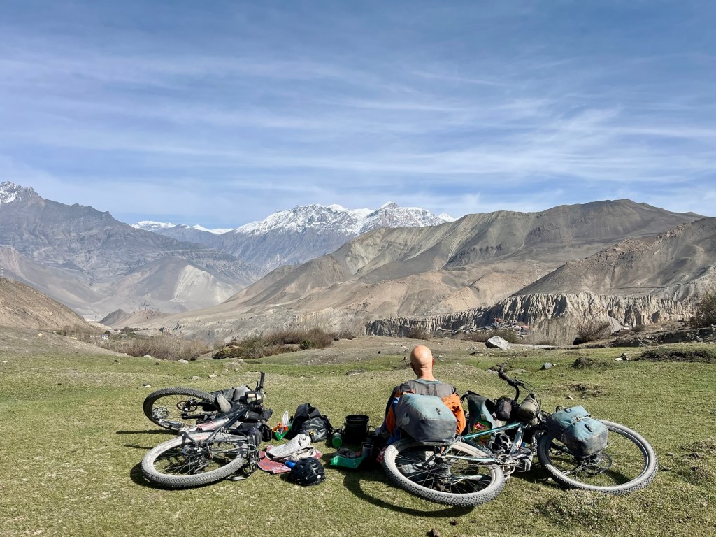
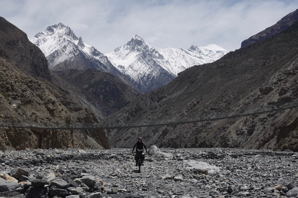
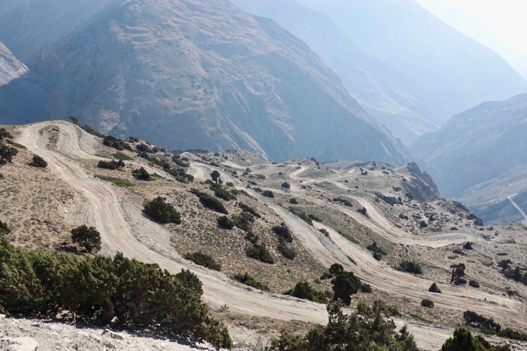
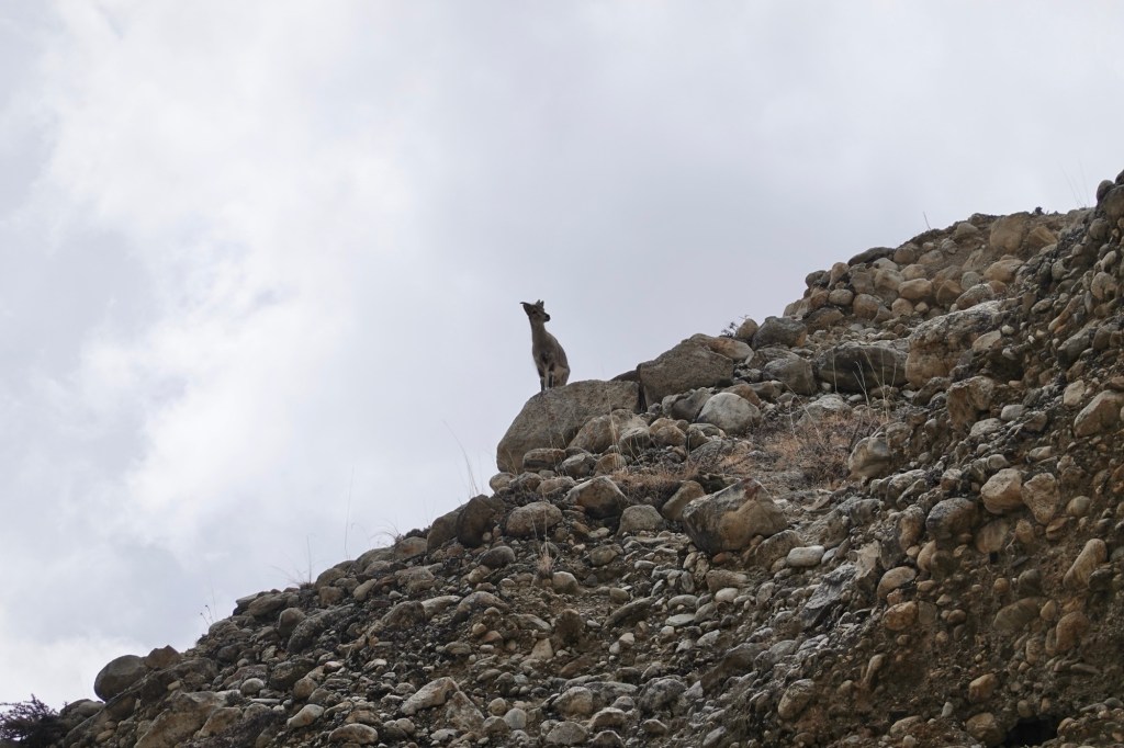
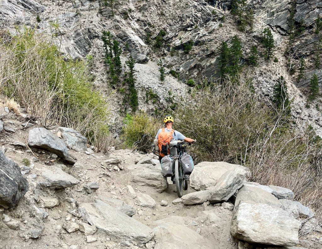
The tracks leads over a beautiful plateau towards a canyon. It is way smoother than we expected, hard packed gravel. Wild goats graze on the dry slopes. A gentle breeze follows us, the sun stings on our skin.
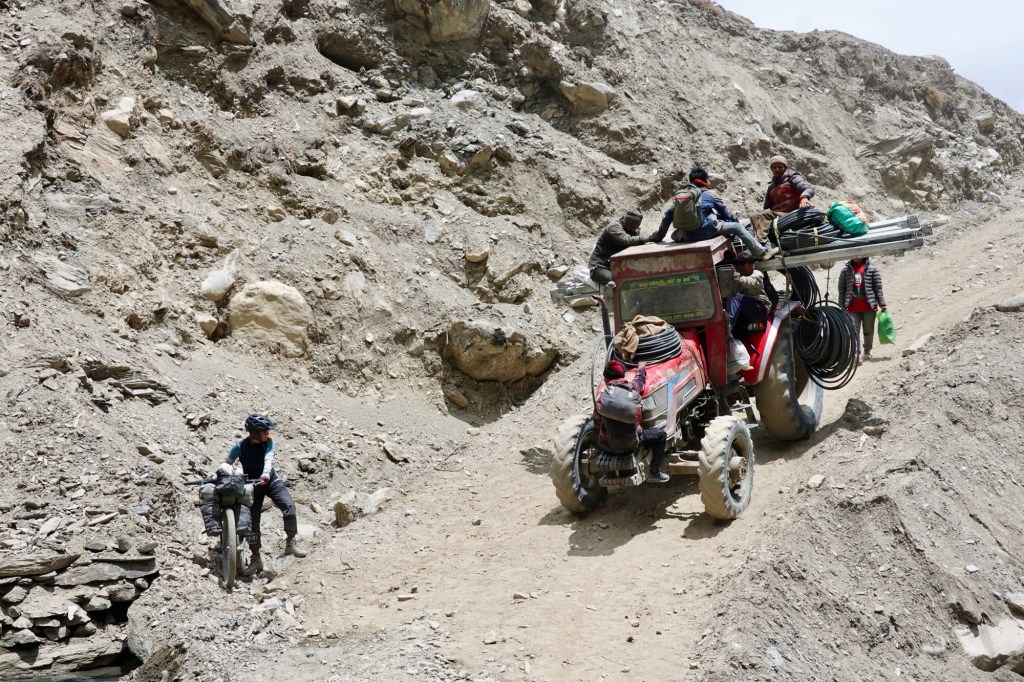
A few kilometres later, we encounter the tractors from yesterday once more. We have arrived at the end of the dirt road, a bittersweet moment that stirs the spirit with adventure.

This is the gateway to the area we are so eager to explore. Only to be reached by foot or hooves.
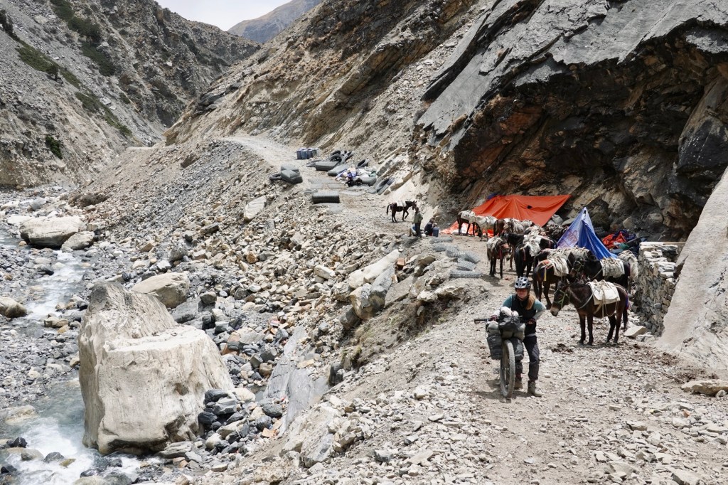
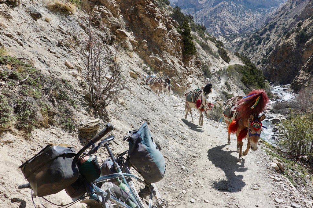
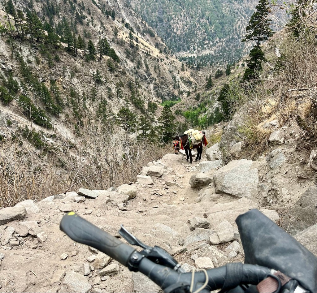
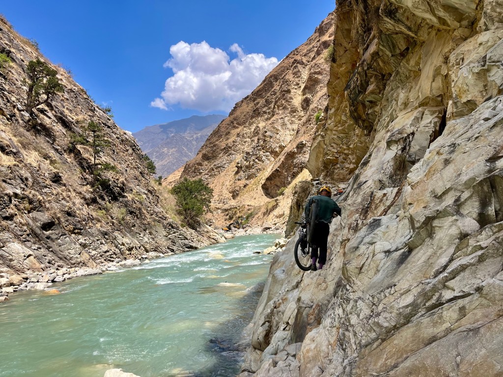
The canyon unfurls boldly before us. The river surges downward. The water level is thankfully not too high. While the tractors unload and goods are packed onto donkeys and humans, we fill our backpacks to the brim, preparing ourselves to carry the cycles up the canyon in two strong turns.
Bags of food, pipes, and building materials are carried up as they supply the remote villages of Dolpo. We follow the human and donkey-powered supply chain, trying to keep up with the pace. Chatting, smiling, and laughing, we navigate the riverbed together, united in our mission, each with our own motivations. Although they inform us that the route we’ve chosen is challenging and lengthy, their encouragement fuels our desire to explore the area. One of the men lifts Rolfi’s bike, helping us carry it with a broad smile up the canyon.
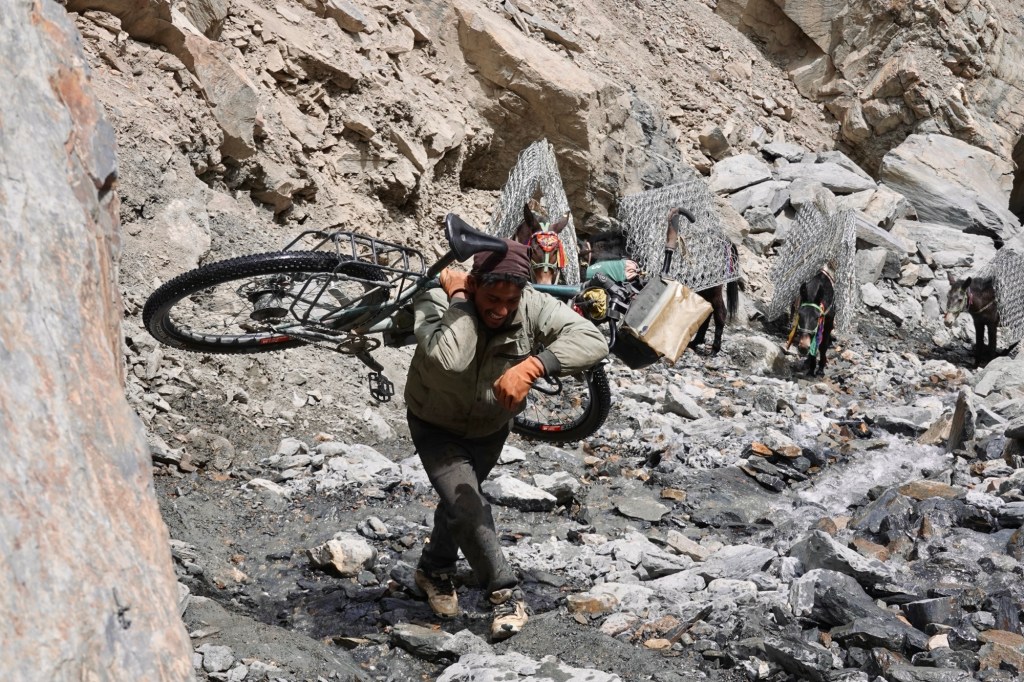
Us, embarking on this tough route for “fun and adventure,” while for him, it signifies days spent away from the comfort of home and facing a challenging, often perilous path. Yet, with a genuine smile, he is eager to assist us, carrying yet another load. It’s difficult to articulate the depth of such situations and the kindness that is offered amidst the struggle.

I am surprised by my physical capability to carry the heavy bike and bags up that challenging terrain. At over 4000 meters, the air is thin and our lungs feel the strain, but the thrill of experiencing this unique route makes it all worthwhile. We are discovering a different side of Nepal, far away from the tea houses and tourist trails. After carrying the bike, we push onward, navigating the steep and rocky slope as we gain altitude.
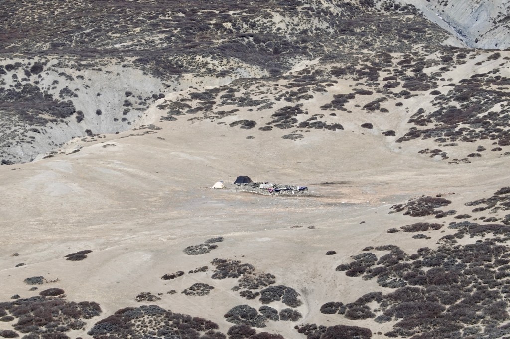
Then we reach a temporary camp where the guys and ladies are chilling out and getting some shut-eye for the night. This is where they load up all the gear onto vehicles, motorbikes, and donkeys to take it into the villages. They’re planning a road, but since the terrain’s very challenging, it’ll be ages before it’s done.
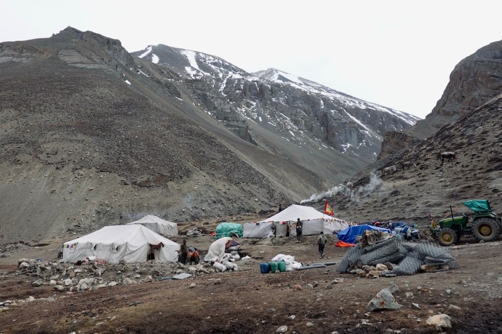
We gather for some butter tea, a traditional Tibetan beverage made from hot water, salt, and Nak butter (female “yak” butter—Pure energy, right?). Rolfi isn’t quite the butter tea enthusiast and slyly swaps our cups. As we plod along a little further, the trail remains as steep, but the terrain is more forgiving. Hills are rolling, and so are our tires—thank goodness! We’ve managed to cover less than 20km today (not including those parts we walked twice). Though this might be our least “successful” cycling day, it’s definitely packed with unforgettable memories and those moments that you just can’t make up!

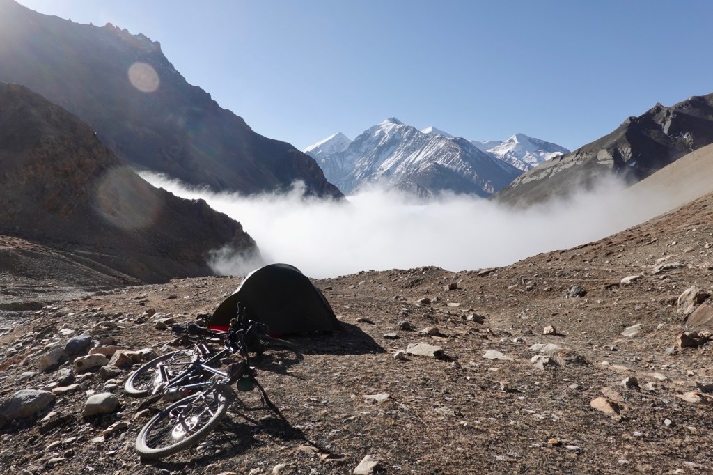
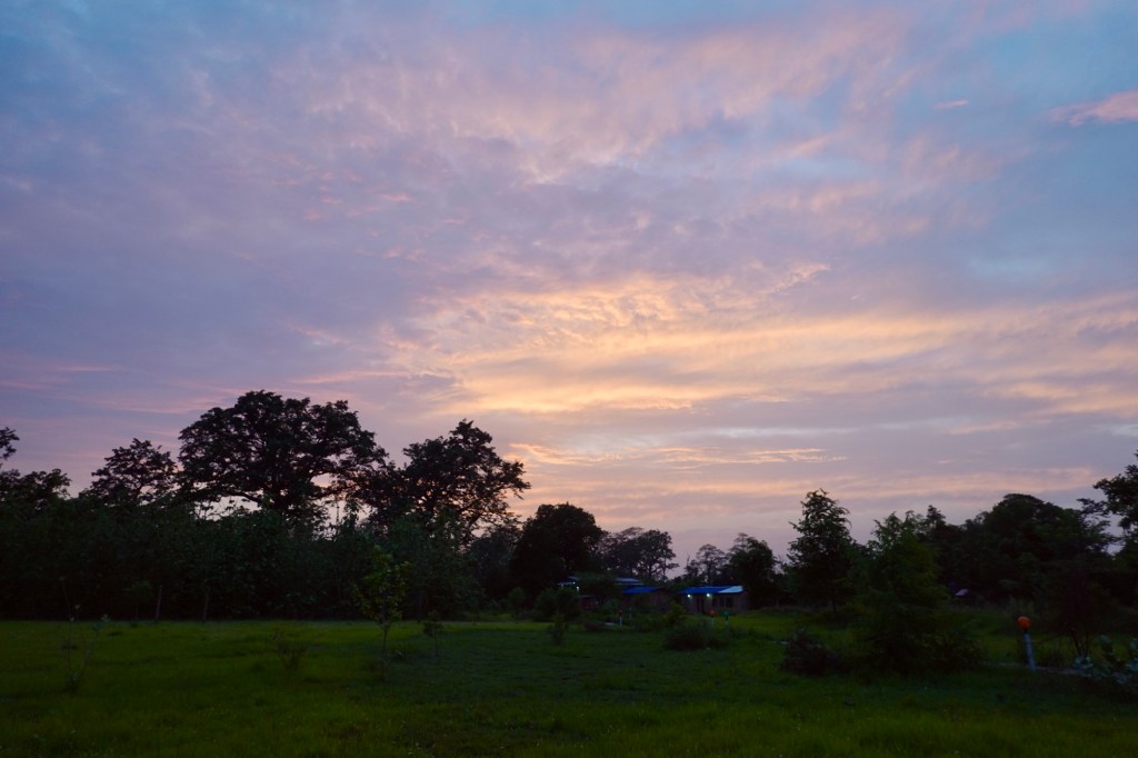
The next morning we wake up to a breathtaking day full of promise. The canyon thrusts a magnificent, thick white wall of clouds toward our camp. Just a few meters in front of our resting place, the clouds dissolve in a dance of ethereal beauty. We sit, captivated by this spectacle, inhaling the thin, tranquil air that surrounds us, feeling so alive in this moment.
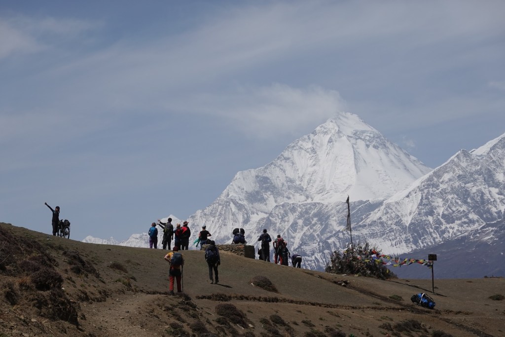
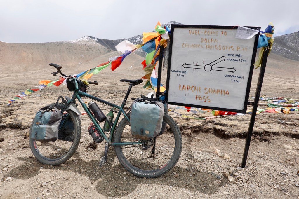
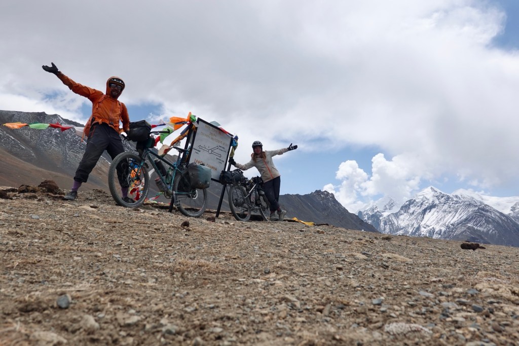
After a slow breakfast we head to our first pass: Lapche Sharma La 5152 m.

A spectacular downhill rewards us for yesterday’s efforts.
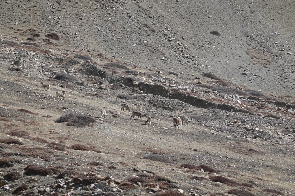
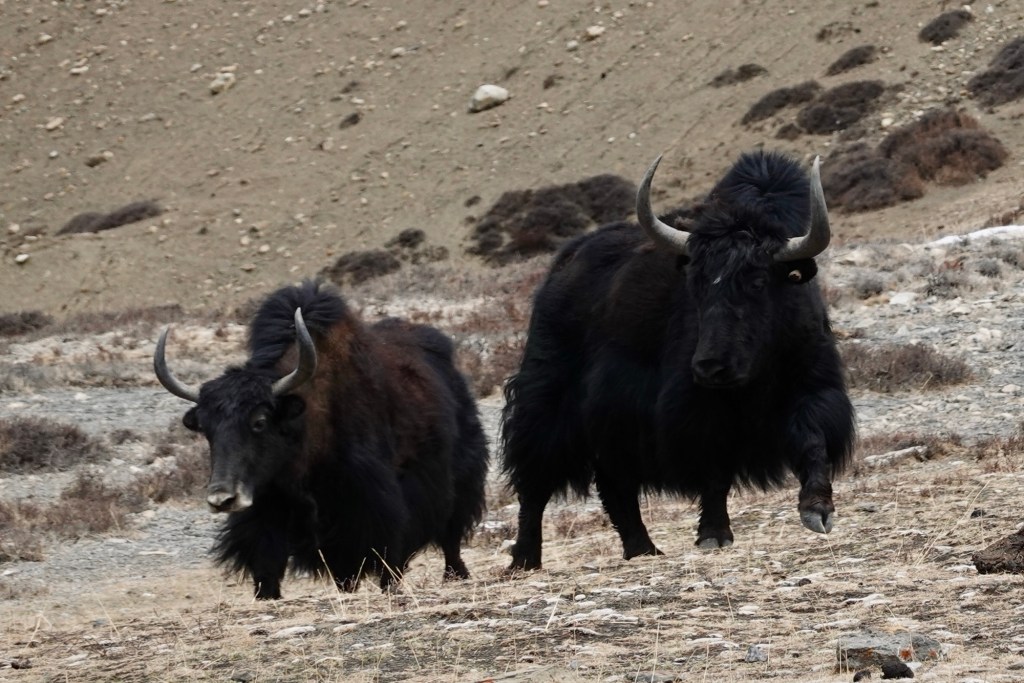
A small herd of yaks ambles across our path, still dressed in their winter outfits like they just came from a mountain fashion show. They look so fluffy, but also massive!
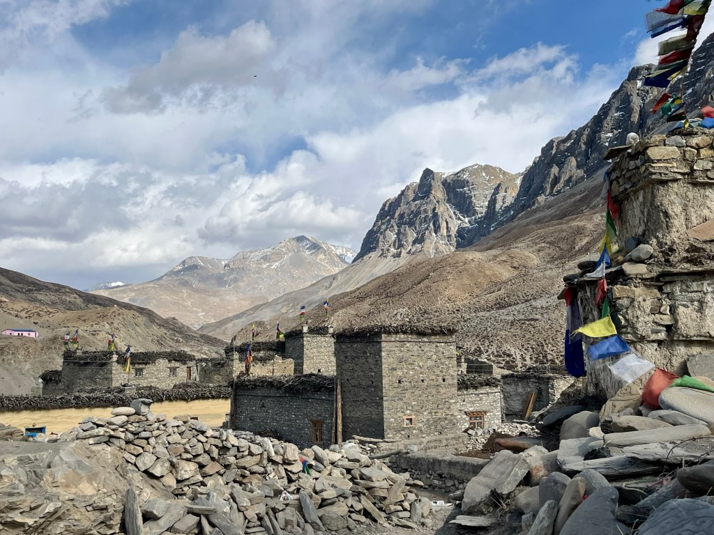
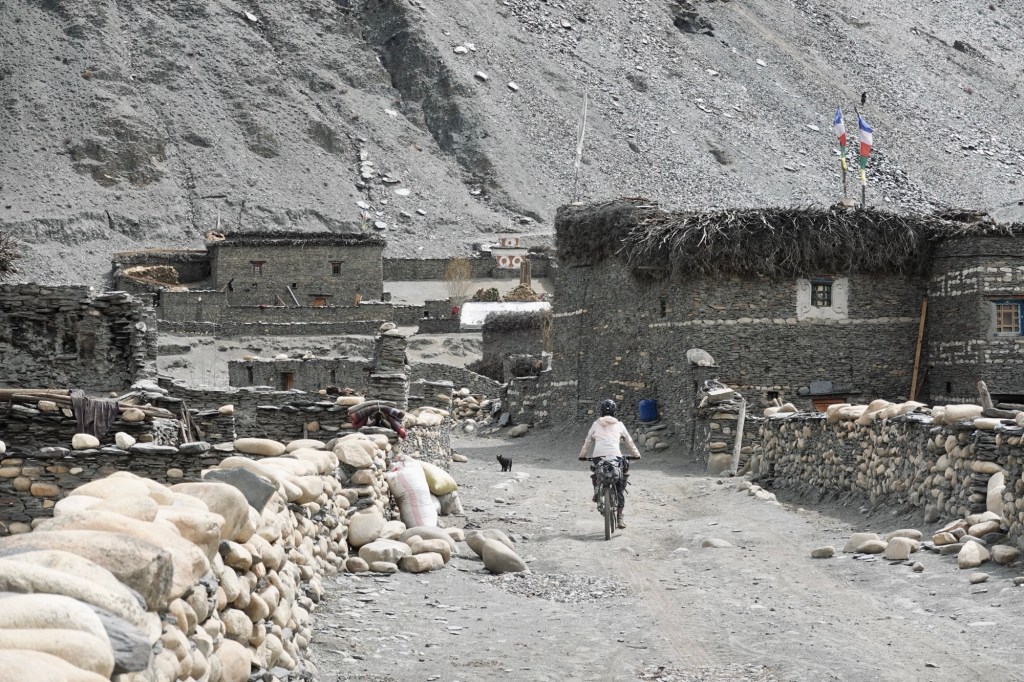
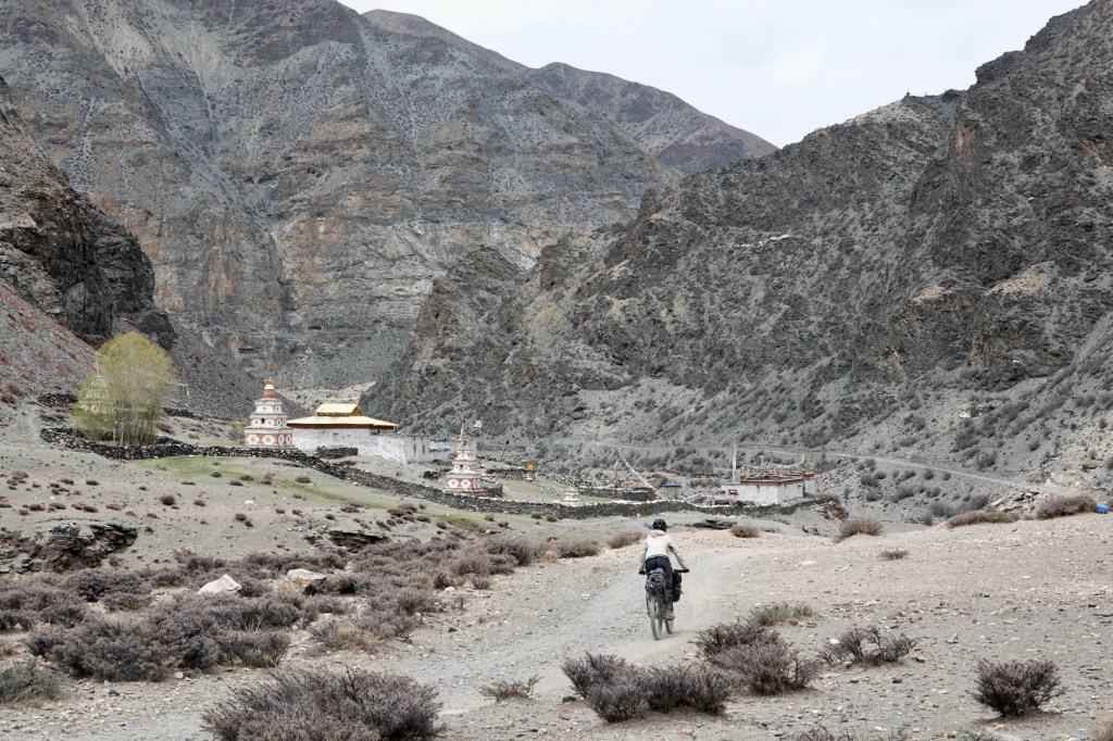
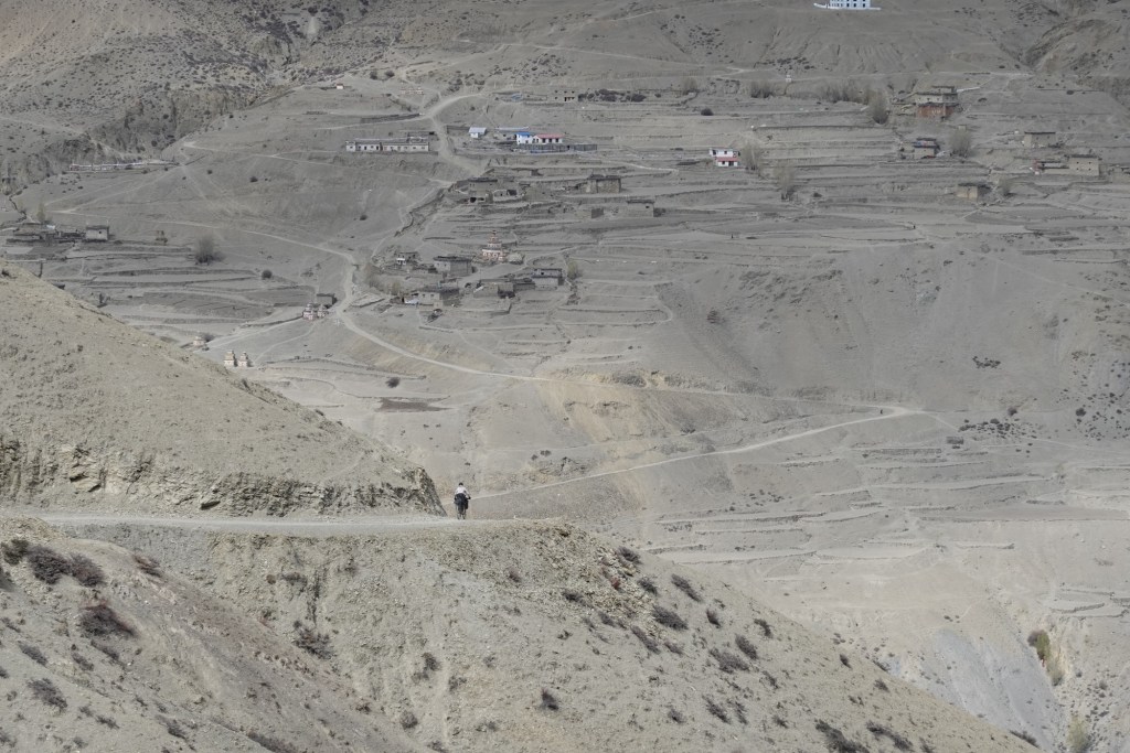
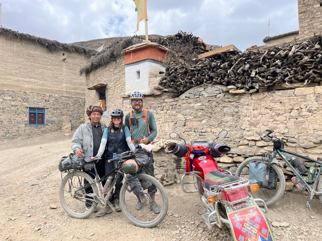
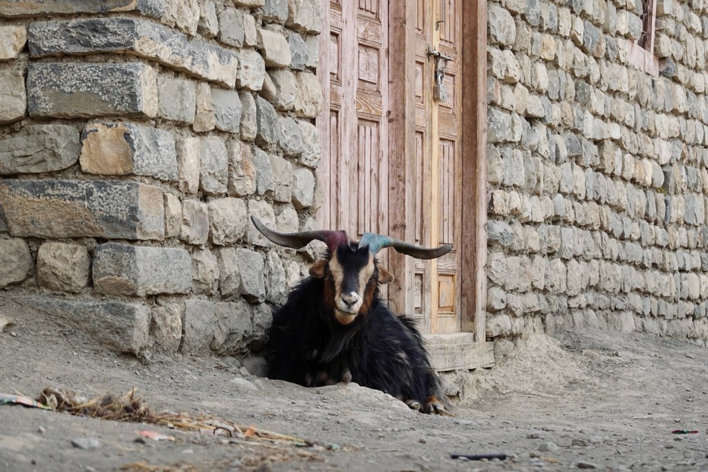
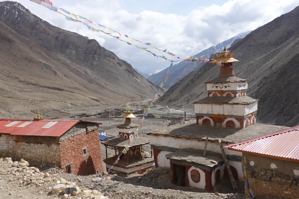
After some counter climbs and river crossings, we arrive in the beautiful Chharka Bhot. Sitting at 4302 meters, this village is on the Great Himalayan Trail, a long hiking route through the stunning Himalayas. The local Dolpo-pa community is known for their traditional ‘Bhot,’ a cloth made from sheep and yak wool. Like most of northern Dolpo, the people are mostly Tibetan Buddhists. As we walk along the gravel roads, lovely Stupas dot the landscape, adding to the village’s charm.
Here we find a small guesthouse. To be honest, we’re a little bit nervous to knock on doors without a guide and without a permit. But we are greeted with warmth and hospitality. Our host is taking us on a tour where we also meet a very young local teacher, who speaks amazingly well English.
The parents of our host warmly join us for dinner, and the father captivates us with his curious gaze, his smile as he gestures stories to us, holding his mala—a beautiful prayer necklace made of 108 seeds. His long black hair is tied back in a ponytail, held in place by a vibrant red hairband, common for men in region. Though we’re too shy to ask for pictures, his enchanting presence and aura linger in our memories. With only “hands and feet” to communicate, we dive into an exchange, uncovering interesting insights. We learn that some cycling groups brave the terrain, though their bikes are typically carried on the backs of donkeys until the paths become smoother. In these days there is a 14-day trading window with the Tibetan Chinese border, where herds of resilient yaks transport goods and provisions to remote villages. Back in the days the borders were open and it was a very common trading route. The pass soars over 5500 meters, leading into Tibet, where the landscape softens into vast plains and plateaus, making it easier for motorcycles and horses to traverse. Interestingly, motorcycles here lack license plates, as they are imported from China and rarely venture beyond the region. Fields bursting with potatoes and barley await the new sowing season that has just begun. Summer is the prime time to explore this area, when the lush, green fields transform the barren landscape into a breathtaking spectacle. Many village children find their purpose and education in monasteries, and during winter, countless souls journey to Kathmandu, seeking warmth and work.

Originally, we had envisioned a journey southward from this point, but a sense of adventure compels us to venture north instead. We’ve discovered the existence of two exciting new roads, crafted for motorbikes (and so cyclists), that supposedly connect the villages. The following morning, filled with anticipation, we set off further north. On our route to the next pass, we encounter the teacher once more, returning to her village and school after a night spent tending to the goats and sheep.
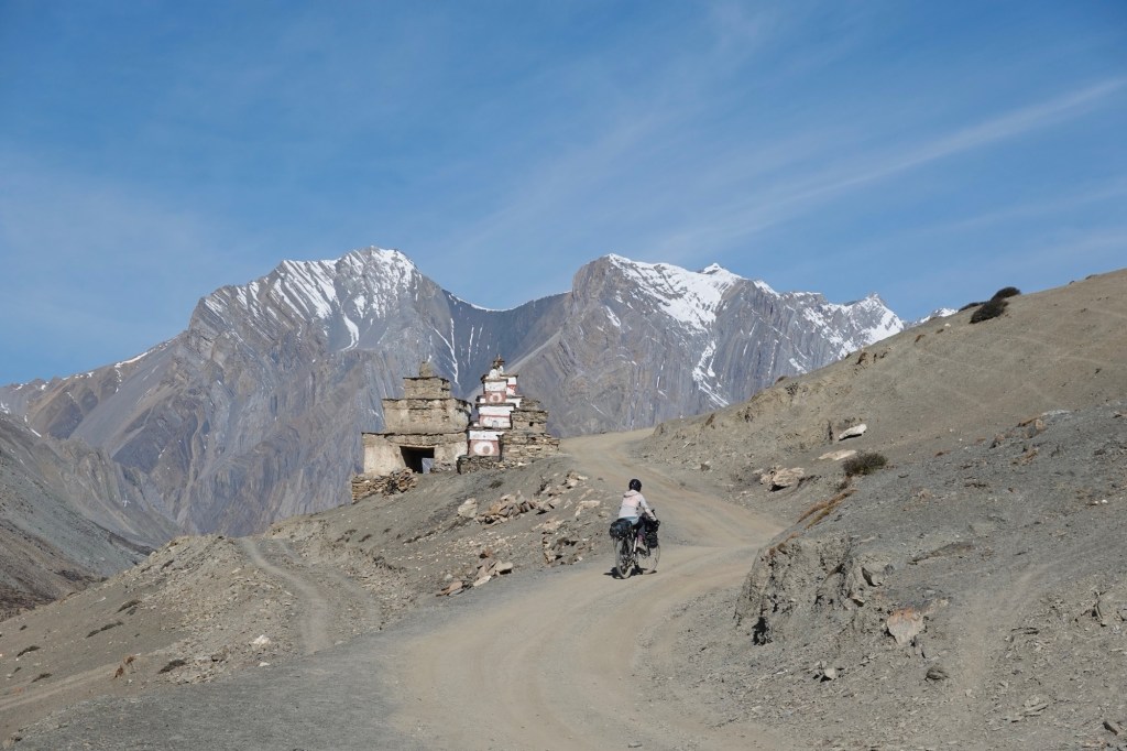
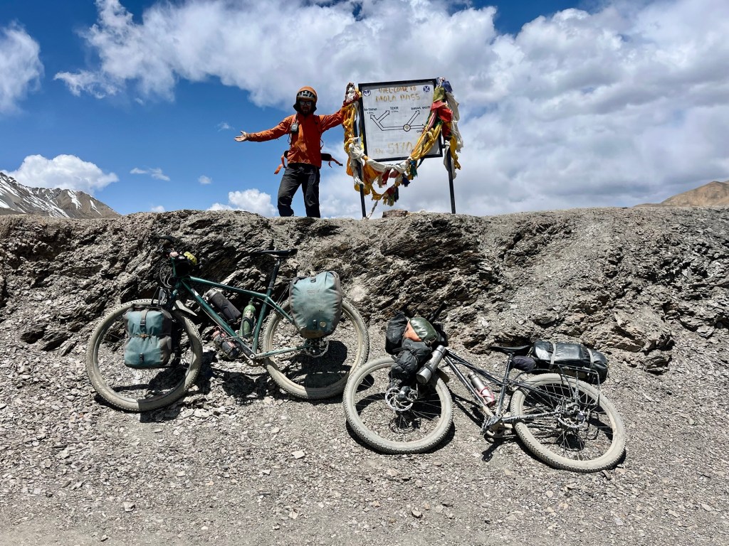
Mo La 5170m – en route to Saldang
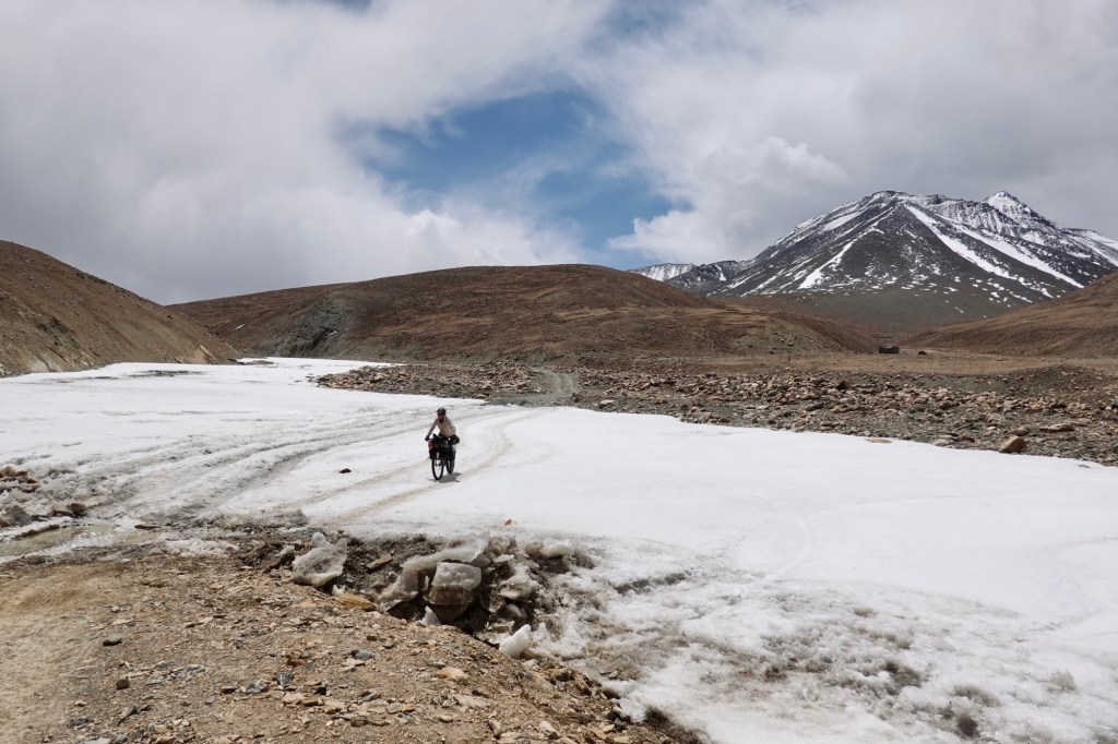
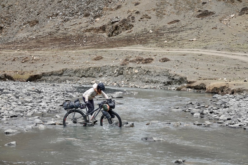
A little bit later, we find ourselves at the top of the pass. The way was smooth with the occasional smaller river crossing. Yet up in this elevation every tiny pebbles feels like an obstacle! Cycling feels tougher than hiking in the elevation. So, I choose the hiking option. One switchback hiking, one switchback pretending!
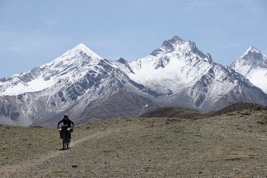
After the pass snowfields are awaiting us and we make our way via a beautiful plateau.
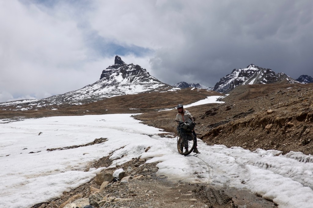
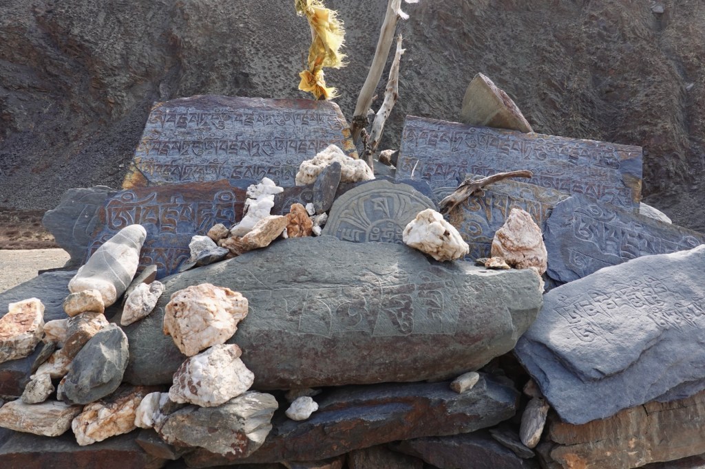
The area exudes a remarkable peace and serenity. We confidently traverse the expansive shepherd areas, admiring the stunning Mani Stones, and effortlessly share the path with the occasional marmot hopping gracefully across the plains beside us. Mani stones, which are stone plates, rocks, or pebbles inscribed with a mantra, are strategically placed along the roadsides and rivers or artfully grouped together on long walls as a respected offering.
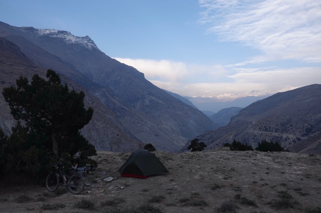
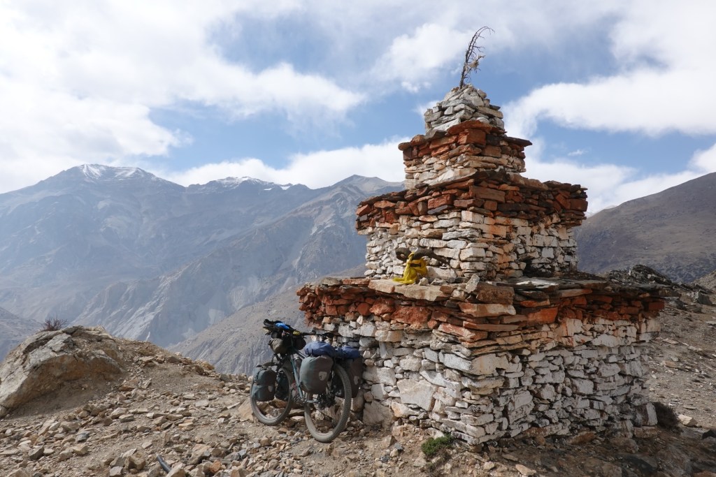
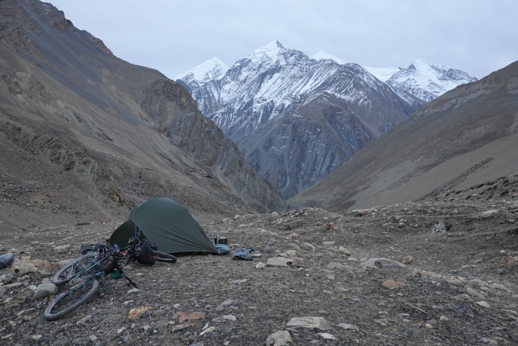
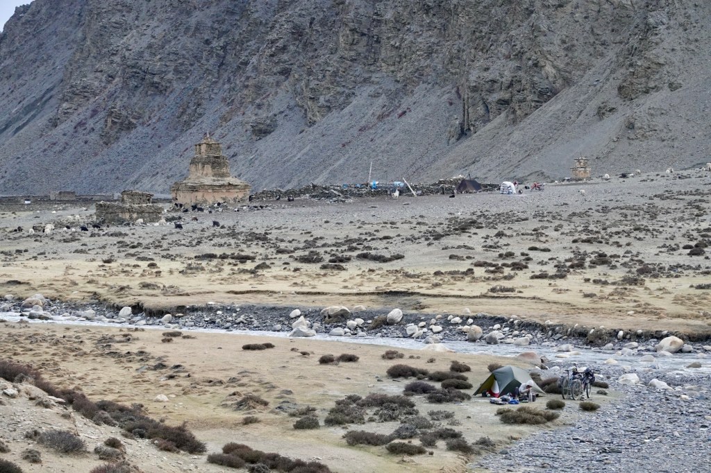
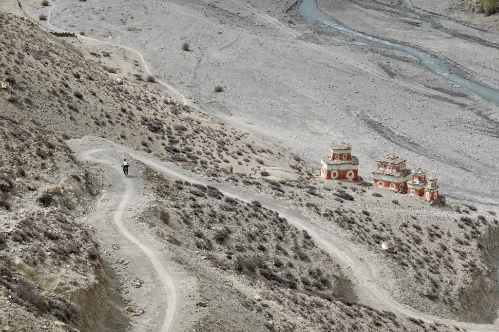
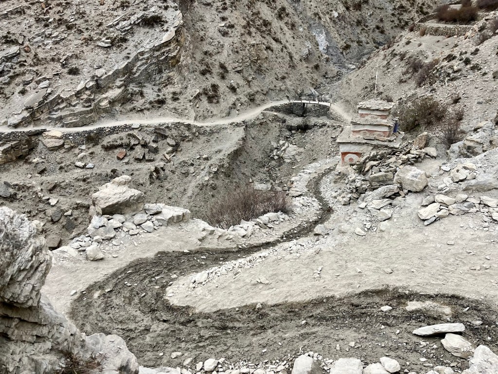
After a few kilometres, the road transforms into a single trail motorbike path. To top it off, we arrive at a stunning junction adorned with beautiful old stupas by the riverside, and we make the decision to set up camp right here.

From here, we can either continue further north or head back towards the valley again.
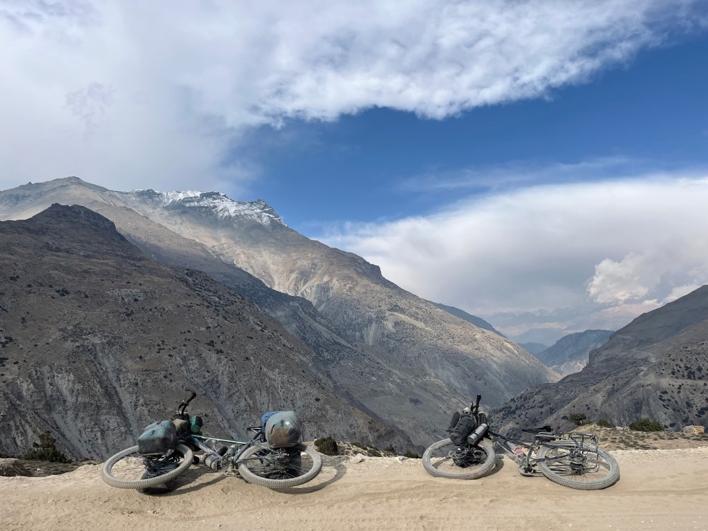
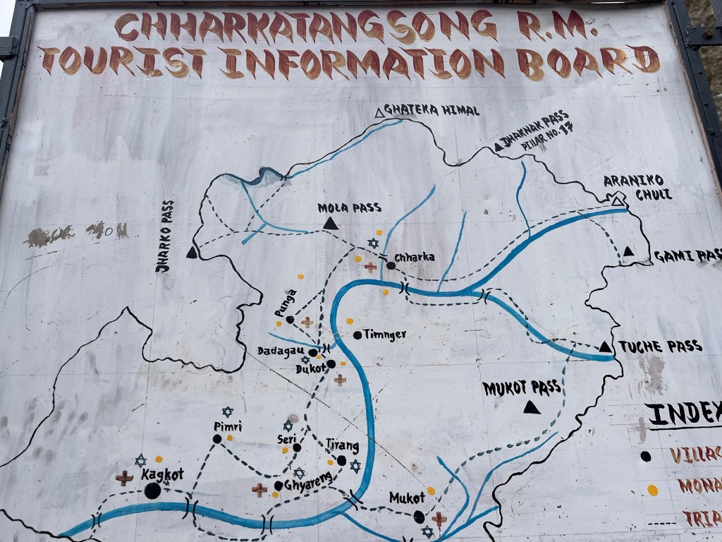
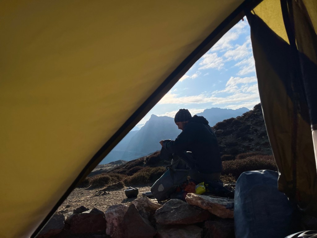
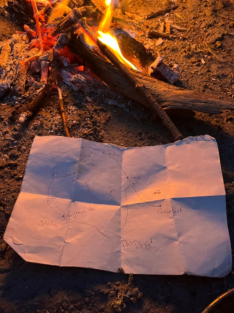
At the guesthouse, we gathered what seemed to be valuable information, but a few hours later we cannot make sense any more of our notes. We’re uncertain about which passes are a “no-go” and which ones might actually be suitable for cycling; the sheer number of highlighted dots on our offline maps makes it hard to discern anything meaningful. In our cozy tent, we pore over our offline satellite imagery, trying to plan distances and resupply points.
I hastily sketched a “map” on paper, and Rolfi rushes for the next motorbike passing by to check if we could add another detour to our route!
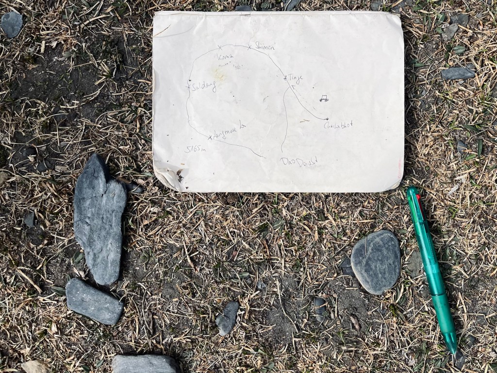
He didn’t appreciate my “map” but started drawing on the dusty ground. Like in so many countries, the dust maps have never failed us. Its a good omen and we are happy to go ahead.
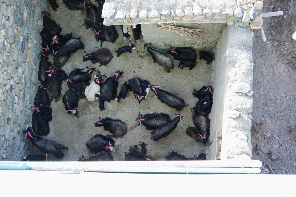
A few herds gently wander past our camp. A shepherd is cradling a newborn kid, lovingly swaddled in a soft woollen cloth. It’s heartwarming to see how the mother stays close by, never straying far from her young one. Meanwhile, a dog watches us from a safe distance, a silent guardian—will he offer us protection through the night, or will his presence keep us on edge? Thankfully, the night and the dog are comfortingly quiet.
Under the sway of theTibetan villages passing through Shimen, Koma and Dho
The next day we extend our route further to the north and pass through Tinje. As we pass by a shepherd area a very very little goat would not leave my side and started following the bike. It has physically to be carried back to the nursery. The grown ups are out and about, only the fresh kids stay back in the safety and guardance of some ladies. In Phalwa village a young female school teacher greats us and guides us to a little shop. A shaky ladder leads up to the shop in the attic. We stag up in Pasta, rice, lentils and some emergency instant soups. For lunch the lady prepares buckwheat pancakes and some potatoes for us. Smells and tastes super good!

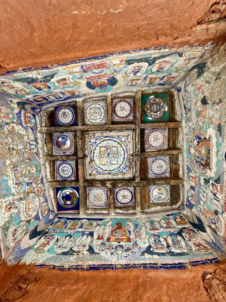
Afterwards an even remoter path follows where we pass many mani stones and a beautiful monastery.
Wild goats are wandering up in the cliffs above us, and they really freak us out when they drop rocks right in front of us!
Spring brings a vibrant energy to the fields. In Shimen, the fields are slowly transforming into lush greens, while trees are dressed in a juicy green already. We receive cheerful greetings and friendly waves from the locals as we pass. The atmosphere is filled with warmth and heartfullness. From here, we eagerly continue our journey to Shimen La along a delightful single trail.
The village looks absolutely stunning from above – with barren mountains lurking behind, fields scrambling like a confused maze on the slopes of the river, and those old stupas. A motorbike zips past and waits at the top, looking all smug. After some small talk and an offer of beers, the rider asks if we’ve spotted a box of speakers along the way, claiming he must have dropped them. Welcome to village life, where essentials like music somehow have to hitch a ride!

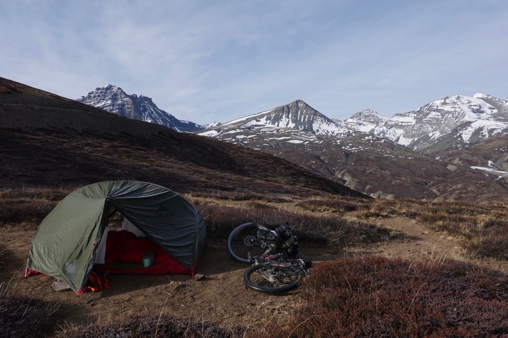
Above Khoma, a stunning camp spot beckons us to experience nature’s embrace. For dinner: instant noodles and herbs! As dawn breaks, we ascend to Khoma La, where we can spot many more settlements, paths and winding roads, inviting for boundless exploration. This serene landscape pulses with tranquility, ready to inspire and uplift our souls.

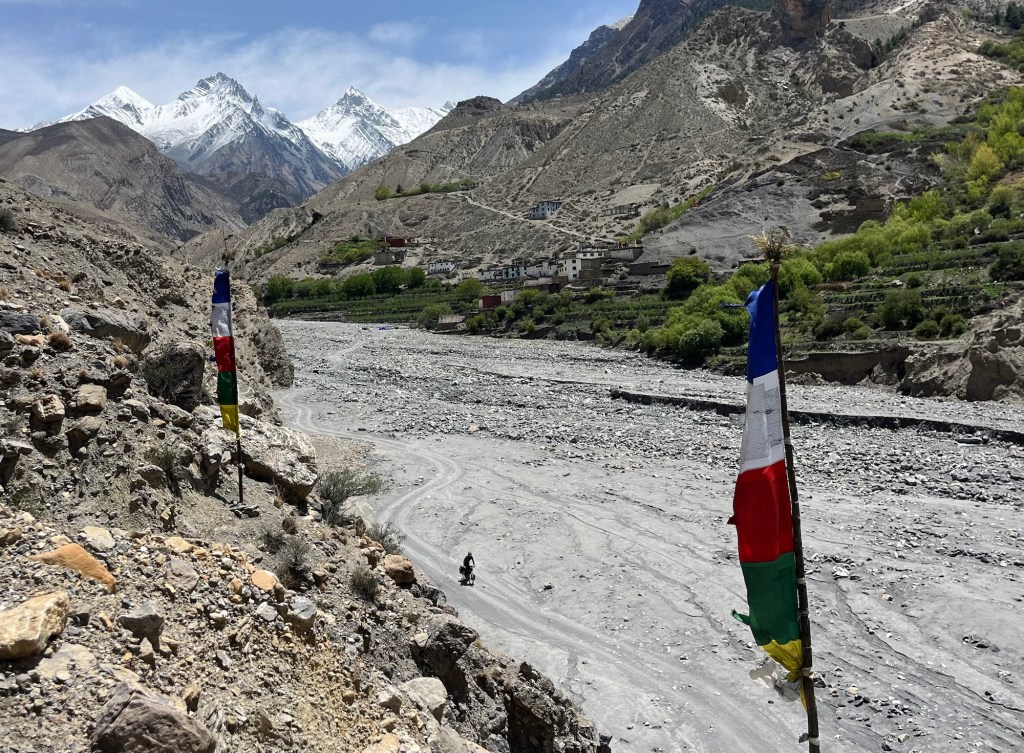
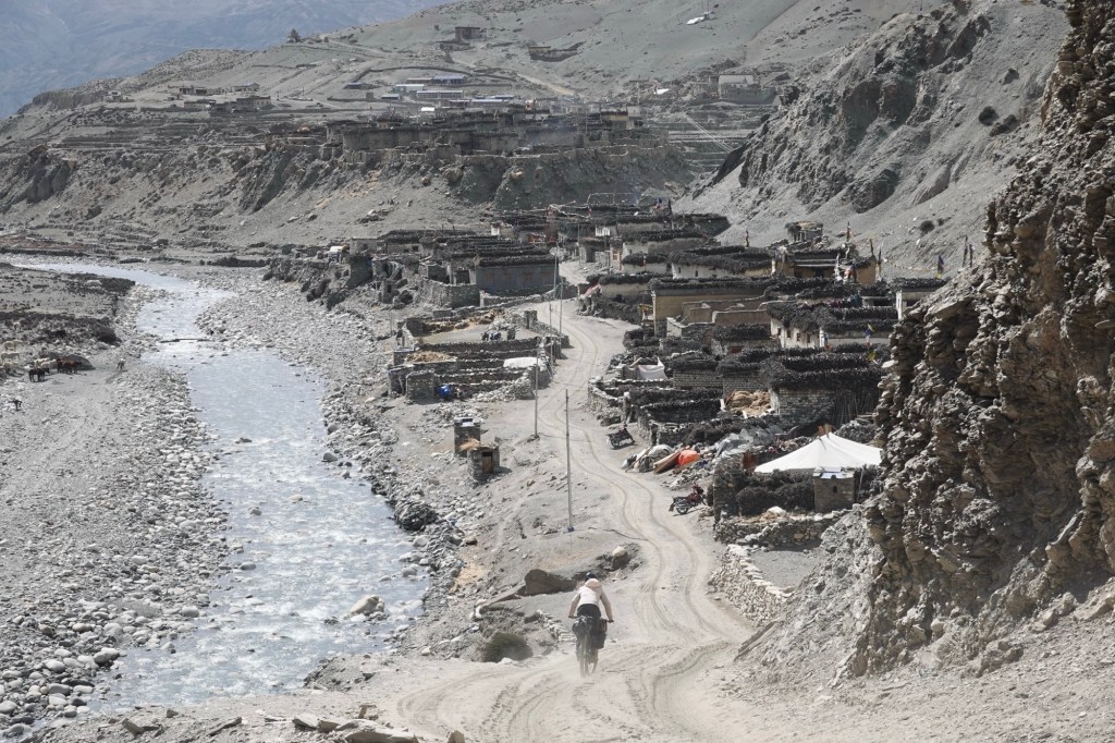
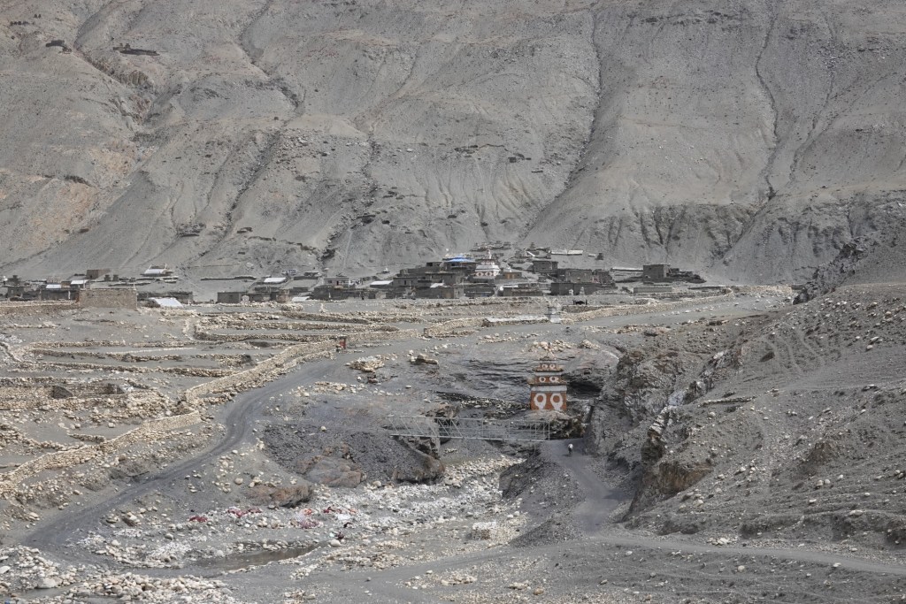
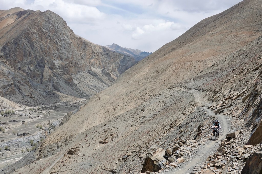
A spectacular single trail leads down to Saldang, where the houses are scattered on the high slopes typical for Tibetan villages. The motorbike paths are so easy to cycle and so much fun!
We pass the beautiful Salgompa.

After a few kilometres we see the first tractors again. The road becomes wider. A guesthouse offers some much needed snacks and some supplies and a bit of petrol for our stove.
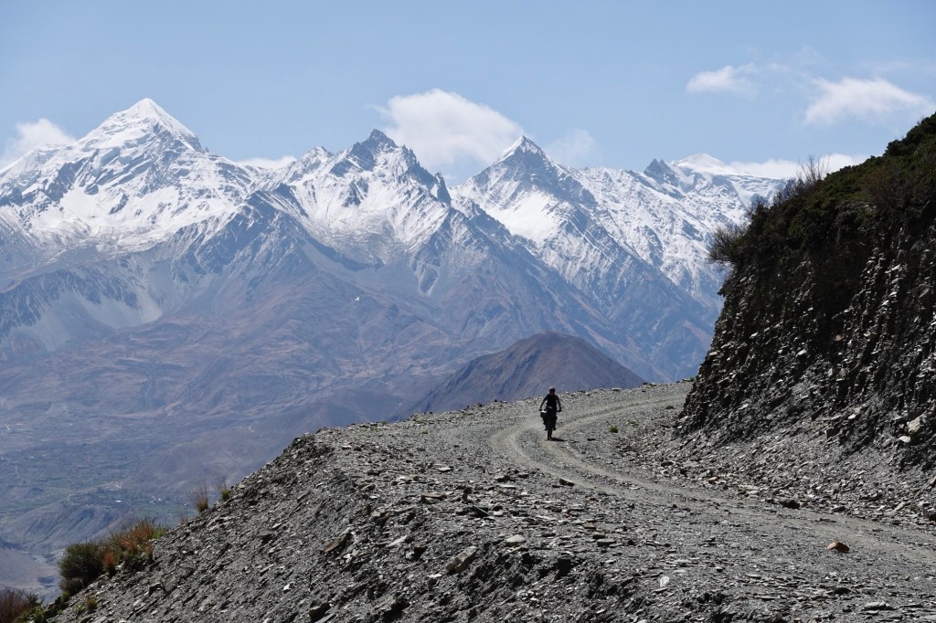
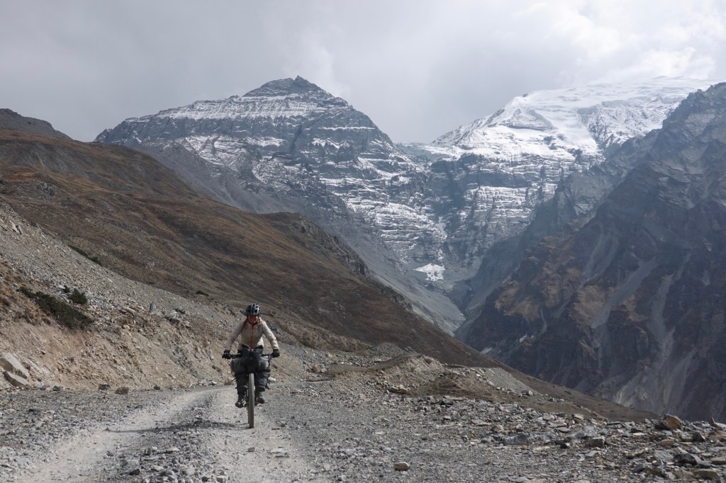
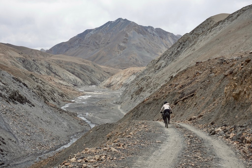
One last pass follows a new gravel road up the mountain. In the distance, the ancient hiking trail emerges, still alive with the rhythm of donkey caravans echoing through time. Majestic yaks roam freely, embodying the spirit of this untamed land. The snow-capped mountains tower nearby. The rivers dance wildly through the valley, narrating stories of nature’s raw power and beauty.
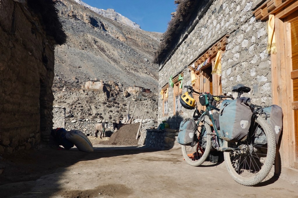
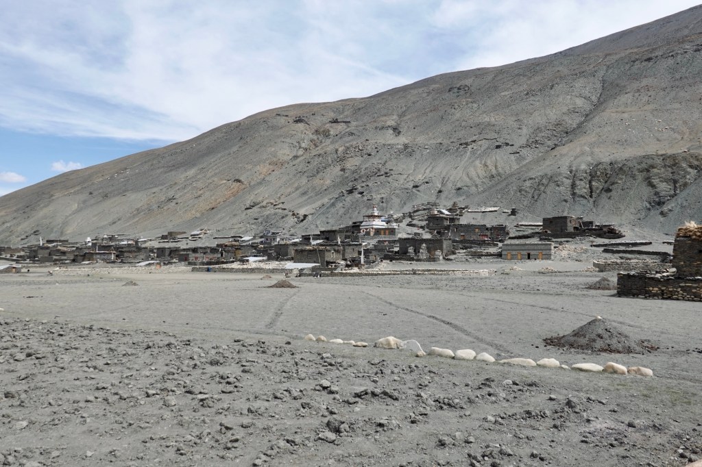
The path to Dho is rough and rocky, so we’re glad to reach the guesthouse. Instead of camping, we choose to stay in a room this time. Nice! We’ll relax here for the afternoon.
Dho is a larger village with nearly 1000 residents, but aside from two shops and three guesthouses, it seems similar to the other villages we’ve passed. While sitting above the monastery overlooking the village, we hear the monks singing.
We were given the heads-up that the road to the southern Dolpo area is about as relaxing as a roller coaster ride!
Dho Tharap Valley – the gateway to the southern area or our hike-a-bike ultra
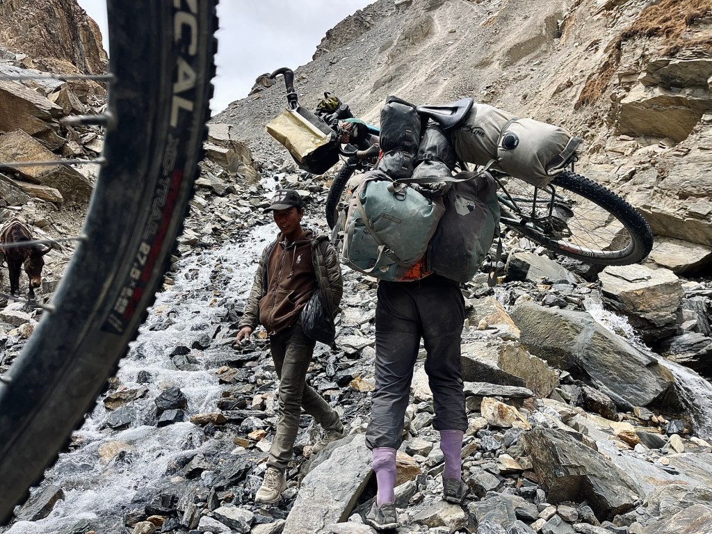
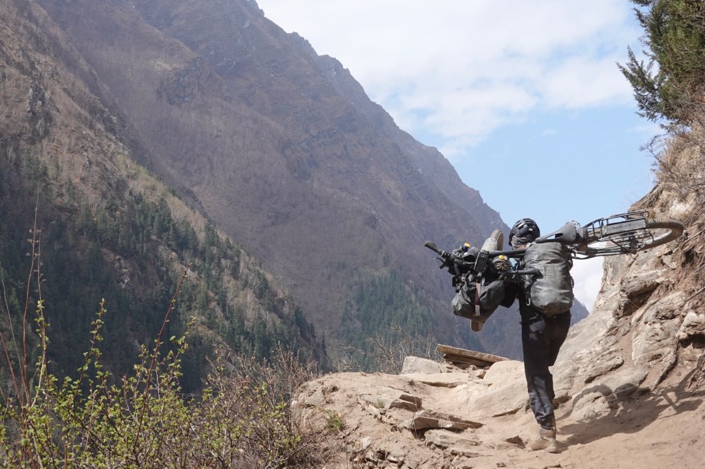
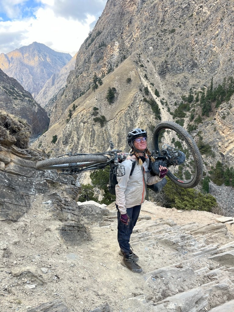
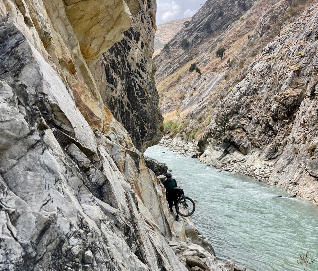
The next day, we set out with determination – 10 km of rolling, and then the thrilling challenge of pushing, dragging, and carrying our bikes begins!
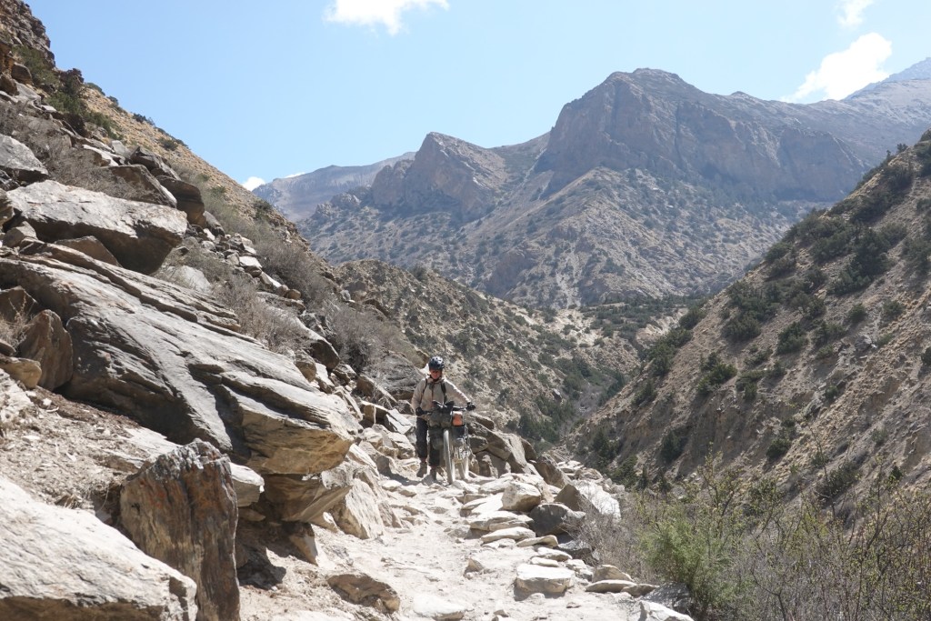
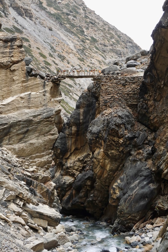
The trail is narrow and leads through a spectacular canyon. Donkeys make their way up, carrying building materials, goods, tents and even bikes.

Many of them supply the tents for the caterpillar fungus “search.” This parasitic fungus ophiocordyceps sinensis is used in traditional Tibetan medicine. The price can reach an astonishing 40,000 dollars per kg.
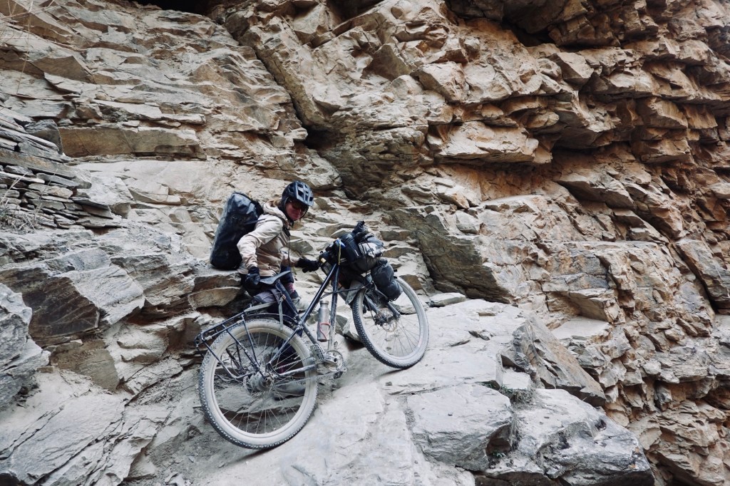
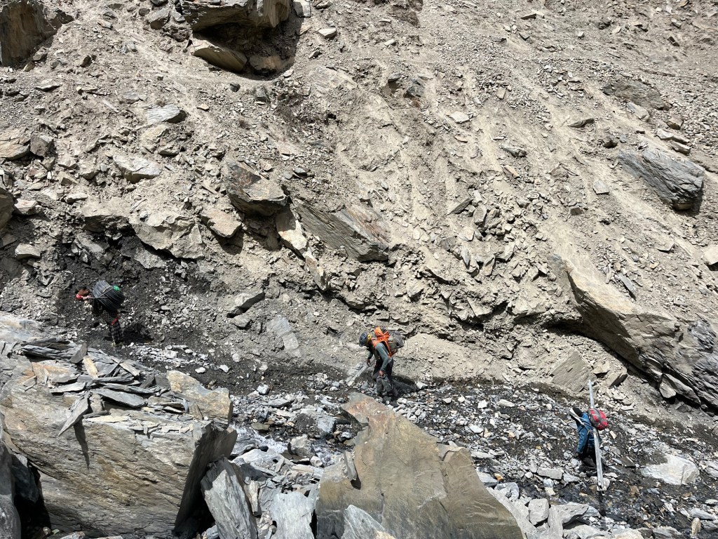
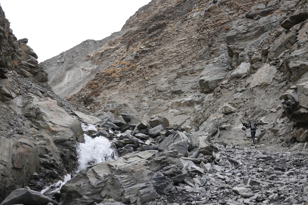
The track is super rocky, it is hard to decide if pushing or carrying the bike is the better option.
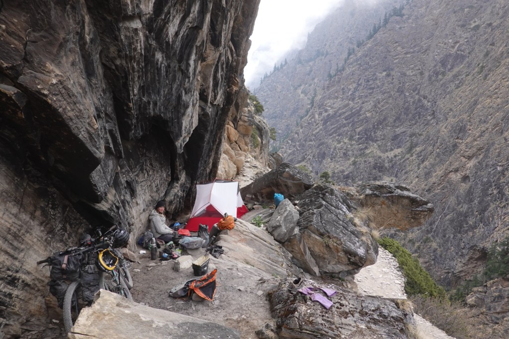
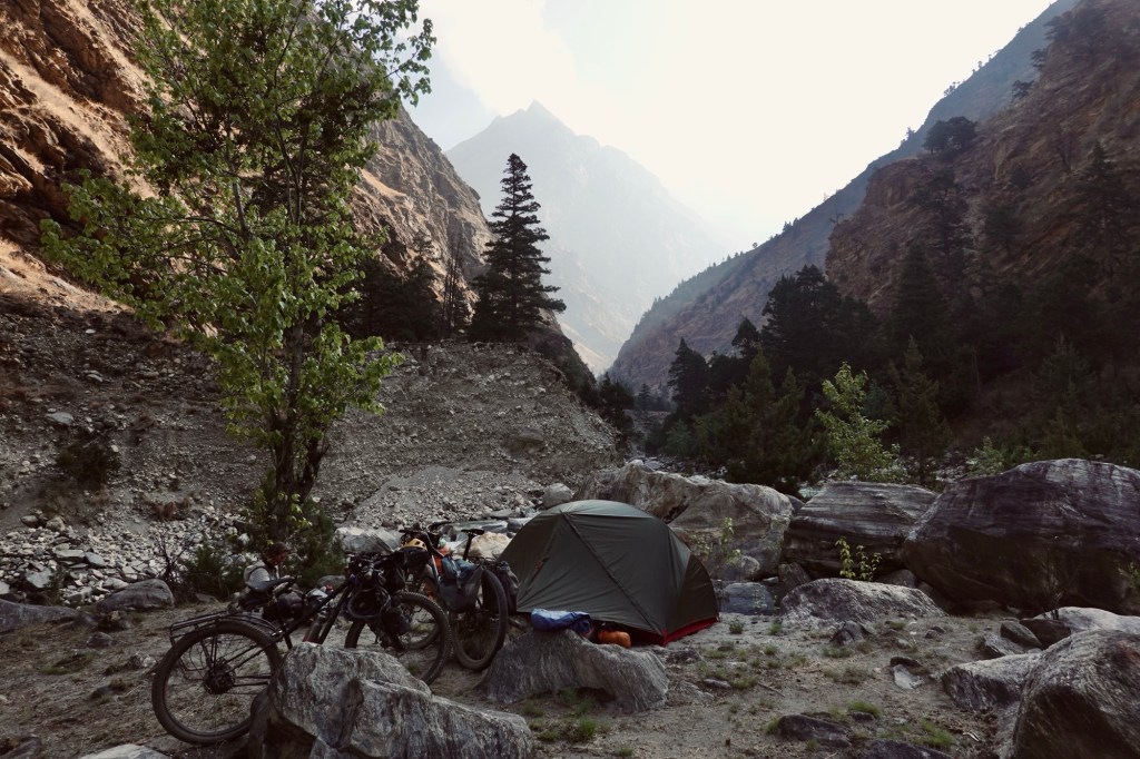
In the evening, we throw in the towel after what feels like an ultra endurance event of bike pushing for a few kilometres. A rock ledge pops up like a luxury campsite, perfect and dry! Rolfi is doing a happy dance, camping on a rock ledge feels about as exclusive as it gets—“boven”/ glamping, here we come!
The next morning, it’s the same old routine—up and down the canyon. I carry the bike on my shoulders for the really steep sections and maybe push it over the flatter parts. Honestly, I can barely lift the bike over the bigger rocks anymore; my arms feel like they’re about to give out. Rolfi ends up having to cover some of the distance twice. Thirty kilometers, a load of altitude gains, and still no end in sight.
In between, we wait an hour as the donkey caravans pass by. The donkeys are beautifully adorned with colorful head gowns, a vivid sight against the rugged backdrop. Yet, it often tugs at our hearts to see the burdens they carry along these challenging trails. Most of the shepherds treat them gently, sometimes going out of their way to guide each donkey through the tricky and exposed sections. However, it’s disheartening to witness that some are less compassionate. I find myself speaking softly to the donkeys as they pass, offering encouragement – perhaps also to uplift my own spirit as well.
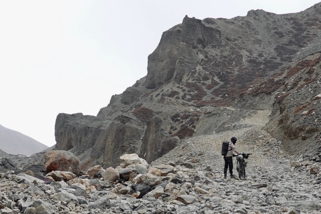
At the end of the canyon the road gets wider but not easier. A few meters of cycling but mainly we continue pushing the bikes.
One last highlight was a climbing section next to the river. It’s amazing that our bikes are still intact after everything we’ve put them through. At first, I was worried that my gates belt would break as I dragged the bike over so many stones. But now we can confidently say that our setup is utterly adventure-proof! Also, the brake pads are still in decent shape. In the end this 50km stretch took us 2,5 days of hard work – what a challenge.
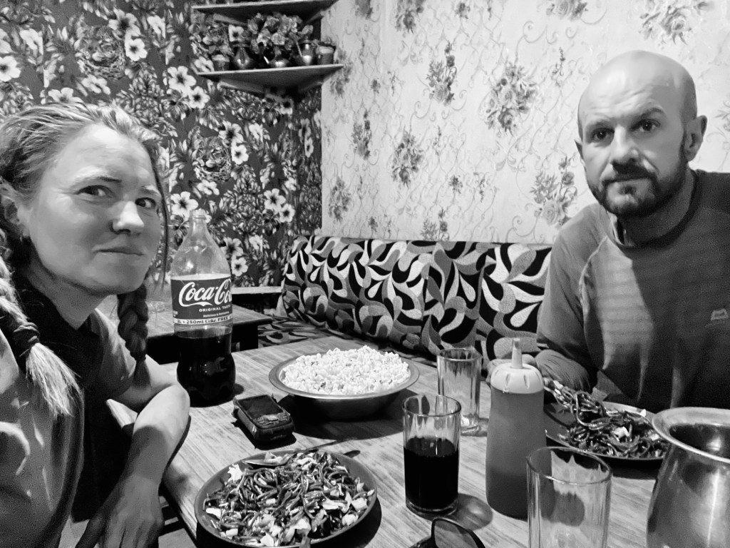
Only when we trudge into Dunai, with what feels like a half-broken spirit, do we spot the gravel roads. Dunai, the gateway to the Northern area, where goods are shipped to storage facilities. To celebrate our arrival, we waddle into the nearest restaurant, a true culinary and stylisch jackpot! Imagine leoprint wallpaper competing with flowery designs and the coziest sofa chairs begging us to sit and never leave. A delightful lady whips up not one, not two, but FOUR portions of chow mein for us, then plops a gigantic bowl of popcorn in front like we’re at a movie premiere! Apparently, every guest gets their VIP popcorn treatment, and peeking into her kitchen reveals a mountainside of popcorn!
We take a moment to ask ourselves- Was it worth it? Oh, yes absolutely! Was it tough? Uh, absolutely! Would we do this again knowing the challenge we just signed up for? Well, probably – but maybe with a slightly lighter load 😂.
The gravel road out of the valley is very dusty and rocky, with a lot of altitude gain. At a checkpoint, the police stop us and ask where we’re coming from. They laugh when we share our route. “From Lower Mustang? Alone? From Dho? Difficult!” They check our Annapurna permits and are excited that Rolfi shares the same age as the officer. They tell us they’ve never met someone cycling this whole route. Then we’re off. This was the checkpoint we feared. But we are certain that if we had done the route the other way around, they would not have let us pass! In another village, we ask about public transport back to Kathmandu and learn that direct “daily” buses aren’t running today, maybe tomorrow but only maybe. We can, however, take transport via southern Nepal. Since we left some belongings in Kathmandu and plan to trek in the Everest region, we choose this option.
The bus ride progresses at an excruciatingly slow pace, leaving us to reflect on our decision to abandon cycling. It is apparent that our lack of progress is met with indifference, as we linger for extended periods in villages and then halt again after merely 10 kilometers for dinner.
All those awesome memories we’ve made cycling, the best route we’ve ever taken on this journey—are now kind odd buried under a pile of exhaustion and frustration.
After our canyon adventures, this experience feels particularly unbearable. One landslide, a flat tire and many many food and delivery stops (in the middle of the night) later we arrive in Nepalganj. We roll into the hottest city in Nepal, 8 or 10 hours behind schedule, and decide there’s no way we’re going any further. So, we grab a hotel room at 6am in the morning and take a power nap. Luckily they had an “early check” in option! After that, we rethink our route to Kathmandu. Our bikes take a break at the hotel while our tired bodies hop on a super VIP sleeper bus. A few hours later, we find ourselves sprawled across some seriously comfy beds, but choosing the sleeper option was a mistake—every bump in the road sends us flying to the ceiling (and trust me, there are tons of those in Nepal). The bus is mostly empty, so we manage to switch to the sofa seats. Where is the popcorn now?
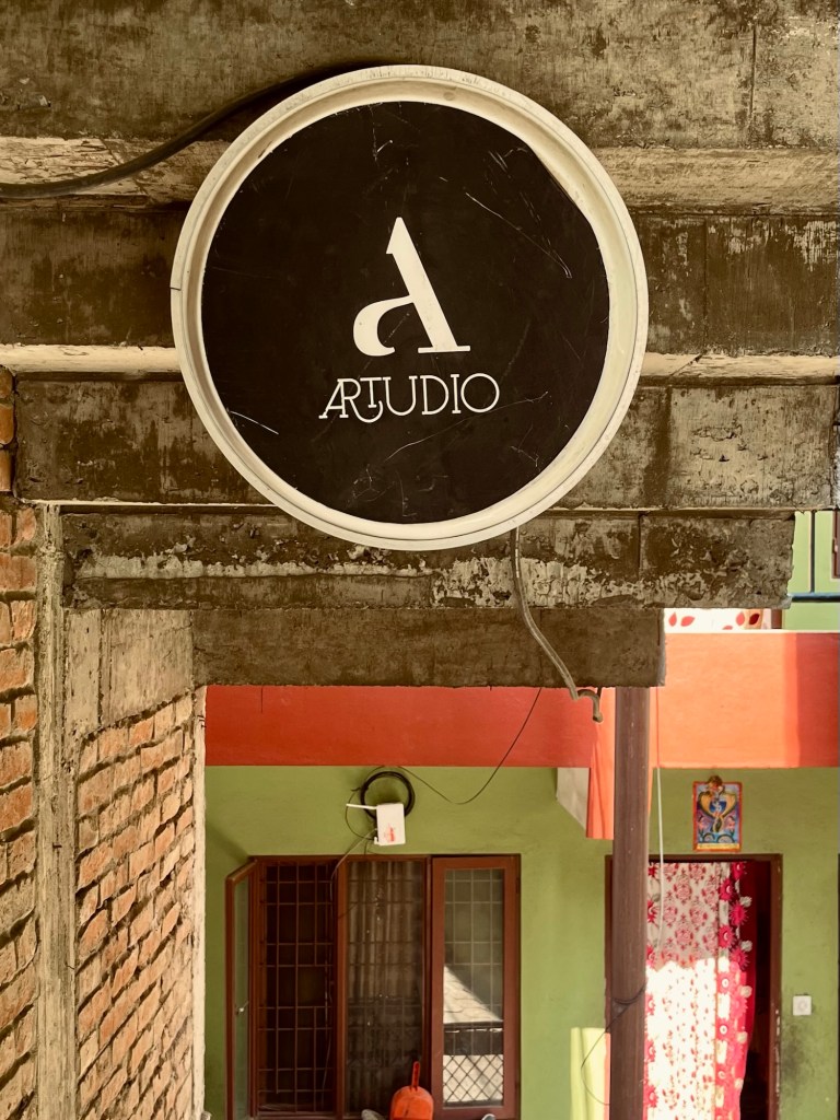
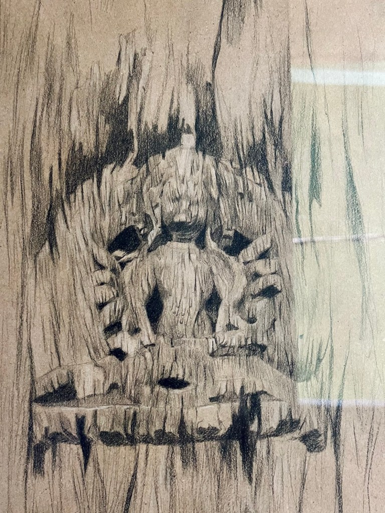
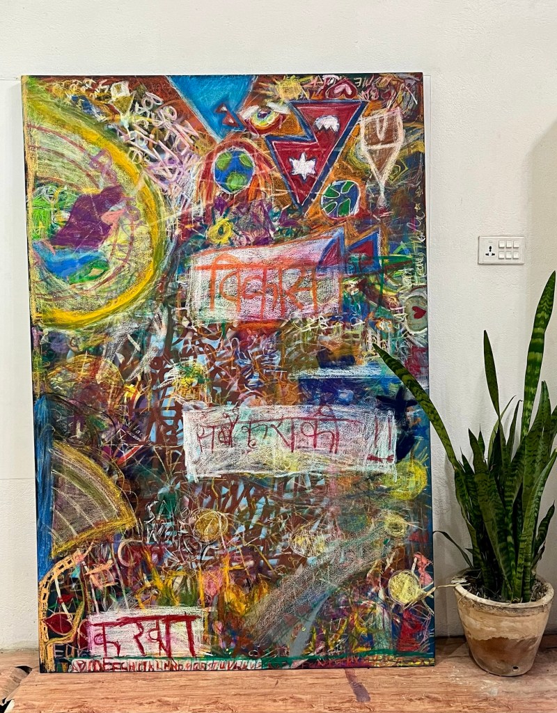
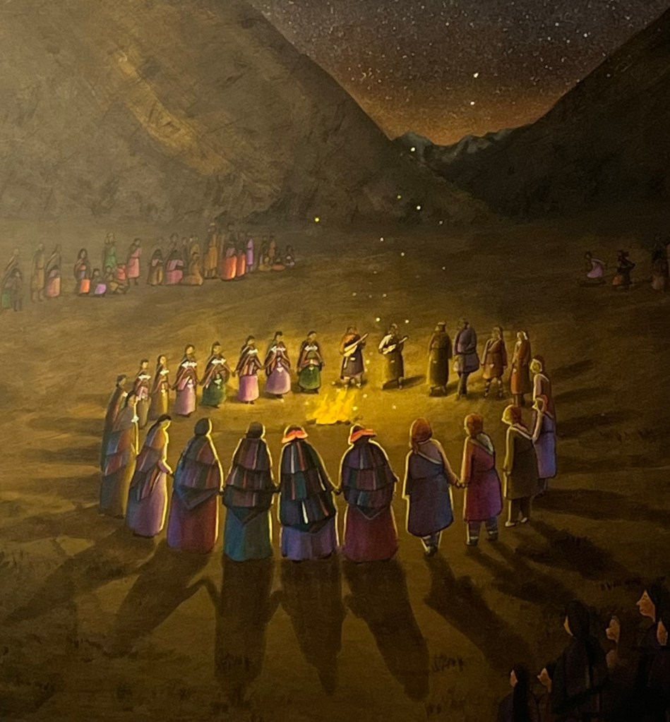
Back in Kathmandu we stayed a bit longer to meet friends, enjoy a yoga session held by Bea from Soweit die Füße uns tragen and visit a beautiful small art gallery called Artudio. We met some of the artists and had a great exchange. Next to many beautiful paintings, we discovered a children’s book about the Dolpo region. It is a story about a brave young girl on a mission to find and protect the region’s cultural heritage, beautifully illustrated by Krisha Tamrakar.
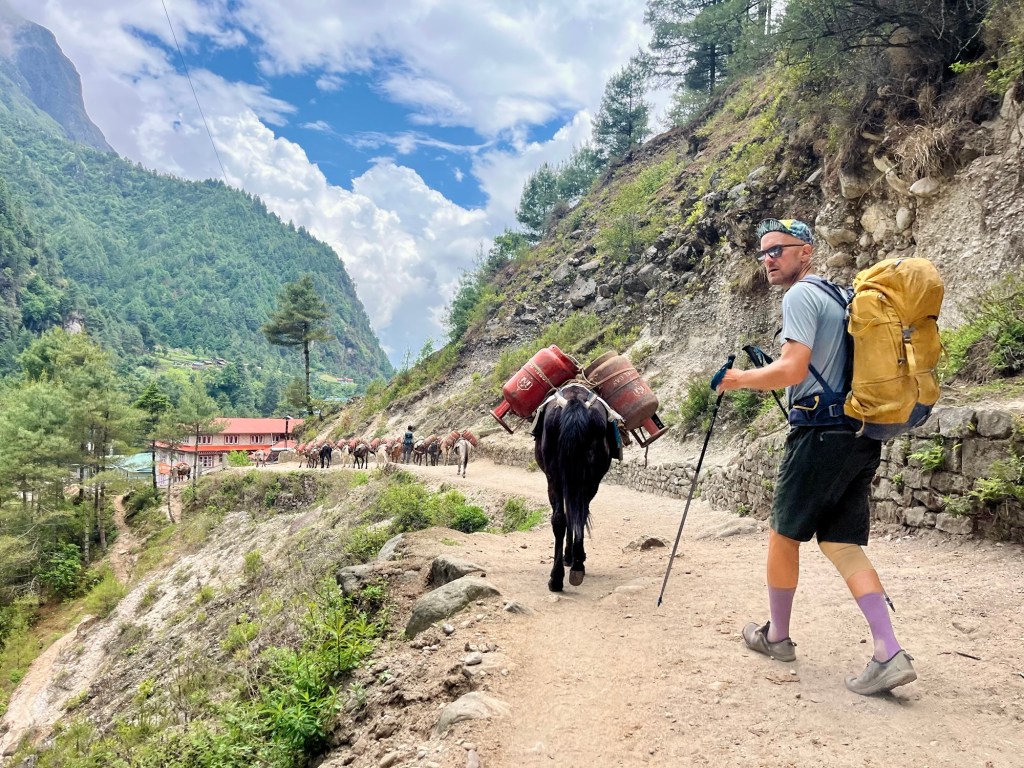
Afterwards we head to the Everest region for some hiking.
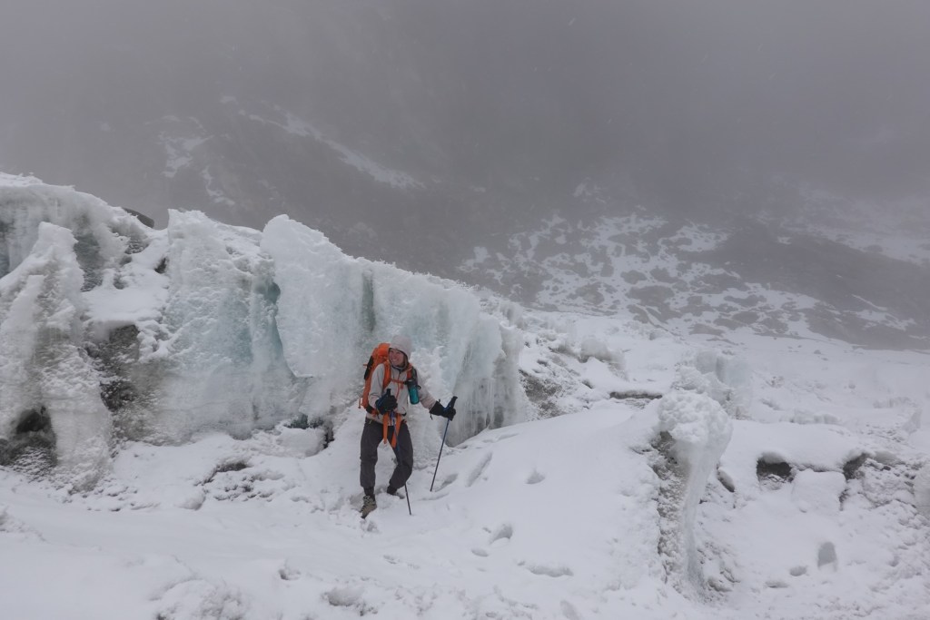
3 passes track
We picked a fairly popular trek this time. Since Rolfi’s knee is acting up, we’re putting off our alpine tour for our next trip to Nepal. With just our light backpacks, skipping the camping gear, and only bringing along a couple of snacks, we’re off to explore the Khumbu Valley!
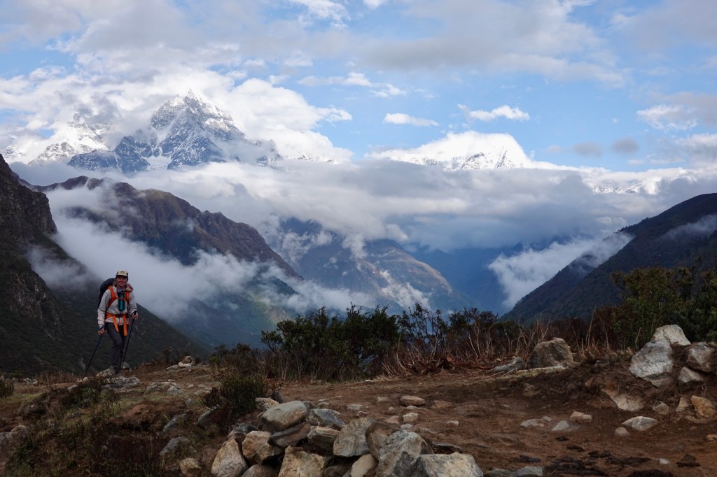
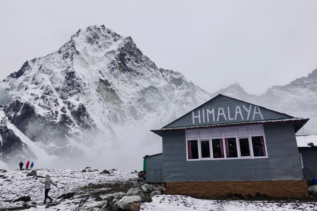
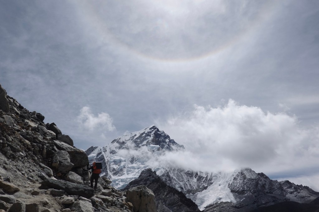
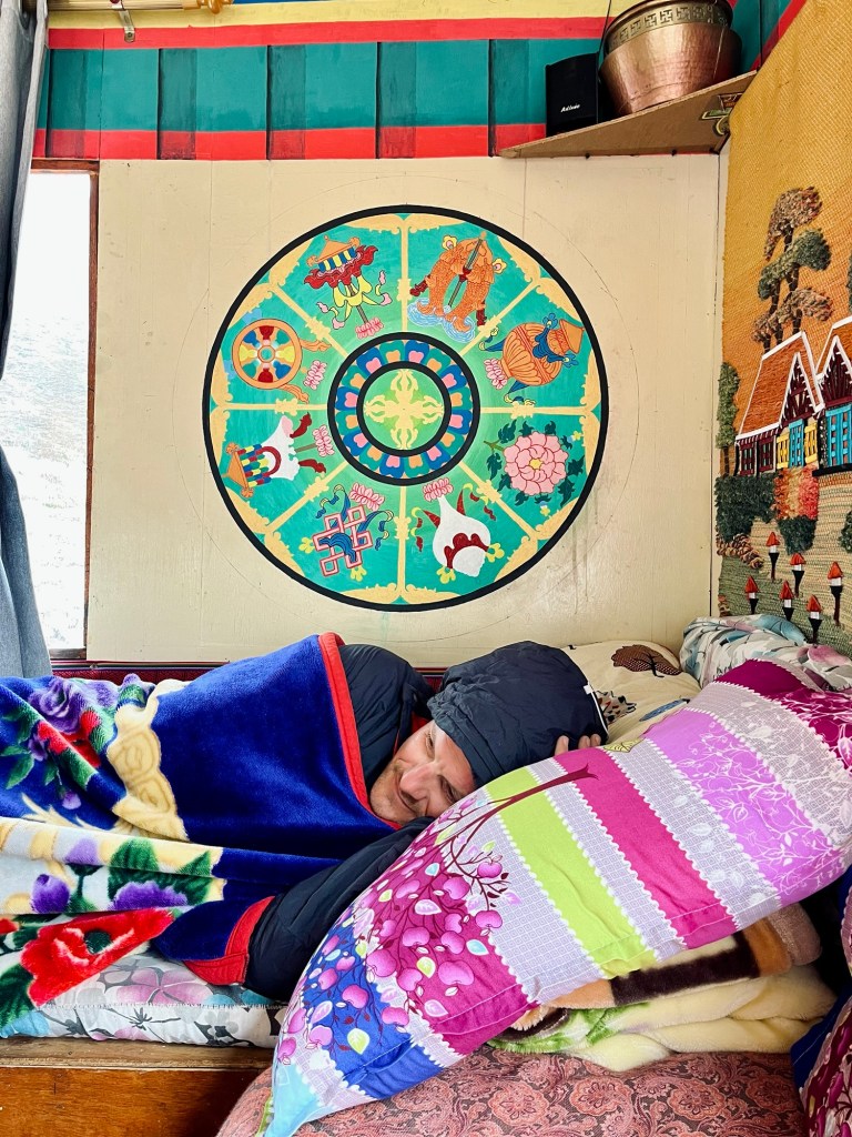
The epic views of the Himalayan range are just ahead! We zoom past the craziest part of the trail and end up at some chill guesthouses since it’s pretty late in the season. The first village, Thame, suffered from a flash flood last year that swept away parts of the village along with several guesthouses. Our guesthouse was set up provisionally, but nevertheless was a wonderful place, which was run by an amazing lovely couple.
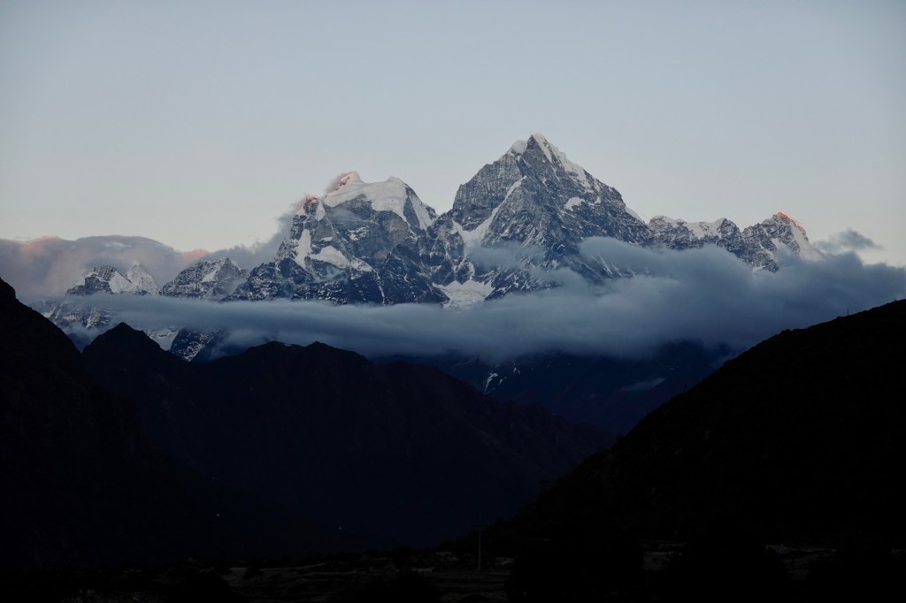
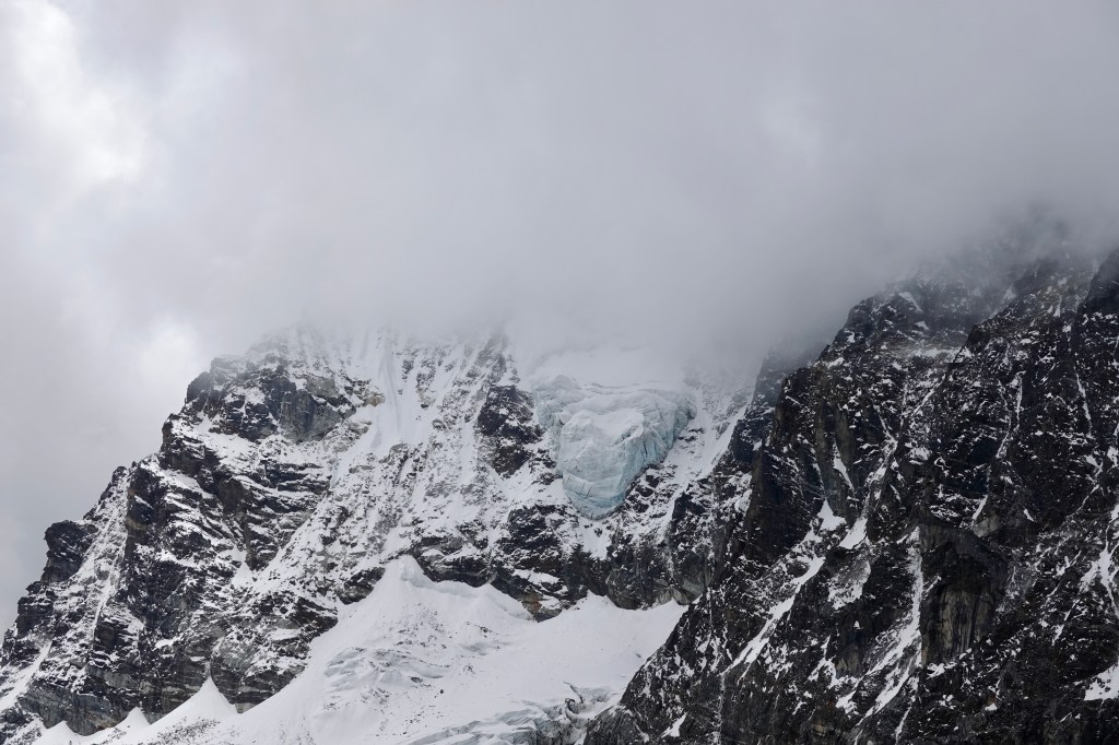
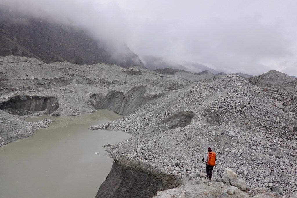
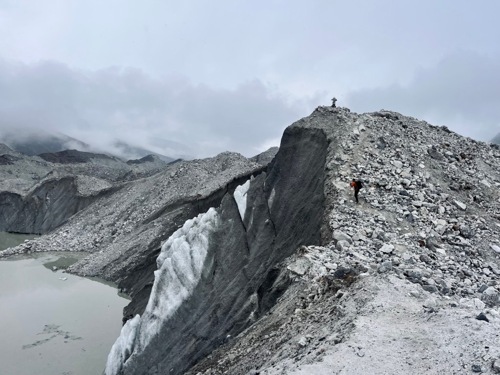
At the passes, we didn’t have the best luck with the views.

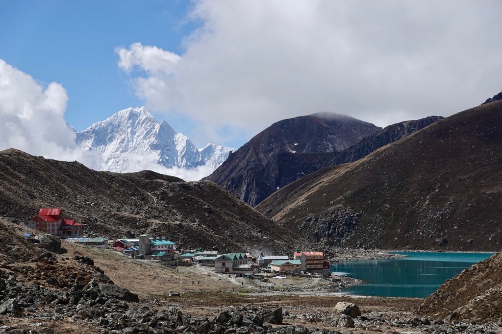
But, we did catch some sun rays lighting up those fresh, snowy mountains! And guess what? We were lucky enough to spot the highest mountain in the world from one of the Gokyo Lakes.
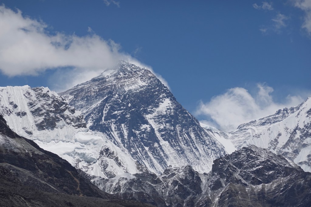
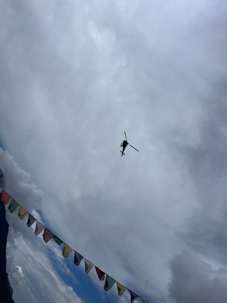
As we approached the Everest route, helicopters flew continuously. The scenery is stunning, but the air traffic is chaotic! It’s a contradiction: local people carry beds, mattresses, and even doors out of base camp while tourists are flown out. We can’t quite understand it.

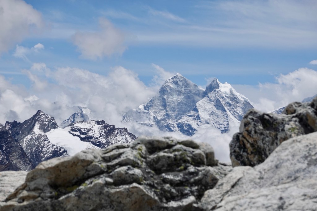
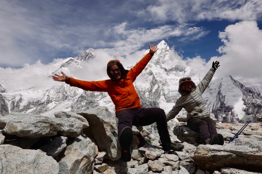
At Kala Patthar 5675m we get another glimpse of the mighty Everest and the huge Basecamp!
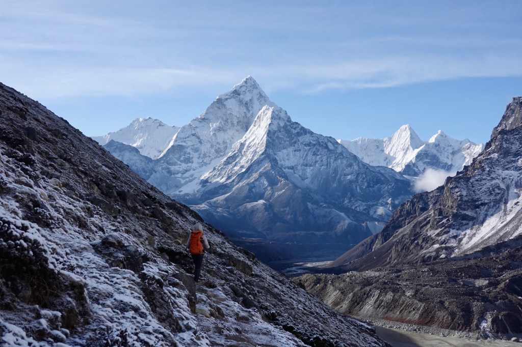
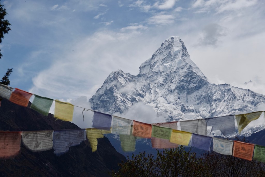
One detour to Phortse and to Mong La brings us in the breathtaking yet terrifying presence of Ama Dablan, where we lose ourselves for over an hour, mesmerized by its stunning beauty. Bumblebees dance around us as we relish every moment, completely captivated by the magnificent view.
We spent 10 days of most beautiful trekking crossing a few passes:
Renjo La 5360m, Cho La 5420m, Kongma La 5535m, Mong La 3985m
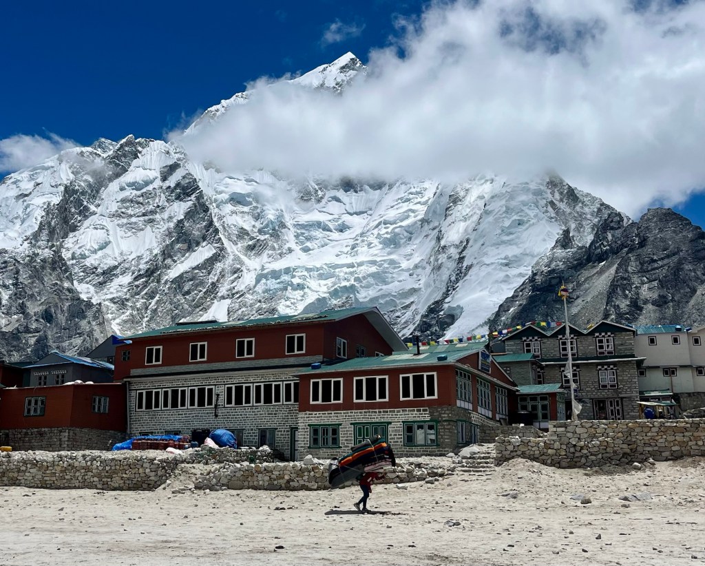
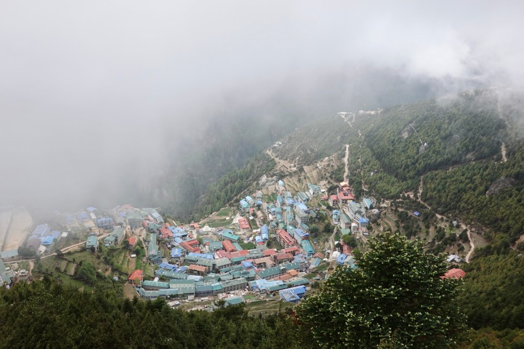
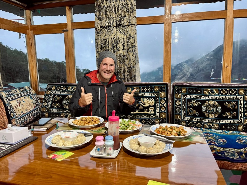
As we decided to stay at tea houses instead of camping, we were a bit afraid if we like the “more comfortable” and less adventurous way to do it. But we shared the trail with a lot of amazing people, spent nice and cozy evenings with great conversations. As we were so late in the season the guesthouse were not busy at all and it was very nice to chat with the locals and the owners of the huts and get some insight in daily life. Everyone was super friendly and welcoming and the food was incredibly good. A few museums next to the town of Namche Bazar, the trading and tourist hub in this area, were already closed for summer bream but we were quite impressed by the visitor center and the Sargamartha Next Initiative exibition, addressing the social and environmental efforts and challenges in this area. Furthermore we absolutely loved to loose ourselves in the photography collection of Lhakpa Sonam Sherpa at the Sherpa Culture Museum.
Back in Kathmandu there is a mountain film festival going on and so we spend one day in the cinemas and theatre halls of Kathmandu, watching beautiful short movies by talented local and international artists. One way to escape the heat!
Bardyia Nationalpark
Then embark on another bus ride back to Nepalganj. We left Kathmandu at 8 PM, and by 3 AM, we are still on the outskirts of the city because of traffic jams and/ or a strike, who knows.
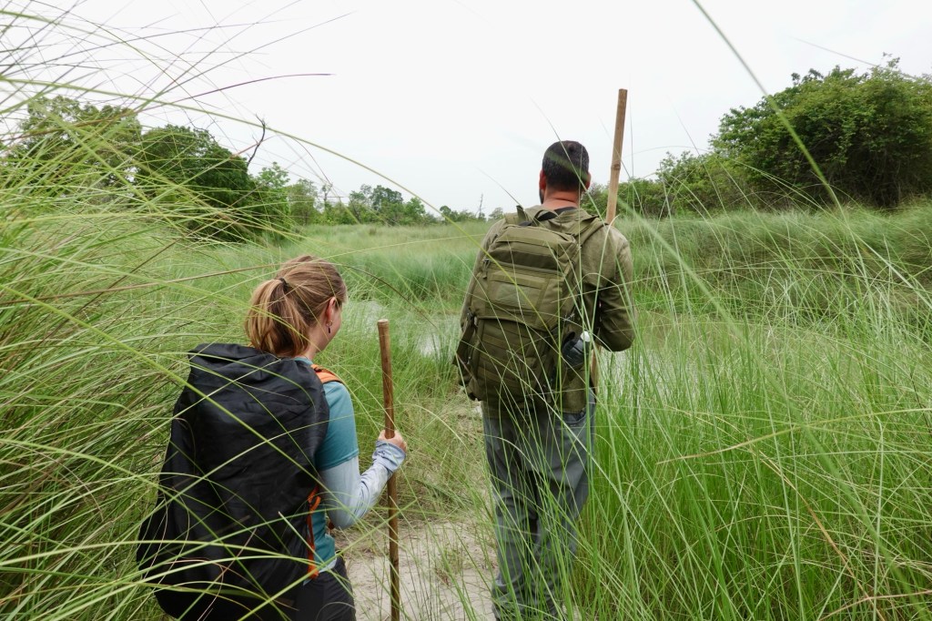
One day of cycling brings us to the breathtaking Bardyia National Park, where adventure awaits in the form of a Hiking tour and a thrilling Jeep Safari. Our guide, Krishna, who grew up amidst this stunning landscape and has been guiding since his teenage years, warmly welcomes us. With a passion for the wild, he emphasizes that our safety and that of the animals come first as we prepare to enter the national park. Here, in their world, sightings can’t be guaranteed, but the respect we show for each creature is our greatest priority!
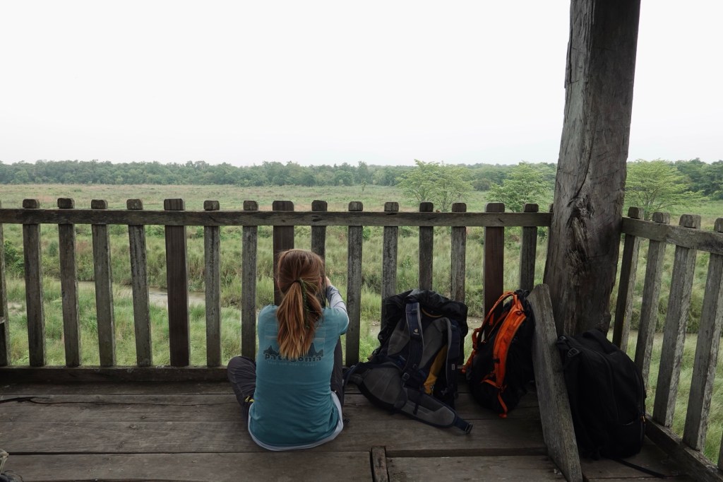
The first day we head into the national park by foot carrying a long stick. The stick is there to make us seem bigger and in the case of emergency smack an animal on the nose – let’s hope it won’t come to that.
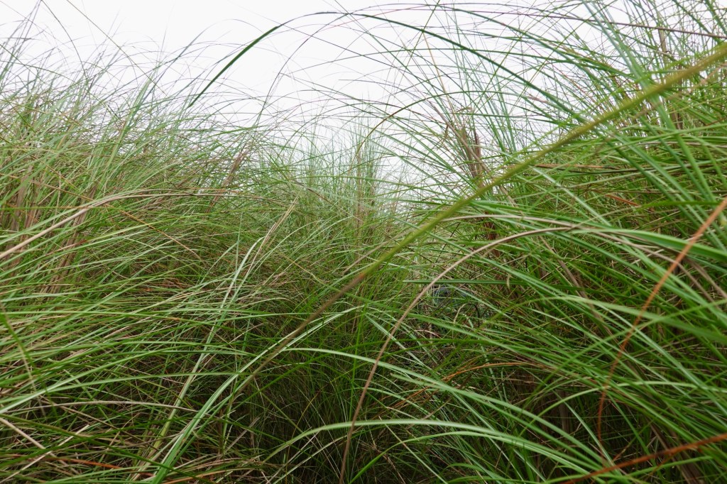
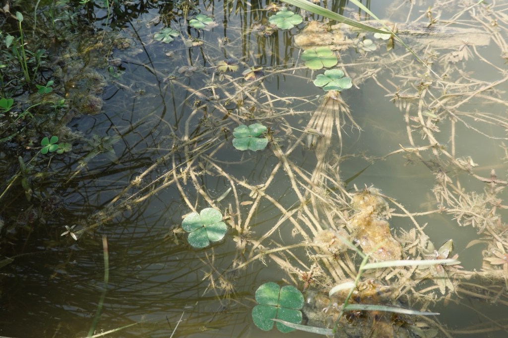
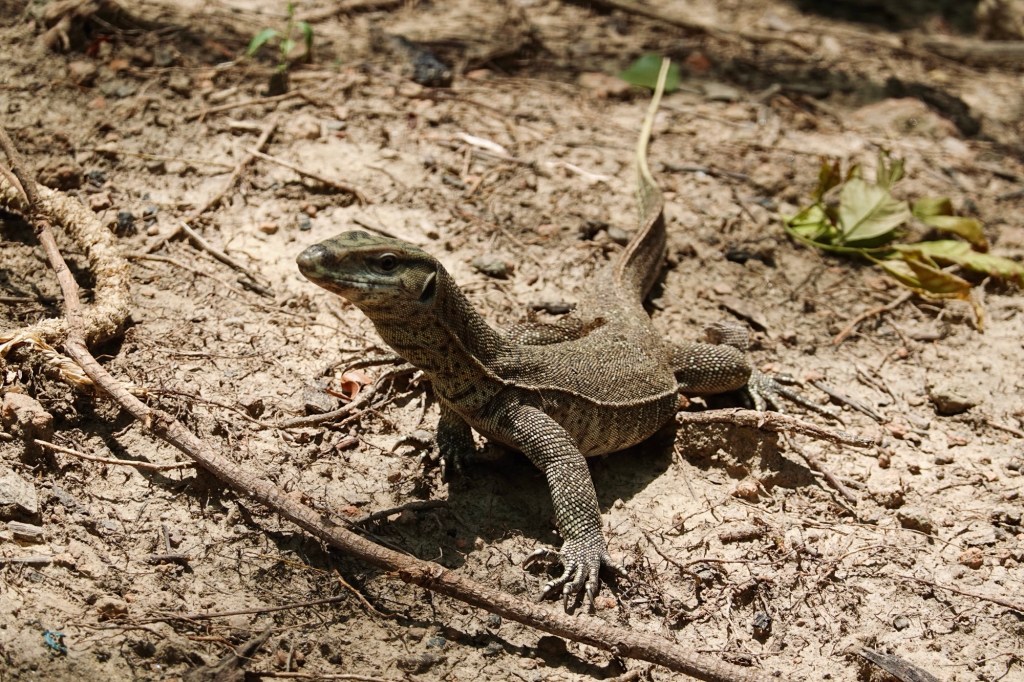
We roam through high grass and stay at a watch point. On the way we saw footprints of tigers, rhinos and elephants. Super excited!
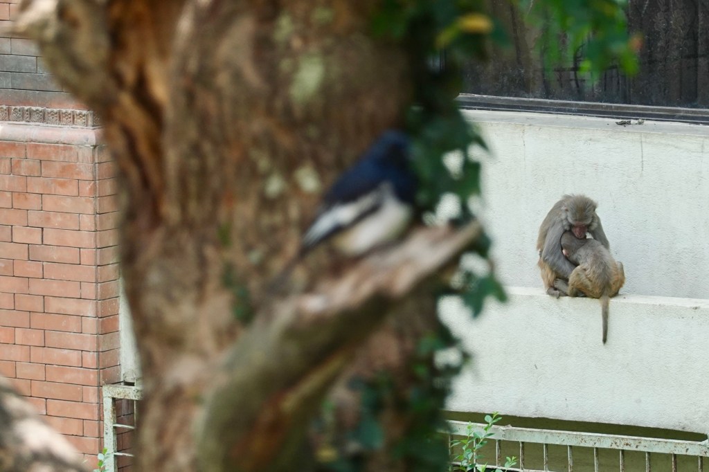
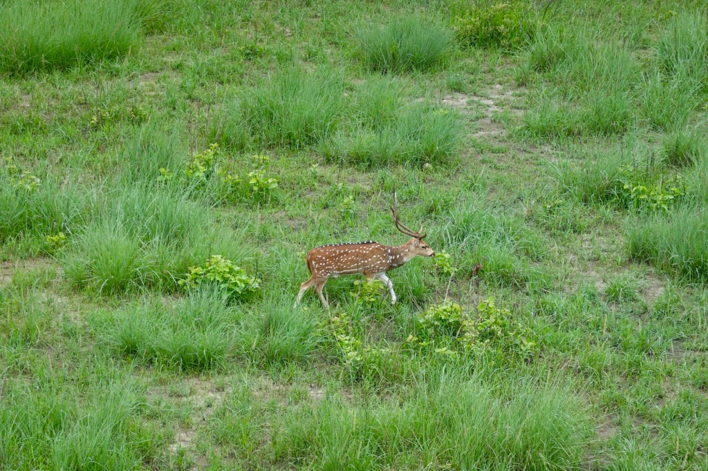
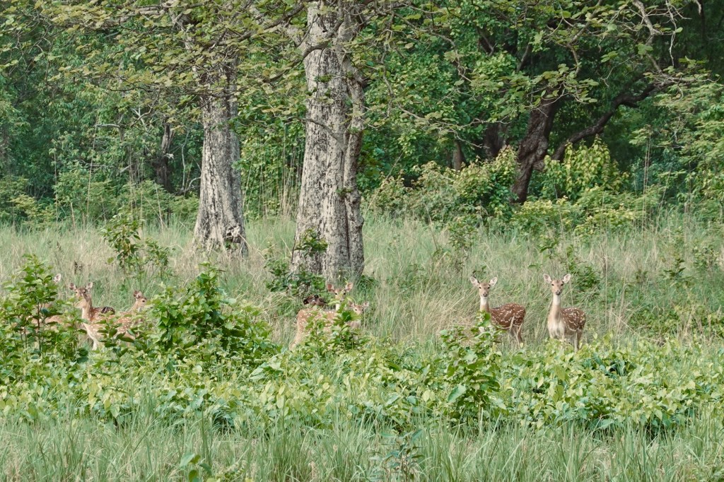
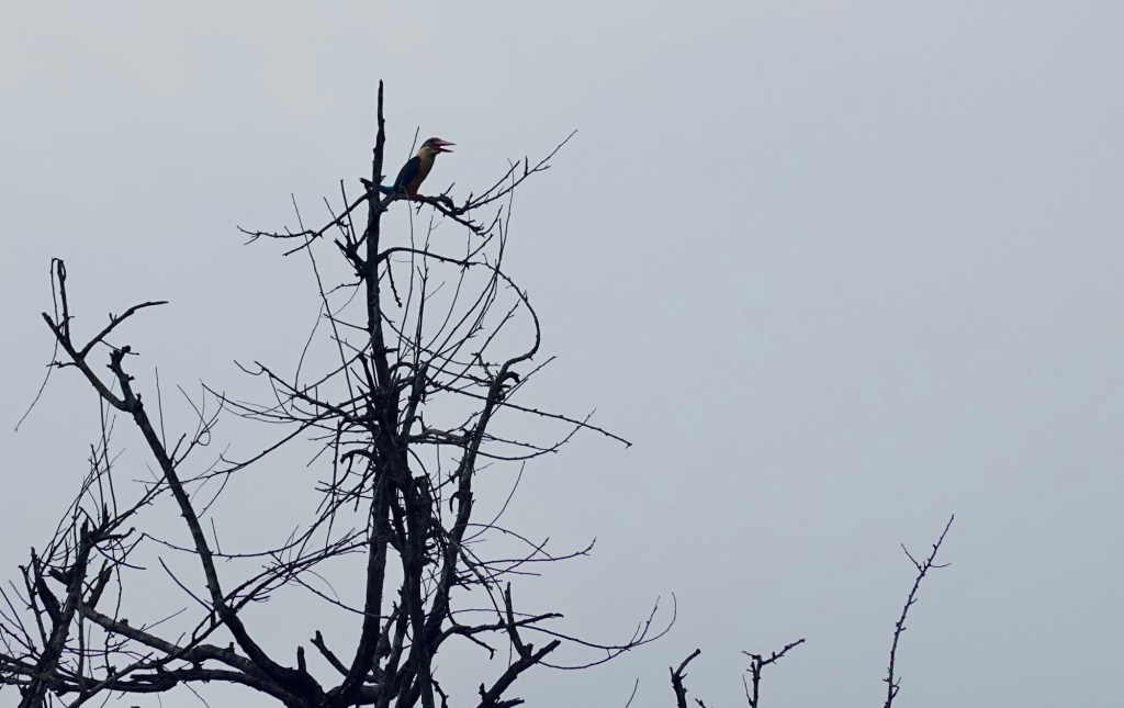
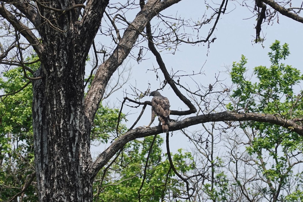
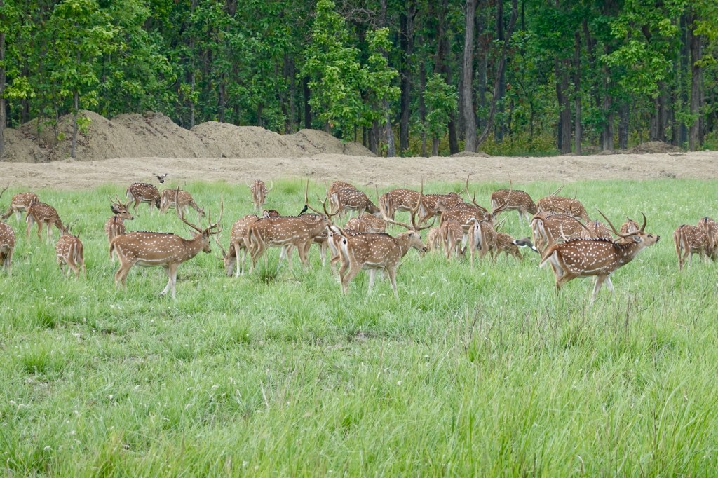
Deers pass by, many birds and even more monkeys.
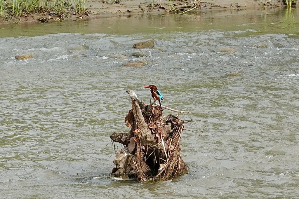
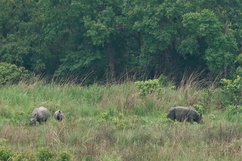
At another watchpoint we spot a rhino family in the distance. One highlight! In Bardyia there are only 37 Rhinos as the Tiger population increases.
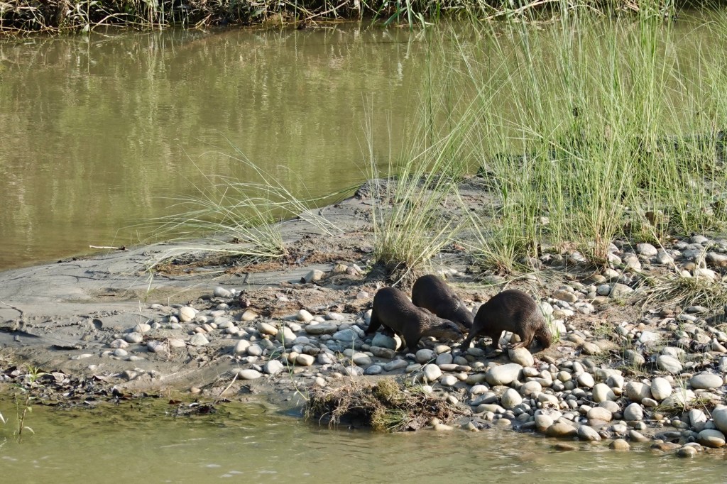
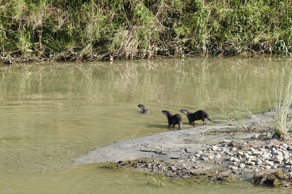
The next morning, we eagerly set off in a jeep. Kirshna, incredibly knowledgeable and enthusiastic, suddenly urges us out of the vehicle, leading us to the river—a playful otter crew frolicking on a river island! These delightful creatures, with their curious noses buried in the sand, are so funny to look at, as they shake their tails against the grass, marking their territory. They look like cats dressed in a dinosaur costumes!
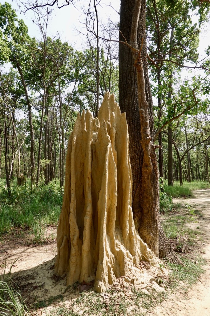
We traverse the rugged dirt roads of the park, where the majestic castles of termites rise impressively, towering like tiny fortresses across the landscape. High above in the trees, the bee hives nestle away, skillfully hidden from any predator that dares to approach.
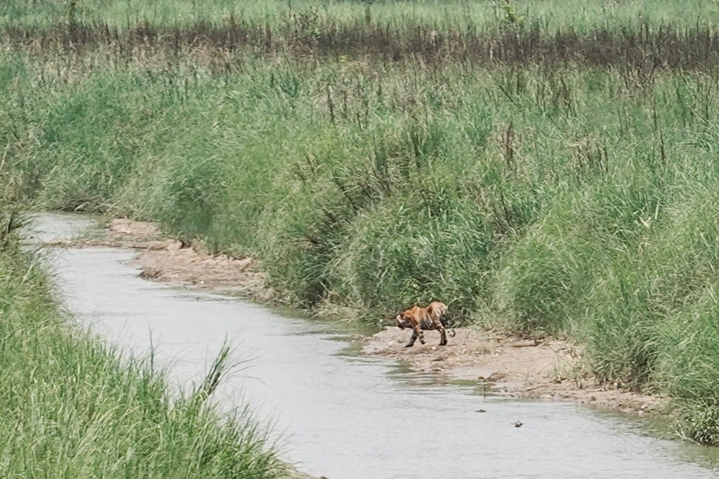
Thereafter, we move from one water hole to another, eagerly hoping to spot tigers, elephants, and more. During lunch, while everyone enjoys some downtime, Kirshna suddenly gets excited and points to the river. There she is – I just assume it’s a female – but we don’t really know! Her majesty, the tigress! A good distance away, she walks gracefully through the river, glancing at us as if she knows we are admiring her. Elegantly, she crosses the river and hides in the grass on the other side. What a magical moment in the national park! All of us are absolutely thrilled!
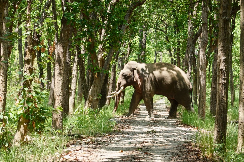
As we roll along, a massive male elephant is just trying to hide behind the trees.
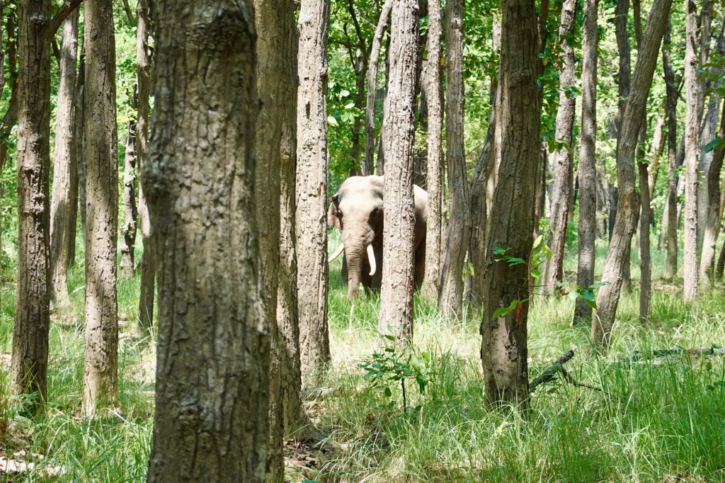
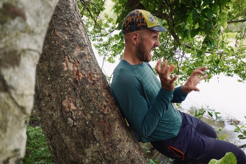
We found out that these big guys like their personal space, so we back off in the car while he makes his way towards us. It’s mating season, and every time he flaps his ears, those pheromones are hitting us hard – and nope, it’s not exactly turning us on.
On our way out, Krishna noticed two crocodiles in the river.

The next morning we leave the little paradise and head towards the Indian border.
Final thoughts
Cycling and exploring the breathtaking landscapes of Nepal has been an unforgettable adventure that has touched us in countless ways. We embarked on the iconic Annapurna Circuit with our bicycles, a dream we both held dear, and found ourselves unexpectedly wandering through stunning, less-trodden regions. We found ourselves at the foot of some of the majestic peaks, including the highest mountain in the world, alongside countless other beautiful giants. We’ve had the privilege of immersing ourselves in the rich wildlife of southern Nepal. As many tourism ads put it: people come first for the awe-inspiring mountains, but they return for the warmth and spirit of the people. Yes, it may sound cheesy, and perhaps even cliché, but it is undeniably true. Our time here was filled with joyous moments and delightful encounters. We cannot help to wonder how tourism especially in the mountain areas will develop over the future. Though it may be a small country compared to its immense neighbours, Nepal still holds a treasure trove of wonders waiting to be explored. I have the feeling that at some point in my life I would love to come back.
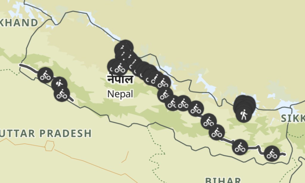
Our Path
Nepal in total: 1500km | 49.000 altitude meters cycling and hiking

Leave a comment